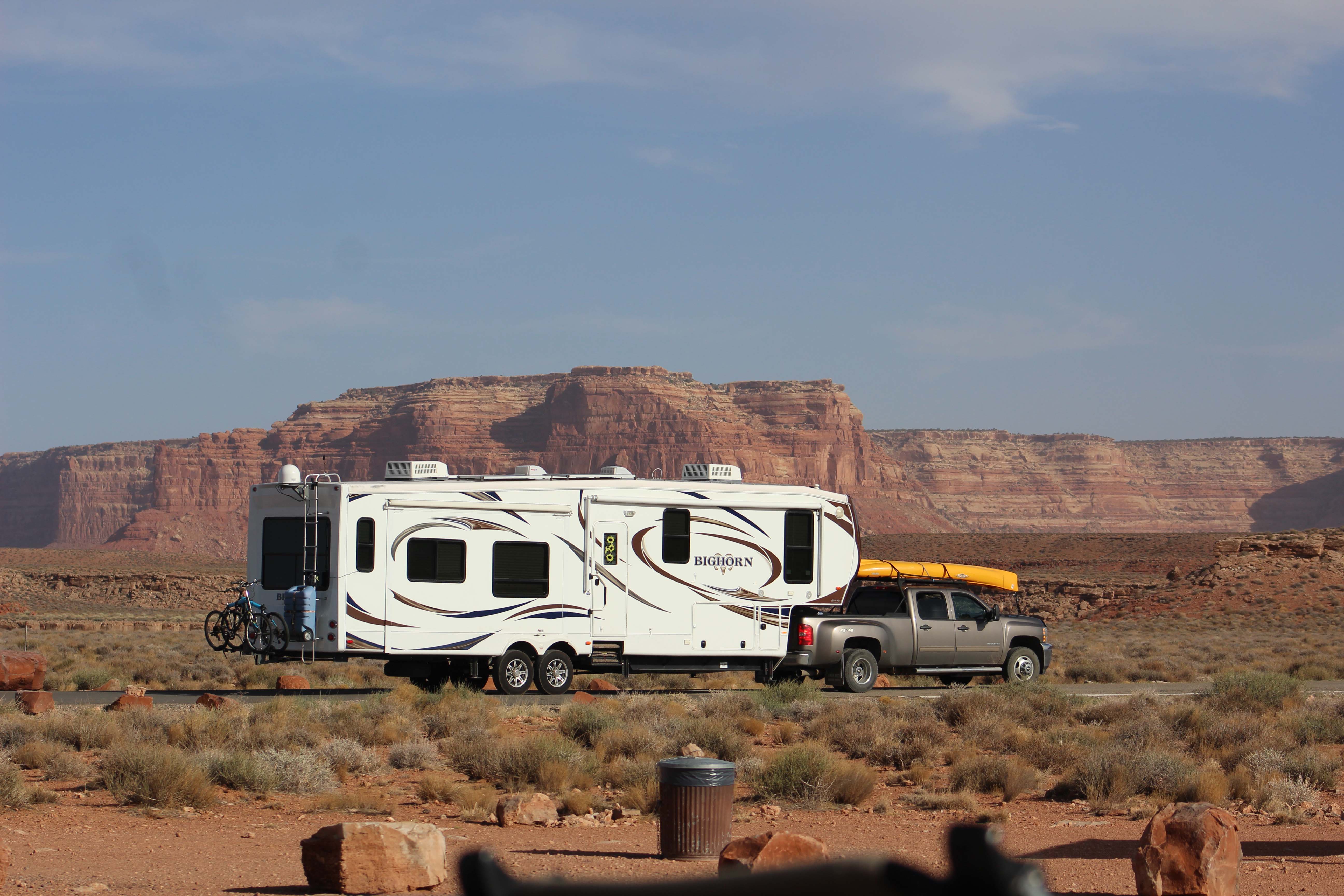
Bright and early we started out the next morning for Canyonlands – Island In The Sky, and we took HWY 313, which was pretty close to our boondocking spot, but still a 24 mile drive to the park entrance from where 313 meets the main highway. It was a bright blue sky day, but very windy, which is actually decent weather for a scenic drive. The drive itself was once again beautiful as we drove through free range cattle land and passed Horse Thief BLM Campground. Unlike the campgrounds down in the Needles, there is some cell service up on the mesa and many of the campsites in Horse Thief are big enough for large RV’s. They have 58 sites and we liked 10, 13, 16,17,21, 23, 24. 29, 30, 44, 51, and 37 the most. They also had a couple of group campsites, but again, those were mostly designed for tents, and since the campsites themselves were only $15 a night (dry camping only) those seemed to be a better deal.
Eventually we arrived at Island In The Sky and saw that the entrance fee was $25 per vehicle. Once again we gained admittance for free with our America the Beautiful Pass and stopped at the visitors center right inside the gates. The visitors center was pretty small and there were definitely more children around than in Needles, so we took a quick look, and then headed on the scenic drive.
Lee loves the topographical maps
(When we first walked in it was really dark, and after a minute or so of wandering around inside I overheard a park employee apologizing to someone that they couldn’t take a credit card because the power was out and they had no idea when the power would be back on. The customer was getting pretty cranked up and being an ass about it. I muttered to myself that this poor employee was going to have a long bad day because people are the worst, and this was apparently her first encounter of the day with someone who wan’t going to be able to get what they wanted when they wanted it, and I hoped out loud that the power came back soon for her sake, and POOF, the power came back on. I’m not saying I’m a power God, or anything, but the power did come back on right after I wished for it. Just saying. – Lee)
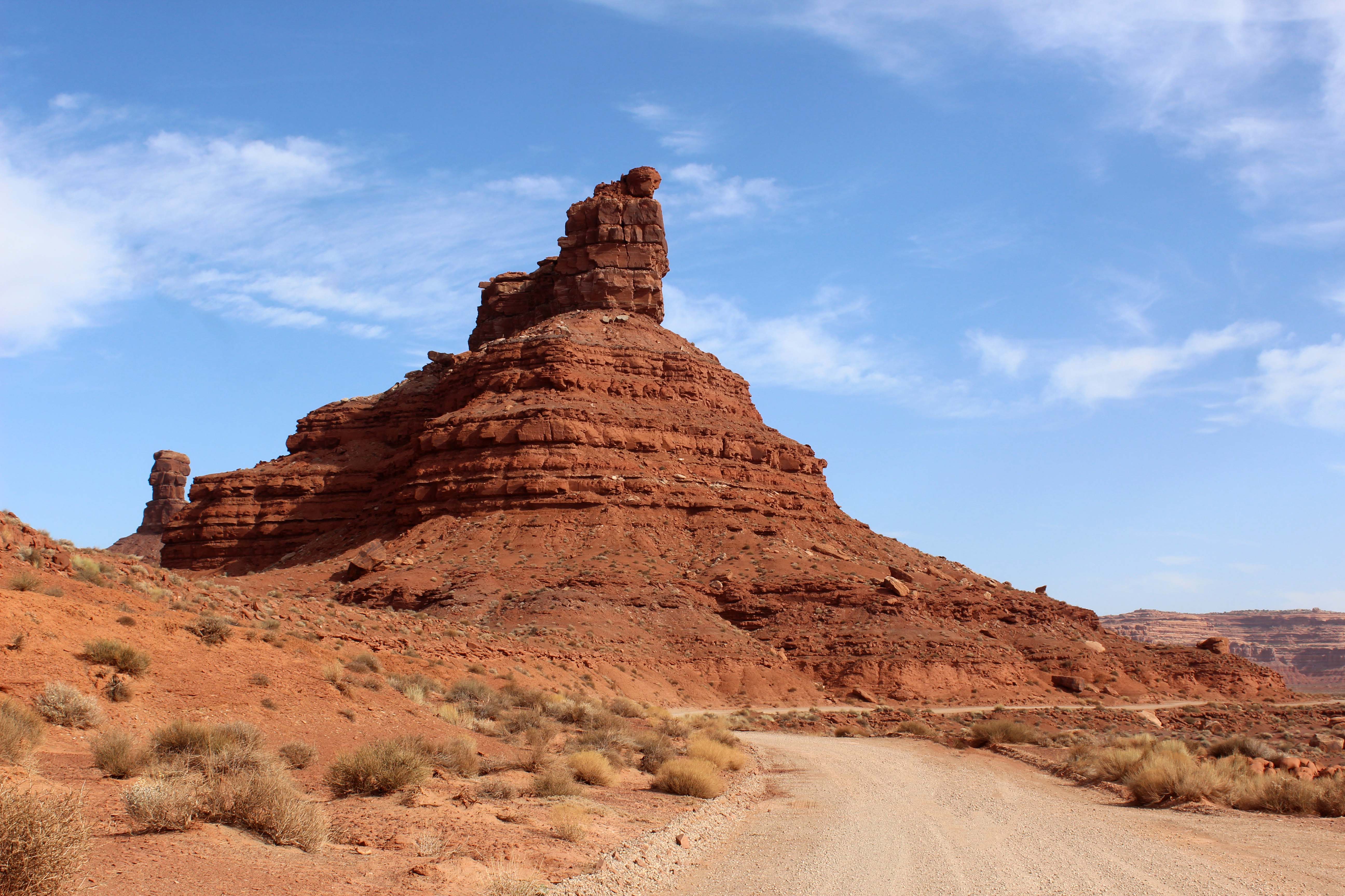
Our first stop was Shaded Canyon Overlook, and we got out and walked down for the beautiful views. It was a little steep and some of the path was on slickrock, but it was definitely worth it. The only downside was the wind was very cold, and strong enough that I stayed away from the edge. Neither the wind nor the steep drop-offs bothered Lee though, and he stayed a while and took several pictures.
Even Lee didn’t go around the big rock at the end because the wind gusts were pretty strong.
This is one of the roads we want to go back and drive with a Jeep.
Views of some of the roads we wanted to take in the future on the valley floor.
We passed the Mesa Arch trailhead, but although the route was somewhat short it was pretty steep, and it was still too cold for me. It was a lot colder up on the Mesa than it was when we left our boondocking site, and I wasn’t really prepared for the cold weather. So instead we went on to Green River Overlook and again stunning views.
You can see the Green River in the right of the picture.
We also stopped at a small pull off for Candle Tower overlook and got out and walked a bit. It was warming up and the “path” was flat enough even for me and you could see lots of stuff and still stay away from the edge. Lee of course just walked right up to it.
I took a ton of pictures here. Loved this spot. I just wish we could have gotten some sun on the really cool rock in the background. Next time!
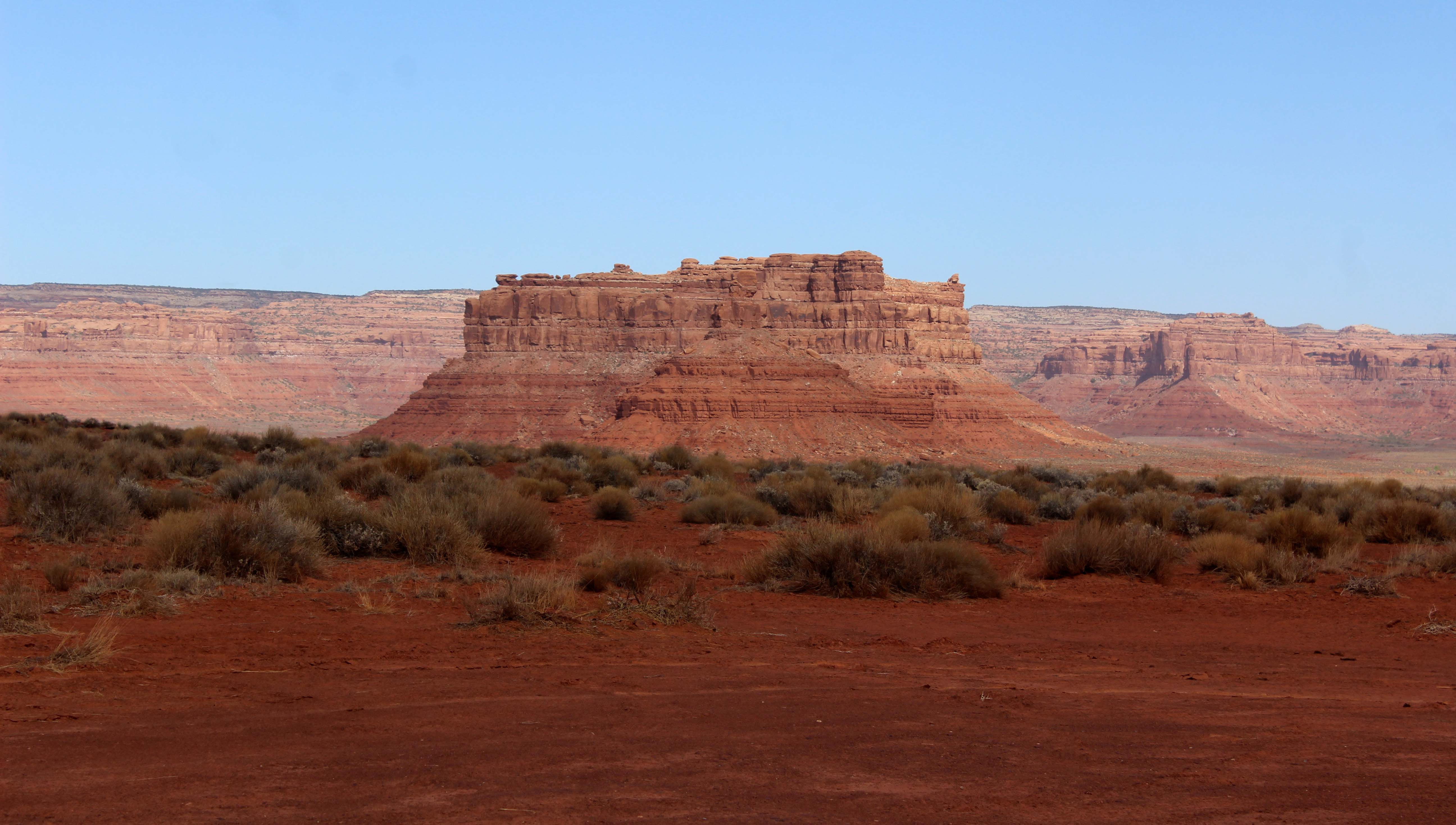
Next up was Buck Canyon, and that overlook was stunning. As with many of these pictures that show wide landscapes, you really can’t capture how pretty it was, especially on an overcast day.
I liked the wooden barriers at the edges
It was cloudy but we could see the La Sal Mountains in the background
I could take pictures of these cool trees all day
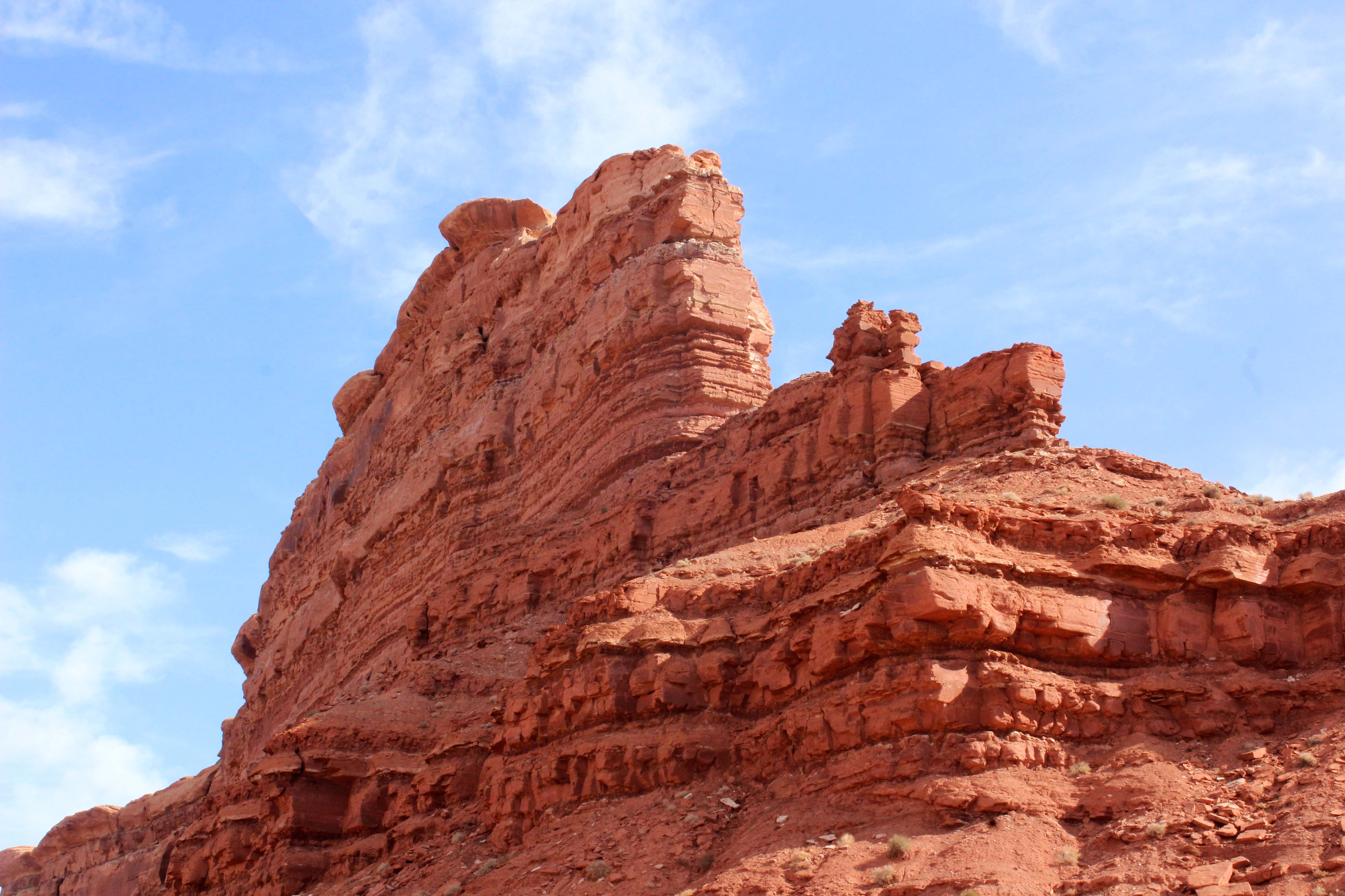
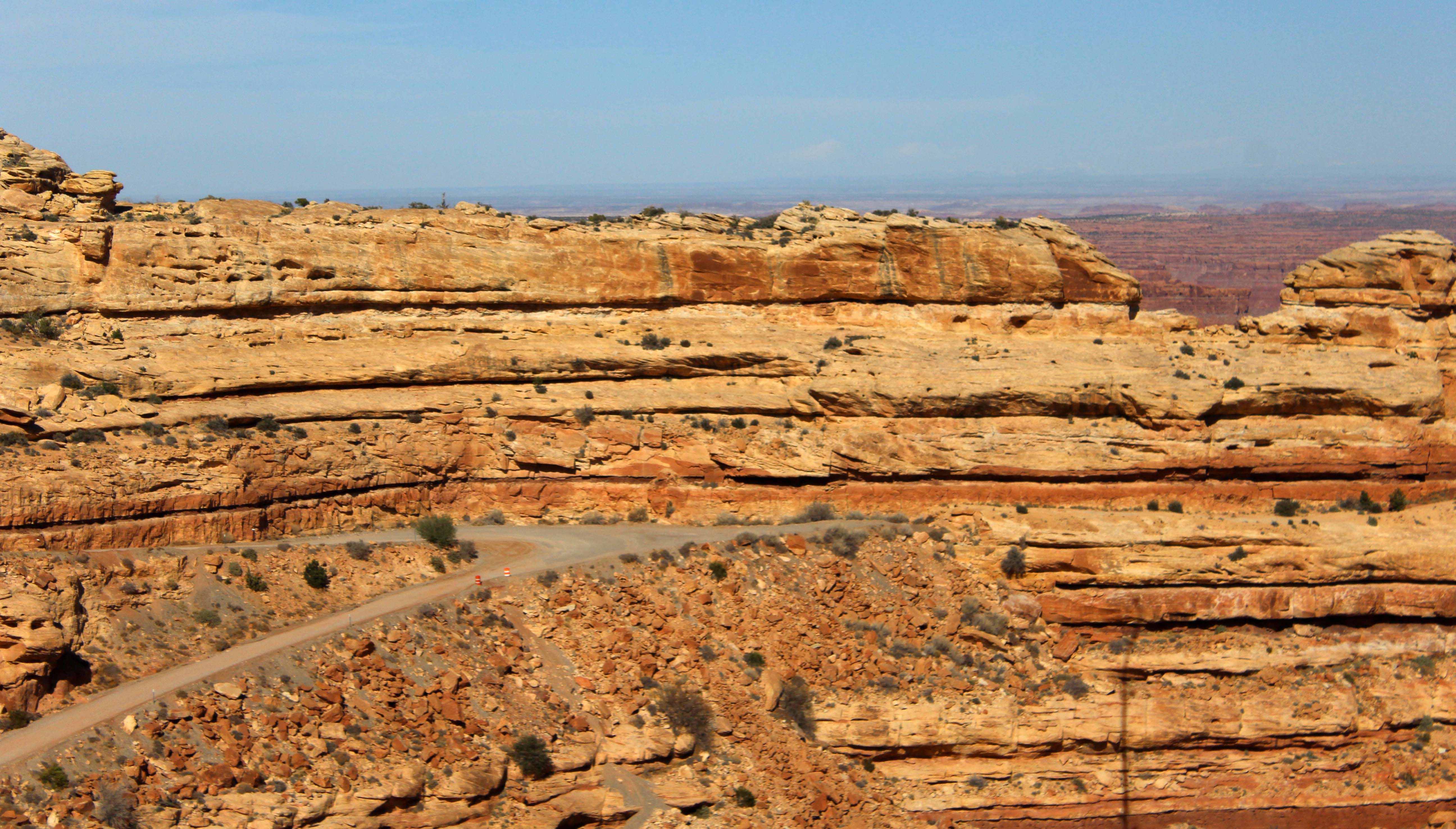
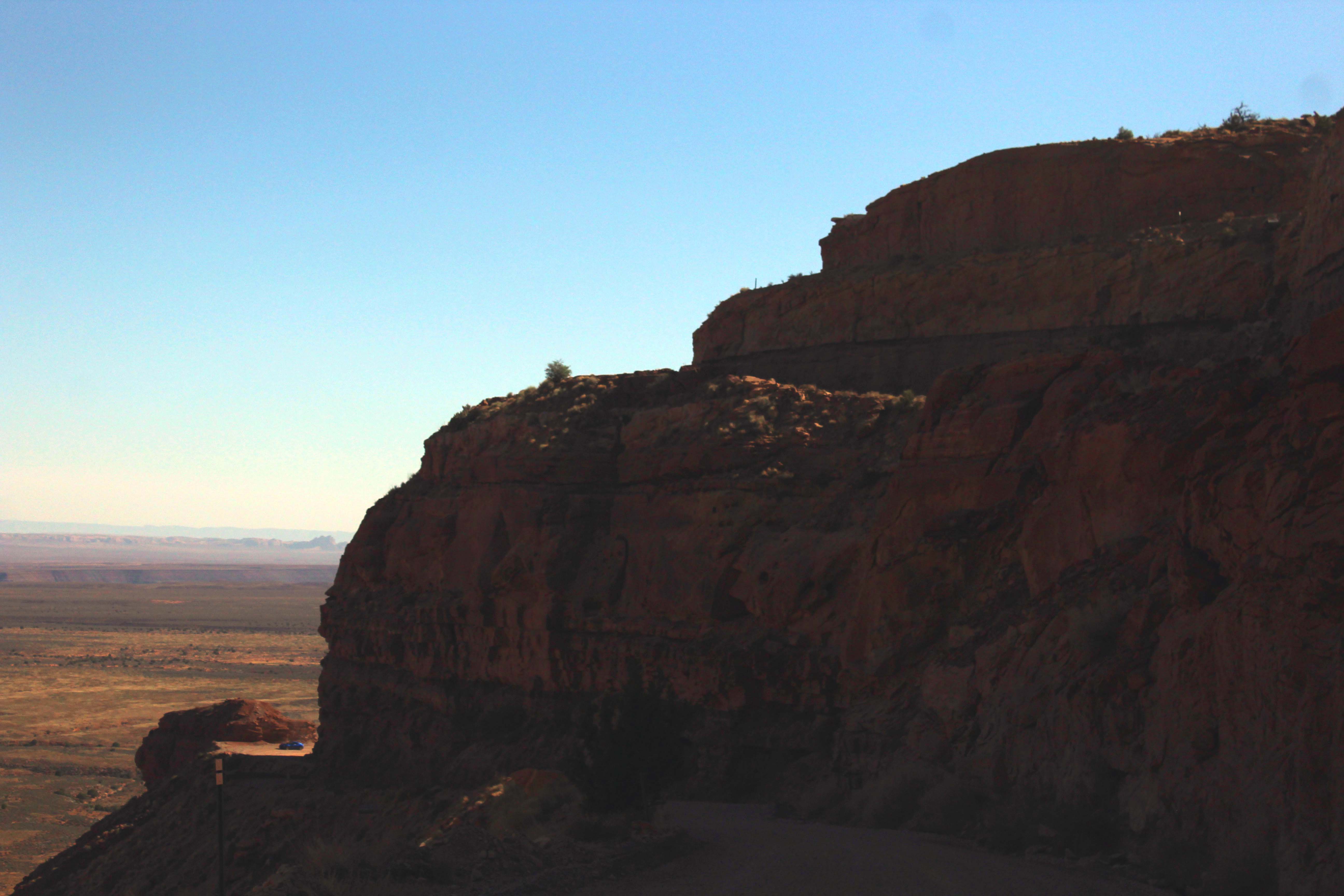
Then we had Grand View Point, which was at 6080 ft. There is a 1 mile walk around the canyon that you can take here, but it actually started snowing a bit while we were up there, which definitely made me feel less like a big baby. Plus the wind was pretty strong and I just wasn’t feeling it so we took some pictures and then decided to come back and take a half a day. I loved the Canyonlands, but the pace and excitement of the last couple of weeks was finally catching up with me and I really just needed some time to rest a bit.
You can see the snow to the left. It wasn’t heavy, too dry for that, but it was cold.
Explains the layers of the canyon. In particular I found the desert varnish interesting as it explained those beautiful brown streaks on canyon walls. If you click on the picture you can get a much bigger image to read the info.
So here are the rest of the pictures for the day. To be honest, it’s hard to tell one canyon view from another in these pics, but all the views were great. The parking lots weren’t very full, but the trail heads were definitely seeing a ton of use, even mid week on a not so nice day. I think of the two I actually preferred the Needles, because the nature was more accessible and of course we were at lower elevation. The Mesa is definitely worth a visit though, and again I couldn’t come close to capturing the beauty of it. I’m not sure any could.
For scale that little brown line at the tip of the hole is a dirt 4×4 road.
Sharks fin 🙂 It wasn’t the prettiest view we saw all day, but something about it called for a picture to be taken!
Camper Chronicles is a participant in the Amazon Services LLC Associates Program, a program designed to provide a means for sites to earn advertising fees by advertising and linking to amazon.com. We very much appreciate any purchase you make via our website links. There is no additional cost to you and helps support our blog. Search Amazon.com here
Or you can check out our recipe book filled with 80 real recipes we have cooked in our RV and taste tested by Lee himself. The cookbook specializes in recipes that have a limited number of ingredients, without sacrificing flavor and is organized into categories that matter to full time RVers such as Happy Hours, Travel Days, and Pot Lucks You can preview the kindle version on Amazonor the Apple version onItunes. It is available inpaperback on Amazon if you prefer.
After we left the Needles Overlook, we decided to continue on into the Needles entrance of Canyonlands. We could have split this into two days, but the Needles entrance was 65 miles from where we were staying, and since we had seen the needles from a distance I really wanted to get closer. So we continued on HWY 191 and eventually turned onto 211. This is the road into Canyonlands proper, and also had the advantage of having a stop to see Newspaper Rock about 12 miles in. (It was an additional 22 miles to Canyonlands from there.)
There is a large turnout at Newspaper Rock and we decided it was a really good place to eat lunch. We had seen several of these petroglyph sites in our travels, but this was a big one by any standards, and we were able to get closer to this one than we had to others.
The road driving in was really great in and of itself
Newspaper Rock site
These sites are pretty cool, but the main problem I generally have with them is that you can’t tell which petroglyphs are ancient and which are more current. Up until the 1950’s it was pretty commonplace for folks to “add” to these sites, and as interesting as it is to see someone’s initials from the 1900’s the pictures themselves are what I find interesting, and there is no way to date those. The sign posted at the location does a great job of talking about that and because of the cross-cultural contamination archaeologists have a really hard time figuring out the meaning, if any, of the drawings. They might have just been doodling even back then.
Upper left hand corner you can see a more modern addition
Still it was a nice place to stop, and after lunch and a few pictures we continued on our way. The road was paved, but a little rough in places, but we were lucky to hit a little sunshine as we traveled along the way. The day was largely grey in the area, but the clouds had cleared to show a little sunshine in places the further south we got and we were glad for both the sunshine and the impact it had on the pictures.
Right before getting in the Canyonlands, we stopped at a little private RV Park called the Needles Outpost and went inside and met a young woman named Laura who was working there. She was in the process of hiking from Zion to the Arches and had taken the job to earn some extra money along the way. When she found out we were full time RVers she had a lot of questions and we learned she wanted to buy a camper van and see the country that way. We gave her our number one piece of advice: “Be Debt Free” and then after chatting a while we headed out. I always like meeting young women like her in my travels, who have the courage to strike out and do something different. I would never have had the guts to do that at her age, and I find it very admirable.
Next we stopped at the visitors center and went inside to look around. When we were looking at a topographical map to see the places we had been earlier in the day a VERY friendly park ranger came up and talked to us. She seemed genuinely glad that we had come and visited (something I often find in the lesser known parks) and gave us some great information about the roads and which ones could be driven in a 4×2.
Visitors center
I love when one person works to save a piece of land
This is the area we traveled in the morning. I circled what I think were Needles Overlook and Antcline Overlook.
And this was the road we came this morning ending where Lee has his finger. Looking at it from this view was really neat
I also was really impressed by a little display they had that showed the different types of rock formations. We had been seeing all of these in our travels in Utah, but this display made it really clear to me.
Arch
Mushrooms, which are probably my favorite, and we were about to see tons of these in Canyonlands
Needles
Hard to tell from the picture but there is an open space between the two slices of rock so it makes a fin from the side view
These are impressive in person but generally hard to photograph
After the visitors center we headed on the drive, and I will say in advance I loved everything about Canyonlands. There was no cell service anywhere, but that didn’t matter, as we explored the Needles rugged and natural beauty. This is exactly the type of landscape I love, and the relatively light crowds made for a great day. Plus there are tons of hikes, many of which are strenuous but have spectacular views, but also lots of areas where you can just get out and walk around, and by the end of the day, I wanted to immediately plan going back and staying longer, which is the hallmark of a really great park.
The rock on the right is called the six-shooter, and there are two of them.
You can see the wooden shoe arch from far away, just a little right of center.
Picture with my long lens
At the suggestion of the Park Ranger we went down a 4×2 friendly dirt road towards Elephant Hill to get some great views of the needles. The road was fine, if a little tight, but the views were spectacular and I highly recommend going that way.
I actually liked the rows of mushroom rocks in this area even better than the needles
They were huge and so many of them
Of course the Needles were really cool too
It was hazy in the background so couldn’t completely capture how vibrant these were.
Elephant rock itself was much easier to see although I really think it looked more like a fat teapot
Really beautiful
Loved this balancing rock
After going down the side road, we continued on the main scenic drive and camp to the Canyonlands campground. Campground B is all walk-ins but Campground A allows reservations in season and although many of the spots are too small for us some would work. Even though there is no internet at the site, the campground was absolutely fantastic, with the added benefit of being in the park, which would make some of the longer hikes easier to do. We vowed that we were absolutely going to come back and stay here and I made a note in my calendar to remind me when to call and make reservations for next year. By the way, in Campground A we thought Sites 1,3,4,and 7 would all work and we really liked 12,16, and 17. Here’s a pic of one of the smaller sites, but it gives you an idea of what they are like. They even had a group site, Squaw Flat, that would fit 3-4 big rigs and had a nice common area among the rocks. All dry camping of course, but wow, the views.
They are all tucked among the rocks
Just as we were thinking it couldn’t get any better, we made it to the end of the short scenic drive. We parked the truck and walked out on the rocks, and I am so glad that we did. In between the two large walks there is a cliff you can walk down and you can see a small pool. Lee even found a small cave in on of the large rocks and the views of this portion of the park were truly spectacular.
Lee walking down between the two large rocks
We love when we find one of these and the place we find them in is almost always really special.
I walked out to the edge here and looked down
And saw where the river flowed
Leading into this tiny pool captured with my long lens
Amazing rock formations. This one looked like a Momma and baby seal to me.
And I had to hug this super big rock.
Lee found this cave.
There was even light shining in, really neat.
Lee is also really great at spotting little flowers as we walk and getting pictures of them. Almost all the flower pictures you see in the blog are his.
We spent a long time on the end of the outcropping, but then as we headed back we decided to take another 4X2 road. One of the things I like about Needles is that there are many roads you can drive through it and although most are clearly marked as needing a 4×4 there were a couple we could do in our truck. In fact there were 4 additional dirt roads we could have taken with 4×4 and renting a jeep is definitely on our “must do” list when we come back. Today though we took the road that led to Cave Spring, and along the way we checked out several group campsites. Unfortunately for us these were all tent sites only, which was a shame, because they were really in some beautiful spots, but at one of these we saw a sign posted that there had been a bear in the area.
All of a sudden Mr.-Walks-To-The-Edge-Of-A-Cliff in the wind to take crazy pictures gets nervous. I couldn’t help it, I started laughing, and said I would take a bear over those sheer drops any day. Lee said he was “sure footed, not bear footed” which was cheesy, but totally cracked me up. He quickly got back in the truck, just in case, and for once on this trip I didn’t feel like the scaredy-cat. I like bears, and was actually glad to hear there was some larger mammal wildlife in the area, Lee not so much! (Whatever dude. Bears eat people. Cliffs don’t. – Lee)
Despite the “bear scare” we were both fully committed to returning and I even said as we left that this area might be my new favorite national park. So far that distinction has been held by Glacier, but the wildness, lack of crowds, and extreme beauty of this park really spoke to me. And this was only the southern half of it. In order to explore the northern part of the park we needed to enter from another direction (the roads don’t connect), and on the spot I changed our plans for the next day so we could see Canyonlands – Island In The Sky next.
(Sure, it looks pretty, but there a hungry bear in there somewhere. – Lee)
Camper Chronicles is a participant in the Amazon Services LLC Associates Program, a program designed to provide a means for sites to earn advertising fees by advertising and linking to amazon.com. We very much appreciate any purchase you make via our website links. There is no additional cost to you and helps support our blog. Search Amazon.com here
Or you can check out our recipe book filled with 80 real recipes we have cooked in our RV and taste tested by Lee himself. The cookbook specializes in recipes that have a limited number of ingredients, without sacrificing flavor and is organized into categories that matter to full time RVers such as Happy Hours, Travel Days, and Pot Lucks You can preview the kindle version on Amazonor the Apple version onItunes. It is available inpaperback on Amazon if you prefer.
Our first day in Moab, we got up nice and early and decided to take a scenic drive. The morning started off a little cloudy, so we thought a drive would be a nice way to start, plus would get us acclimated to the area. Lee was kind enough before we started though to give my camera a nice cleaning. I know it is a pain for him and try to avoid situations where I need it but the wind and sand had gotten some schnibblies (the technical term) on my sensor. This requires me to photoshop those out in almost every picture with sky, and results in a ton more work for me. He was nice enough to clean it for me and hopefully it will last another year before the next cleaning. If you are curious, by the way, he is like a surgeon when he does it, and uses canned air, lens paper, Qtips, and cleaning solution.
Once he was done we headed out and back the way we had came in. Canyonlands is a large National Park, and although we are close to the northern entrance, the southern entrance is over 65 miles away. Since we were planning on a long driving day, we packed a lunch and headed back down HWY 191 towards a couple of roads that I knew had overlooks on them.
The first road we turned on was Looking Glass Road, which is a rough gravel road that goes to Looking Glass Rock. The road actually meets up with CR133 eventually, but it was rough enough that we just drove down to see the Looking Glass Rock and then turned around and went back to Highway 191. We don’t do that sort of thing very often so it gives you an idea how rough the road was. There is a sign at the turnoff and you can’t see it until you turn the corner, but it was definitely worth the stop despite the rough road.
Looking Glass Rock
Once we were back on the highway it was only a few miles more until we hit CR 133. I highly recommend both this road and the dirt offshoot CR132 for their fantastic views of the Canyonlands Needles. Both of these roads were such an amazing surprise and exactly why we love the road less taken. Let me show you rather than tell you, although the pictures don’t come close to capturing how special it was.
Sign at entrance to CR133
The beginning of the road was all grassland with lots of cows and their babies grazing in the fields
We stopped and checked out Wind Whistle Campground along the way which was too small for us but had some amazing campsites for tents and smaller RVs
The road, was pretty, but not spectacular, and then we got to Needles Overlook. It was an absolutely beautiful overlook spot with very clean and stocked pit toilets and a paved path you could follow or you could walk among the rocks. It had picnic tables and benches and not another soul was there. It was absolutely perfect, and the views were spectacular, seriously for me it was the gold standard of what every overlook should be.
I liked that the highest points had a handrail so I felt safe looking down
But I liked this bench the best
I even went and sat on it. Like I said, the picture doesn’t come close to doing it justice. I believe my words were “Holy Crap!.”
This sign explained how the Needles were formed
While I was on the bench he went wandering
And took this great picture.
Then he found this little cave.
There may have been a couple of cave kisses here 🙂
Really cool
Needles Overlook alone was worth the drive, but there was still more to come. We decided to take the dirt road CR132 to the Anticline Overlook. On the way we passed Minor Overlook, which we almost skipped because it just looked like a big rock, but that would have been a big mistake as the road goes around the big rock for another amazing view. First off I have never seen a road go around a rock like this, and Lee took some Go Pro video to show what it was like.
Lee putting the Go Pro on at the Minor Overlook turnoff. See how boring the rock looks.
I didn’t even see the road went around until we got closer
The road curved around the rock
And this is what we saw on the other side. Who knew? That’s what I love about Utah, you always need to go around the corner, because you never know what you will find.
Just wow
After the Minor Overlook we made it to the Anticline Overlook, and this view was the best that we have seen. It is directly across from Dead Horse State Park and the view was totally free. This path was a bit rougher, but completely worth it, and please whatever you do make sure you walk down to the right and look at the view from there. It literally took my breath away, and I said wow so many times Lee asked me if I was having a “viewgasm” to which I replied yes I think I am.
The path
The view
I know, right? All Lee could think though was how he was seeing little tiny jeeps down on the curvy road and he really wanted to drive that road. Once again our lack of 4X4 was holding us back, but we are definitely coming back and either bringing a jeep or renting one, because that road was begging to be driven.
See the little tiny jeep.
And how long the road is
Plus the road goes on both sides
Hands down one of the best views we have seen in three years on the road, plus totally free, and completely unexpected. It was 17 miles each way to drive down to this point from the end of the paved road, but for us was completely worth it. We had a wonderful morning, but we weren’t done yet, because we still hadn’t entered Canyonlands National Park itself yet. I will leave you here though, and pick that up in the next post
Camper Chronicles is a participant in the Amazon Services LLC Associates Program, a program designed to provide a means for sites to earn advertising fees by advertising and linking to amazon.com. We very much appreciate any purchase you make via our website links. There is no additional cost to you and helps support our blog. Search Amazon.com here
Or you can check out our recipe book filled with 80 real recipes we have cooked in our RV and taste tested by Lee himself. The cookbook specializes in recipes that have a limited number of ingredients, without sacrificing flavor and is organized into categories that matter to full time RVers such as Happy Hours, Travel Days, and Pot Lucks You can preview the kindle version on Amazonor the Apple version onItunes. It is available inpaperback on Amazon if you prefer.
As we got ready to leave and head towards Moab, we started looking for a place to stay. In this case, there were so many places it was hard to choose, and we had a conversation about staying at a campground with full hookups, a BLM campground for $15 a night, or just boondock outside of town. Ultimately we decided to go ahead and try boondocking, and ultimately I was glad we made that decision. Several of the BLM campgrounds are really beautiful, and on the Colorado River, but since they are first come-first serve, and only a couple have spots big enough for us, I was not sure what we would have found. Likewise several of the campgrounds were really nice, but at $45+ a night more money than we wanted to spend. So we headed that way with the idea of finding a boondocking spot, with a regular campground as a backup if we needed it.
The drive itself to Moab was really beautiful. Highway 191 is a gorgeous route and we saw several large rock formations along the route along with views of the amazing La Sal Mountains.
The La Sal Mountains in the distance
Beautiful rock formations along the road
Wilson’s arch, which was a beauty and right off the highway
View at Hole in the Rock rest area
We did have several long 6 percent grades along the route and Lee found the drive pretty stressful as folks were weaving in and out of traffic to pass. It’s a heavily traveled road, and not all of it is 4 lane. Eventually we stopped at the Hole-in-the-Rock rest area, which was extremely nice, and had what looked to be permanent staff living onsite keeping it clean. After lunch, the driving was a bit better and then we arrived in Moab.
There are several places to dump and take on water in Moab, but I chose the Feed Store and RV Supply place. The sign was small, so we actually missed it and then had to turn around in the Marriott parking lot and go back, but it turned out to be a good choice. It was only $5 to dump and take on water, and since they were closed on Sunday, we left cash in the metal box by the dump station. The town itself was pretty congested and had a row of businesses on each side of the street. We took our time and made it through town and then came out near Arches National Park.
According to Campendium, the first boondocking area was off of Willow Springs Trail. We were a little worried about making a right off a major highway, but were pleased to see that there was a turn lane at the highway.
Entrance
This is not BL,M land but SITLA land instead. The rules seem roughly the same and we didn’t have any issue while we were there.
There were several large sites near the entrance, but since they were somewhat crowded we kept heading farther back. The road got rougher the farther we went and finally we felt we needed to turn around and head back. We made the mistake of turning into what looked like a circle, but actually was sliprock and not something we could pull the rig over. With some VERY careful maneuvering, Lee managed to get us backed up and turned back the right way and we ended up finding a site in one of the larger circles that at least faced the mountains. For the time we spent there we had a constant stream of people coming and going in different RV’s, but since our back was too them, it was OK. Plus it was pretty quiet, despite how many RV’s there were.
(GPS 38.6956, -109.6899)
Our view and fire ring, which was here when we arrived.
Behind us the first day. It grew more crowded on the weekend, but still reasonably quiet.
So we made it and found a “free” spot, but it was a little stressful. We learned later that there was a much larger area at Dalton Well Road, an additional mile down HWY 191, that wasn’t as pretty, but definitely would be easier to get in and out of. Still it was good to be settled and as we explored the area over the next week, there wasn’t another place we found that was worth hitching up and moving to.
I did want to take a minute here though and talk about the concept of “free” in boondocking. Yes, the site itself is free, but there are some associated costs with boondocking that it is important to keep in mind. If you are only staying for a couple of days in between campsites, most of these costs will probably never come up, but when you are boondocking for extended periods of time, these are the incremental costs that we incur.
Dumping/Fresh Water – We have paid everything from $5 – $10 to dump the RV. Fresh water is often free (or free with dumping, but that isn’t always the case. Some boondocking areas that charge a nightly fee have dump stations as well, like Lone Rock Primitive Beach. Outside of staying there, we have dumped twice and spent $7.50 and $5 respectively for a total of $12.50. Water for us has been free.
Propane – We are set up to completely heat our rig on electric, so use minimal propane (stove only) when on full hookups. In the last 20 days we have gone through three tanks of propane or roughly $60 worth.
Laundry – We have a washer/dryer Splendide combo unit and can do almost all of our laundry using that when on full hookups. Lee has gone to the laundromat twice since we started boondocking, which costs roughly $20 each visit, so again $40.
Ice – We have an electric ice maker, which we use to make ice so that we can use our very small freezer for food. I am a big fan of ice, so we buy bags when we are boondocking and they last around 3 days each. At around $2 a bag that’s around $14.
Trash – Trash is one of our biggest problems although we do separate out the paper from everything else and burn the paper, which reduces it greatly. Finding a place to take your trash can be a problem though, which is one of the big benefits of staying in a $15 a night boondocking spot that at least provides trash cans. Sometimes we ask when we fill up our truck with diesel and I have seen the occasional places that charge $5 for trash drop off. You can also use the local landfill if you can find it, which we have also done on occasion. This time out we haven’t spent anything on trash, but that isn’t always the case, so I thought I would mention it.
All in all, we have spent $126.50 on the items listed above, and $60 for our time at Lone Rock Primitive Campground and $50 for our time at Gooseneck State Park. Considering the prices of campsites in this area, $236.50 for 20 days of camping is a total bargain, but as you can see not totally free. We really like doing it though because the sites are often really great, and we have more freedom and space than in a traditional campground. For those of you who haven’t done it yet, I did want to mention that extended boondocking will have some costs associated with it.
Camper Chronicles is a participant in the Amazon Services LLC Associates Program, a program designed to provide a means for sites to earn advertising fees by advertising and linking to amazon.com. We very much appreciate any purchase you make via our website links. There is no additional cost to you and helps support our blog. Search Amazon.com here
Or you can check out our recipe book filled with 80 real recipes we have cooked in our RV and taste tested by Lee himself. The cookbook specializes in recipes that have a limited number of ingredients, without sacrificing flavor and is organized into categories that matter to full time RVers such as Happy Hours, Travel Days, and Pot Lucks You can preview the kindle version on Amazonor the Apple version onItunes. It is available inpaperback on Amazon if you prefer.
Taking a jeep tour of Monument Valley has long been a bucket list items of Lee’s. Knowing they were pricey though, I hoped that if we went early and had cash we might be able to negotiate a bit of a discount. So we got up early and it was about 8:40am when we hit the iconic Monument Valley view from Forrest Gump and many other movies. Since it was a beautiful blue sky day and there wasn’t much traffic on the road, we decided to stop and get some shots. It turned out to be a great call, because although we had drawn a little crowd by the time we were done, everyone politely waited to get their turn. We even struck up a conversation with a very nice guy who was happy to help us with some pictures and we in return took his.
Here’s Lee’s shot, with just a little bit of photoshop enhancement, mainly removal of things that should never have been put in the way in the first place.
I should probably mention that almost every picture in this post is going to be Lee’s. It was a 1200 picture day, and Lee was really into it so 850 of those came from him. Afterwards I was groaning a bit about going through so many pictures (I know first world problems), but Lee said he was happy to take care of it and somehow managed to pare those down to about 60. If you know Lee, you know that’s a minor miracle. This post probably won’t have all 60 of them in here, but it is picture heavy, although hopefully you will think it was worth it. He took some wonderful pictures. All the boring plot related ones are mine 🙂
After getting our shots we arrived at Monument Valley about 20 minutes after they opened at 9am. We intentionally decided not to visit the Visitors Center until our tour was done, and instead went straight into the parking lot and walked over to two small booths with Jeep Tour information. They had a nice book with some representative pictures, and because of the wind we knew we wanted a private tour in a closed vehicle, and ended up with a 2-1/2 hour tour in a Suburban with a gentleman named Leslie from Phillips Photography Tours. It cost us $110 each, which I thought was well worth it, particularly because of the quality of our guide. Leslie has been doing this for 25 years and is an excellent photographer himself, and once we told him that we were going to do the scenic loop on our own, he completely focused on the back country areas, and showed us numerous places where we could get some very interesting pictures. My big advice here is be very clear about what your priorities are up front. The time can go very quickly and you want to get the most out of the experience.
Another thing I really enjoyed about the tour was Leslie talked to us quite a bit about the different movies, commercials, and MTV videos that had been shot there. One of those most interesting of those stories was the fact that they helicoptered in Ray Charles and a piano to the top of Totem Pole rock and they shot a Pepsi commercial there.
Totem pole is the tall skinny one to the left and when I asked how big the top was, Leslie gestured to a spot of dirt that was about the size of a residential cul-de-sac. Still not that big.
Mission Impossible was shot at the North Window
I should also mention that 15 Navajo Families actually live in Monument Valley, and the back country tour took us by several of their compounds. Leslie told us they only have electric that solar can provide and have to bring in water. There are some springs in the valley (we saw wild horses down in this area), but the valley is very dry in most places and the fact that people were living there was fascinating to me. Our guide was also more than willing to talk about his people and really anything I wanted to talk about. He was obviously very experienced at giving tours, and like the best tour guides, customized the tour to the things we were interested in.
One of the ranches
Leslie our guide and his Suburban which was incredibly comfortable. His driving was great also, as the ride was very smooth despite what I had heard from some other reviews
There were guided horse tours as well, which would be tempting, but you would definitely cover less ground
So here’s the pictures. You decided if it was worth the money, keeping in mind you cannot access these areas at all without a Navajo guide.
This was one of my favorite shots a little place called pottery rock. We would never have seen the spot if Leslie hadn’t pointed it out
And here’s my pic of Lee getting the shot
Actually all day Lee was really in the zone and a couple of times I was really worried he might hurt himself. He always plants his feet solidly when he is taking his pictures, but he is constantly standing on the edge of things, and leaning, which makes my heart beat faster, and not always in a romantic way.
Here is his climbing up submarine rock, and yes, that is a steep drop beneath his feet
He made it though but yikes!
Along with Submarine Rock we got to see Ear of the Wind and Suns Eye. Because we got an early start there was hardly anyone else there, but by 10am we started seeing large groups in open air jeeps going to these same locations. These folks seemed largely miserable, because it was a cold and windy day and sitting high up on the back of a jeep with 12 other people, might be less expensive, but definitely not the way I would like to see this. Plus, they spent much less time at each of these locations, but we were really able to take our time there, even walking up the sand dune and into the Ear.
Ear of the Wind, only one other jeep there which I left in for scale
This shot was recommended by Leslie
Lee going out to get the shot 🙂
Moccasin Arch
I adored the Suns Eye. So beautiful
This was my favorite picture and one of the few of mine that I kept in this blog.
There were even some cool petroglyphs close by.
The Hogan, which was a really cool cave shaped like the traditional huts some Navajo still live in.
This was the top of Hogan rock, beautiful.
Elephant rock
Once we finished our tour, we thanked Leslie and headed up into the visitors center. It was a large building with a nice restaurant, huge gift shop, and small museum. We had brought lunch with us, but Lee really wanted to eat in the restaurant and he had a traditional Navajo plate, while I went with soup and salad. My only disappointment was the VERY long line to the restroom area. There were only four stalls in the entire building that I could see and as there were several tour buses by this time I had to wait about 15 minutes.
Some view from the salad bar!
I had navajo tea which was so good I actually bought a couple of boxes in the gift shop It is naturally decaffeinated and has a really unique flavor.
I didn’t realize that the Navajo nation had this type of government.
Once we finished eating, we headed out for the scenic drive and the road was much rougher than we expected. I was also somewhat bummed out that every stop had craft sellers in the parking area. It didn’t bother me that they were there, but the way they placed their booths completely blocked the scenic view and you were forced to walk around the booths to get the picture. Here’s an example.
Despite that though we did get some beautiful pictures and the farther away from the entrance we were the less populated it was which was nice.
Walk behind the craft booths and you could get this shot.
Three Sisters
The mittens
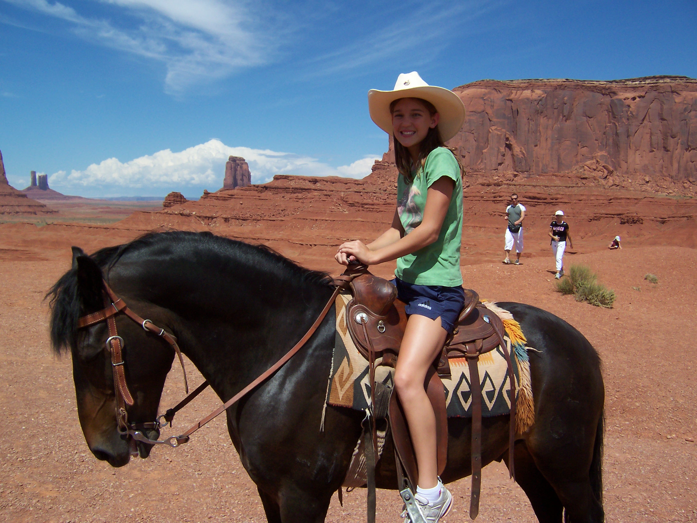
Still it was a long day and with the bouncing road I was starting to get really tired until something wonderful happened. If you remember in a previous post I talked about how we had stopped and gotten pictures of the girls on horses in Monument Valley many years ago, and I got really excited when we went to John Ford’s point and I saw a horse and this sign.
Turns out that the gentlemen who took that picture, Frank, passed away just this past October and now his grandson Zach had taken over the business. Zach told me that the black horse, Pistol, had also passed away, but after 20 years of doing a really great job. His new horse Spirit was almost as good, although the young man talked longingly of how wonderful Pistol had been. I got really excited and wanted to recreate the picture we took and the young man was happy that I remembered his grandfather fondly and was more than happy to help us recreate the shot. I took a moment and dug up the pictures from 14 years ago and here is the original shot with Lee.
Lee, fourteen years ago on Pistol.
Lee and I both took a turn and I have to say it seemed much scarier as a 50 year old because we were much closer to the edge than I remembered. Spirit did a wonderful job though and didn’t move an inch and we were able to recreate the moment.
Lee a little grayer but still has that wonderful smile.
And here’s me, really it felt like we were right on the edge 🙂
It was a wonderful way to end the day and I was so happy that Lee was finally able to fully experience Monument Valley. In our old lives we used to drive through places and take quick pictures, but now we are able to fully sink into the experience. All in all it was the most expensive day we have had in awhile, but for us was totally worth it.
(If you decide to do this, try really hard to go when there’s very few people, and get the “Man On A Horse” shot that people are trying to emulate. This is what it’s supposed to look like, below, and you shoot it not from Ford’s Point, but the point just before Ford’s point. That way you get the full effect. – Lee)
(And if there’s people in the shot, don’t worry, you can edit them out with Photoshop. It’s easier than you think, as you can see below. – Lee)
Camper Chronicles is a participant in the Amazon Services LLC Associates Program, a program designed to provide a means for sites to earn advertising fees by advertising and linking to amazon.com. We very much appreciate any purchase you make via our website links. There is no additional cost to you and helps support our blog. Search Amazon.com here
Or you can check out our recipe book filled with 80 real recipes we have cooked in our RV and taste tested by Lee himself. The cookbook specializes in recipes that have a limited number of ingredients, without sacrificing flavor and is organized into categories that matter to full time RVers such as Happy Hours, Travel Days, and Pot Lucks You can preview the kindle version on Amazonor the Apple version onItunes. It is available inpaperback on Amazon if you prefer.
It was still windy after we went to Garden of the Gods, but since we were traveling back towards Kayenta to meet a friend of mine at 3pm, we decided to make a quick visit to the Navajo National Monument. As a general rule I am a big fan of the lesser known Monuments, but this one was a bit of a disappointment. It didn’t help that the wind was pretty relentless and there were big dust storms along our drive.
Couldn’t see anything as we headed towards Monument Valley
When we finally got to the monument, we were pleased to find out it was free, but the only way to see the large cliff dwellings cave (the main feature of the park) was a 1 mile round-trip walk down a paved, but very steep path. Since it was windy and a little cold, I wasn’t crazy about the hike, but there really wasn’t anything else to see. I did enjoy how they had small signs along the way describing the native plants and how they were used by the people, but it was really cold and by the time we got to the lookout platform I was definitely regretting not having ear muffs on.
I thought the dinosaur footprint was pretty neat
This Hogan was near the visitors center
Paved path
Lots of these signs along the way. I found this one of particular interest because the Navajo people still eat the nuts today.
The valley was pretty
Path got very steep at the end although in all fairness we did see a woman in a wheel chair although her young sons were straining while they pushed her back up.
The view itself was from pretty far away and Lee and I took turns looking through the long lens of our camera to see the structure. There is one of those giant magnifying binoculars at the end, but I would really recommend bringing your own if you want to see any detail. The dwelling itself was very cool and was used by different people over the ages. It held about 125 people at one point and if the climb to the base wasn’t such a long one I would have loved to have seen it from the bottom.
There were several; caves but the one on the far right has the dwellings in it
The view with the naked eye
Telephoto lens
The half mile back up was tough for me and I had to stop a couple of times to get to the top. We were at 7,300 feet and the combination of that and the wind in my face was pretty tough and left me wondering if it was worth it. Quick Update: I was looking for pictures with the girls when we came to monument valley and it turns out we visited this national monument once before. Neither Lee nor I had any memory of visiting the first time. Take from that what you will 🙂
My windblown look
Finally made it to the end and there was a really terrific Navajo gift shop at the top. The woman who was working took the time to explain several items to me and I purchased a pair of earrings and this really cool beaded carabiner. We don’t have a ton of space in the RV so I always gravitate towards mementos that are both a keepsake and functional.
After seeing the monument we had just enough time to get to my friend Rich’s house at 3pm. Thankfully I had asked him his time zone in advance, because despite Kayenta being in Arizona the entire Navajo Nation is on Mountain Standard time. This is an important thing to note, especially if you have a tour you have purchased, because although the phone did a nice job of keeping the correct time, our GPS seemed confused by it all.
We made it on time and had a great evening with Rich and his wife Susan. Rich and I grew up together as our fathers and mothers were good friends, and it’s been a really long time since I have seen him. Last year he moved to Kayenta and is a physician at the Kayenta Medical Center. I was really interested in hearing about working on a reservation and we also spent quite a bit of time catching up on where our lives had taken us over the last few years.
Rich and me
Lee and he got along great, in no small part because he fed us rib-eye and apple pie! They didn’t read our blog up until this point, so just fed us the kind of foods they liked. It was a great meal and the conversation flowed and it was really wonderful spending time with him. Because we were kids together while our Dads were in Medical school, we both shared the somewhat unusual experience of moving from small towns to inner city Philadelphia and then back to small towns again. Those shared experiences on some level have bonded us for life and it was really wonderful getting to know each other as adults. Plus it made our Moms happy and that’s always a good thing 🙂
Lee loving his apple pie. Sorry Susan, I should have gotten a picture of you with Lee and his pie 🙂
We made a point to leave somewhat early, but still ending up getting back to the campground after dark. As Lee was walking up to the steps he stopped dead in his tracks and I almost ran right into him. What he saw, which I barely could see, was that the bottom half of our entry door window was broken. Our initial thought was someone had broken in, but we both soon realized the screen was intact. Lee cleaned the glass and opened the door and I immediately checked the inside. Thankfully nothing was missing and it became clear that the window had probably been broken by a rock or simply by flexing in the strong winds.
It was pretty cold in the rig, and we knew we couldn’t leave it that way overnight. Unfortunately it was late and the nearest hardware store was 45 minutes away, and closed, so Lee started looking around for something he could use as a temporary solution. I have called my husband the RV MacGyver, and once again, he did not disappoint. He found this shallow plastic pan that was actually destined to be thrown away in the next purge, and stood outside in the wind as he cut it almost perfectly in the dark with a utility knife. After he got it in place (on the inside of the door) he used the existing screws to hold it in place, then added some self tapping screws for more stability, and then used black gaff tape (which we never go anywhere without) to seal the edges. Really good job, especially considering the cold, wind, and dark, and we are going to actually try our next drive and see how it holds in place. If it won’t hold we can always stop and get a piece of plywood, because we simply won’t be in a situation for a permanent fix until we get to Oregon. Update: Turns out our door is no longer made and the piece of glass from the factory would cost $900!! The tech Lee talked to recommended getting a local glass person to cut a custom piece of glass, and since there is someone who does it in Moab we are looking into getting it done as I write this. Further Update: The guy replaces glass but can’t cut it, so I guess it will need to wait.
Lee fixing our door!
(The pan is actually designed to go under a household water heater and catch drips and leaks, but I bought it to use as a soaking pan for our giant round fire pit grill, and the grill surfaces of our Weber Q grill. All of those are large but not tall, so this was the perfect way to soak them. But, I haven’t used it in over a year, so it was going to be purged. – Lee) The next morning we woke up and were pleased to see the solution had held up overnight. It was still windy and actually a bit colder and I was really over the weather. We knew that our first 10 days the weather was almost perfect and we were overdue, but it still sucked. I really needed some time to get caught up on blogging before moving onto Moab, so we decided to just drive up to the Four Corners Monument and step on the square since we knew from talking to other people that was a “ten minute thing”.
The drive was kind of interesting, because driving up we saw our first oil rigs in Utah. We also saw what looked like wild burros, but they also were pretty healthy and had tags in their ears so maybe they actually weren’t. We arrived at Four Corner and spent $5 each to get in. One interesting sign we saw at the beginning stated that spreading of ashes on Navajo land was illegal because they consider cremation a “malicious desecration”. Good to know.
This burro was tagged so not sure if it was wild or simply escaped ? He seemed in pretty good shape.
Driving up to the site we could see there was room for big rigs.
The circle
The square is completely surrounded by craft booths and despite the weather many of them were manned. It was crazy windy and very cold, but thankfully there wasn’t much of a crowd. We took several pictures and then got back in the truck and headed back towards our campground on another road. The best part about the whole thing was I got a sticker for my RV, and we bought gas pretty close by for $3.05 a gallon. That is by far the best price we have seen since traveling this area.
You know it’s cold when Lee is shivering.
I did like the seal very much.
Our feet in the very center. (Or ARE they? The answer can be found at the end of the post. – Lee)
I get why they have a limit of three photos but since there was hardly anyone there we took more
Here is my shot with a hand or foot in each state. I decided to go twister style. Way more dignified than what Lee wanted to try 🙂
It was early and cold so the food booths weren’t open.
I was pretty bummed because the Navajo taco stand wasn’t open and I really wanted to try some fry bread. So we went a little out of our way to the Twin Rocks restaurant in Bluff, and for $12 each got to try some fry bread. Lee’s had a huge Navajo taco with chili, and I had a Shepherd sandwich, which was a roast beef sandwich on fry bread. Lee really loved his and I liked the bread, but using it for a sandwich sort of watered down the flavor because there was so much of it. Plus, Navajo food itself is pretty bland, even for me, which is saying something, since I am from the Midwest and pretty used to bland food. Still I am glad we had the experience and I really liked the restaurant. The service was great, they had a wonderful gift shop, and the setting was really beautiful. Highly recommend it if you are traveling through Bluff.
Twin Rocks Restaurant, what a fantastic location
Restaurant
Lee had Navajo Fry bread which was like chili nachos but on frybread. Pretty good
My shepherd sandwich was just too dry. It was all bread, but I am glad I tried it and huge value for the $12. The french fries were actually some of the best I have ever had.
Had a great gift shop with local artists.
The last thing we did was stop and take a picture of the rock at Mexican hat. There is a large pull-off right by the stone pile, and a dirt road that goes around on both sides. We drove the road and took pictures from it from several different angles. After all the amazing rock formations we have seen I didn’t think it was that big of a deal but I did like how it looked like different things from different directions.
Mexican Hat rock. I actually though it looked more like a falcon on a rock from this view.
Hopefully tomorrow the wind will stop because we are going to go into Monument Valley and try to take a jeep tour. We have waited all week for the best forcasted day and Lee is VERY exited about getting to see the places the main road doesn’t allow you to access. Hopefully it will work out, because I am ready to move on. Moab is next, and we are halfway through our tour month in Utah, and I know lots of really great things are waiting for us there.
(So here’s the deal with the Four Corners monument, and hopefully this won’t ruin your day. The Four Corners monument is not where it’s supposed to be. It is around 1800 feet east of the actual location where the borders of the four states meet. Personally I still enjoyed the experience, because it’s just cool. Had I known this information while I was there, I would have insisted that we ALSO take a handful of pictures in the actual location. Partly because it would have been funny, but also partly because what’s accurate is accurate. I have read a LOT of information about this, and it bothers me more than a little that the prevailing opinion seems to be that if everyone agrees it’s in the right place, then it’s in the right place, and the longer people agree, then the more solid that “fact” becomes. I am genuinely distressed by this way of thinking. The longer you are convinced that a wrong thing is right, does it not make it less wrong. The boundaries of the states are based on longitude and latitude, and those lines intersect at a real, actual spot. The fact that the monument was built 1800 feet east of that spot doesn’t move the spot, even if 1800 feet is minute in the scheme of long/lat. And it also doesn’t detract from how awesome and cool and kitschy the monument is. It’s not like I need them to change the name of the place (along with all the T shirts and stickers) to “1800 Feet East Of The Four Corners Monument”. They can keep calling it what they call it, I don’t mind, as long as we all understand and agree that it’s close enough. But it’s still off by 1800 feet, and that matters just as much. – Lee)
Camper Chronicles is a participant in the Amazon Services LLC Associates Program, a program designed to provide a means for sites to earn advertising fees by advertising and linking to amazon.com. We very much appreciate any purchase you make via our website links. There is no additional cost to you and helps support our blog. Search Amazon.com here
Or you can check out our recipe book filled with 80 real recipes we have cooked in our RV and taste tested by Lee himself. The cookbook specializes in recipes that have a limited number of ingredients, without sacrificing flavor and is organized into categories that matter to full time RVers such as Happy Hours, Travel Days, and Pot Lucks You can preview the kindle version on Amazonor the Apple version onItunes. It is available inpaperback on Amazon if you prefer.
It was windy as forcasted the next morning, and Lee was outside waiting for Harry and Vicki to leave because he wanted to pay forward the favor Steven had done for us, and take a picture of Harry and Vicki’s rig as they left. When he noticed they stopped near the entrance for a long time he walked over to check on them, and Harry told him that there was an error message on his dash about the wiring harness for the trailer and he had noticed that the trailer brakes weren’t working.
This is something that has happened to us twice (once in Alaska when Lee, Bill, and Ben had to cobble something together) and a second time more recently when it stopped working again while we drove through Texas to the RV Dreams reunion rally. Because of these incidents, Lee always carries a spare RV Blade Connector plug (only $6.41 on Amazon) and because they are universal he was more than happy to give it to Harry. I have included the link above, and seriously, do yourself a favor and buy one of these. I think we have proven that you are bound to be in an inconvenient place when one fails!
Before Harry replaced it, Lee recommended making a diagram of the wiring before removing the old one. Lee had learned the hard way that even though the connectors are universal, the wiring colors are not always, and it was much easier to wire the new one if you knew which wire went where. So they did that and then replaced the connector pretty quickly. It was especially impressive because they were outside in the crazy wind, but that didn’t phase either one of them.
Vicki and I, on the other hand, stayed in her truck and were talking and laughing until they were done. I know we got the better end of that deal, which I was totally fine with, and it was nice getting some more time to talk before they left. The new plug worked perfectly and after testing the brakes, we all said goodbye again and they headed down the road. I am really glad we got to spend some one-on-one time together and it was wonderful getting to know them better.
Harry and Vicki pulling out with a shiny new trailer connector, and on the way to their next adventure!
By the time Lee finished and we got settled back in our RV, it was really rocking in the wind. Lee said it felt a little like we were in a boat in high seas and the motion started to get to both of us a little. Ultimately Lee put rubber wheel chocks between our trailer wheels, lifted the back jacks, and lowered the front, which helped a little. We really didn’t want to just sit in the rig though, and since there was lots of blue sky (despite the wind) we decided to give The Valley of the Gods a try. We were hoping that it would be less windy at lower elevation, which turned out to be the case, so we headed out for a scenic drive.
Through sheer dumb luck we selected the entrance on Highway 163, but you can also access the road on Highway 261 just south of the Moki Dugway. After traveling the road I absolutely recommend going in off 163, and maybe even turning around and going back that way, because I found the second half of the trip pretty miserable. The first half of the road was absolutely incredible and definitely the views earned the Valley of the Gods name. I did the best I could, but the pictures absolutely don’t do it justice, and since the drive is only a couple of hours, it really isn’t something that should be missed.
There were several boondocking spots near HWY 163 and most had 2-3 bars of AT&T
Yes, it was that red.
The rocks were beautiful, both from far away and closeup, which isn’t always the case.
Despite the wind it was a perfect blue sky day
These two rocks were like sentinels at a gate.
Panoramic of the entrance to the best section
The road was really great until this point and friendly for a big rig, then we hit a dry creekbed. The drop off was much steeper than it looks.
Definitely wouldn’t want to bring a rig through here, because we took it slow in our truck due to low clearance. Lee went slowly on the left side which had a little more gravel and we did OK. This was by far the worst spot, and our 4×2 handled it just fine.
So glad we made it through because on the other side the views were even better
This formation was my favorite because it looked like toy soldiers are lined in a row
The boulders at the base were taller than me.
A little truck porn 🙂
Unfortunately after we got through the great section the road got really bouncy. Lee wanted to turn around and do it again with the Go Pro, but I actually had to pull a veto on that idea. The first half was absolutely tremendous, the second half not so much, but I would absolutely do it again, just maybe turn around and drive back the way we came once we’re past the good part.
You can also boondock in this area, which many friends of ours have done and liked. If you do, I wouldn’t go too far from the 163 highway entrance with the big rig unless you have a second vehicle to check out the road conditions. We liked it so much we even briefly discussed moving down there from Gooseneck, but moving is a pain, and we were pretty happy at Gooseneck Park. Next time though we might check it out, because it would be nice to spend a little more time there walking around.
Camper Chronicles is a participant in the Amazon Services LLC Associates Program, a program designed to provide a means for sites to earn advertising fees by advertising and linking to amazon.com. We very much appreciate any purchase you make via our website links. There is no additional cost to you and helps support our blog. Search Amazon.com here
Or you can check out our recipe book filled with 80 real recipes we have cooked in our RV and taste tested by Lee himself. The cookbook specializes in recipes that have a limited number of ingredients, without sacrificing flavor and is organized into categories that matter to full time RVers such as Happy Hours, Travel Days, and Pot Lucks You can preview the kindle version on Amazonor the Apple version onItunes. It is available inpaperback on Amazon if you prefer.
The next morning we woke up bright and early, but decided to delay our departure until the clouds cleared a little bit. We had been having amazing luck with weather, but this morning was sort of cloudy and since we were doing a scenic drive, needed some good sky to get the pictures we wanted. Thankfully it cleared up by around 11am, so we ate an early lunch and headed out.
There is a big loop that circles the Valley of the Gods and the decision on which way to go was largely determined by the Moki Dugway. There is a 3 mile section of Highway 261 that is gravel road and seriously extreme switchbacks. Harry had driven it the day before with his four-wheel drive, so we had the information from his experience, but once again the 2-wheel drive made us more cautious and essentially Lee had to decided if he wanted to drive up the 10% gravel grade or down it. He decided he would prefer to drive down, which I was a fan of because this put that section at the end of our day. Consequently we made a right onto Highway 163 and started around the loop.
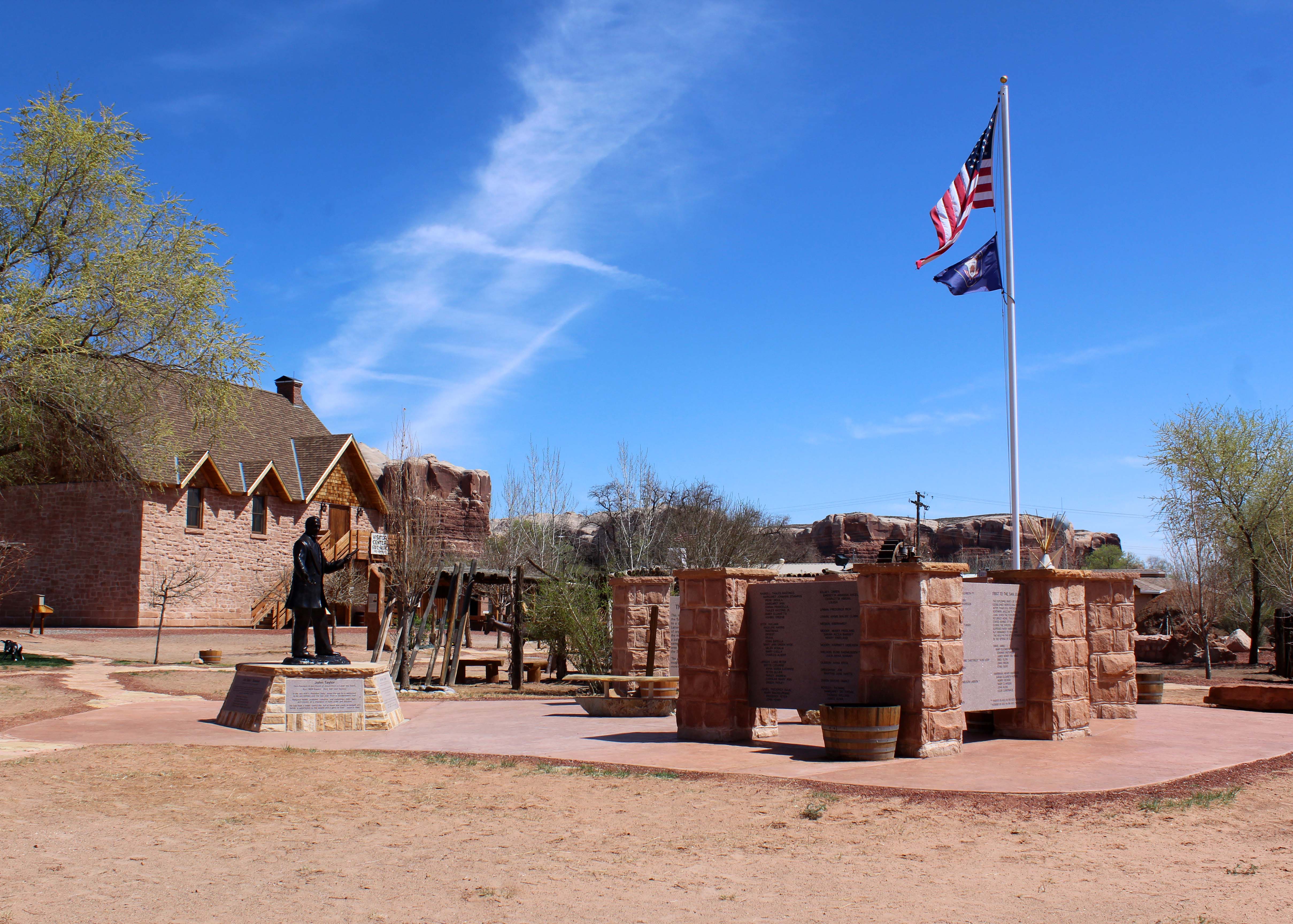
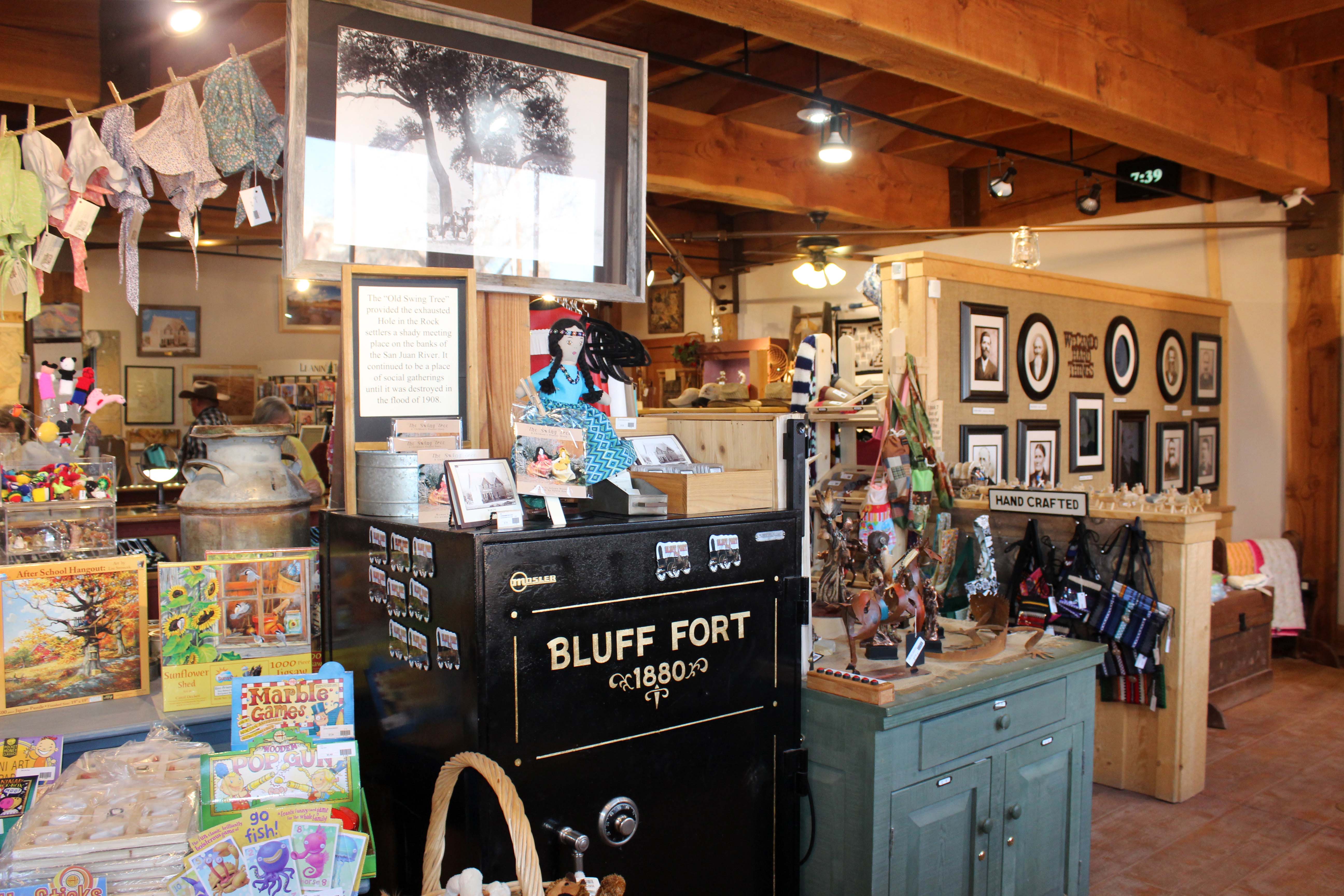
The first place we stopped was in Bluff, Utah which is right on the outer edge of Navajo Nation. We followed the signs and turned down the road to an historic loop to stop at the Fort Bluff visitors center. I mentioned in our last post how frustrated I was by the lack of information in the area and Steven had mentioned that this visitor center was a really good one. Despite all that we almost didn’t stop, but I am so glad we did, because it was really terrific.
Fort Bluff Memorial for the settlers who made the journey.
The moment we walked in a woman, in historical garb, walked up to us and started telling us the story of the fort. A group of pioneers were sent to settle the area and in order to make it had to go through Hole-in-the-Wall pass. They had 125 people, 1800 head of cattle, and an early winter had created snow behind them when they reached the pass. They thought they would be able to get through with minimal issue, but the journey of 6 weeks actually took 6 months.
They managed to get through by dynamiting larger holes in the rocks and then building a narrow road on the outside of the cliff. They also lowered the wagons on very steep grades, using men and ropes to manage the feat. It was a fascinating story and I was completely caught up in it, having never heard it before. Lee knew the story, but not in that detail and he enjoyed the telling as well.
A picture of the “hole” they came through. You can visit this by traveling hole in the rock road in the Grand Staircase-Escalante National Monument. Landslides have caused this route to no longer be passable.
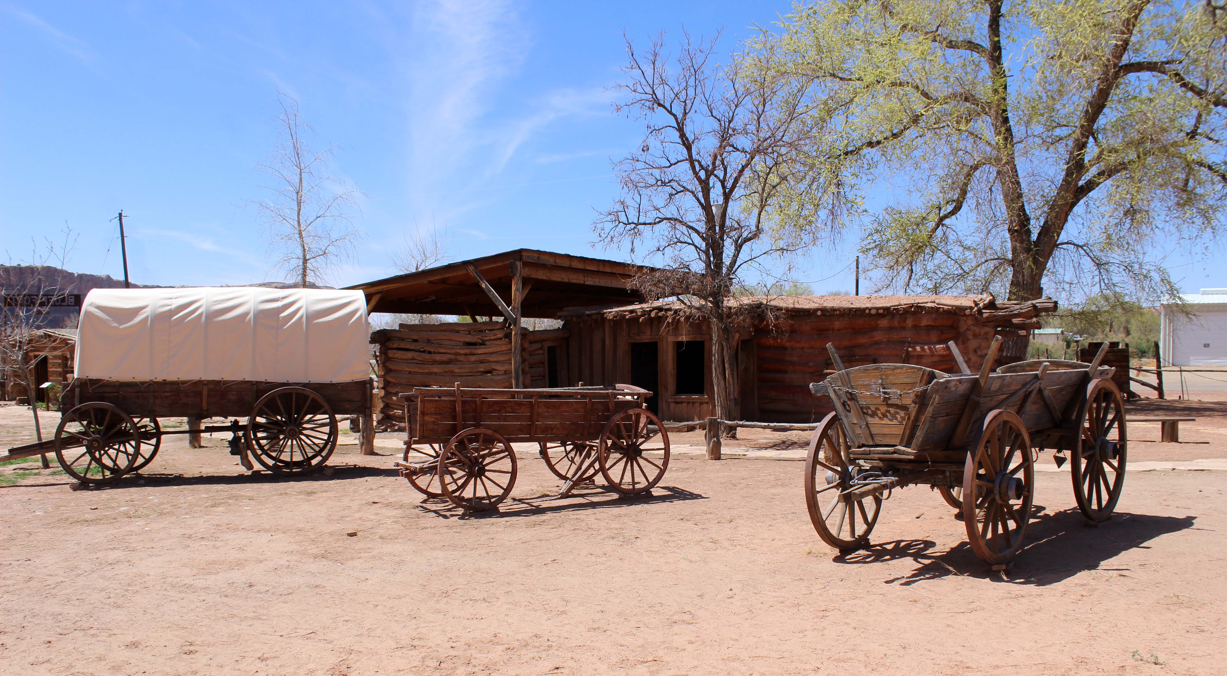
This picture is a recreation of how they did it. There are men in the back holding onto ropes and acting as human brakes to get the wagons down the steep grades. Absolutely incredible feat.Along with the information, they also took us to a nice little section with lots of free maps and pamphlets, we looked through a very nice gift shop and then went out to walk the fort re-creation, which was built around the one original cabin remaining.
Visitors Center
Original Cabin
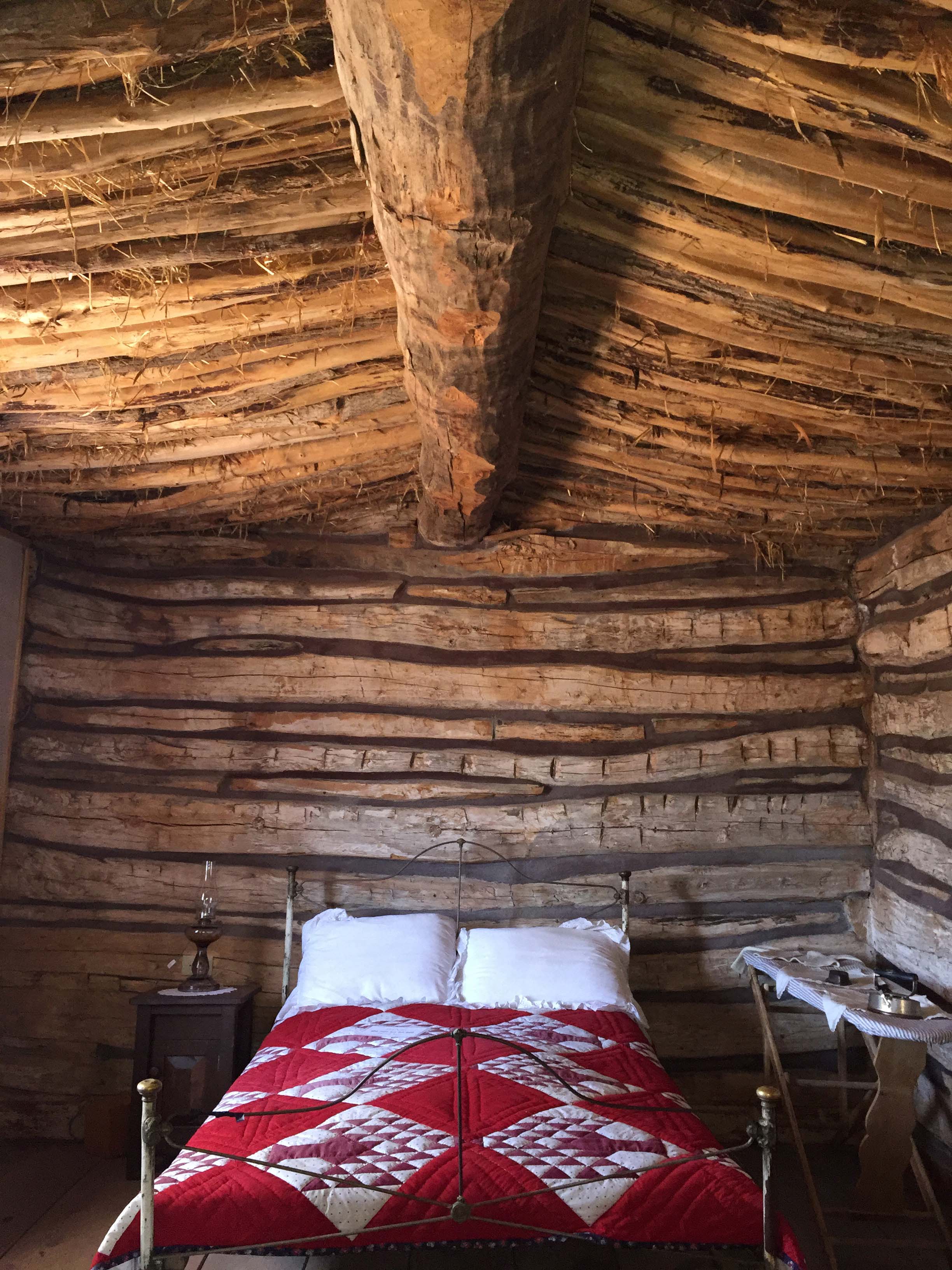
The thatched roof was really interesting to see
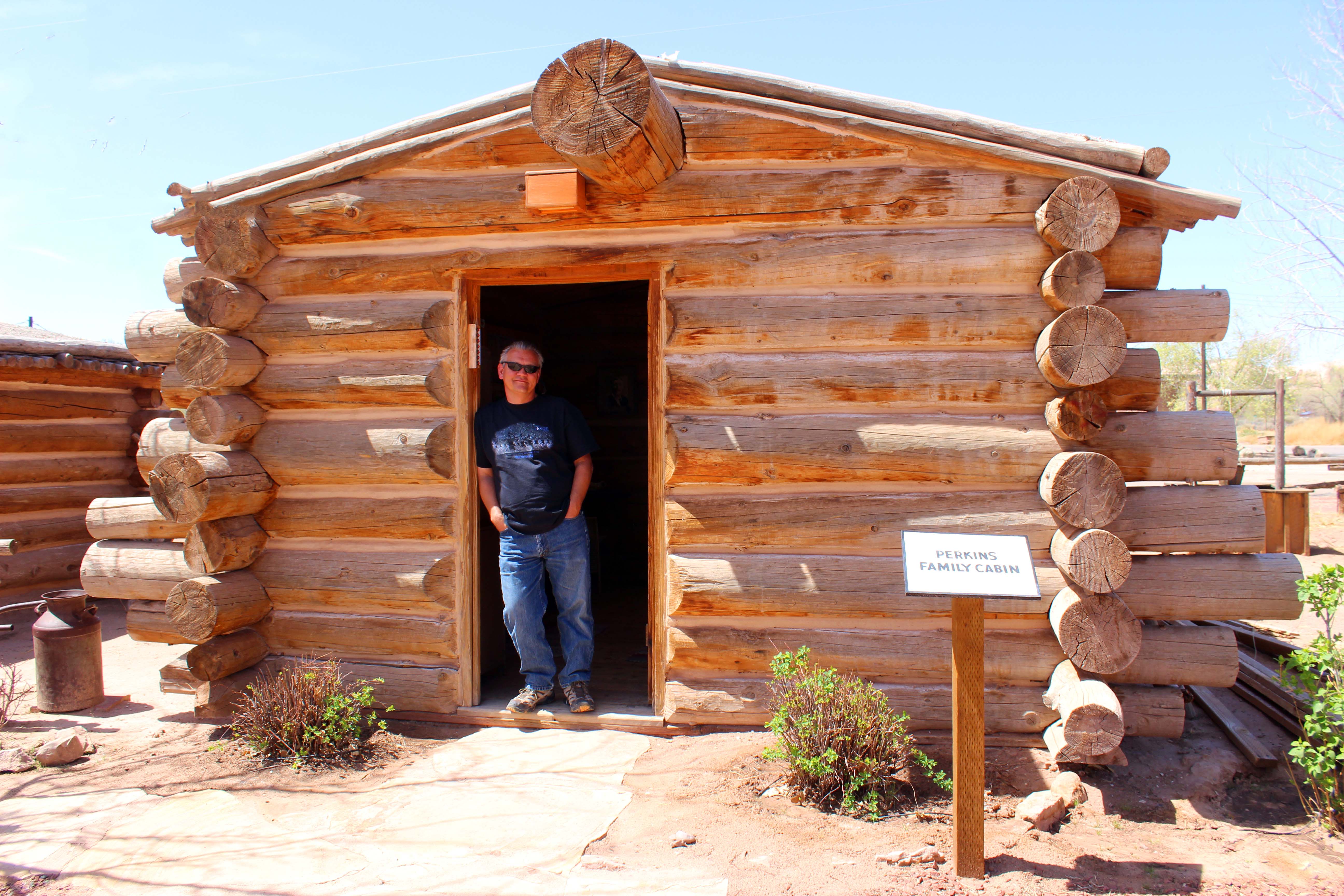
This is where the visitors center took itself to the next level as every cabin told the story of one of the families and had authentic memorabilia provided by the families descendants. There were pictures, family trees, items used in the crossing, and everyone had an audio recording about the family that was done in multiple languages.
Every cabin had a short recording of the family including little details about them that really brought them to life
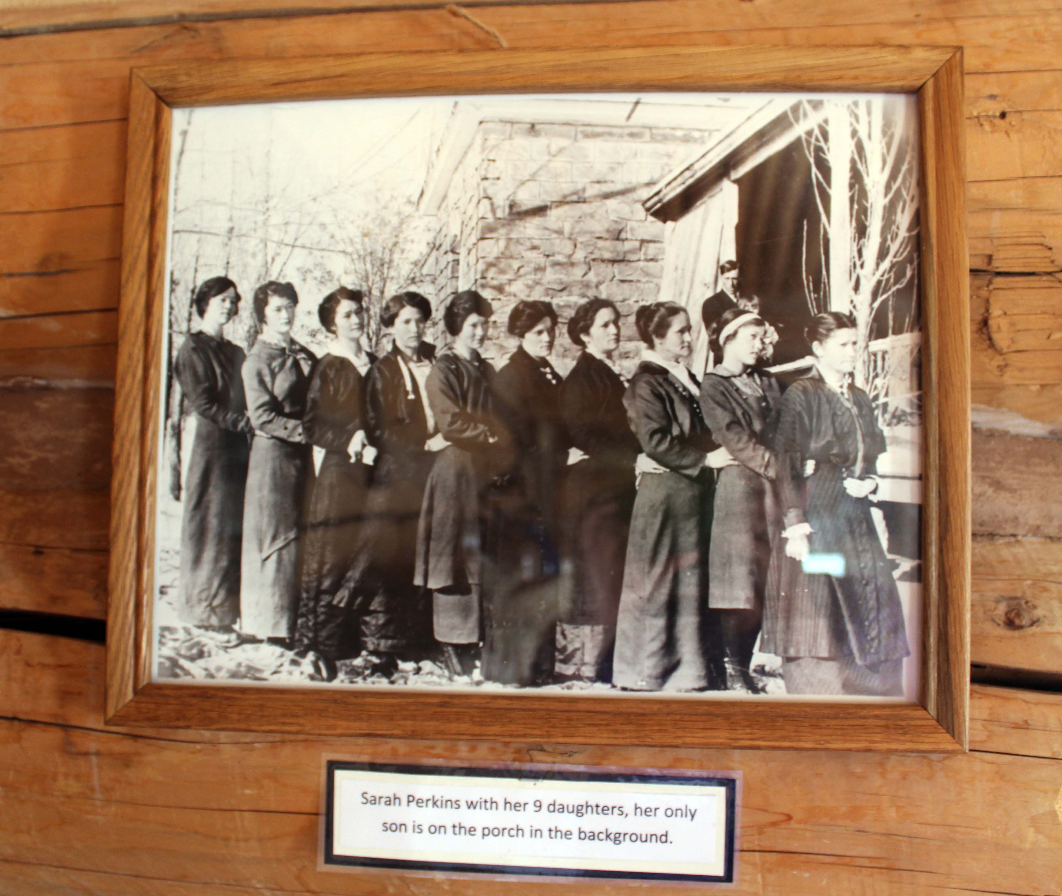
The Perkin’s Brothers were from Wales and were dynamite experts. They were the ones who made blowing the hole wider possible
Sarah Perkins with her 9 daughters. I thought having three girls was challenging!!
Extremely well done and I especially appreciated how they were open about the polygamist families. I found that particularly fascinating and was happy they didn’t cover that up, but provided pictures of all the wives and many of their children. The entire experience was the complete opposite of what had happened the day before and the best part of all was it was totally free. I absolutely recommend taking time to make the stop and they do have spaces for large rigs, if you are just passing by.
This was the local Bishop and pictures of his three wives. I found it particularly interesting that the women all looked alike (they weren’t sisters) except of course they got progressively younger.
After Fort Bluff we got on 191 North and saw a sign for the Hovenweep Monument. Since it was a 25 mile in the opposite direction from where we were going we decided to give it a pass, but definitely might be worth a visit on a later date. Next we turned left on 95 West and saw a gas station where we decided to pull in for some gas. Here we had a moment of travel serendipity as we ran into a couple we had seen twice before.
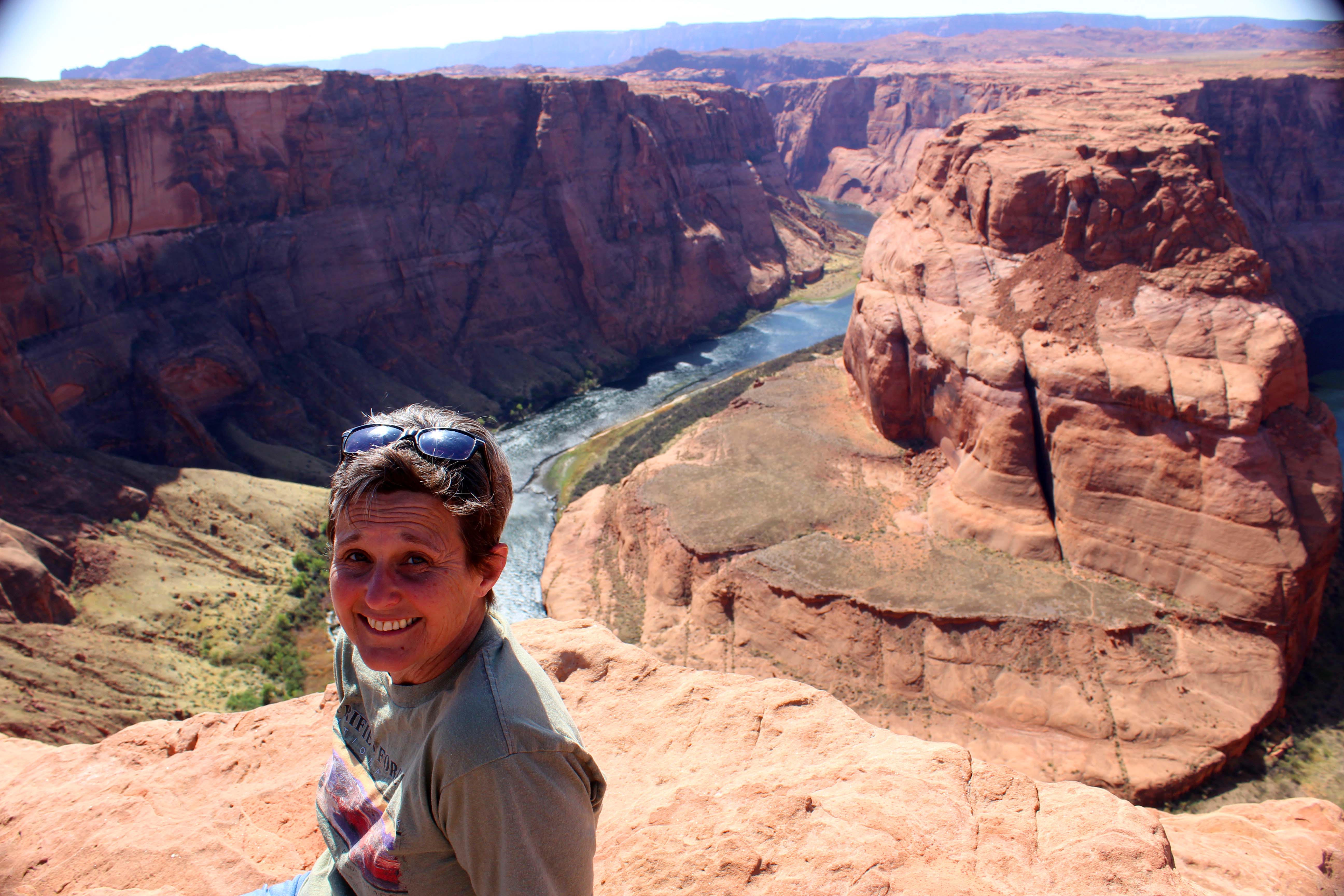
The first time I saw this couple they were at Horseshoe Bend and one of the ladies caught my attention because she had a great smile. I was hot and tired, walking up the hill, but she was obviously having a great time and it got my attention. The second time we ran into them was in the Welcome Center the day before as they were walking out as we were walking in. I mentioned that we had seen them before and introduced myself and we had a great chat in the lobby.
Turns out they are full-timers as well and were staying at the RV park next to Monument Valley. We said our goodbyes and I thought it was cool I had saw them again, but on this drive third time was the charm. We pulled into the gas station and they were at the pump right next to us. I aw one of the women over Lee’s shoulder as he was pumping gas, and immediately got out to say hi. Turns out they were doing the same route we were but had started in the opposite direction and were just finishing. They had already done the Moki-Dugway and said they saw motorcycles on it, which made both of us feel better about how our truck would handle it. I said goodbye and “we’ll see you tomorrow,” and they both laughed, but said tomorrow they might stay in. We were expecting pretty high winds for the next two days and it’s tough to find fun stuff to do when you are fighting the wind.
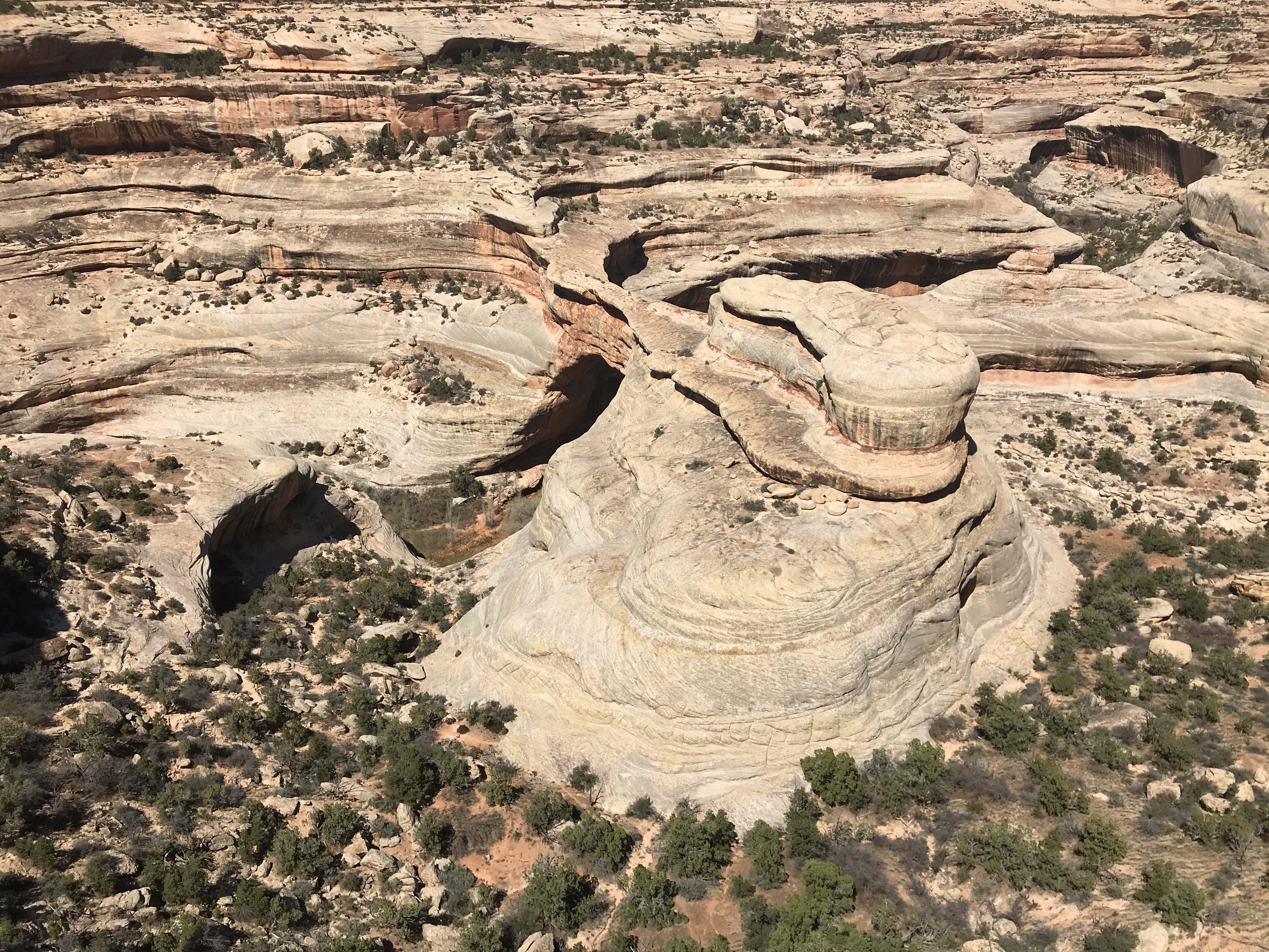
We continued on the way staying on 95 until we got on 275 towards National Bridge Monument. We had heard really good things about this park from several of our friends but it completely exceeded our expectations. There was a $10 entrance fee, but for us was free with the America the Beautiful pass, and can I say we have absolutely gotten our money’s worth from that in Utah.
Visitors Center
The park is a 9 mile drive-able loop with several trail heads and three places to stop and look at the arches. Since the trails to the base of the first two bridges were strenuous with 400-500 foot elevation changes we decided to just go to the viewing platforms. I would love to do the hikes to their bases at some point, but that’s a bit out of my hiking comfort level for now.
Path to Sipapu. It was really windy down on the point, but the walk was easy.
This is what we saw. Can you see the arch? Nope me either. Lee had to point it out to me and then I couldn’t stop seeing it. Look right in the middle of the picture for a circle to the left of a round stone with a little tip. The reason it’s hard to see is there are trees on the other side so it blended in at first.
Still can’t see it? Here it is in closeup. Right in the middle.
Next up was Kachina and we stopped first at a trailhead and walked down just a little ways to get views from both sides. This bridge is a big one and I actually preferred the view from the trailhead over the viewpoint, but both sites were good. The path to this one was a little steeper and again windy at the viewpoint.
View from trailhead. Really shows the “bridge” aspect
This is the view from the viewpoint side, which shows less of the hole but more of the bridge.
There was a rock slide (which you can see in top left of hole) which now stops the water from running through the arch.
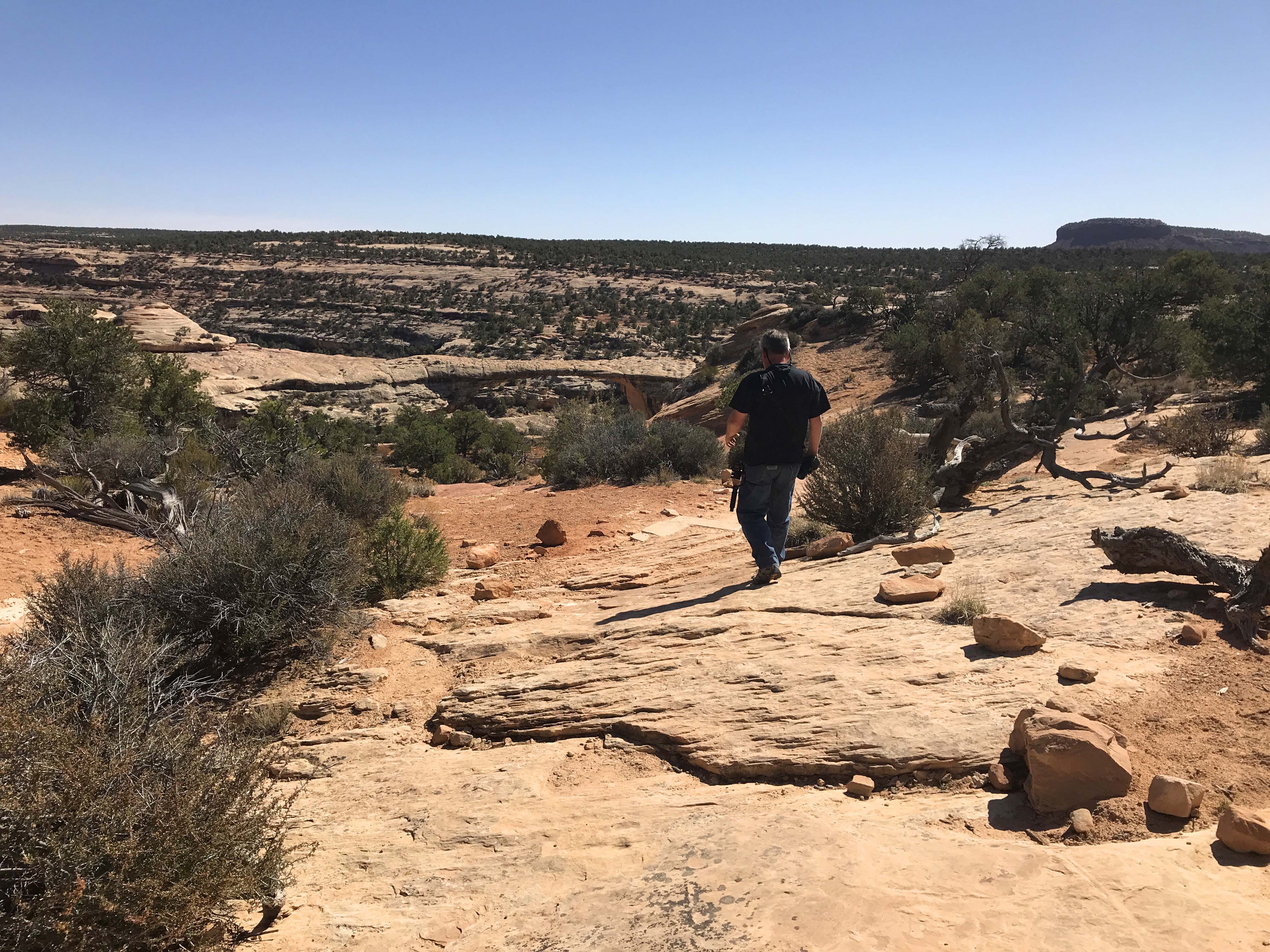
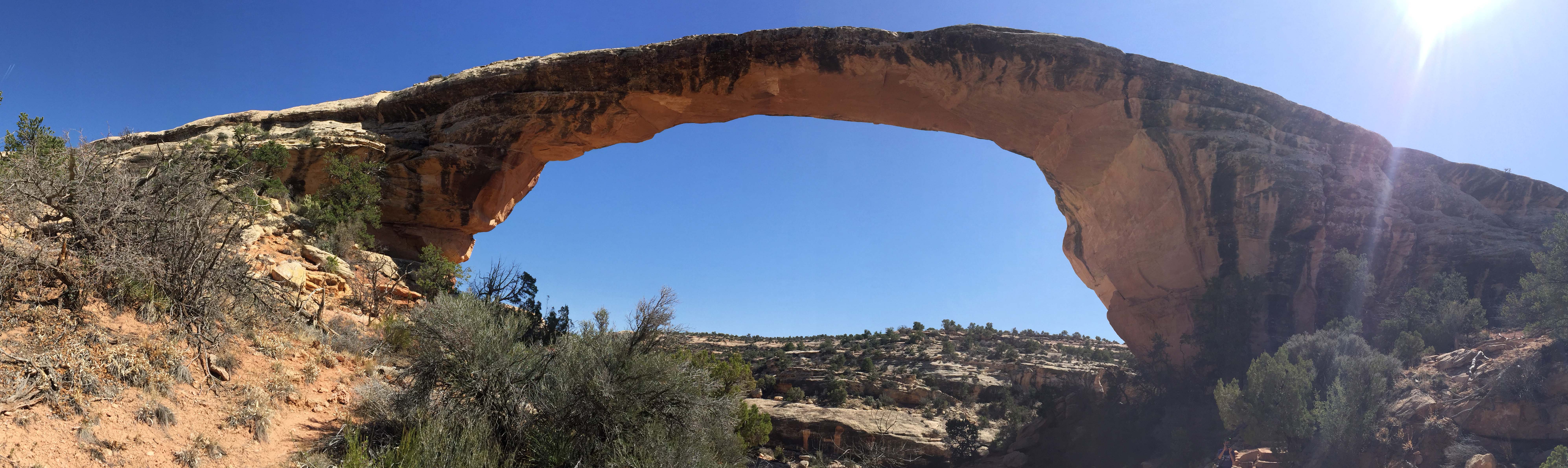
The first two were cool, but the third bridge, Owachomo, really blew them away. This bridge is 225 feet long and it was only a 2/10 mile hike (180 feet elevation change) to the base. Yes, the route was steep, and because of that we almost didn’t do it, but I am incredibly glad we did. It truly was one of the coolest thing I have seen since the three years we have been on the road and for a little while we had it all to ourselves.
Right from the beginning on the walk down you could see the bridge in the distance which I really liked
The closer we got the better the pictures
Once we were at the base it was like being beneath a brontosaurus neck. You can see me for scale
And the underside of the rock was so beautiful. Really just incredibly cool!!
About the time we were finishing up a group of teenagers came down the path and we were ready to leave. Yes the walk up was tough and I had to take a couple of breaks, but I would do it again in a minute. I loved the beauty of the rock and the dry river bed, along with the surrounding area. I hope my pictures do it justice, but even if they don’t if you are at all capable of taking the hike, please do so. I don’t think you will be disappointed.
Walking back up to the overlook you can see it is steep.
I stopped for a rest in a little bit of shade I found while Lee took some extra pictures.
The day wasn’t done yet though because after the park we still had the Moki Dugway. The road wasn’t close to the worst we have been on and the views from the top down were spectacular.
One of the many hairpin turns on the Moki-Dugway.
The picture is dark but you can see a car waiting for us around the corner at the bottom. The road is 1-1/2 lanes and we had the dually, but folks were really good about looking ahead and waiting in a section that was until our truck passed.
We saw several motorcycles going up. I thought that was a little crazy personally.
(Here’s the drive down the Moki Dugway with the boring bits cut out, and the speed at 200%, because it’s such a slow drive. For anyone who would like to know what to expect, it gives you an idea of the width of the road (about 1 1/3 lane wide) and how bumpy it is, etc. We went down instead it instead of up, because I had concerns about our 2×2 slipping on the gravel going up. Going down was a lot of fun, I just left it in a low gear and stayed off the brakes. Amazing views, and some really scary dropoffs. – Lee)
What a terrific day, and even with the late start we still got home by 5:00pm. Harry and Vicki had invited us down for some appetizers and the great conversation has us staying until after 8:30pm. At that point I reluctantly said goodnight, because I was starving and we ate a quick dinner, read a little, and then went to bed. Another big day scheduled for tomorrow, when we hope to finally see The Valley of the Gods.
Camper Chronicles is a participant in the Amazon Services LLC Associates Program, a program designed to provide a means for sites to earn advertising fees by advertising and linking to amazon.com. We very much appreciate any purchase you make via our website links. There is no additional cost to you and helps support our blog. Search Amazon.com here
Or you can check out our recipe book filled with 80 real recipes we have cooked in our RV and taste tested by Lee himself. The cookbook specializes in recipes that have a limited number of ingredients, without sacrificing flavor and is organized into categories that matter to full time RVers such as Happy Hours, Travel Days, and Pot Lucks You can preview the kindle version on Amazonor the Apple version onItunes. It is available inpaperback on Amazon if you prefer.
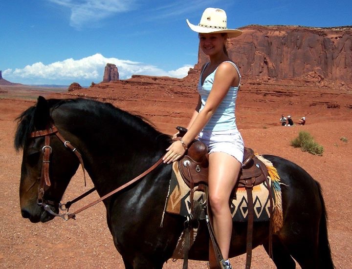
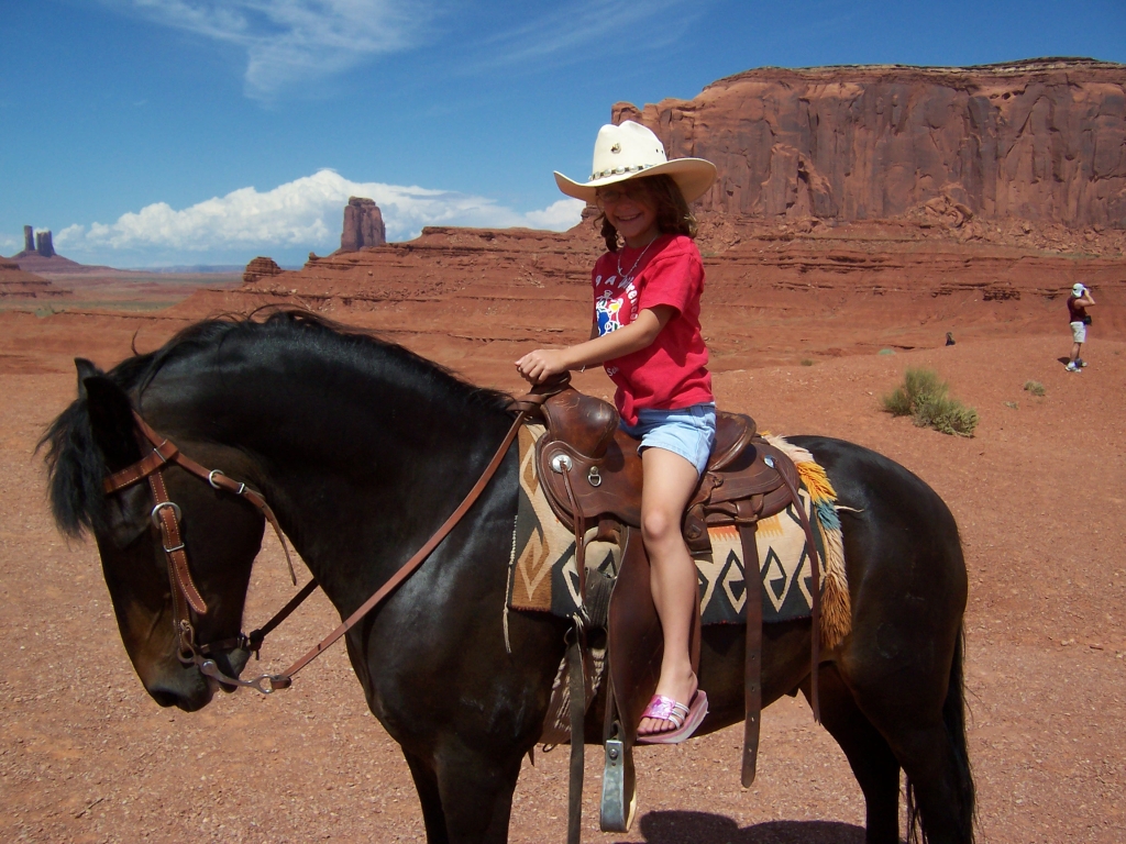
Our next major stop in Utah was the Monument Valley area, which we had actually seen a little bit of before. When our kids were young we took them on a trip to Las Vegas with my Mom, and one day we rented a car and drove round-trip to the Grand Canyon and we tacked on a fast trip to Monument Valley. Lee loves westerns, and some of the most iconic views from those movies are in the monument itself. We all had a wonderful time and took some wonderful pictures, the best of which was each of our girls sitting on a horse on a plateau, and I treasure those pictures to this day.
Kyrston/Sis at Monument Valley (K1, for our friends)
Katlyn/Katy/Kat at Monument Valley (K2 for our friends)
Kassidy/Kasey/Kay at Monument Valley (K3 for our friends)
What we didn’t get to do, not uncommon in those days of traditional vacations, was get to see anything but the park itself. We knew from talking to our friends that there was much more to see, so we scheduled a full five days to finally explore the area.
Almost everyone knows that iconic shot from Forest Gump where he is running down the road with the stone formations near the entrance to Monument Valley. Lee wanted to get some video of us walking down that road, but unfortunately we were coming from the south which was the wrong direction. It was also a pretty cloudy day, and since we knew we would be coming back this way several times, decided to wait until another day. There are several large pull-offs along the road and we saw plenty of people had stopped, so we definitely could have if we wanted to.
Iconic Monument Valley sight as seen from the “wrong side”
Beautiful views along the road
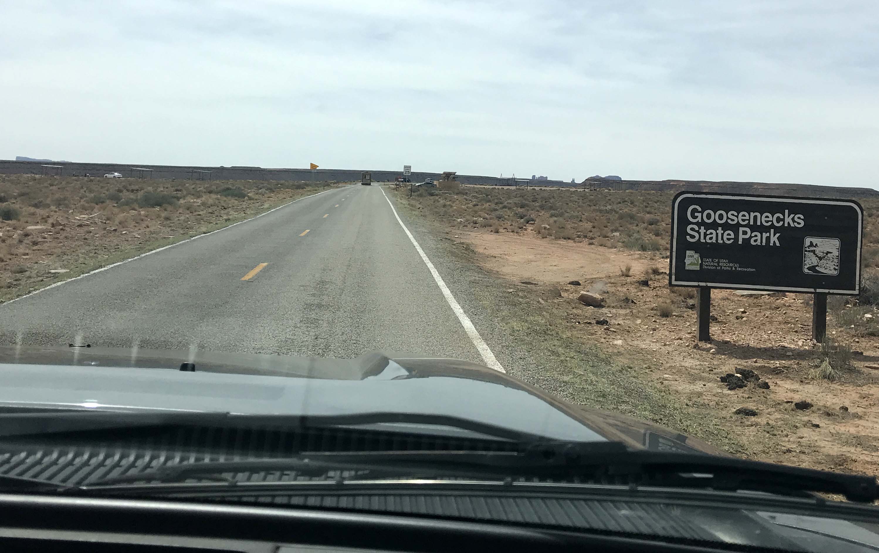
Those crowds cleared as we headed north and the road got much more challenging. There were several 6-8% grades, which included one particularly challenging one near Mexican Hat that was a 10% grade with a hard right at the end at a solid wall of rock. Yikes!! Lee handled it like a champ and very soon we were headed onto Highway 261, which is the road Gooseneck State Park is off of. The road has some scary warning signs when you turn onto it stating that it was not recommended for RV’s greater than 10,000 GVWR, but we knew that the warnings were for the Moki Dugway which was several miles beyond the turnoff to Gooseneck.
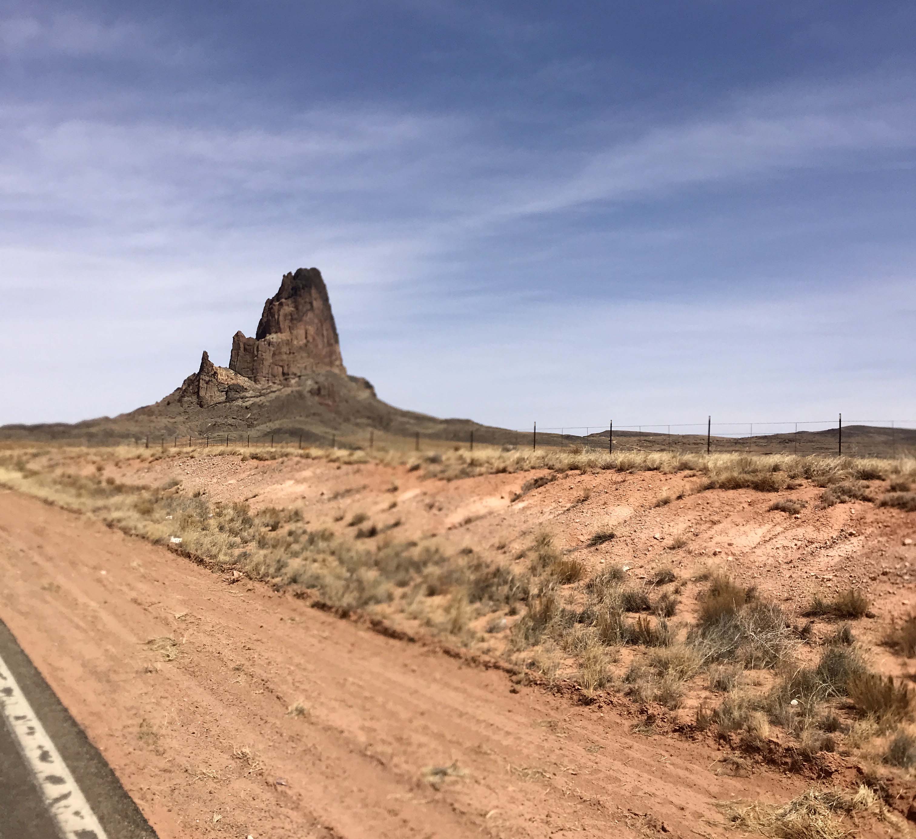
This was the road with the 10% grade and hard right at the end. The yellow sign down by one of the inns in Mexican Hat is where the road turns.
Wild Horses along the road
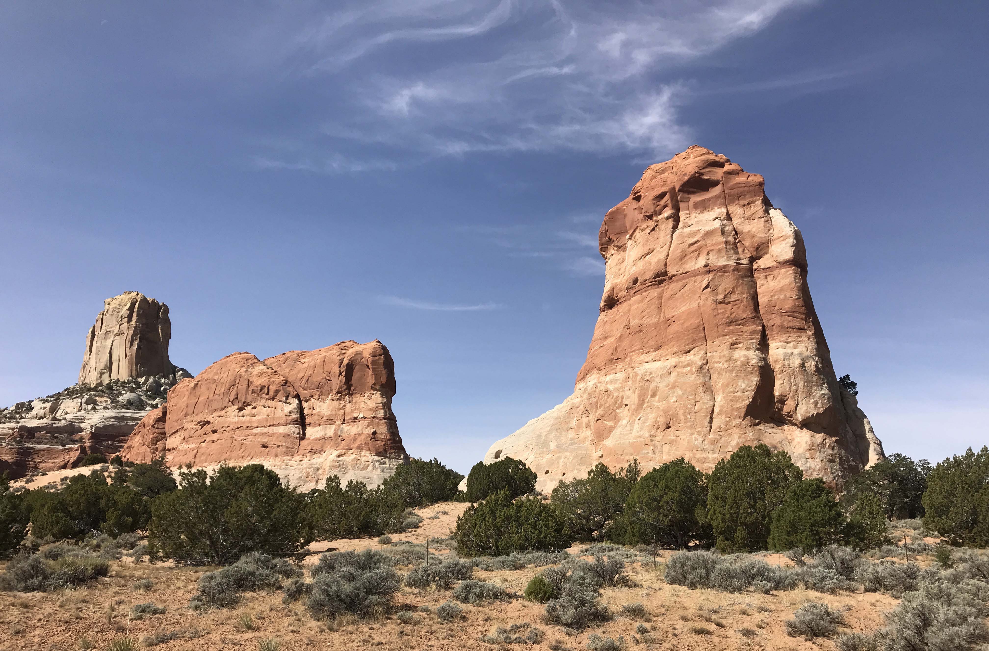
And more beautiful outcroppings
Entrance to Goosenecks
(For those interested, here’s a video showing the drive from the beginning of the road to Goosenecek to the entrance, without pulling the rig. The video is just under 5 minutes, but it takes longer when pulling a rig. I’ve included it because some people like to know what the approach will look like. I had read it was really steep, and it was not. There are a few gentle grades, and some somewhat tight curves, but overall it was’t bad. Keep in mind the Go Pro’s super wide view tends to make grades and curves look like less than they are. – Lee)
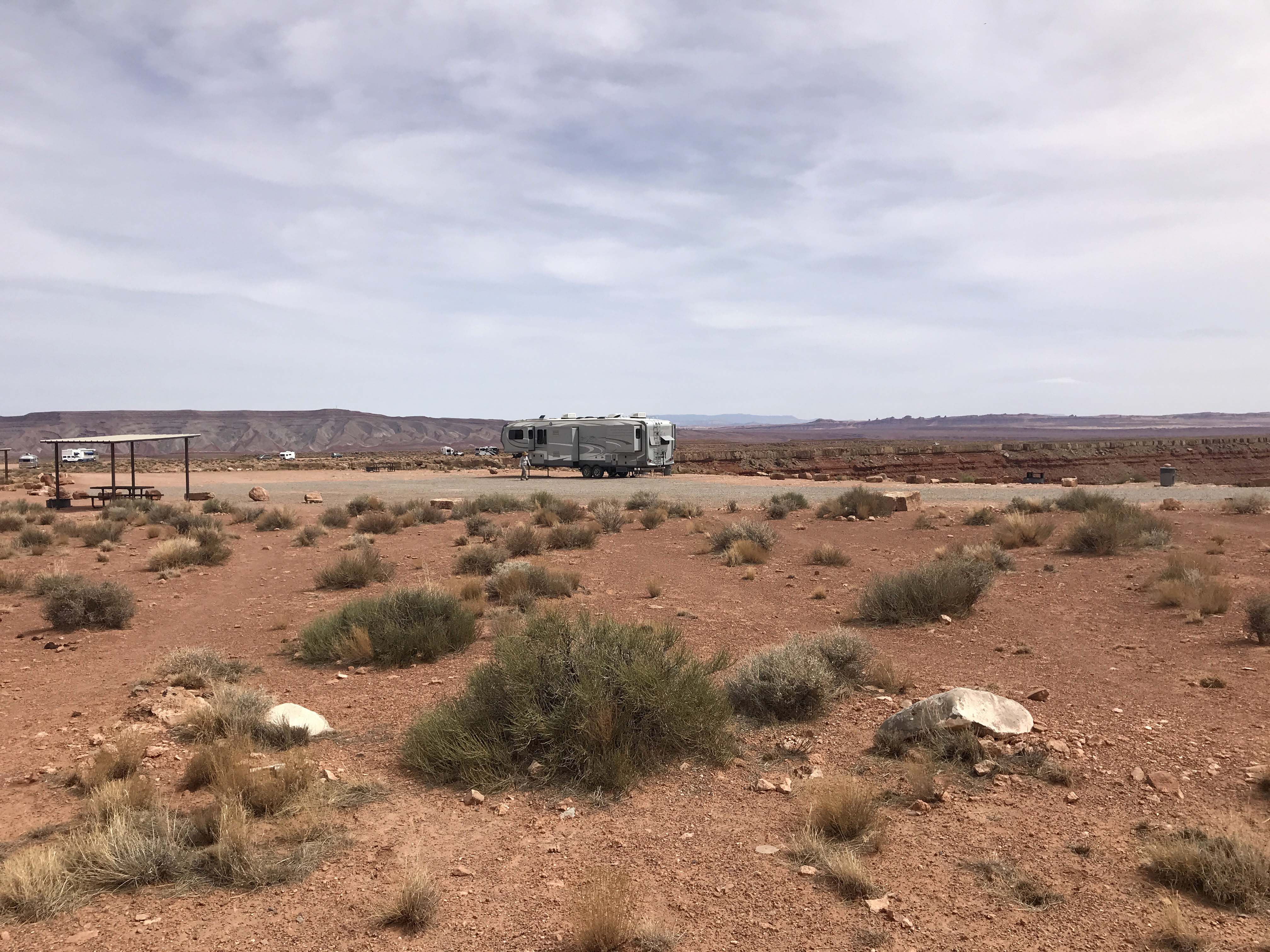
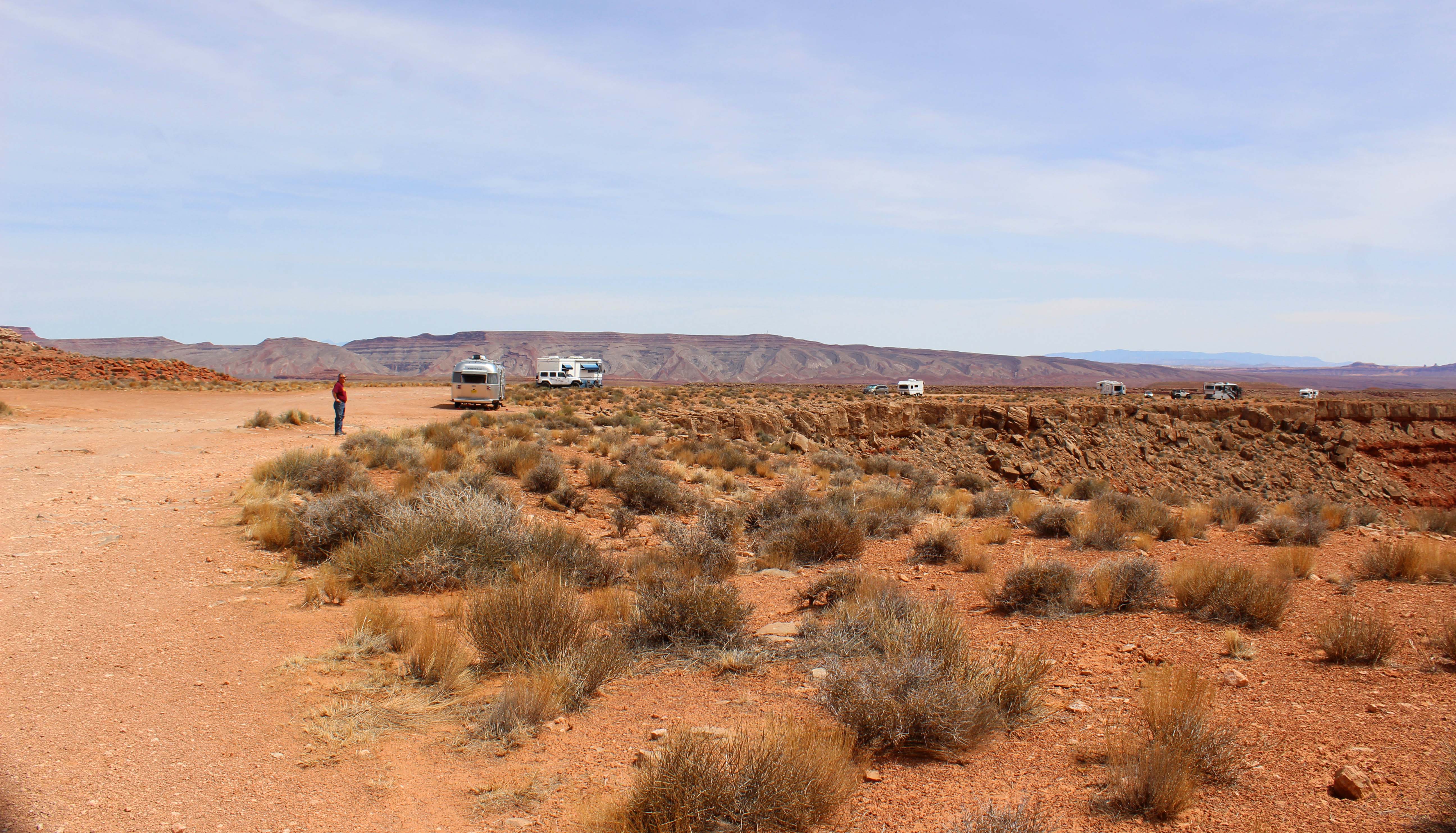
Once we reached the gate we talked to a very nice parks employee who allowed us to park our rig and take a walk around before deciding whether or not to stay the night. Unfortunately many state parks will not allow you to do this, but Gooseneck is a very informal place. It is mostly a day use park ($5 per car entrance fee) and only has a few established camping spots. That being said, there is a huge area farther down a dirt road, where several rigs could fit, and after walking the path and a ton of discussion about where we wanted to be, we finally picked our perfect spot.
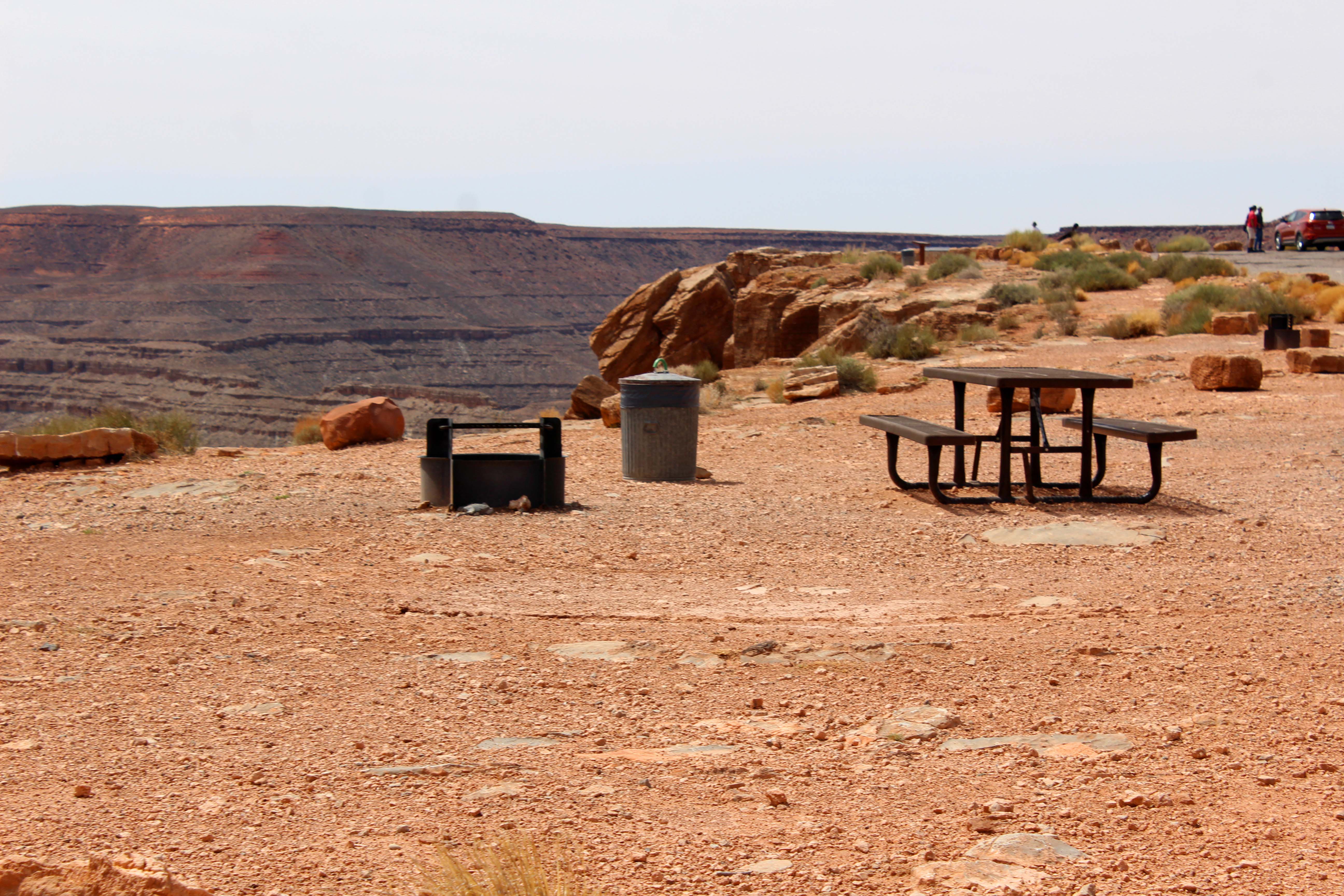
Our spot
It came with picnic table, firepit, and trash can
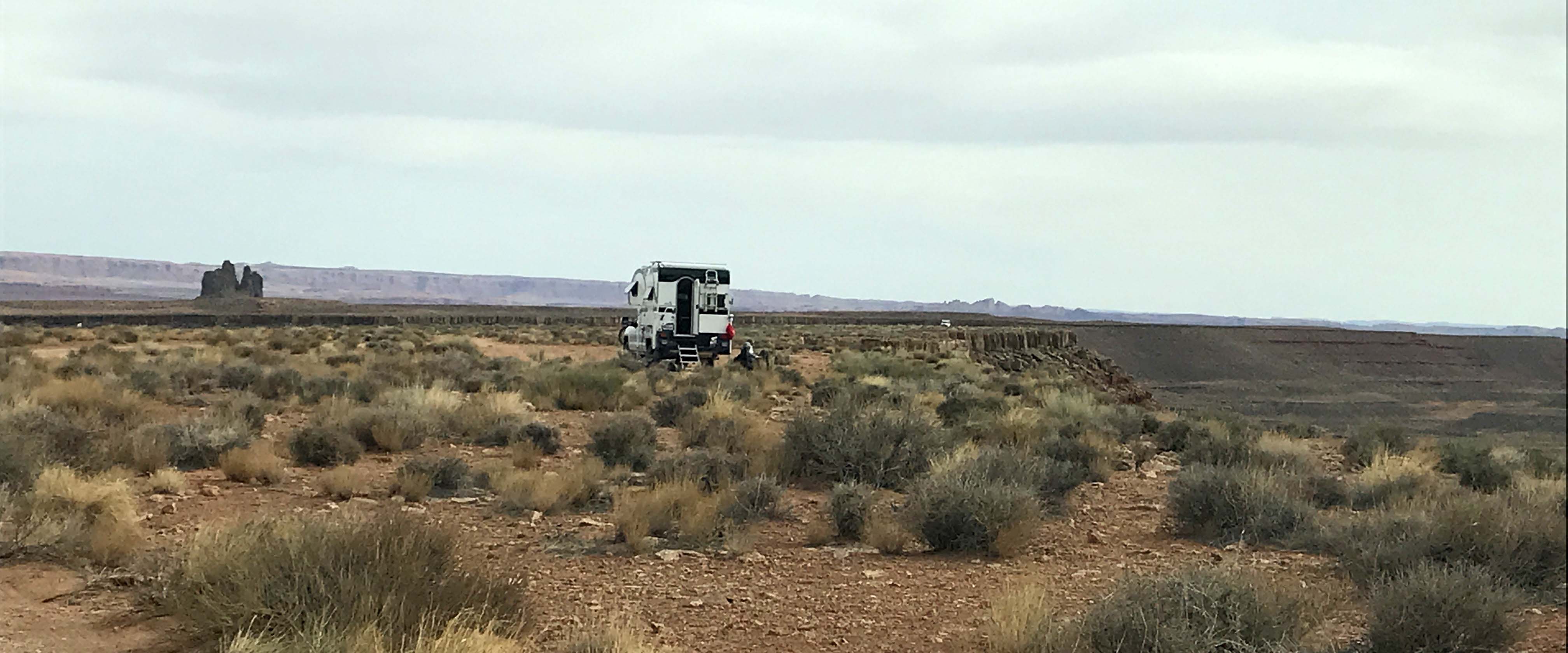
Smaller rigs could park up close to the edge. The land comes to a point as you can see to the right.
And there were many sites along the outer edge people we staying in, including Harry and Vicki. I just felt more comfortable in an established spot.
We walked back and paid $10 for the night and learned it was exact cash only, but thankfully with some change we had enough for that first night. We also saw that drones were not permitted March through October and the campground had no water or fire wood, but they did have a couple of pit toilets and trash removal. Our site was one of the established ones and also had a very nice campfire ring and picnic table, and the view of course was pretty spectacular, so we felt the price was a fair one.
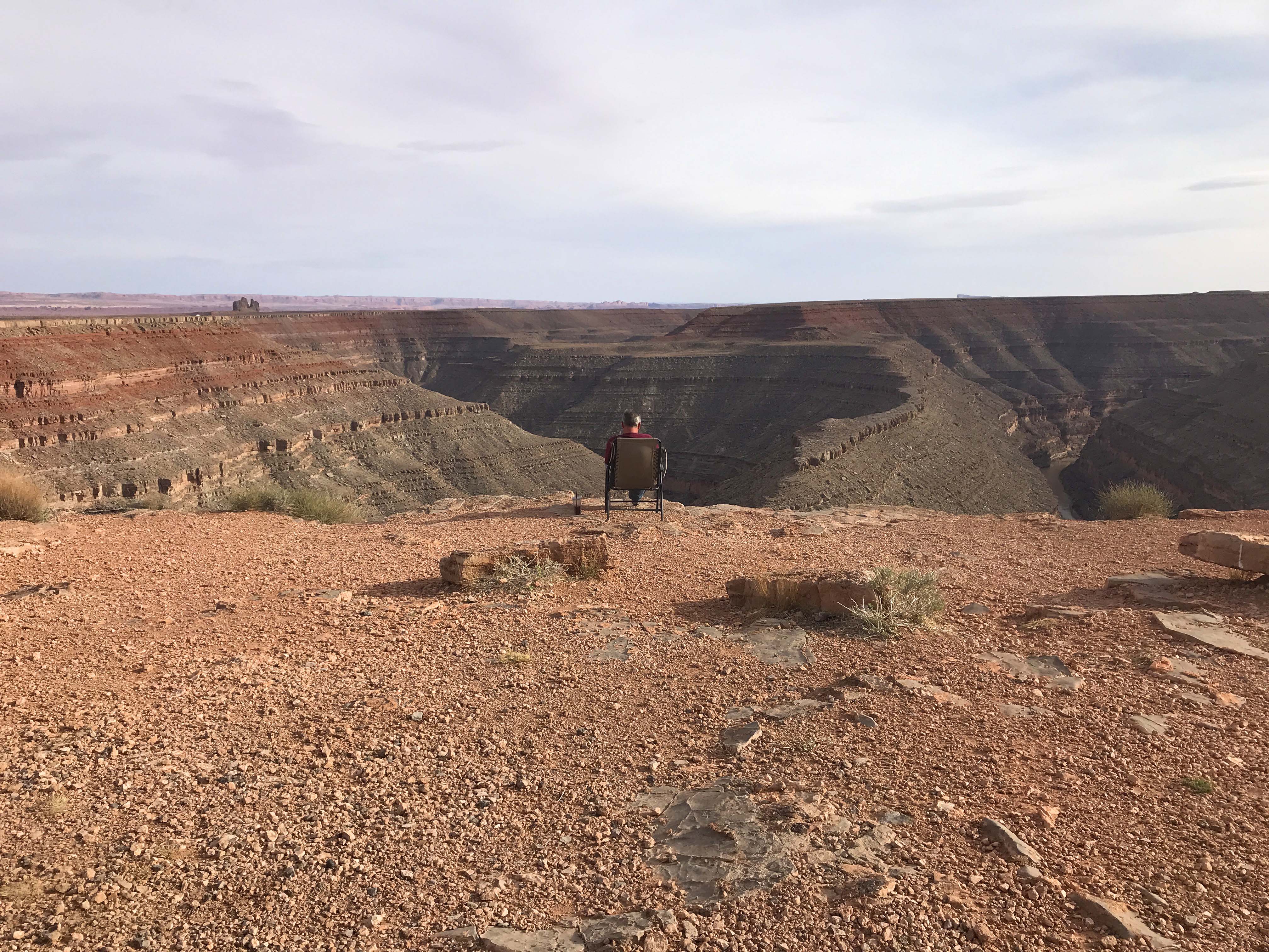
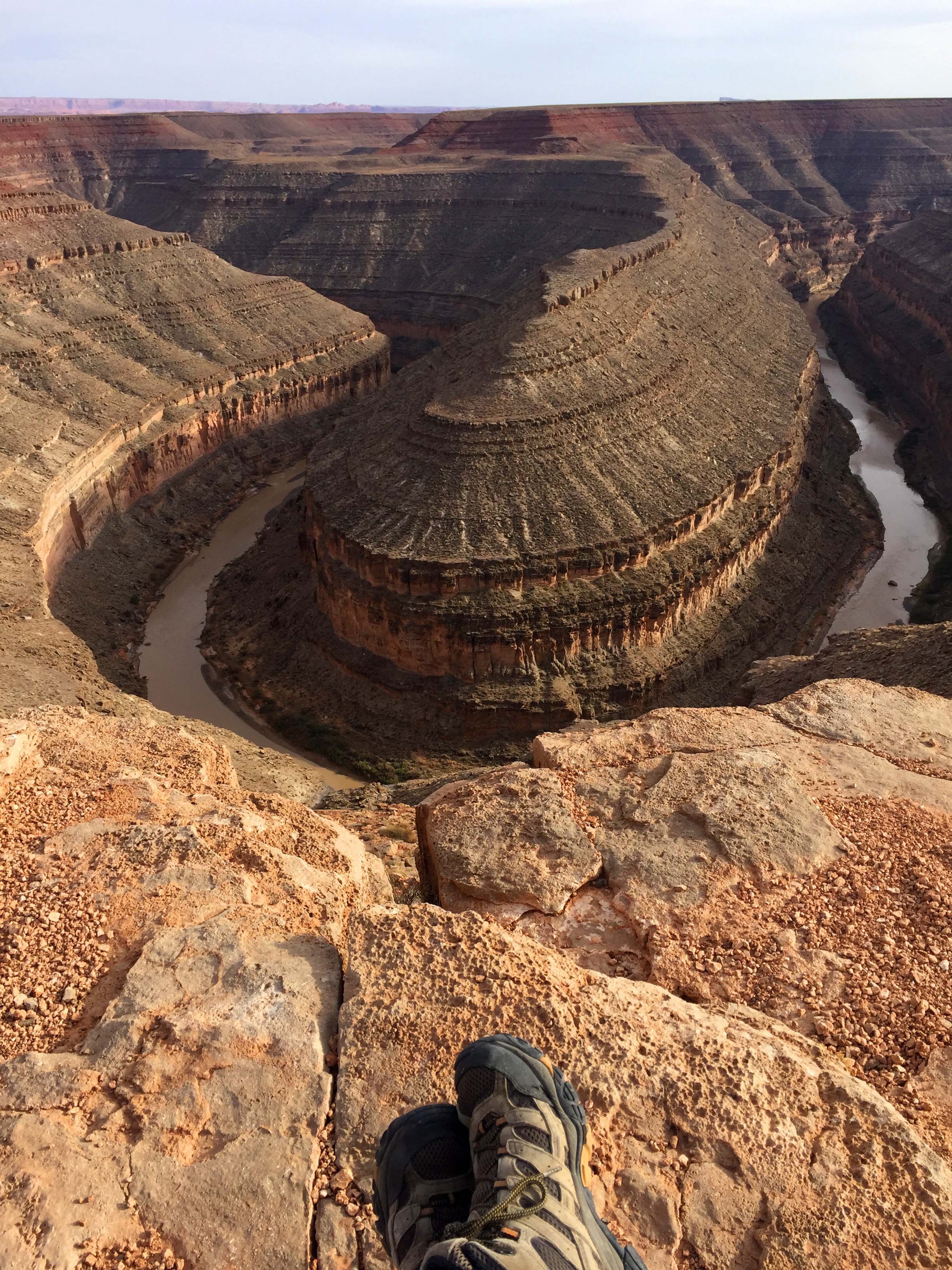
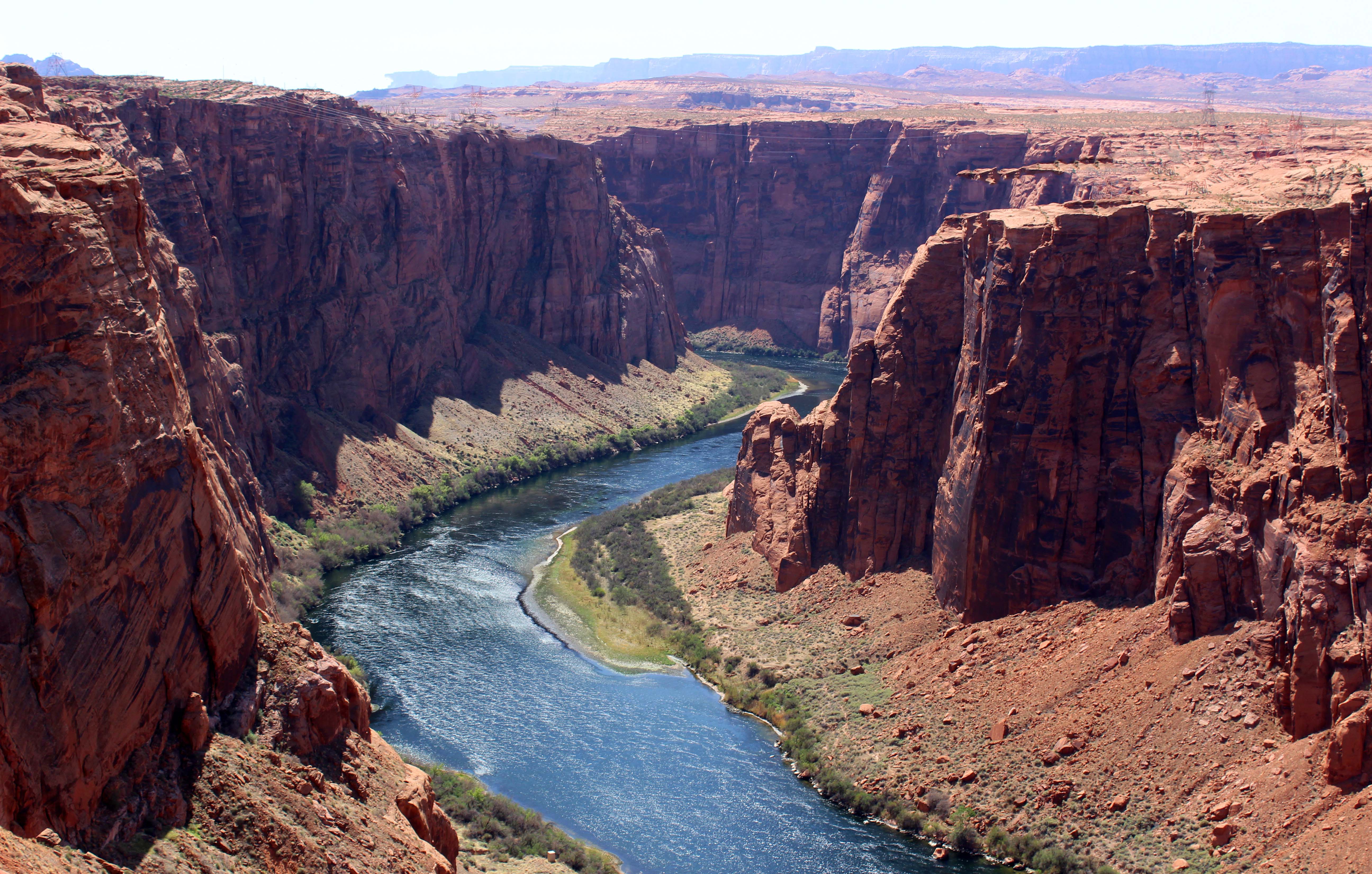
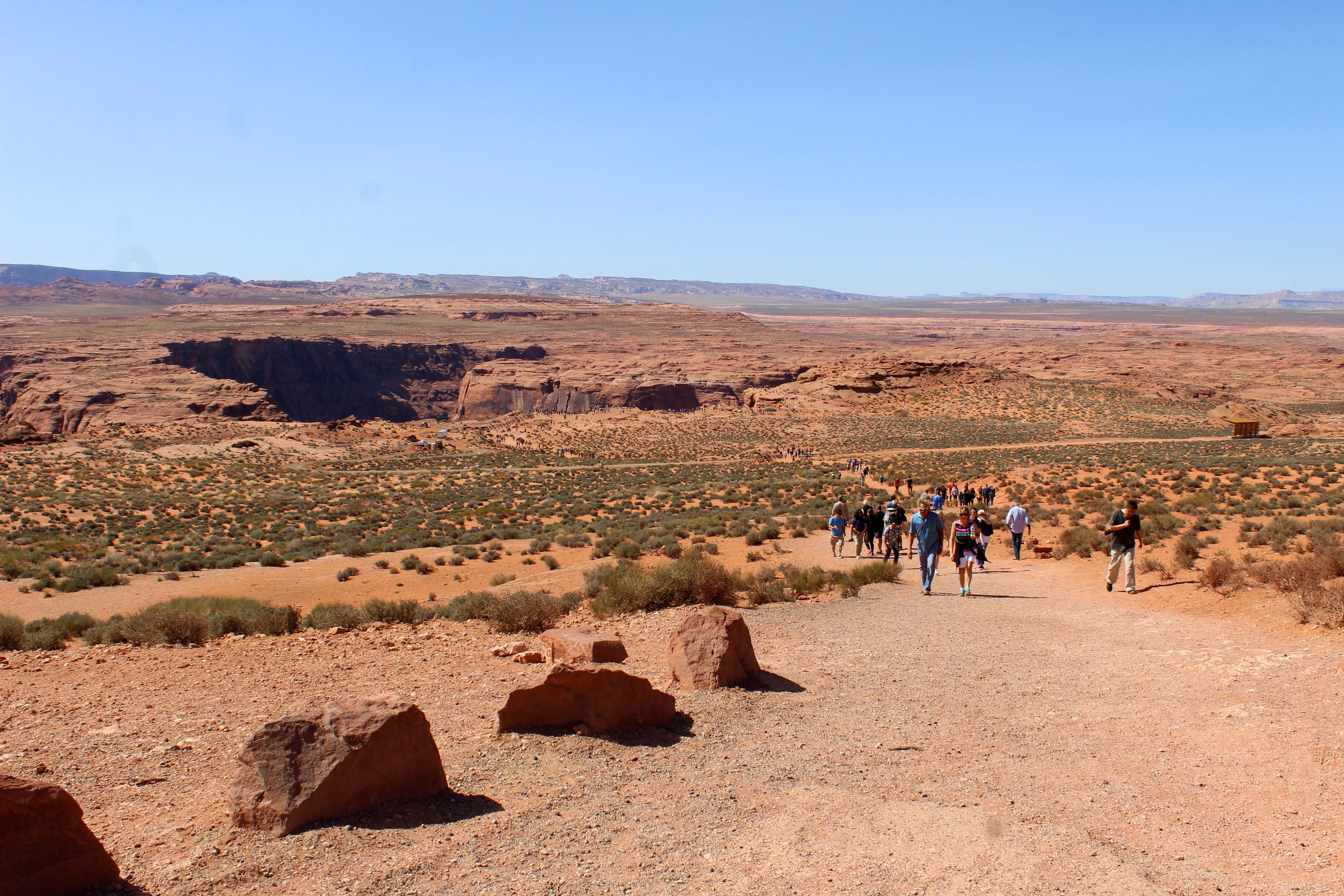
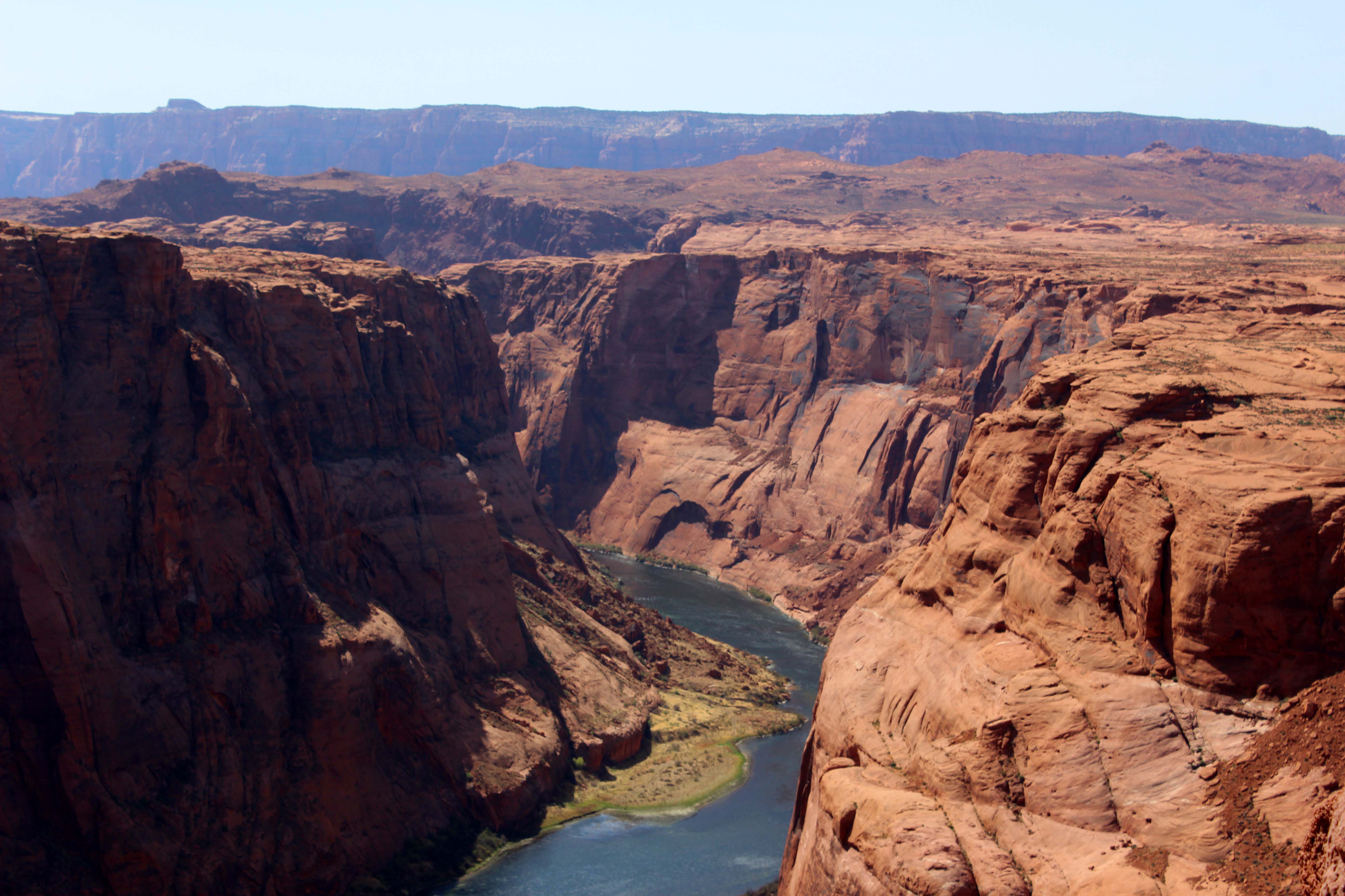
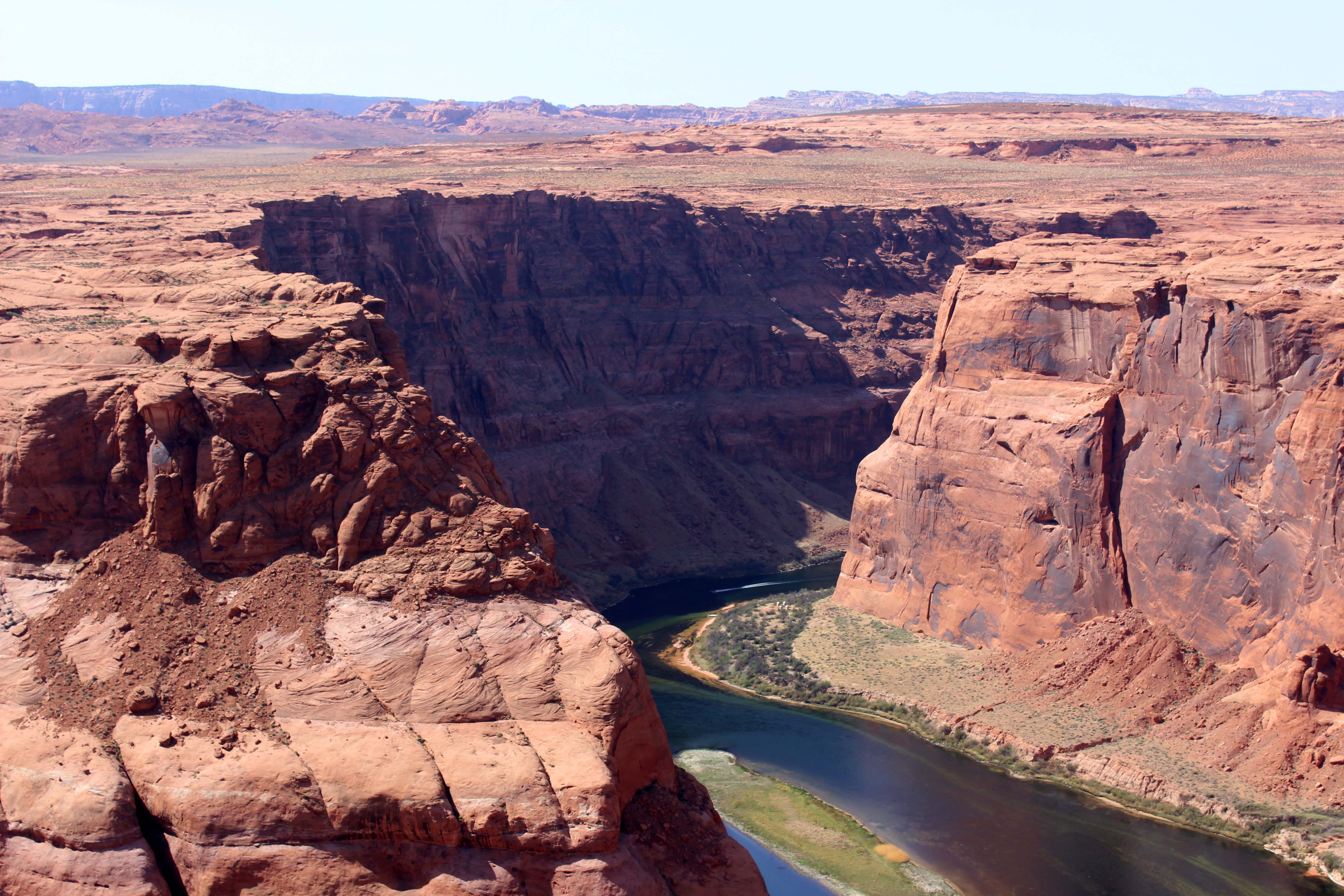
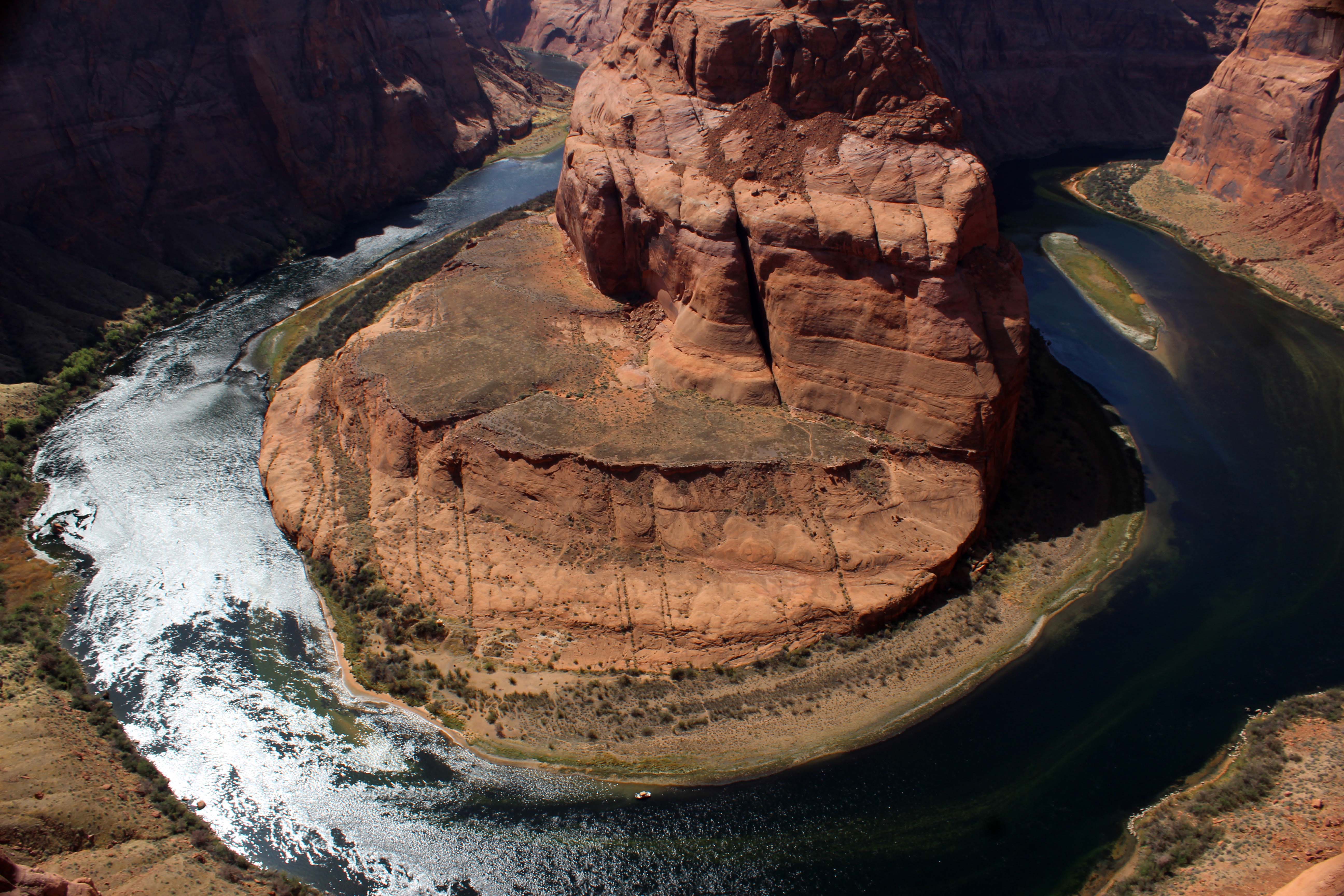
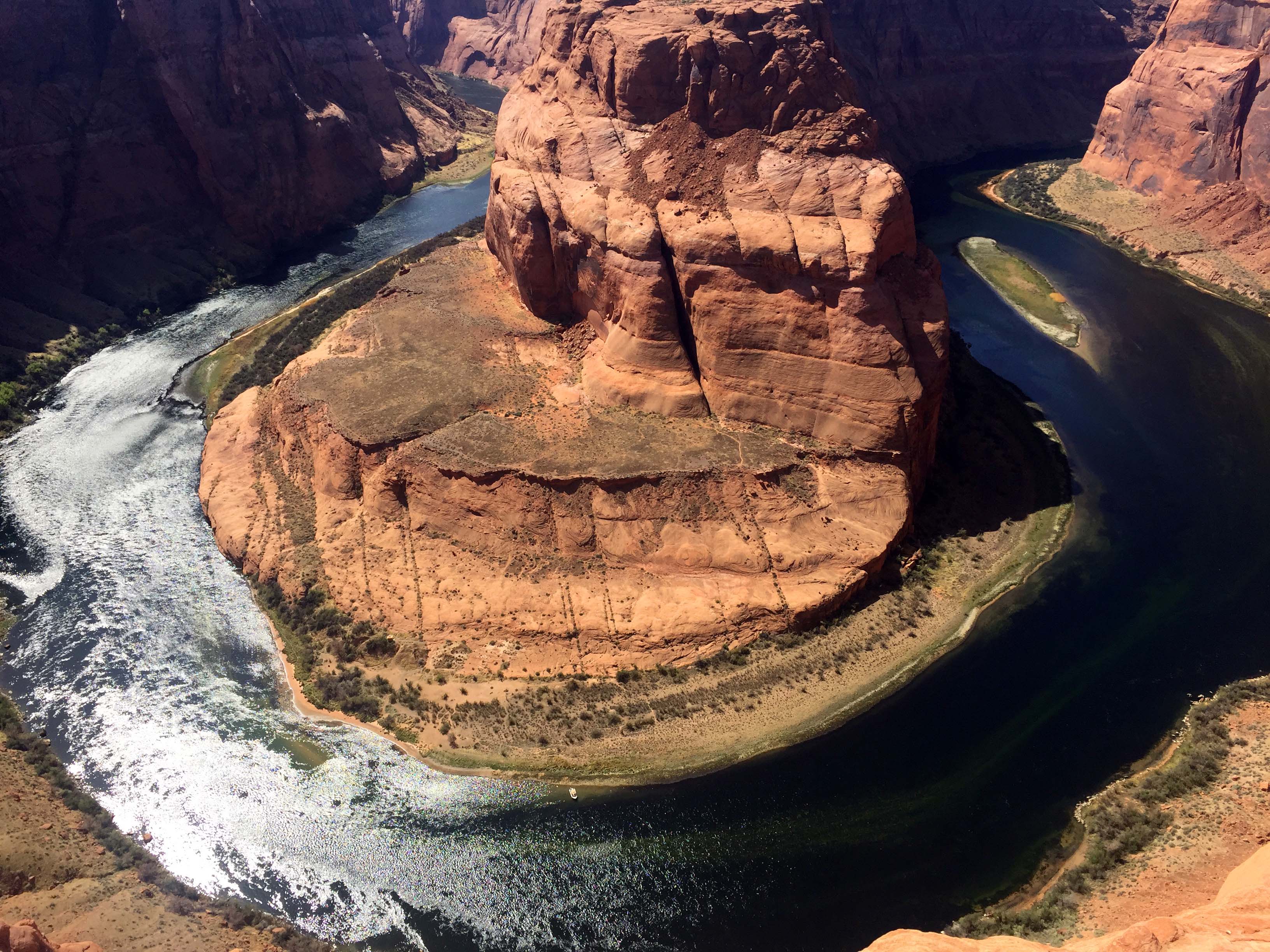
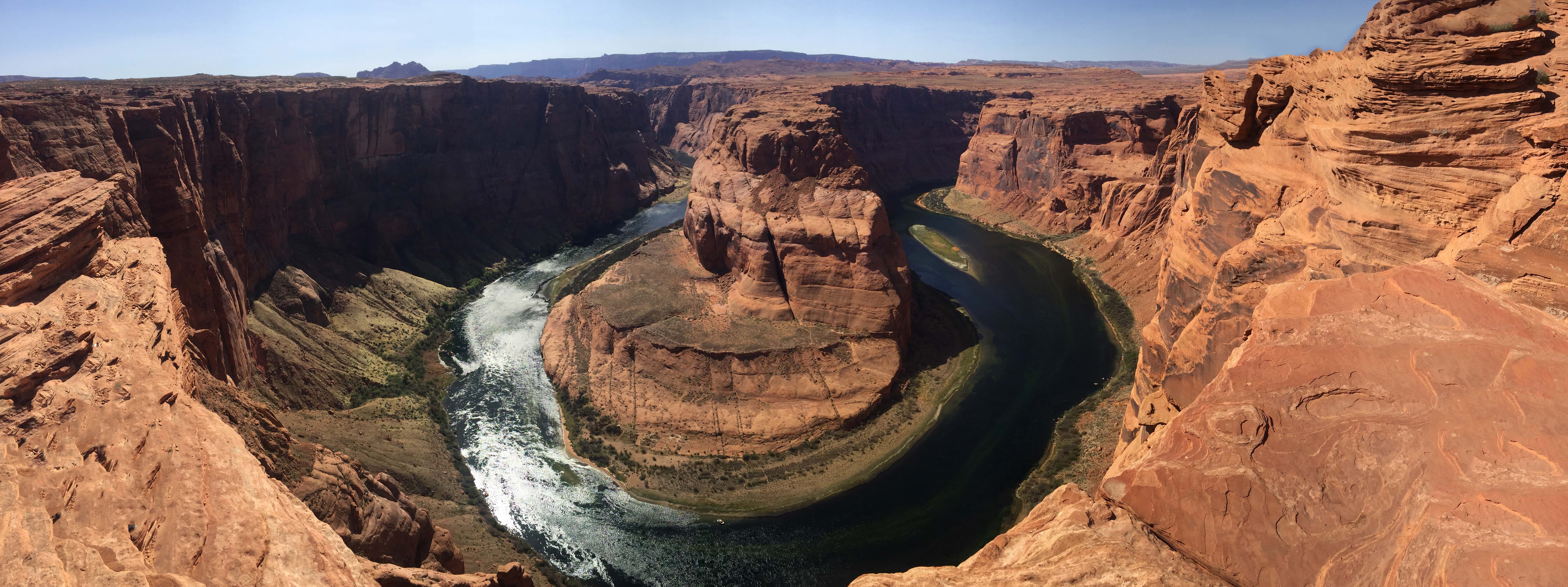
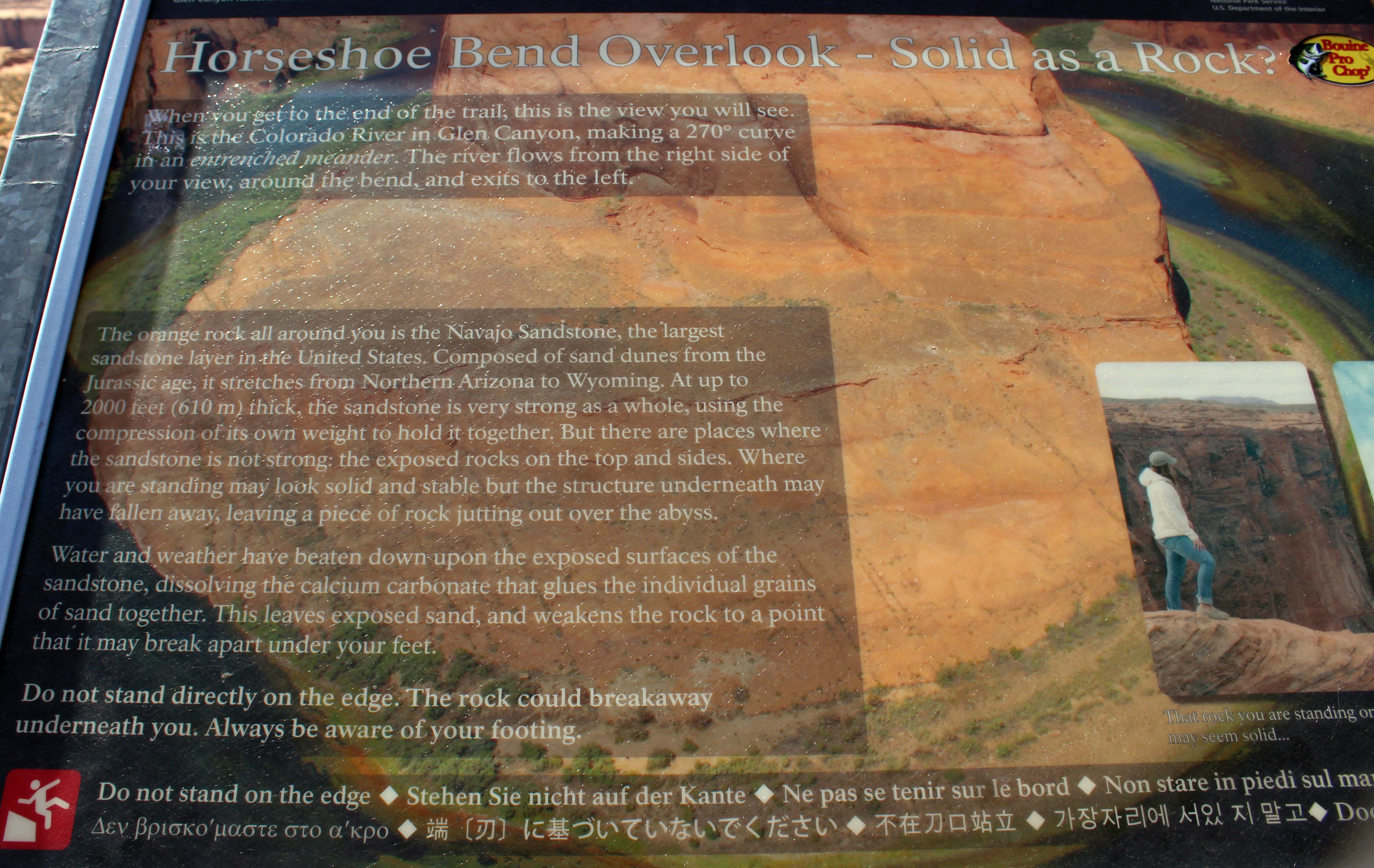
The view if you walked up to the edge, which I didn’t do much. The river is the San Juan which runs through much of this area. Muddier than the Colorado, but still pretty cool, and no crowds or long walks to see it. And there are actually two horseshoe bends, this one was a short walk to the right.
And we also had one directly in front of us.
Lee’s view from his chair
(And here’s a super quick (40 second) video showing the drive from the gate to our rig. – Lee)
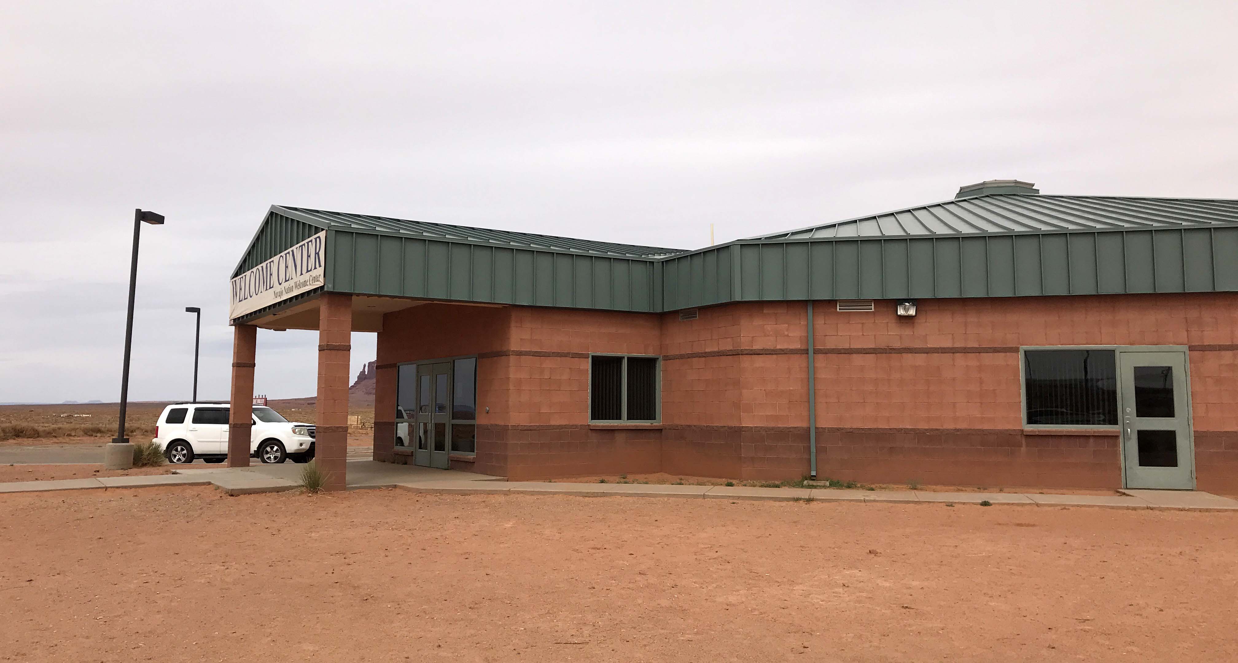
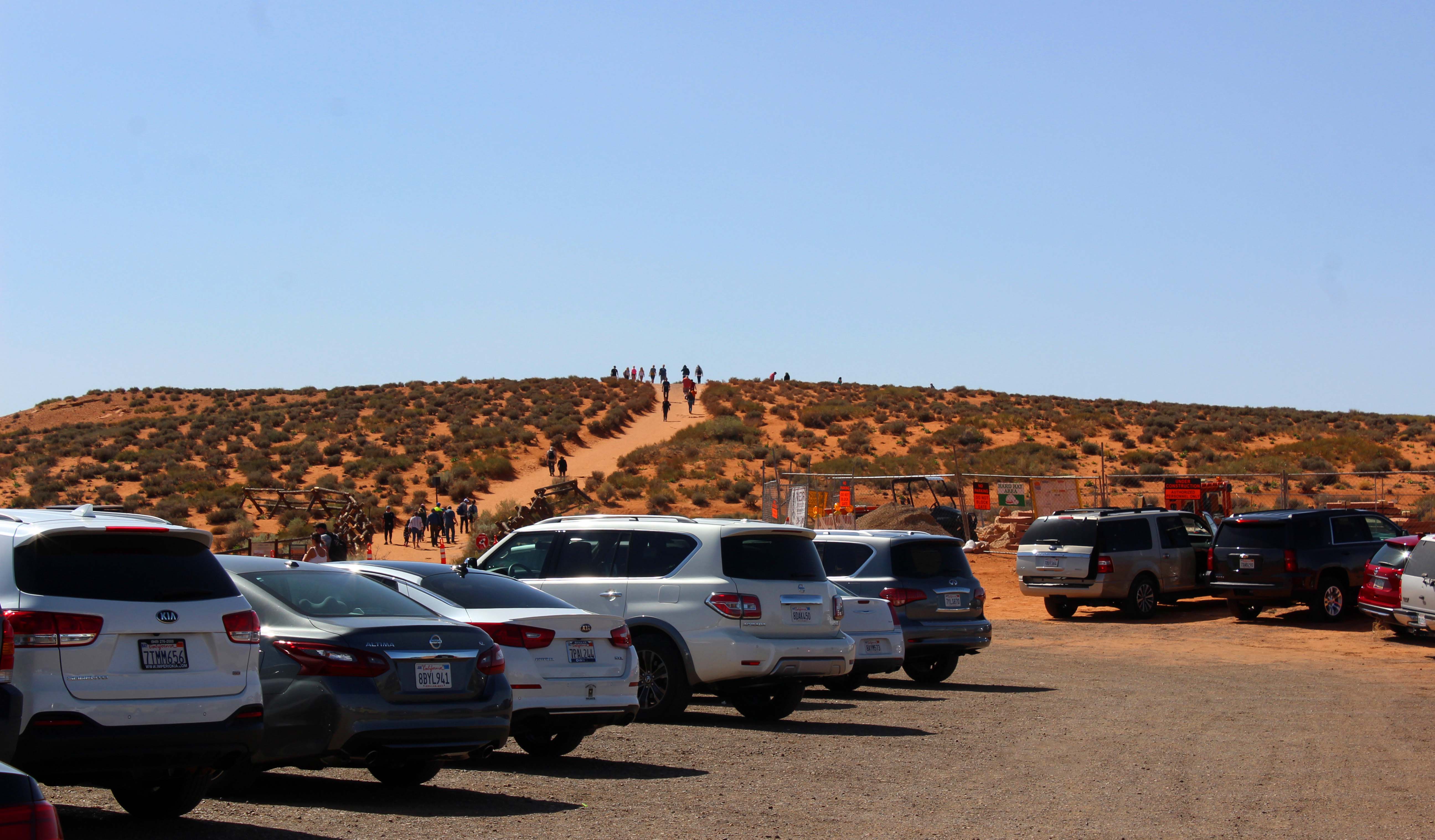
We knew prior to arriving that our friends Harry and Vicki were staying in the same park, but since they were out exploring for the afternoon, after setting up we decided to get the lay of the land. Usually when we hit a new area, I like to go to a BLM office, but unfortunately there wasn’t one nearby. Instead we drove down to Monument Valley in the hopes of getting some information from the visitors center. Unfortunately you had to pay $20 to get inside, and since it was already late in the day we decided to keep going.
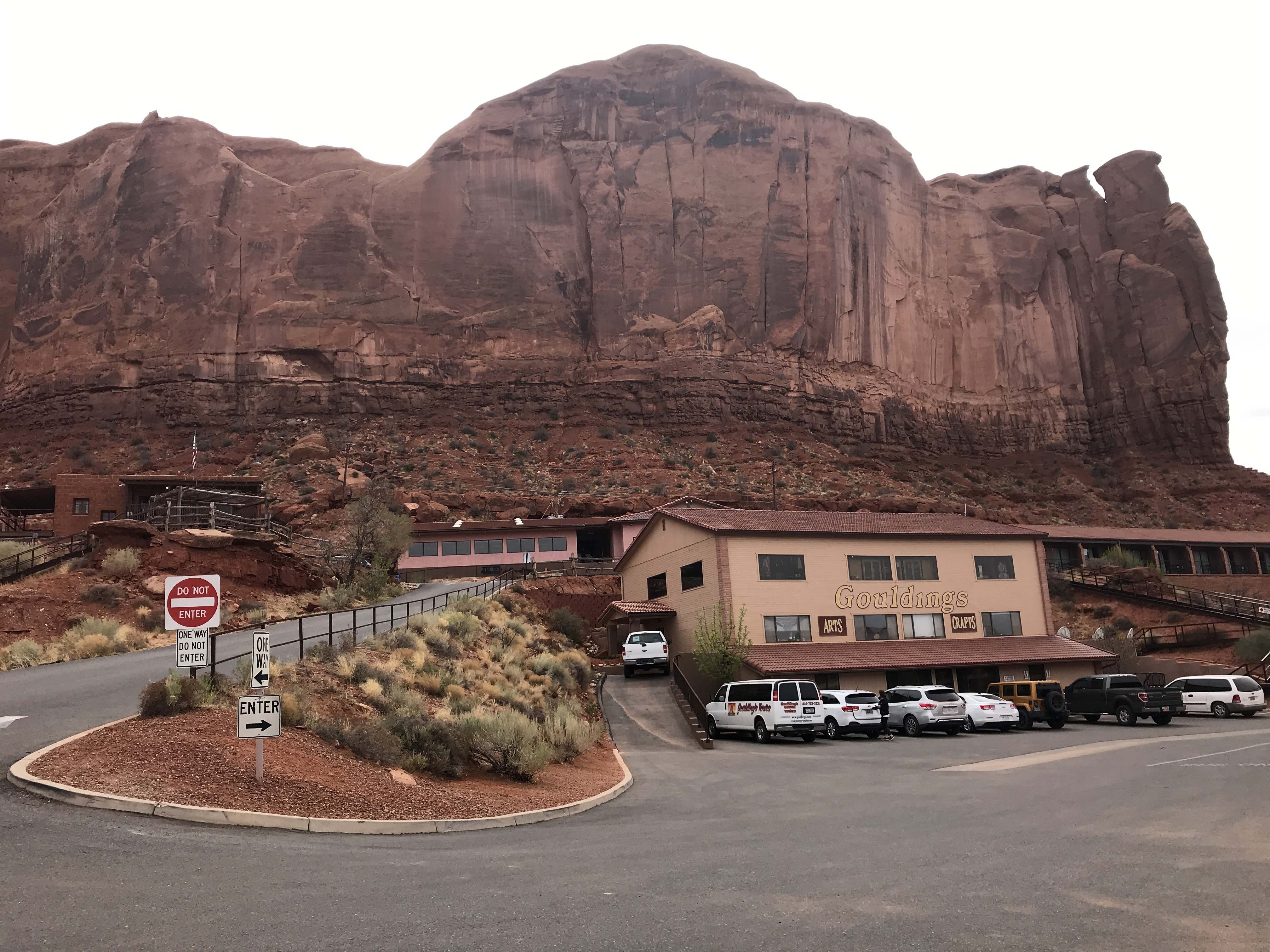
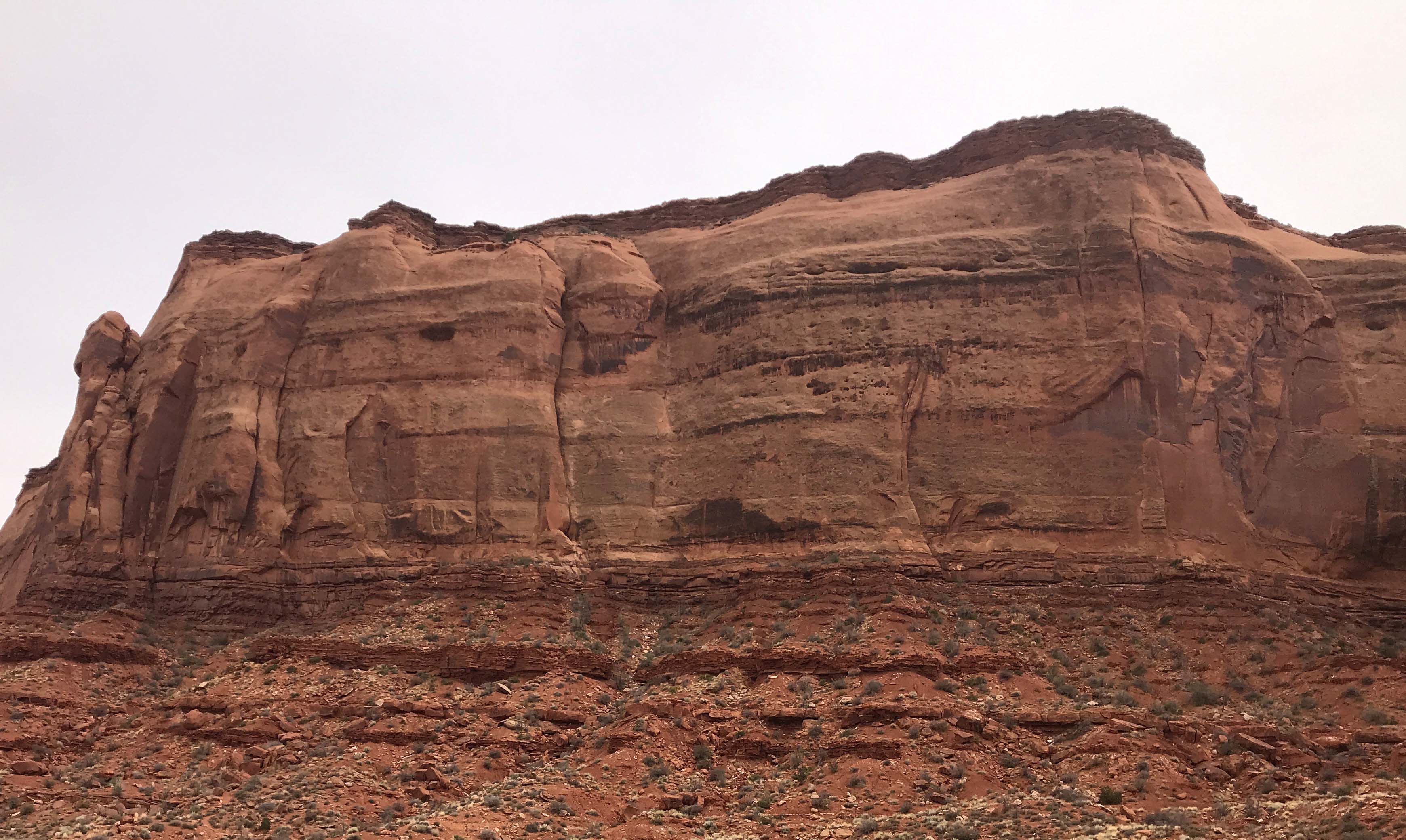
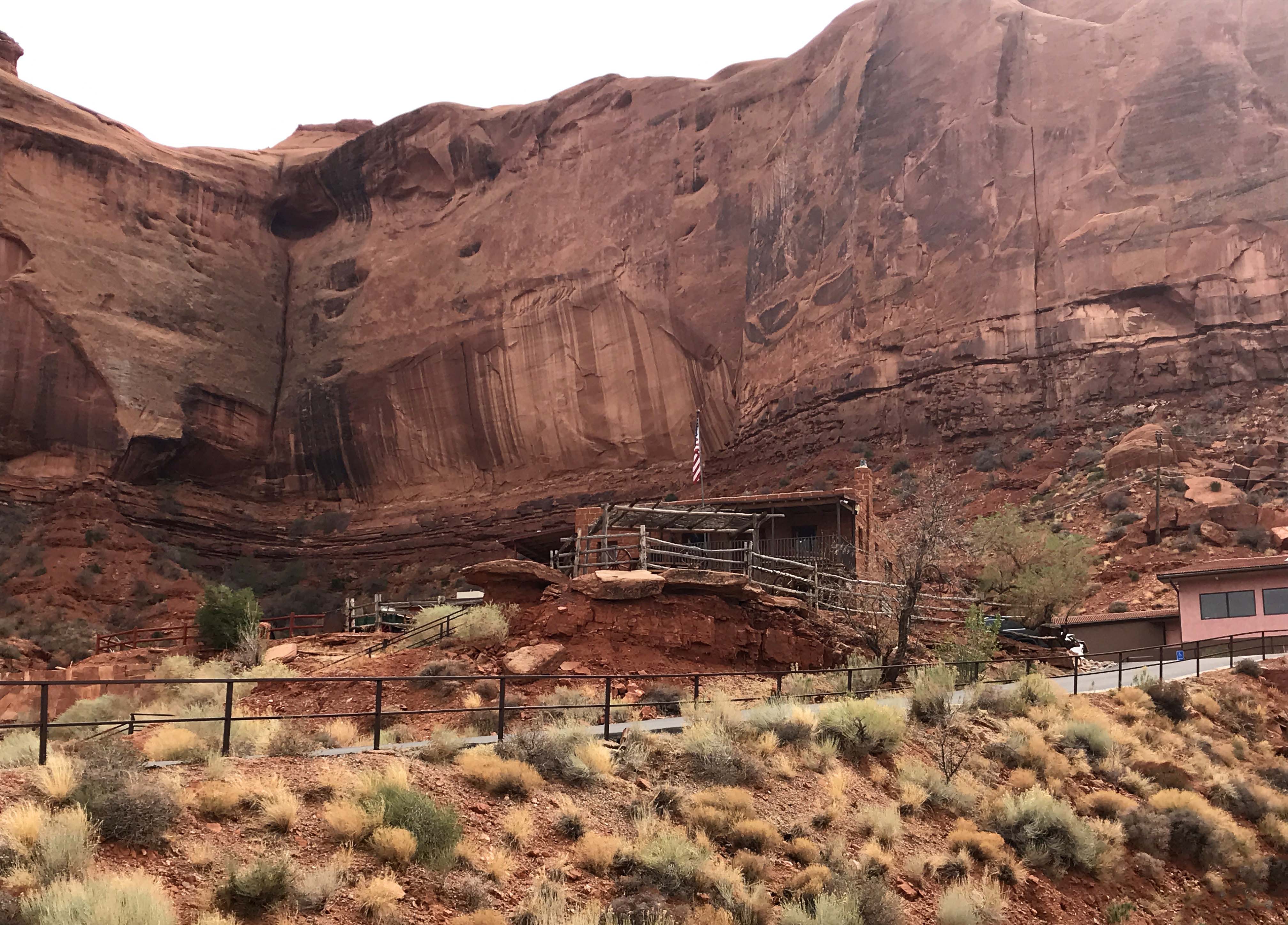
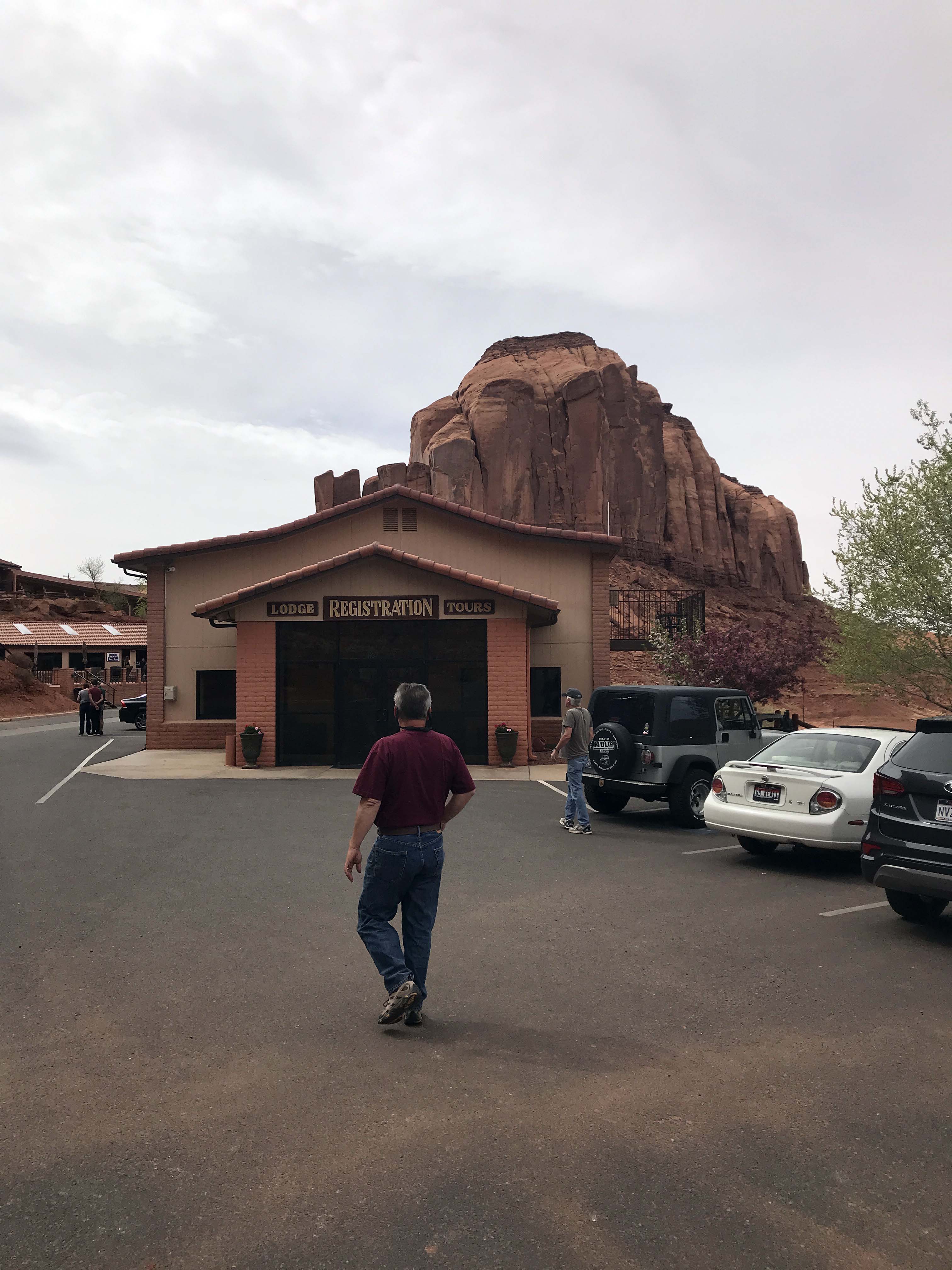
Next we went to a large RV park/hotel called Gouldings to see if they had information there as well. They only had information about the tours they offered and although it was a pretty site that wasn’t really what we were looking for.
Gouldings is a large resort complex, with a museum, RV park, gift shops, restaurant, and hotel.
Surrounded by beautiful rocks on three sides and only a couple of miles from Monument Valley
We heard the campground was $60 a night, but folks we met who were staying there liked it
They offer monument valley open air Jeep tours, but I wouldn’t recommend them. We saw some folks on them and it was so windy and dusty they looked pretty miserable. Closed vehicle is definitely the way to go, but I’ll talk about that more in a future post.
We kept driving down Highway 163 and arrived at the Navajo Nation Welcome Center and Navajo Market. We went into the Welcome center, which said there were maps, only to be told that we needed to pay the $20 to get a map of the area. At this point I was pretty frustrated, so tried another approach. What I really wanted was information on was the jeep tours, but the companies who ran the tours were inside the park. The woman at the welcome center told me that there were always plenty of guides and their prices varied from person to person. I asked if I needed cash and she said yes some didn’t take cards and at that point I said could you at least give me a rough idea. She very hesitantly said $80 -$100 a person, which at least gave me some idea how much cash to take and then sent us on our way. Update: We ended up paying $110 cash per person for a 2-1/2 hour tour. We took $300 cash with us just to be safe, but found out later we could have booked online. Why this Welcome Center didn’t have an information sheet on the names, websites, and phone numbers of the companies who give the tours I have no idea. Because despite the impression I was given it absolutely was all companies and not individual freelancers giving the tours.
It was hands down the most frustrating experience at a Welcome Center I have ever had. They had no maps, no flyers, no information at all. What they did have was a very small museum, a conference center that the tribe uses, and one person sitting behind the desk who wasn’t able to provide us with much information. Thank heavens a few days later we discovered a visitors center in Bluff that had lots of great information. We also learned from our friend Cori that many of the jeep tour companies have websites. I swear I was extremely polite, no clue why the Welcome Center was so unwelcoming.
After the Welcome Center experience, we decided to just head back to the RV. Since it was a beautiful night, we invited Harry and Vicki down for a campfire and had a wonderful conversation that covered a variety of topics. You know it was good because Lee and I stayed up way past our normal bed time 🙂 It was a great end to the day and after talking to them, I was really excited about exploring the area.
From left: Me, Lee, Harry, and Vicki
(And here’s one more video driving from our rig, which was in one of the very first sites inside the campground, to Harry and Vicky’s rig, which was quite a bit farther in. Again, this is to give you some idea of the sites and the condition of the road. It gets significantly tighter and bumpier past where this video ends. – Lee)
Camper Chronicles is a participant in the Amazon Services LLC Associates Program, a program designed to provide a means for sites to earn advertising fees by advertising and linking to amazon.com. We very much appreciate any purchase you make via our website links. There is no additional cost to you and helps support our blog. Search Amazon.com here
Or you can check out our recipe book filled with 80 real recipes we have cooked in our RV and taste tested by Lee himself. The cookbook specializes in recipes that have a limited number of ingredients, without sacrificing flavor and is organized into categories that matter to full time RVers such as Happy Hours, Travel Days, and Pot Lucks You can preview the kindle version on Amazonor the Apple version onItunes. It is available inpaperback on Amazon if you prefer.
There are several pictures that I consider iconic in the RV lifestyle, you know the pictures that you see on Facebook and people’s blogs that initially make you want to live this lifestyle, and we have been lucky enough to gather several of those in our travels. We stood on the corner in Winslow, Arizona, camped at City of Rocks, and saw the church in the rocks at Sedona. Generally what I have found though when taking those pictures, is there is a story behind the picture, and Horseshoe Bend is no exception. So if you want to maintain your illusion that this was an easy picture to take, I will start with the best of the ones we took and you can stop right here. Or, if you are a person who likes knowing what you are getting into, you probably should read on.
This was my favorite picture of the day because you can see how close I was to the ledge and I loved the wake of the speedboat in the lower left corner
Horseshoe Bend is near Page on 89 and there are actually a couple of scenic view stops along the way. There is a huge wide gravel lot big enough to fit any rig near the dam and it’s an easy in and out to take a peek of both that and the Colorado River. Since we just had the truck on Sunday, we decided to stop at a smaller scenic view sign and ended up walking down a path to a lookout location. I say path, but that is an exaggeration, because the route was a combination of a few carved stairs and terraced rock with a hand rail that led down to the viewing platform. It was STEEP going down and more so coming up, and I am not 100% sure it was actually worth it. There are electrical lines obscuring all of the views and although the river was pretty I definitely think there are better places to view the river from.
The “path” down to the lookout point. I used the handrails almost the entire way down.
Views of the dam
Here’s the view of the Colorado river, with the power lines. I only point it out because it was a really steep to get down there.
And here’s the same picture with the power lines removed. I also threw in some color enhancement.
Going up was really steep as you can see.
After that stop we headed to Horseshoe Bend and into the big parking lot. It’s worth mentioning that traffic was being directed while we were there because the police were still dealing with the wreckage of a very nasty accident that took place right outside of the parking lot. The pull off is right off 89 and there is a small hill in one direction that obscures the view. There were four crosses in that spot as well, so it was obvious this was an area where accidents had occurred before. Just be super careful when pulling in and out. On the plus side, the parking lot was really large, and despite the huge crowd we were able to quickly find a spot. There are even spaces for tour buses and a few RV’s although I am not sure I would chance trying to stop there in my rig. I was also happy to see several very nice pit toilets and they were stocked and well maintained.
View of the parking lot. It was 2:30pm on a Sunday, we did see it less crowded at other times during the week. It also looked like they were expanding it.
Several well-maintained pit toilets.
As someone who has cleaned these toilets I found this sign pretty interesting. I would love to say it is overkill, but I have actually seen evidence of all these behaviors. I even sent this to my boss in Oregon, part as a joke and part as a possible suggestion.
This was the hill I thought we had to climb
But when we got to the hill this is what we saw
And then had to walk down to the big hole. Going down not so bad…coming up..whew.
The worst part of the hike is you can’t see anything but a hole in the ground until you are right on top of it. They are doing construction on the site, so that may change in the future, but currently the only way to get the picture that is in your mind is to walk right up to the cliff edge. And it is a CLIFF! 1,000 foot straight drop down and no handrails of any kinds. I am not crazy about heights, but can handle them if I have something to hold onto, but that was definitely not going to happen here. It is also important to note that there are only a few spaces on the cliff where you can see both sides of the river and those places were the most congested. Generally people were polite, taking turns, but the crowded feel definitely didn’t help me feel more comfortable.
Lee, of course, was scampering about without a care in the world, but I struggled. (I’m pretty sure footed. I hardly ever fall down. I did have some concerns about the hordes of people who didn’t seem to be aware there were people close to them. There was a lot of backing up and turning quickly, and I had to keep a close eye on them to avoid being knocked in an unwelcome direction. Anyway, it’s not the fall that kills you, it’s the sudden stop. I believe medical professionals would call it “deceleration trauma”. I just think of it as rock poisoning. In any case you usually can’t get the shot you want from a safe distance. Except for bears. I would photograph bears from space. – Lee) I would walk as close to the edge as I could stand and take a picture (the one at the beginning was taken that way) but no matter how many spots I tried I couldn’t get the entire bend in the river. That was frustrating me, so finally I bit the bullet and crawled on my belly to the hang the camera over the edge of the cliff. I had it tightly strapped to my body and I was terrified, but I wanted to get the shot, except it turned out I couldn’t. No matter how many ways I positioned the camera I couldn’t get both the entire river and the outcropping and it was really frustrating. Plus I was really fighting my fear, so eventually I slunk back and went to see how Lee was doing.
Picture to the left
Picture to the right. Steve says I should learn how to merge two shots together to get the whole thing, but I think they should just build me a viewing platform 🙂
While I was hanging over I was able to get a better shot of the boat which I liked
Here’s the best I could do hanging over the edge. And yes I know it’s a pretty great pic. But if you are going to walk down a steep trail, fight crowds, deal with sandy wind, and crawl on your belly to the edge of a 1,000 foot drop off, you want the perfect pic. At least I do.
Lee had his iPhone and his selfie stick which enabled him to get some height on his shots. He couldn’t get the entire river either though (which oddly made me feel better), but he did insist on taking a few selfies. In order to get yourself and the water in the shot, you need to get pretty close to the edge, and we took the pictures, but you can tell by the strained look around my eyes, that I had had enough. I am really happy that he got the panoramic view though, which was really terrific. I have photoshopped out the people in the picture and that turned out very well.
Lee’s best shot with my camera
Lots of guys were taking this picture with their very pretty girlfriends. I liked the concept of the pic, but not so much where I had to sit to get it. I think the expression on my face says it all.
His shot with the selfie stick was pretty good. Just a tiny section of the river at the bottom cut off.
And a fantastic panoramic view
At this point I was more than ready to go, and although I was glad I had checked seeing it off my list, I just couldn’t really enjoy the views the way it was all laid out. As we trudged back up the hill I was arguing with myself a bit about being such a chicken, until I stopped and read this sign that said the cliffs were sandstone and you should absolutely not walk out on the edge. Ha!! The sign validated that I was being smart, not a big chicken, although if they don’t want you to walk out on the edge they really need to provide an alternative, because you really can’t see unless you are very close.
When we were headed back, I was was still trying to get over my feelings about the whole experience when Lee recommended the Chinese buffet in Page. That man really knows me, and I had a huge plate of mediocre, yet extremely satisfying Chinese food to take the edge off. That helped me feel much better, and we headed back to our RV to look at the pictures, which were much better than I thought they would be when I previewed them at the site.
Monday we finally took the day off, and I wanted to talk to you a little about the blogging. The richness of the experiences we are having is a tremendous blessing, but it has generated a ton of work in the form of writing blogs, choosing and enhancing pictures, and in Lee’s case, creating videos. There was no way I could keep the blogs relatively up to date and still provide the level of detail I like to have, so pretty early on I had to make a choice. I decided to focus on creating the blogs I wanted to have at the end of this and worry less about the time frame they were posted in. Consequently, although you are seeing a blog post every two days (sometimes more frequently) we are still posting in arrears and I think the delay will get worse as the month progresses. On the plus side though, I should have posts to carry me through the first couple of weeks at my summer job, which is a good thing as I am not sure how much time (or content) I will have when the new job starts. (To give you a more clear idea of how this is working, the Horseshoe Bend pictures were taken April 8, and this post is scheduled to be published around April 23. – Lee)
And for those of you who are curious about how I can keep up the blogging and still enjoy the experiences (I get that question a lot) I wanted to take just a moment to describe the process. Most blog posts take me an hour to write, and then Lee takes about 20 minutes editing and proof reading. Picture heavy posts are a whole different thing as we generally take 300-500 pictures on one of our scenic trips/hikes. I dump the pictures onto the PC, and then look at every one, selecting a first cut for the blog or Facebook. I always put my favorites in the blog, but there are generally really good second tier shots and I make albums for my friends there. At this point I usually have about 60 photos per blog post which I put into photoshop and look at one-by-one. In the case of duplicates I choose the best and send the others to Facebook and then I am left with about 40 or so to work with.
My pictures fall into two categories, the ones for plot exposition (signs, informational placards, parking lots, restaurants interior/exteriors, etc. ). Those I do a quick check and crop out anything that doesn’t belong and then save them. That leaves me with about 20 pictures that get the “royal treatment”. I crop them, add contrast, use the eraser to remove lens spots or people, and then add saturation to the color to the point where it looks like what I saw, but no so much it looks cartoonish or fake. Those all take a while and when they are all done, I upload them to WordPress. Then I start to write, and I use the pictures as my guide, adding information as much as possible to the pictures themselves. As I am building the narrative, I lose some more pictures (many good ones), because they are too repetitive, don’t fit the story, or simply make the whole post so long it is ridiculous. If I absolutely can’t bear to lose the pictures, occasionally I will take one long day and break it up into two posts. I try not to do that very often, but sometimes the situation just calls for it, and it works if we do two very different things in the morning and afternoon. (For what it’s worth, I think there’s no such thing as too many pictures. People can scroll past them if they don’t want to look at them, and people who do want to see them can enjoy them. I’m talking to you, Mom! – Lee)
Once all that is done, Lee does his edit, and on occasion, inserts video. Video content is not something I ever request from him, but what he does when he feels creative. Taking the video is generally easy for him, but the editing, rendering, and subsequent uploads can take hours. Some of that time he can walk away from the computer, but it needs to be on and running and since we are boondocking that means we need to be with the rig. All of that being said, this is how we choose to capture our experiences, but there are times were the workload gets overwhelming and I start to feel the pressure of “being behind.” What I have done to mitigate that on this trip is to take notes on my phone about the experience and I am using them to help me remember details when I write the posts. I am also grouping the pictures by event, to help make sure I don’t unintentionally put a picture from one area into another post (it happens when landscapes are similar) and I am spending most of our off time plugging away at it. Lee has been terrific about this, by the way, doing laundry, going to the store, and other household tasks to give me more time, and as of this writing I am caught up with posts, as of yesterday. There are 7 of them currently sitting in the “draft” status, waiting for Lee to finish the final edit and/or add video. That’s 14 days worth of posts (with an every other day release schedule) and since we just started Monument Valley, I may start releasing them more frequently. We will just see how it goes.
Knowing all of that it is probably not surprising to you that I spent my first “day off” in the 8 days since we started Utah in blogging related activities. I did stop around 4:00pm though and cleaned the house because The Chouters were coming down. They were staying at the same campground we were, and although we had been in contact throughout the week, we hadn’t had a chance to meet up. We had a wonderful time talking about how things had gone for each other all week and they gave us some great information about out next stop in Monument Valley. I also really enjoyed spending one-on-one time with them and getting to know them better. Steven even took a great picture of our rig as we left the campground, which I really appreciated. Hopefully we will get to see them again in Washington State this summer, and even if we don’t I know we will definitely see them down the road.
From Left: Steve, Lee, me, and Linda
Picture of us leaving Lone Rock Beach Primitive Campground. It really was a great boondocking spot.
Camper Chronicles is a participant in the Amazon Services LLC Associates Program, a program designed to provide a means for sites to earn advertising fees by advertising and linking to amazon.com. We very much appreciate any purchase you make via our website links. There is no additional cost to you and helps support our blog. Search Amazon.com here
Or you can check out our recipe book filled with 80 real recipes we have cooked in our RV and taste tested by Lee himself. The cookbook specializes in recipes that have a limited number of ingredients, without sacrificing flavor and is organized into categories that matter to full time RVers such as Happy Hours, Travel Days, and Pot Lucks You can preview the kindle version on Amazonor the Apple version onItunes. It is available inpaperback on Amazon if you prefer.

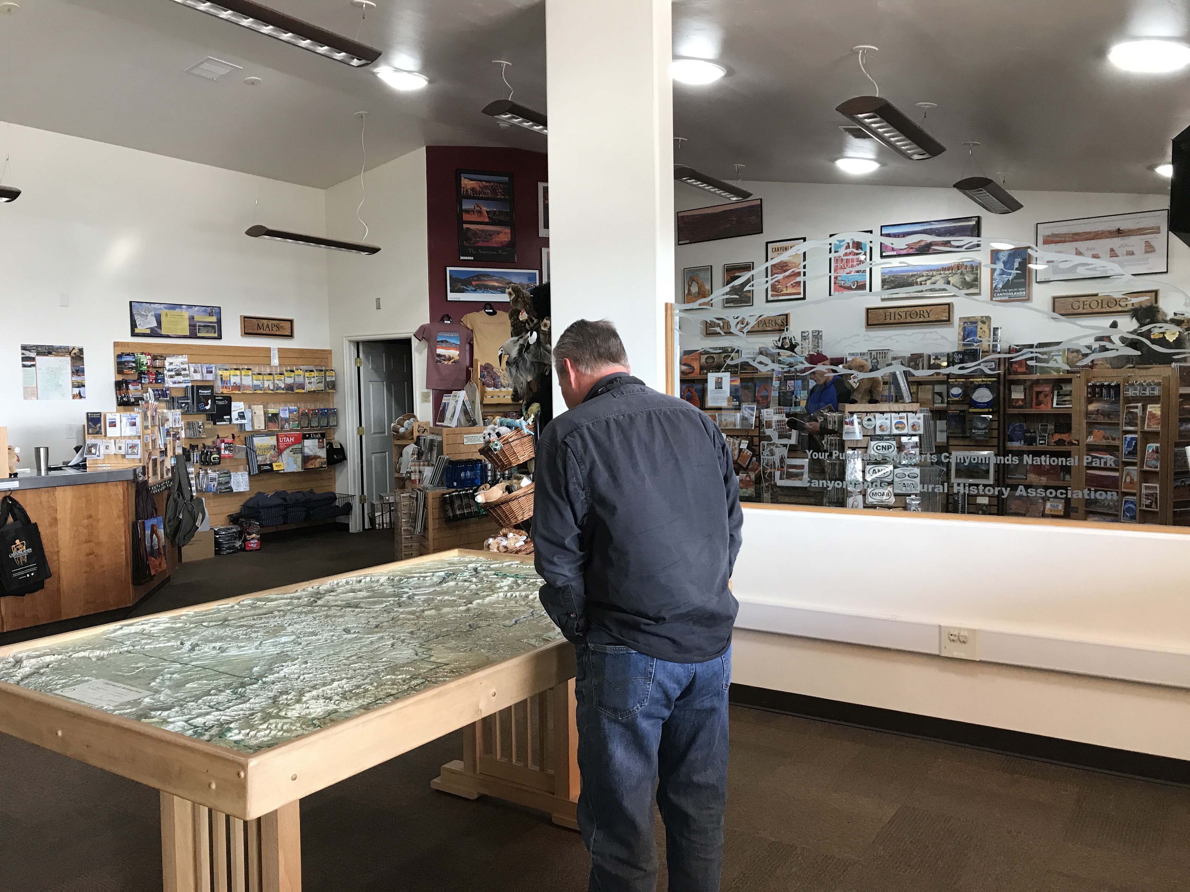
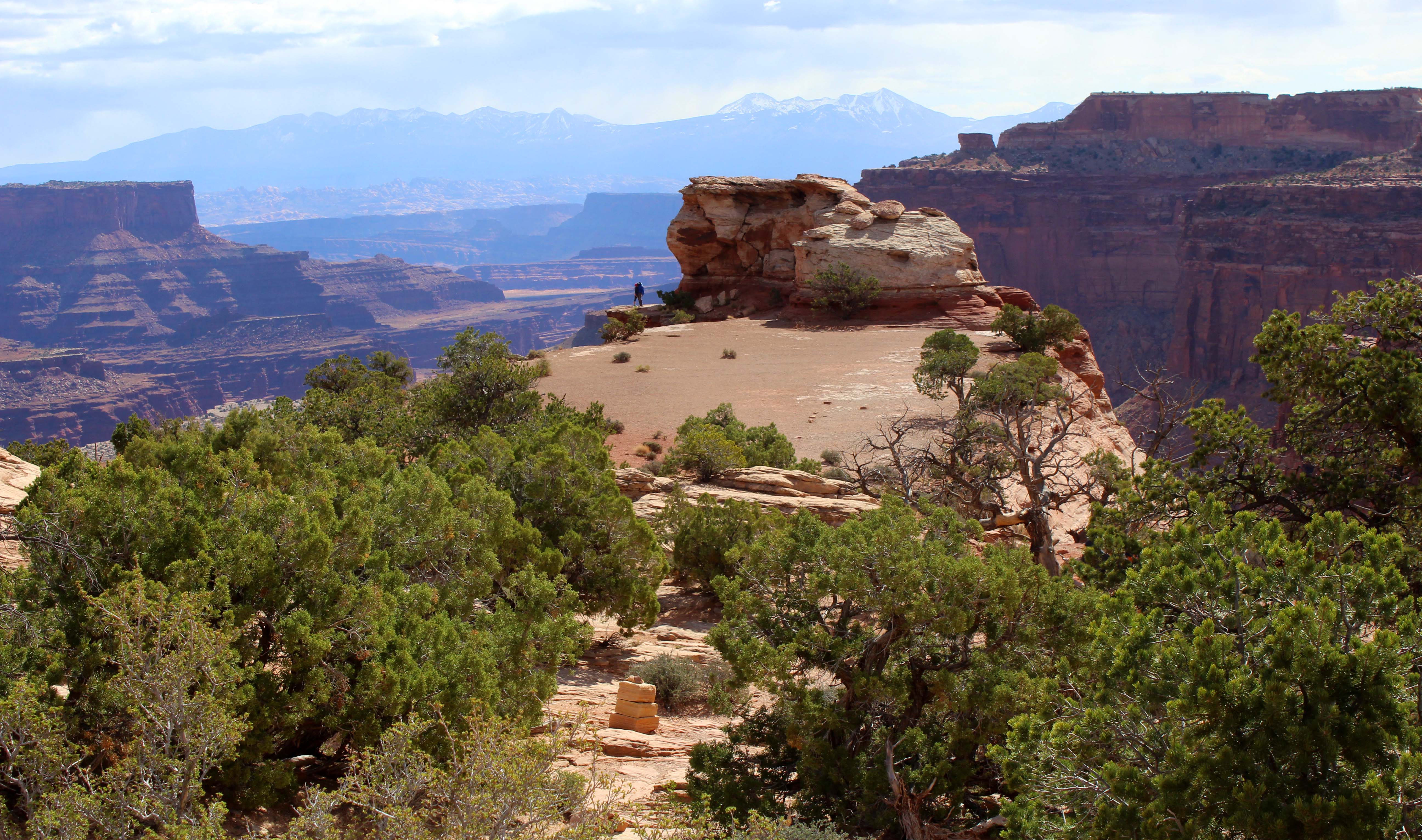
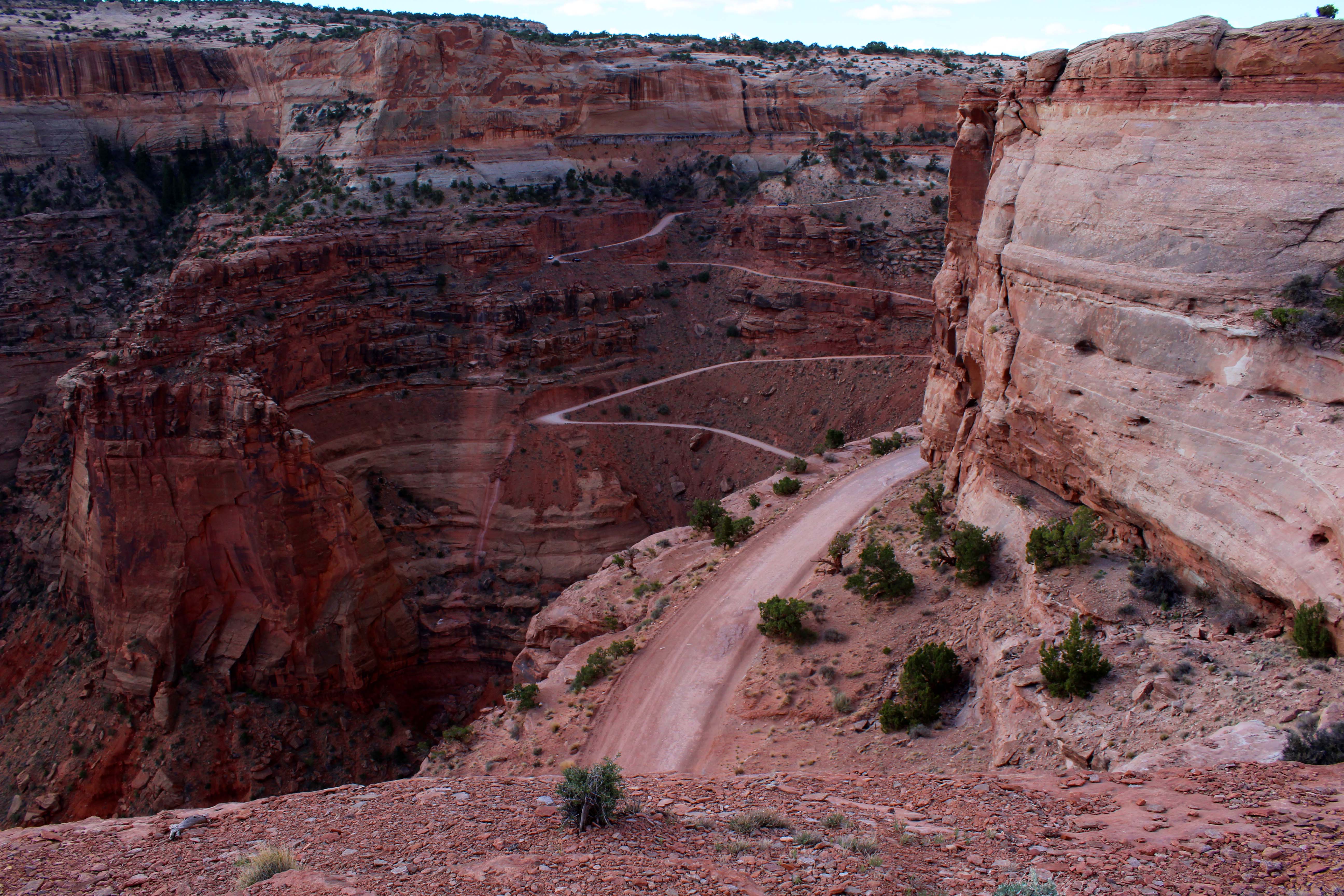
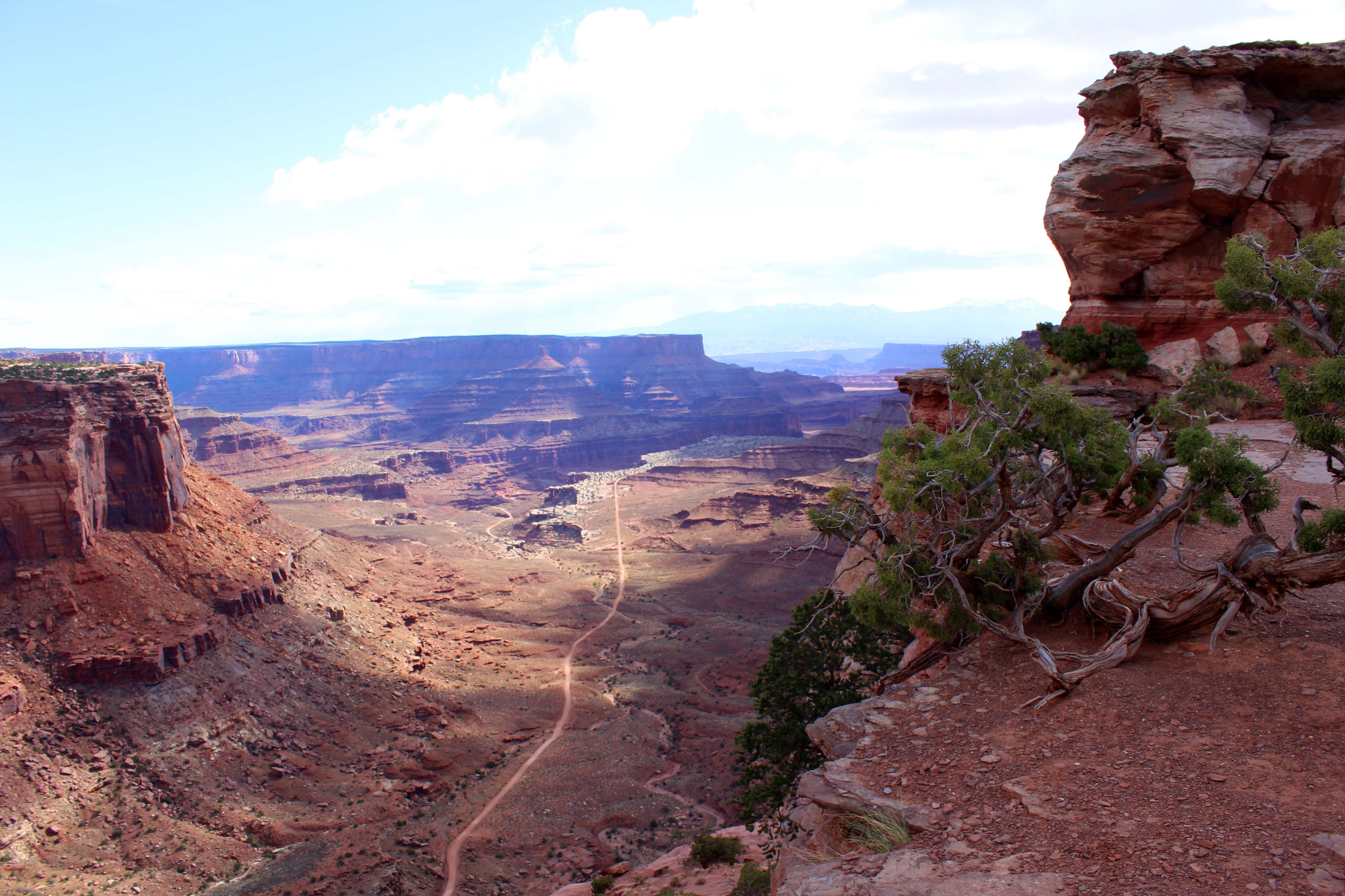
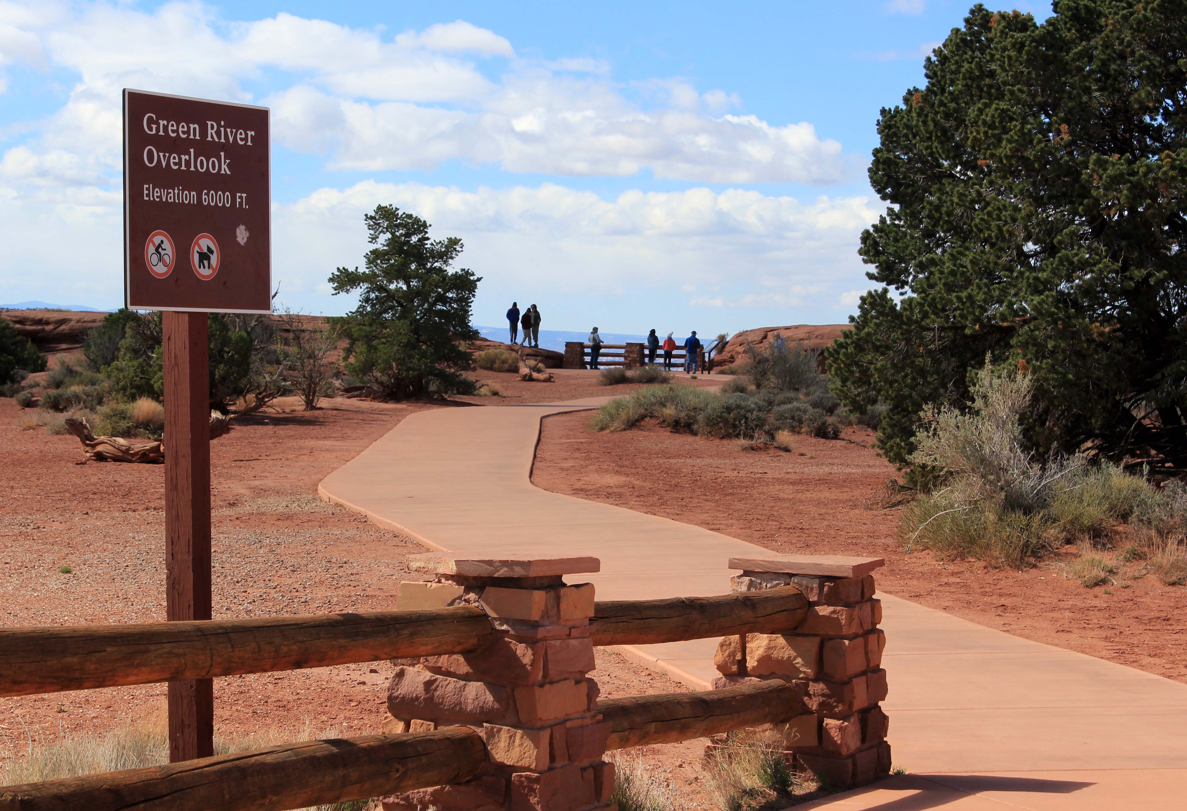
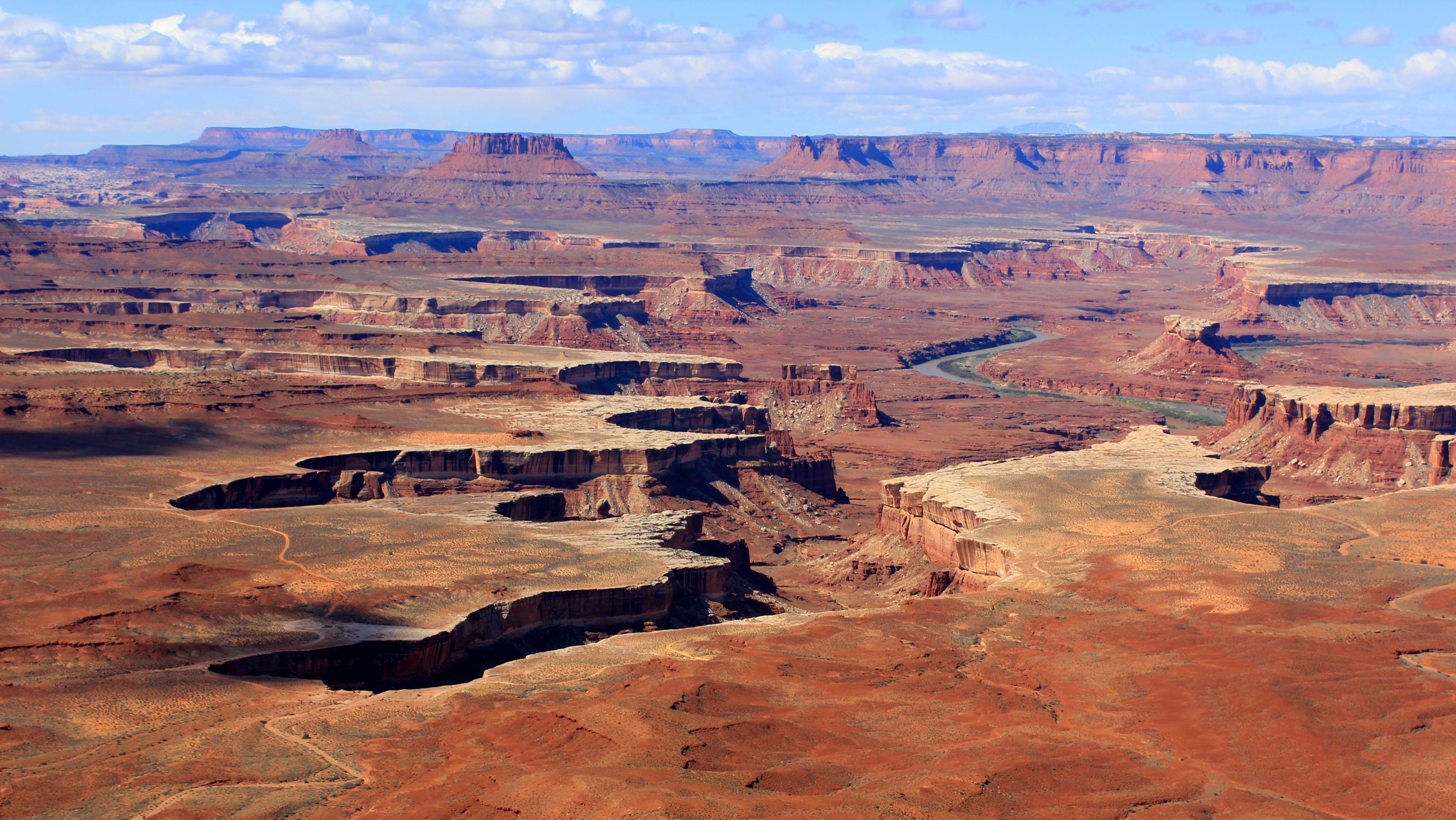
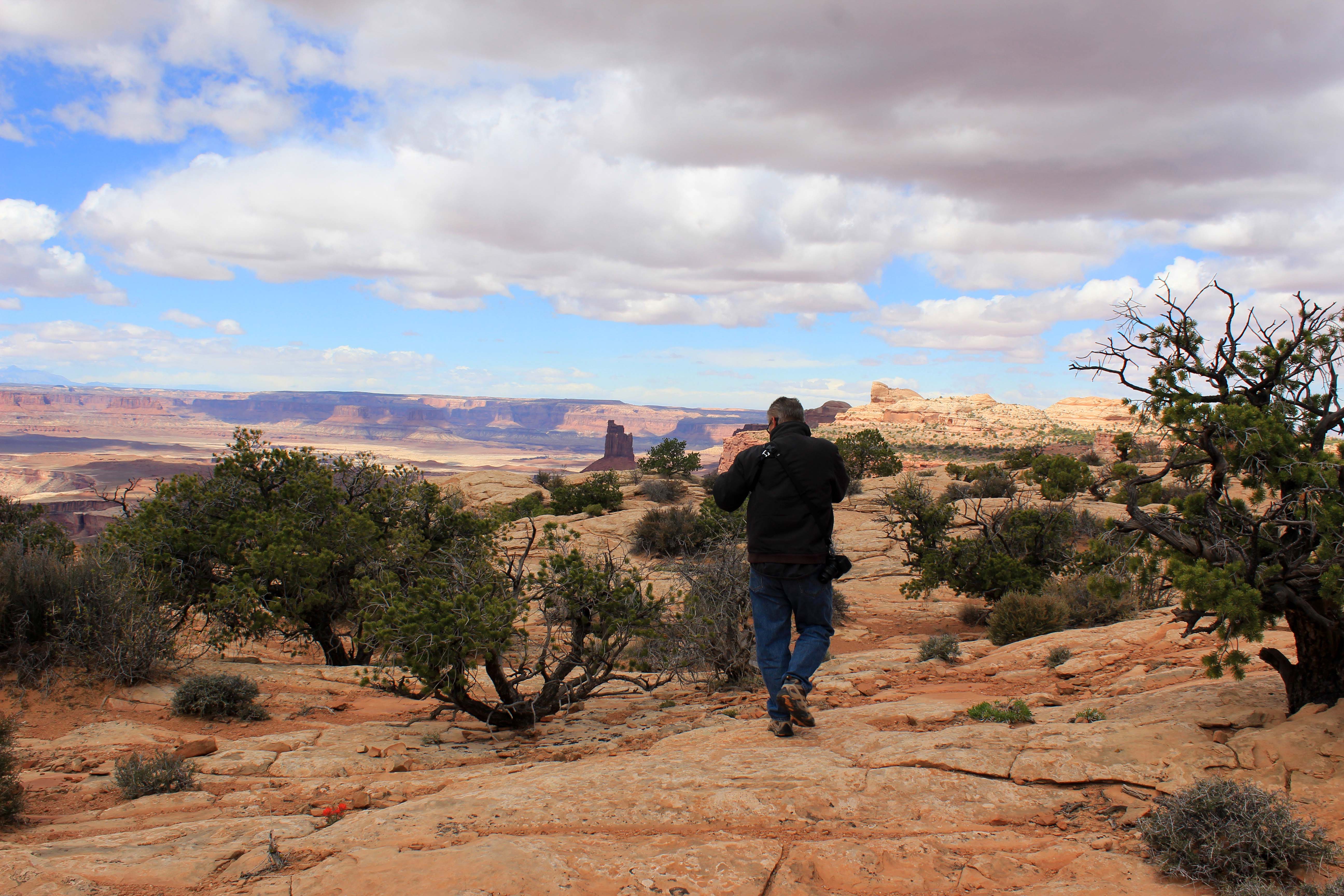
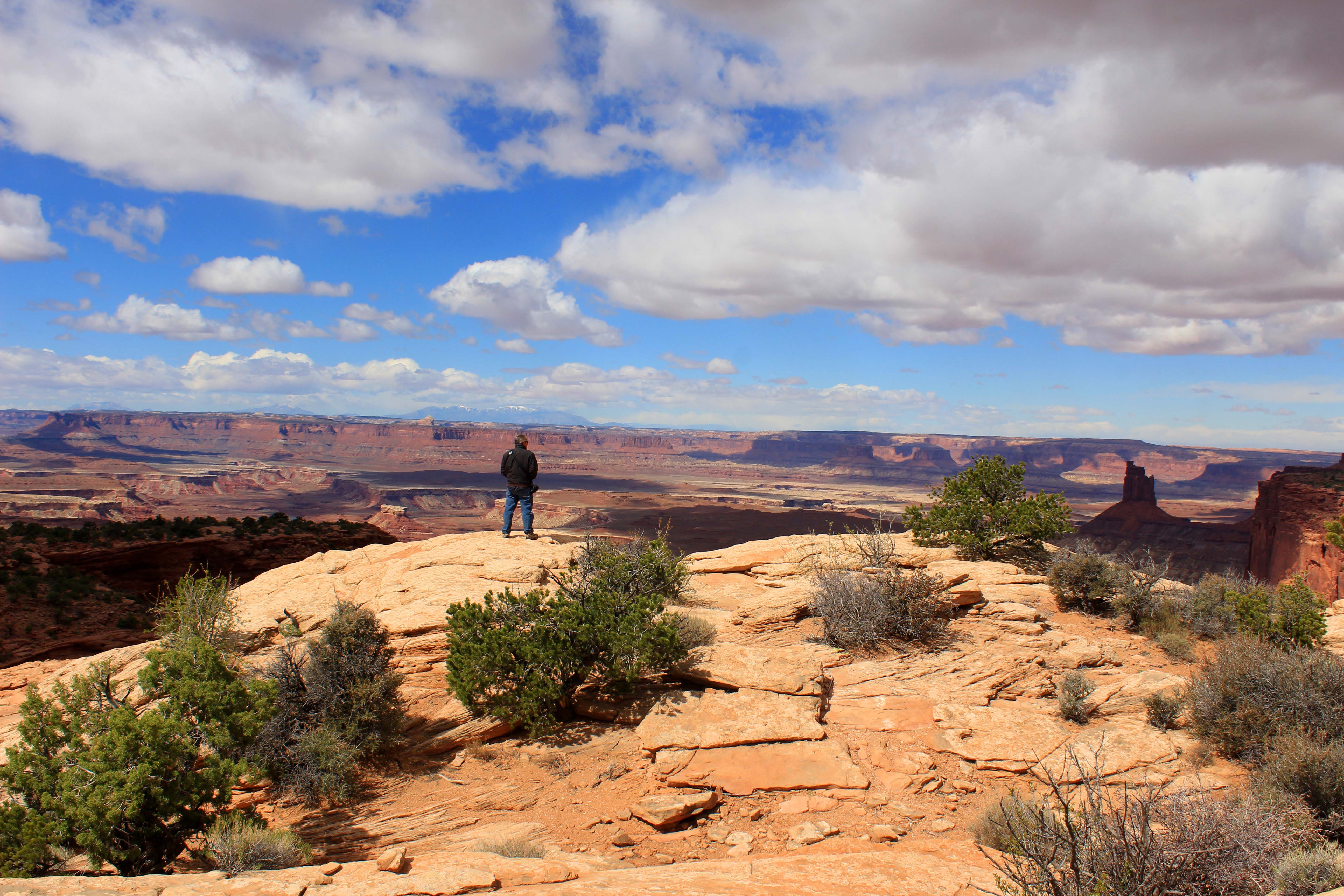
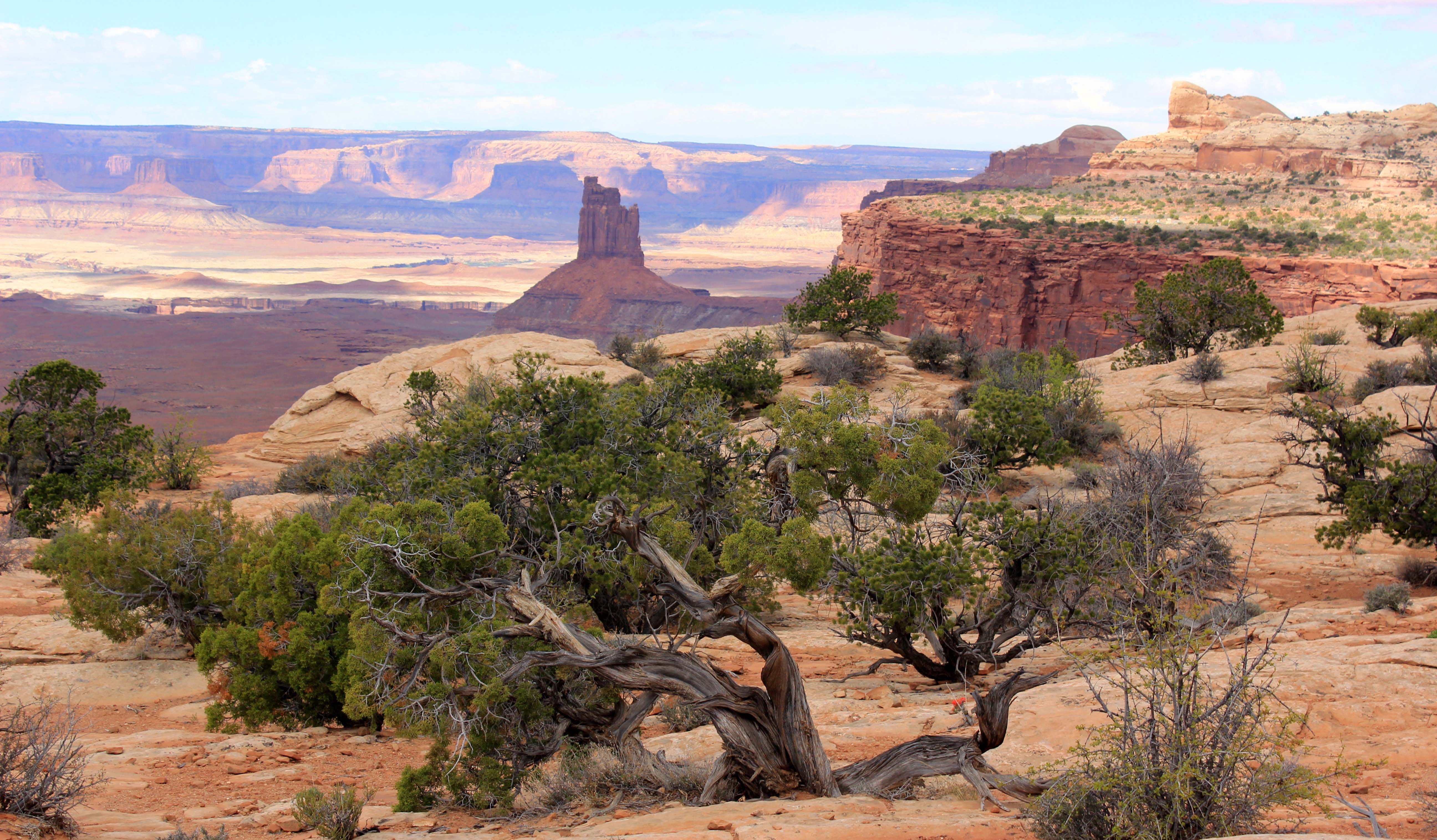
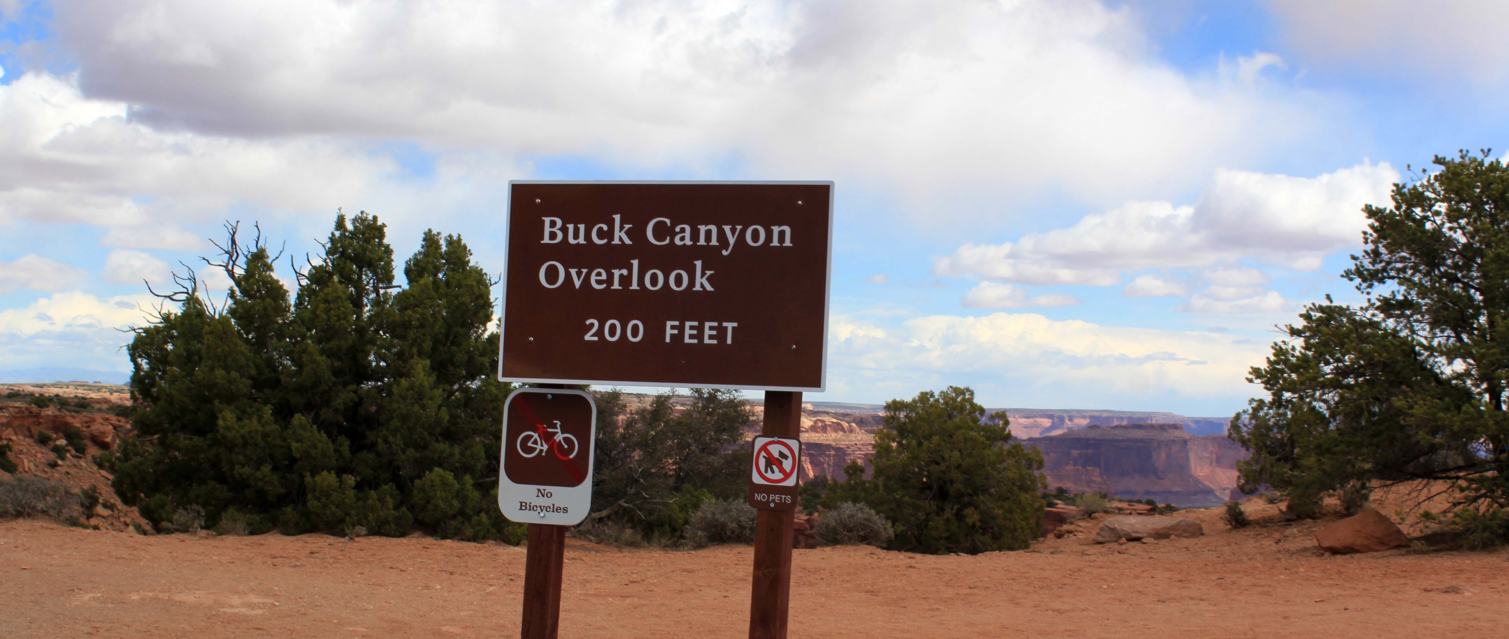
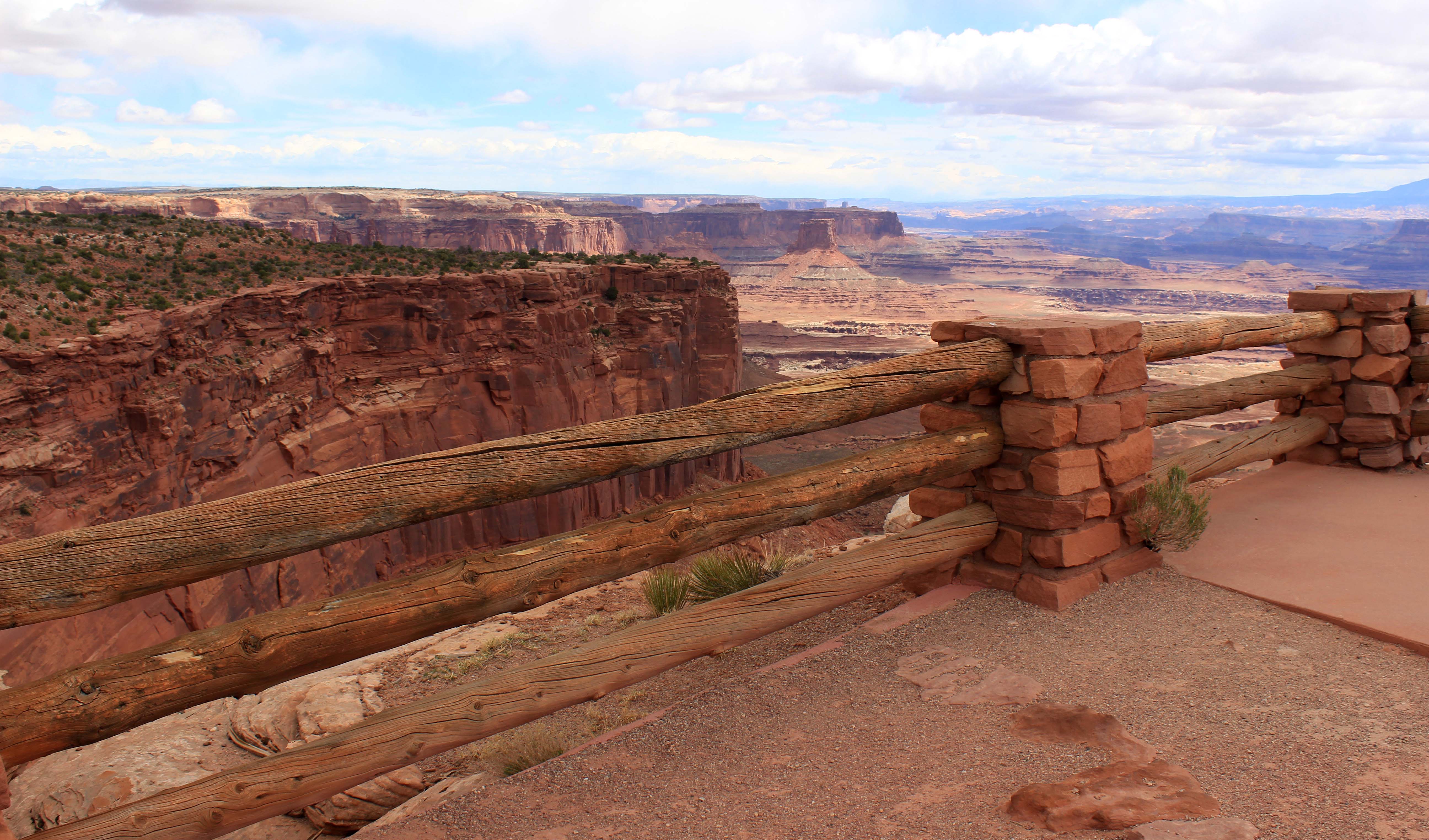
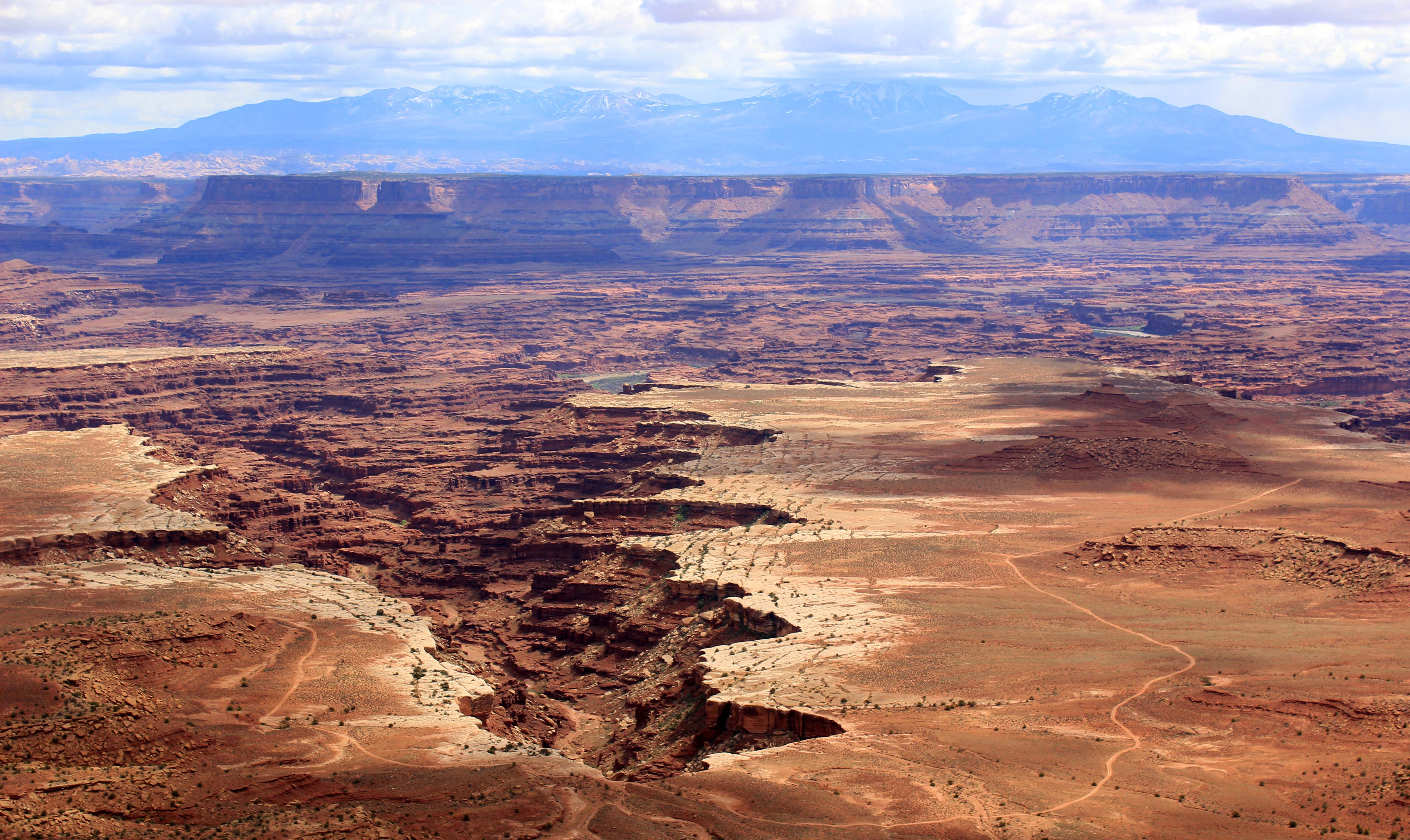
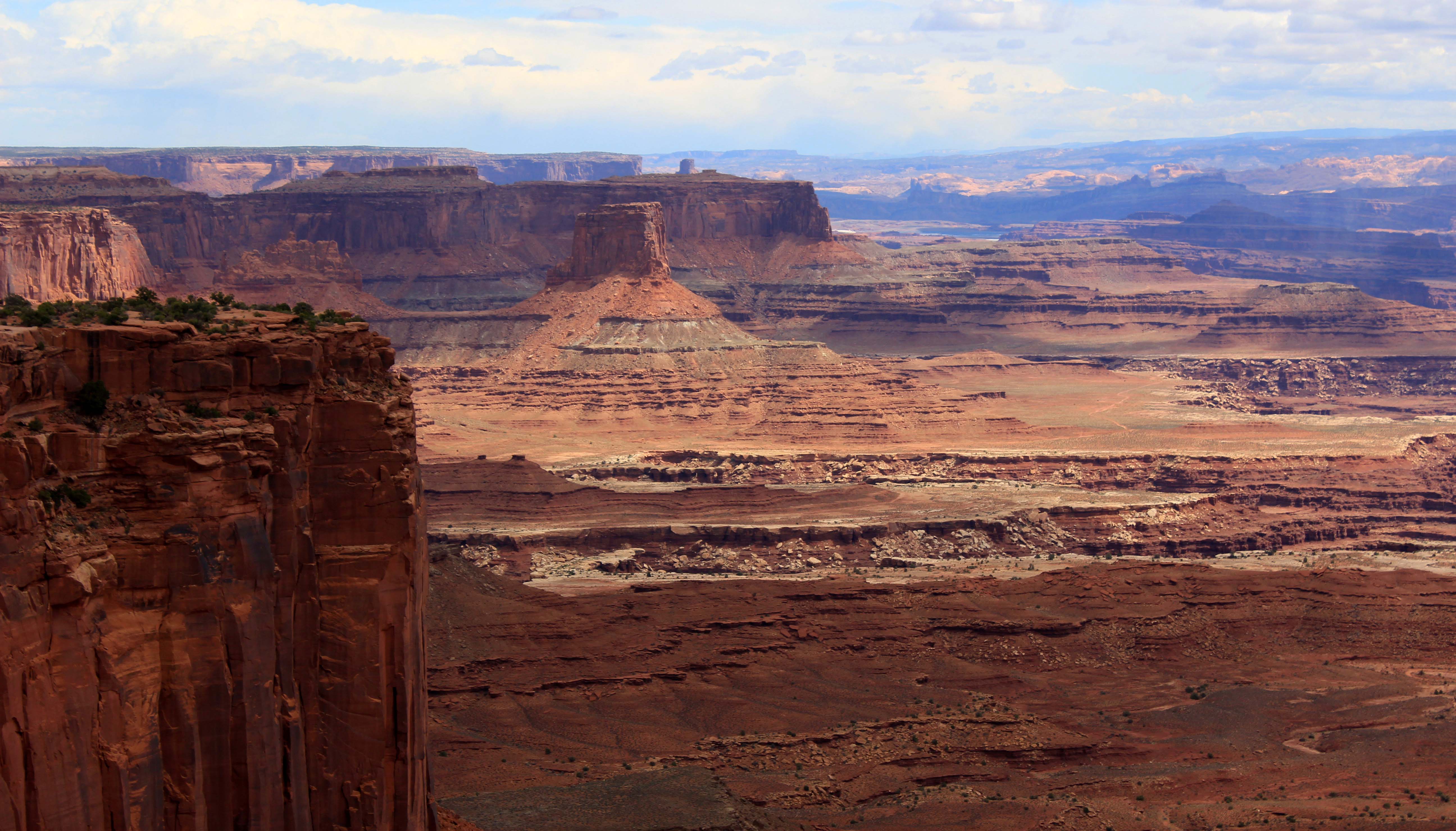
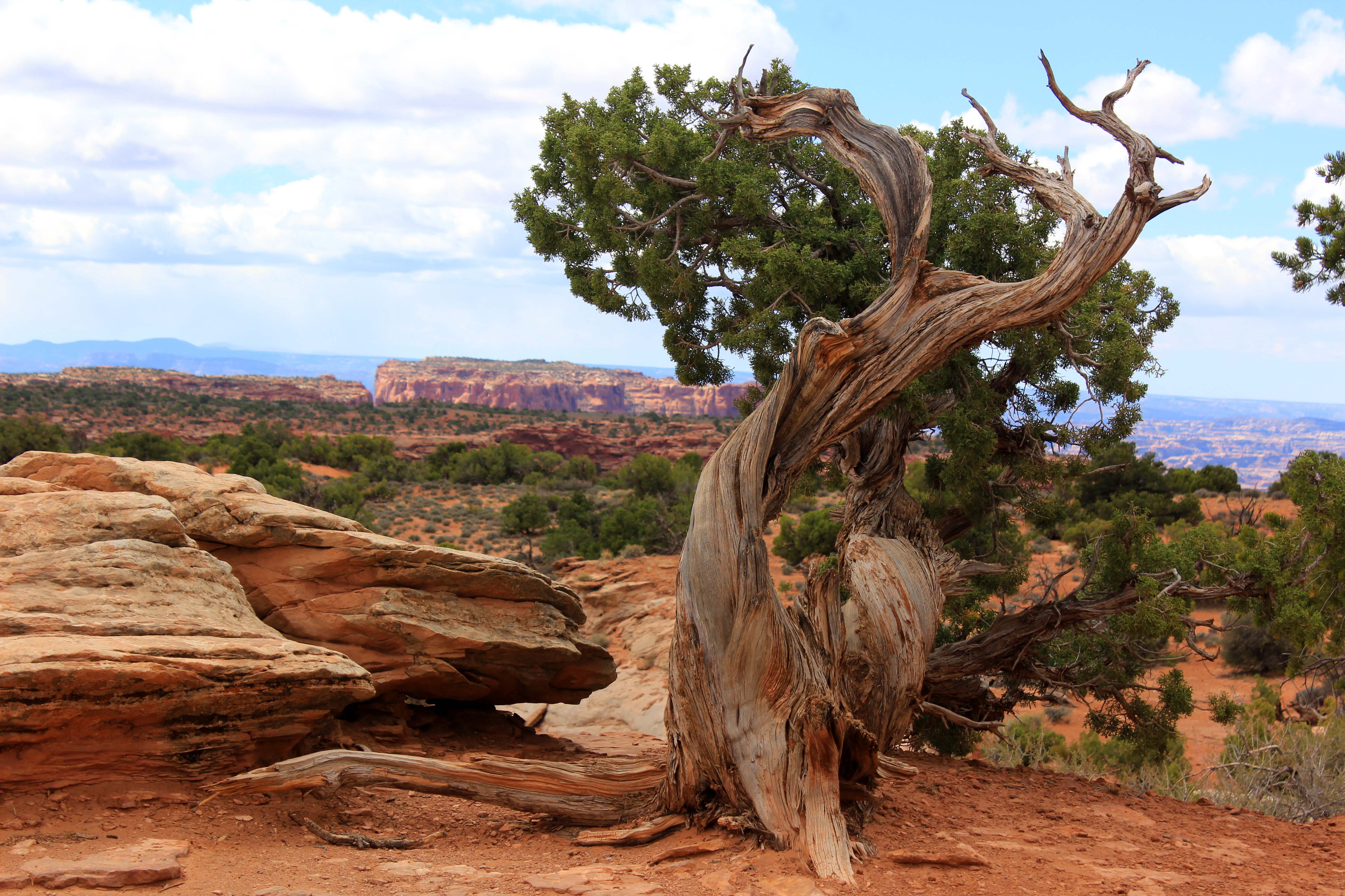
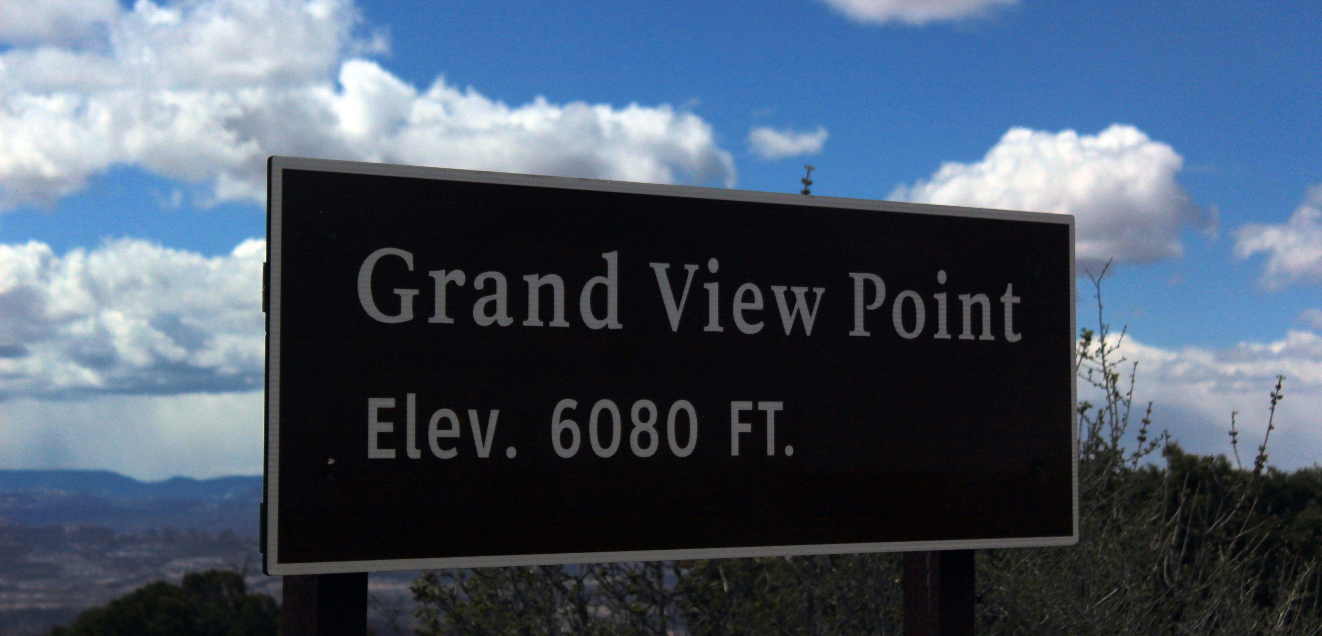
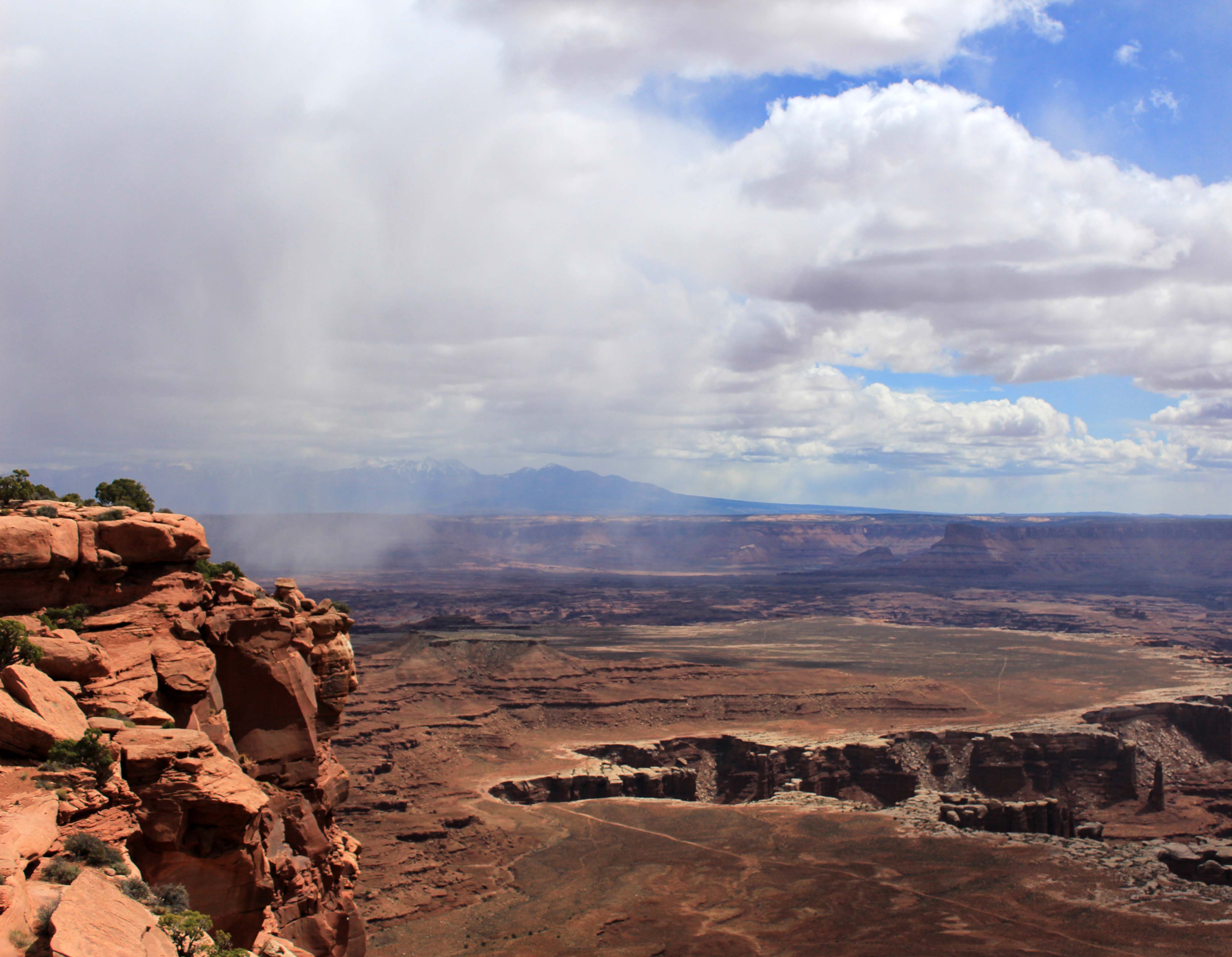
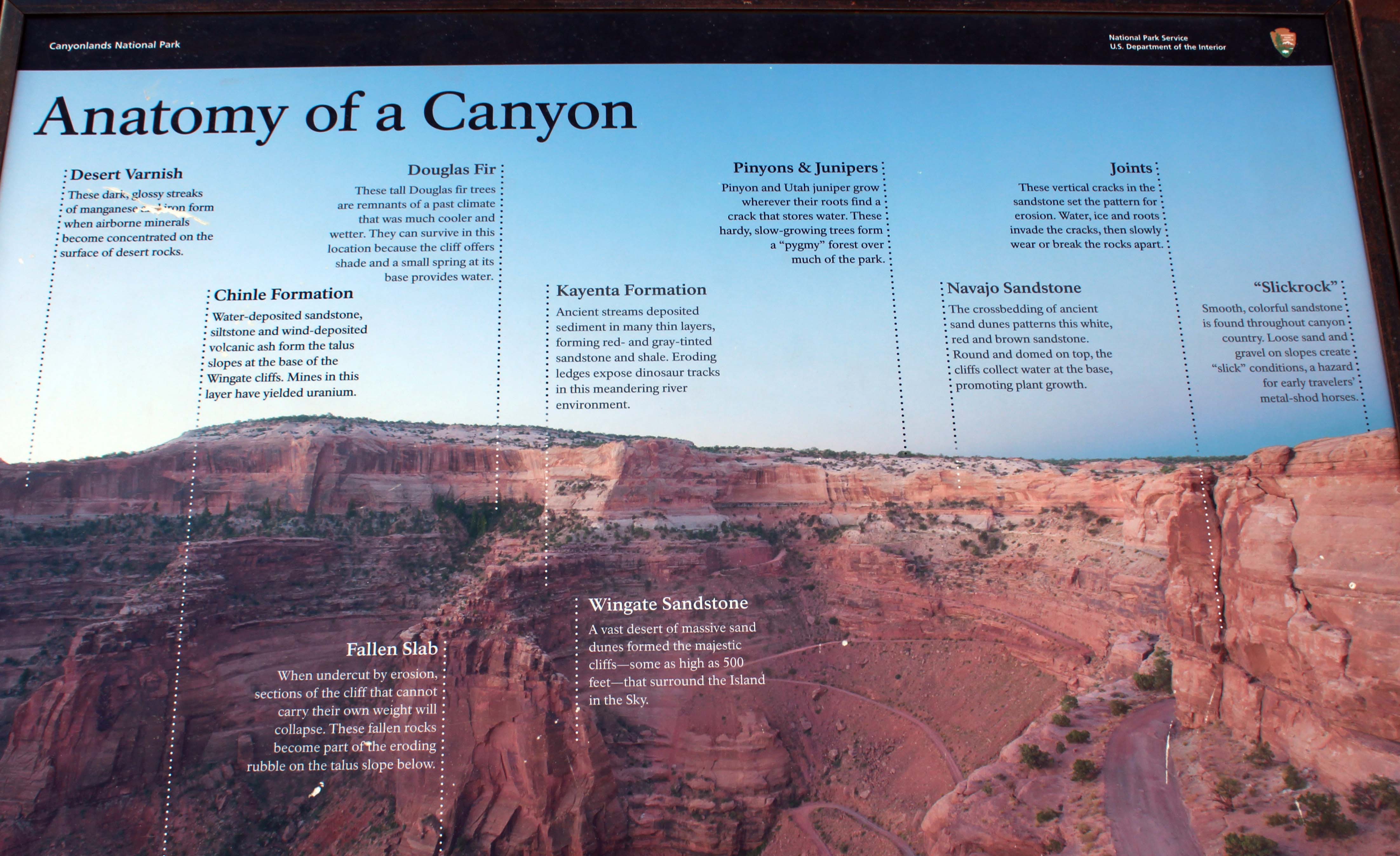
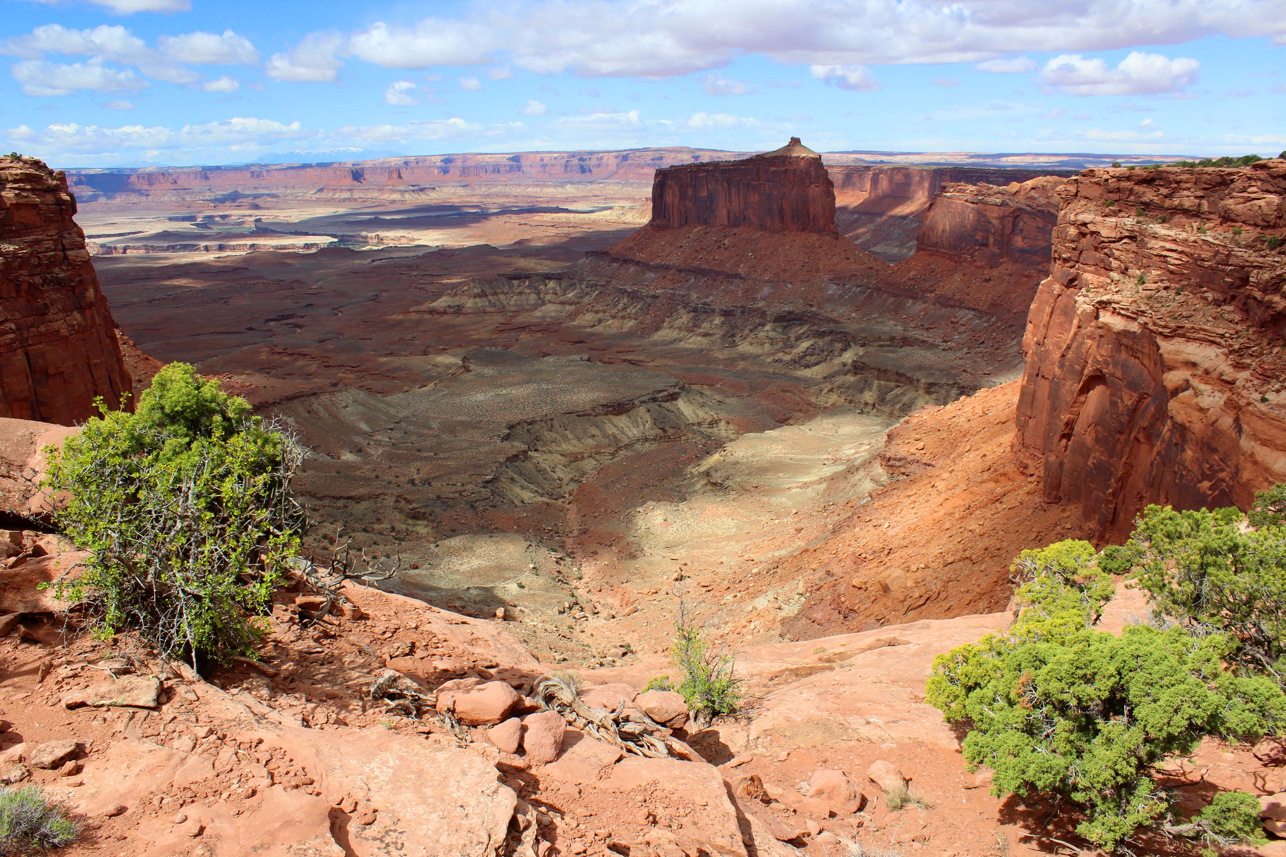
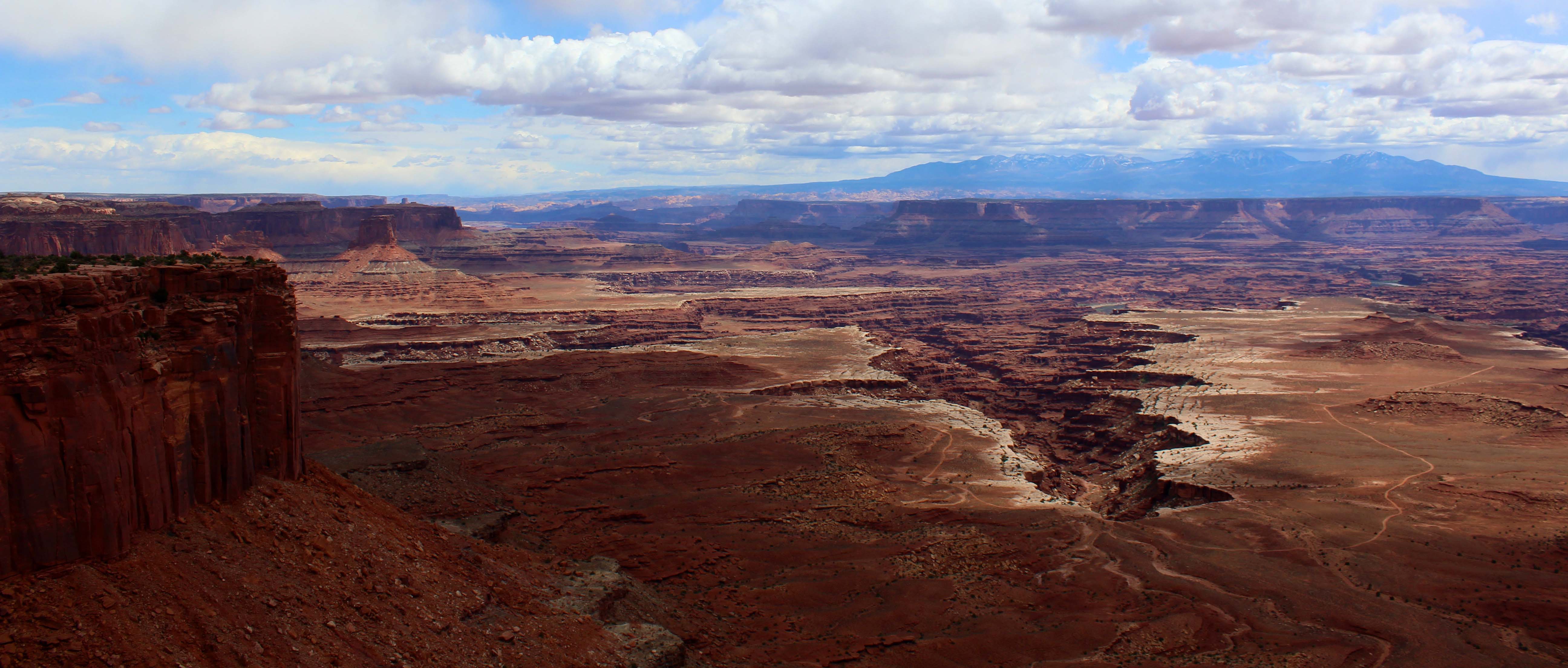
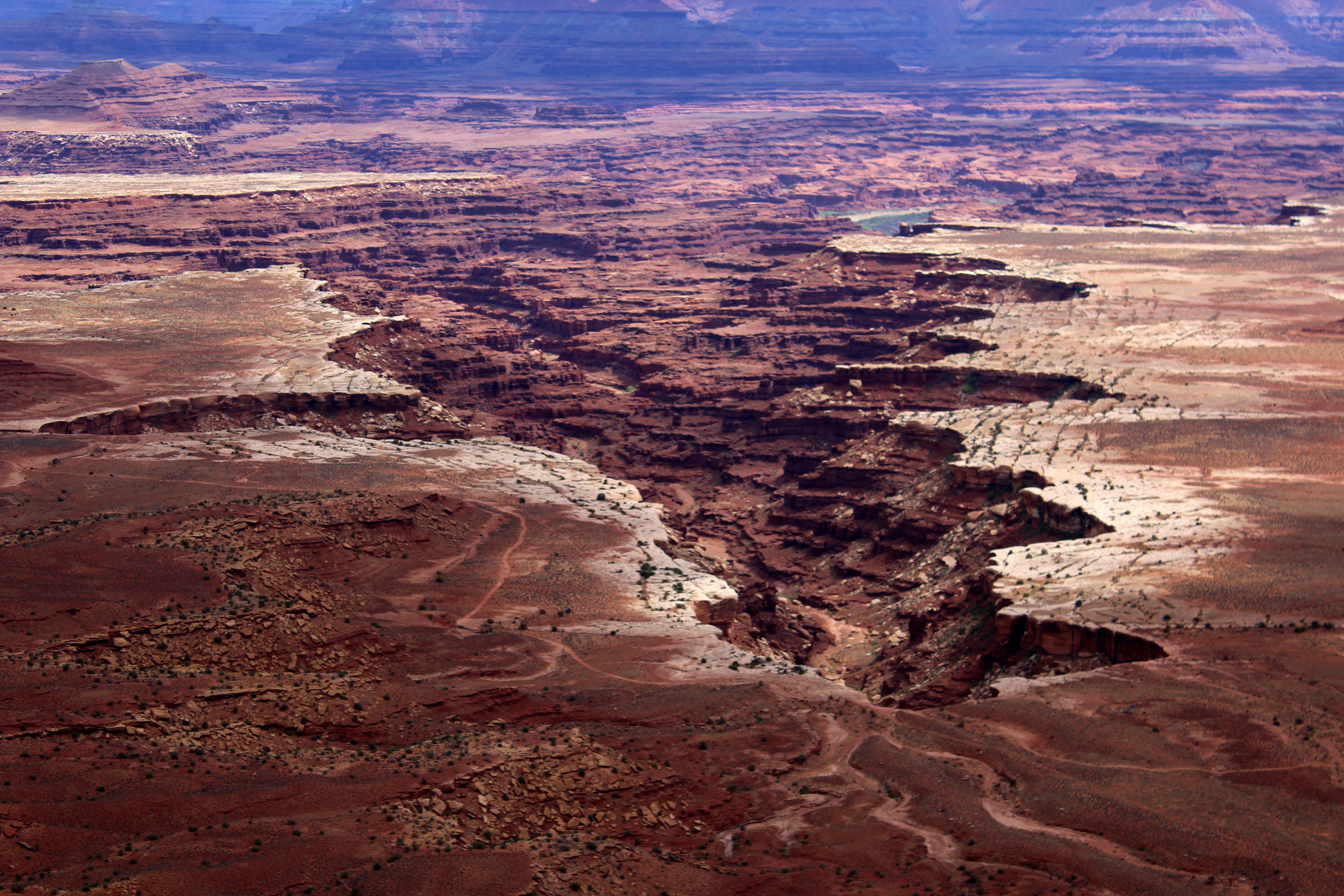
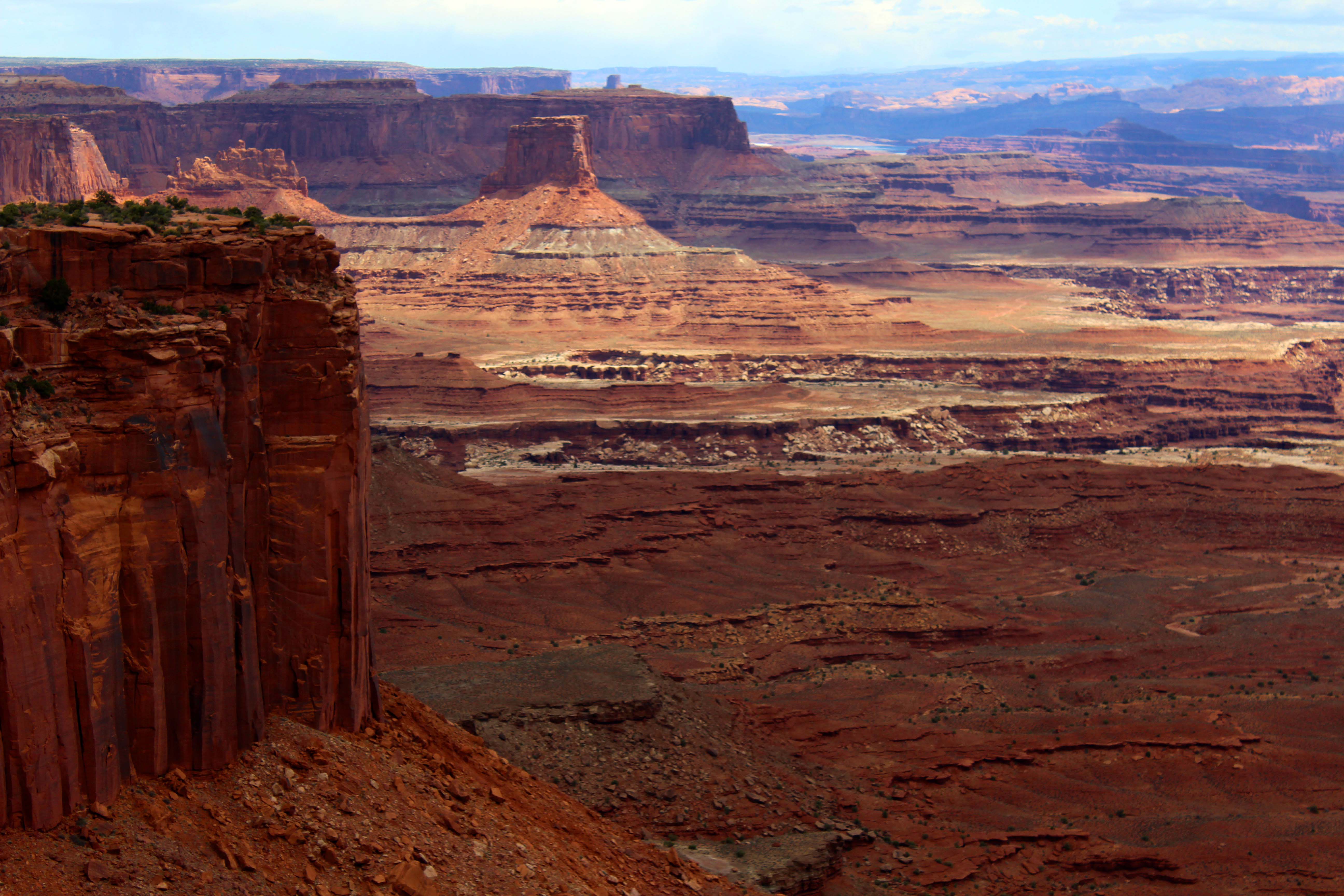
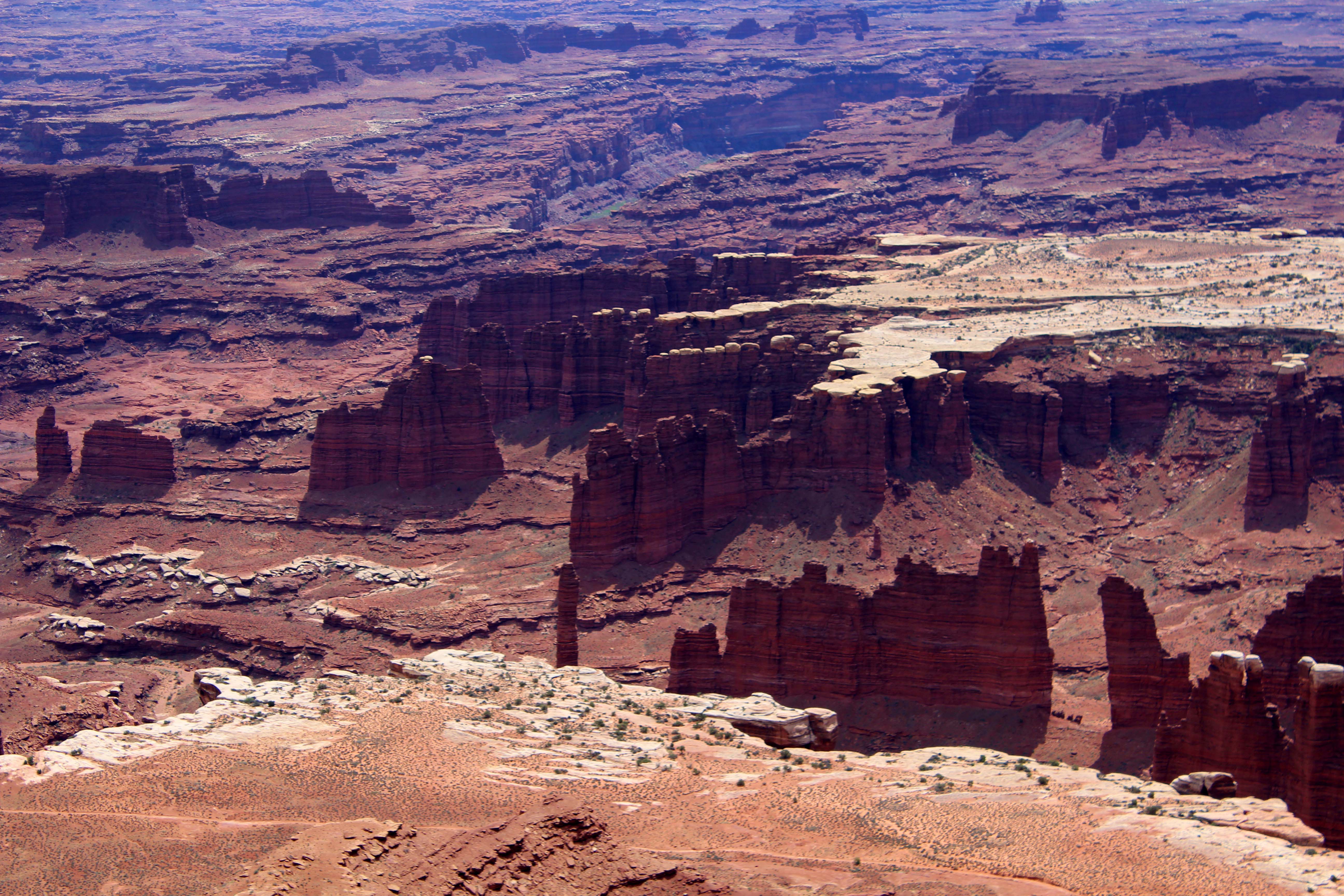
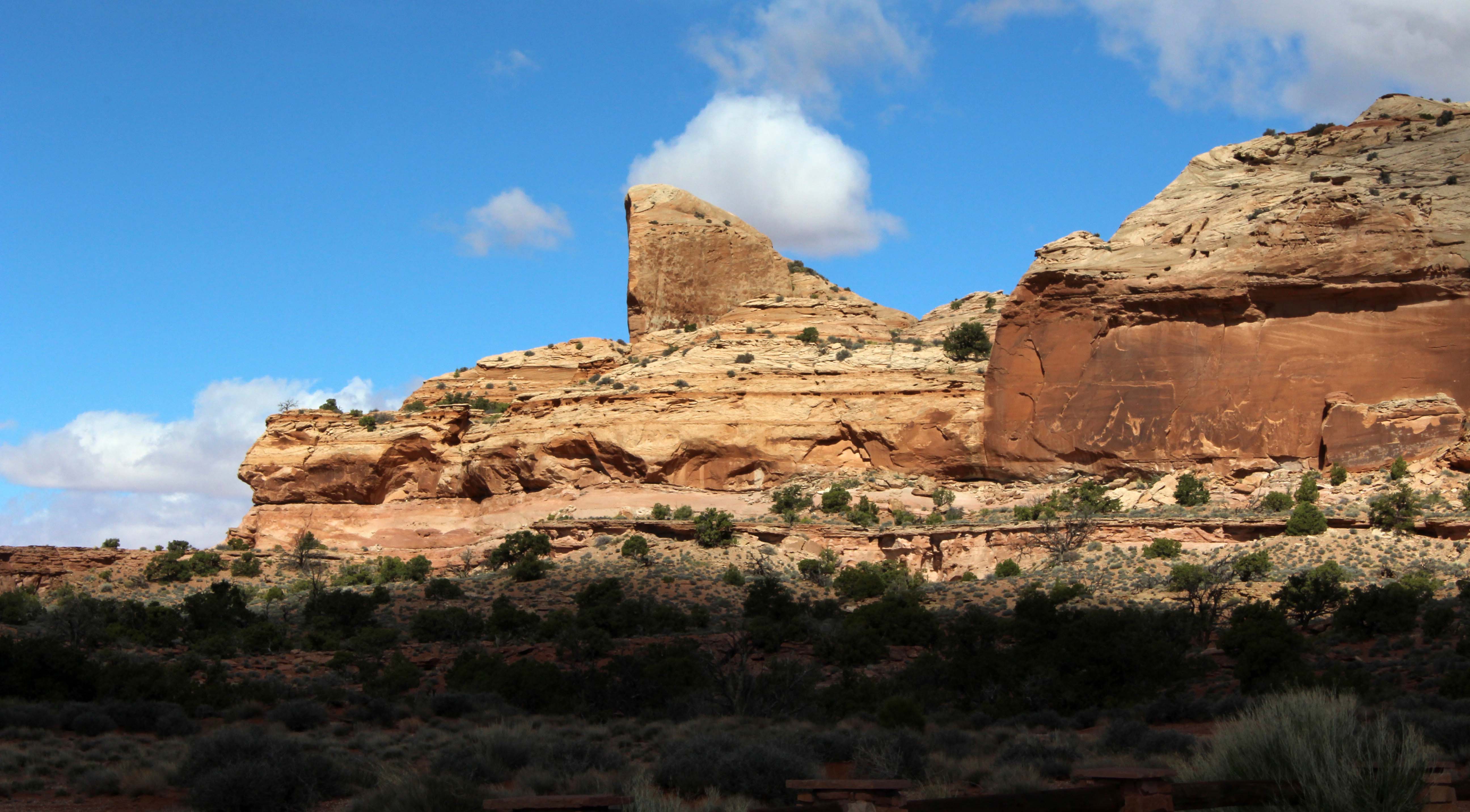


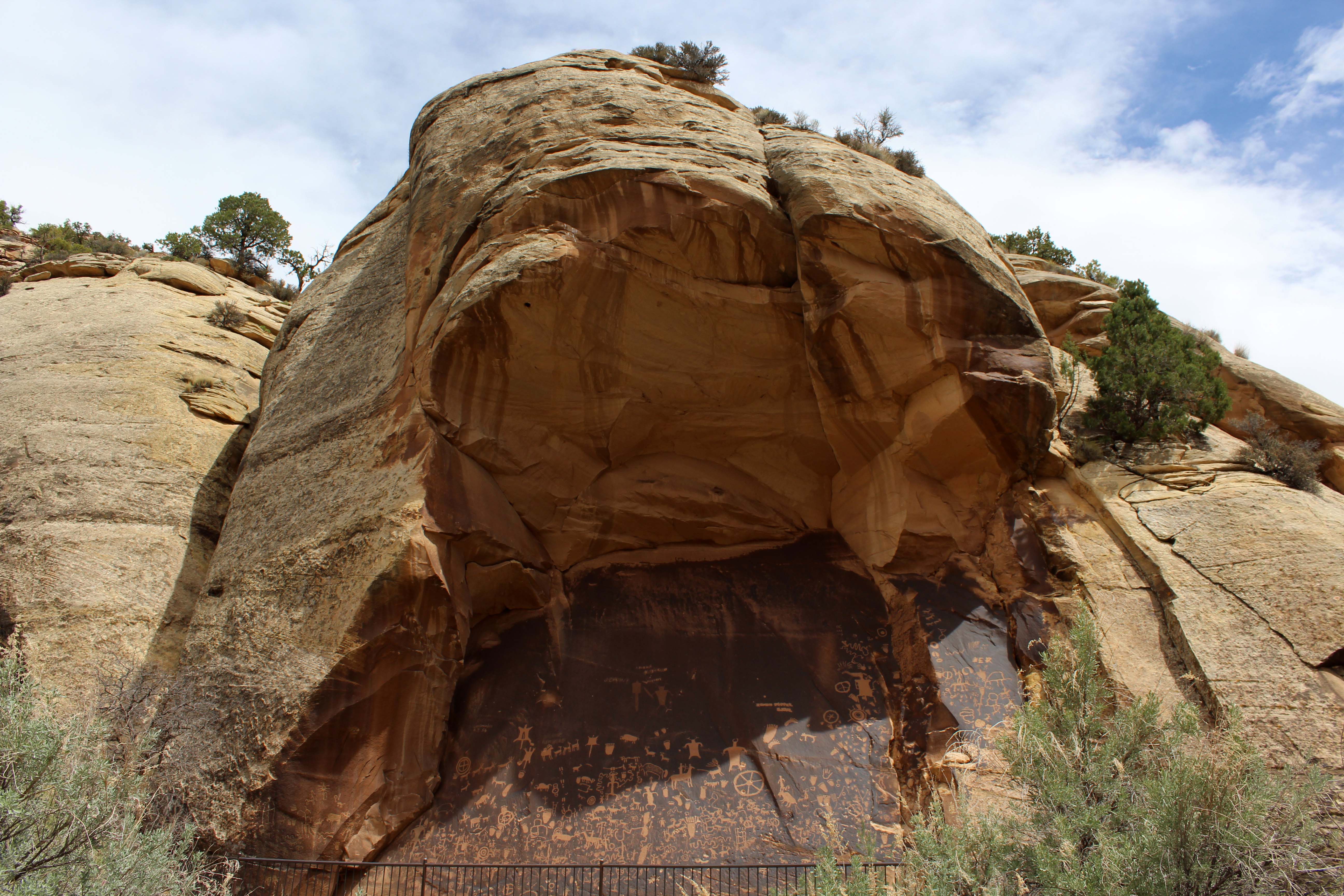

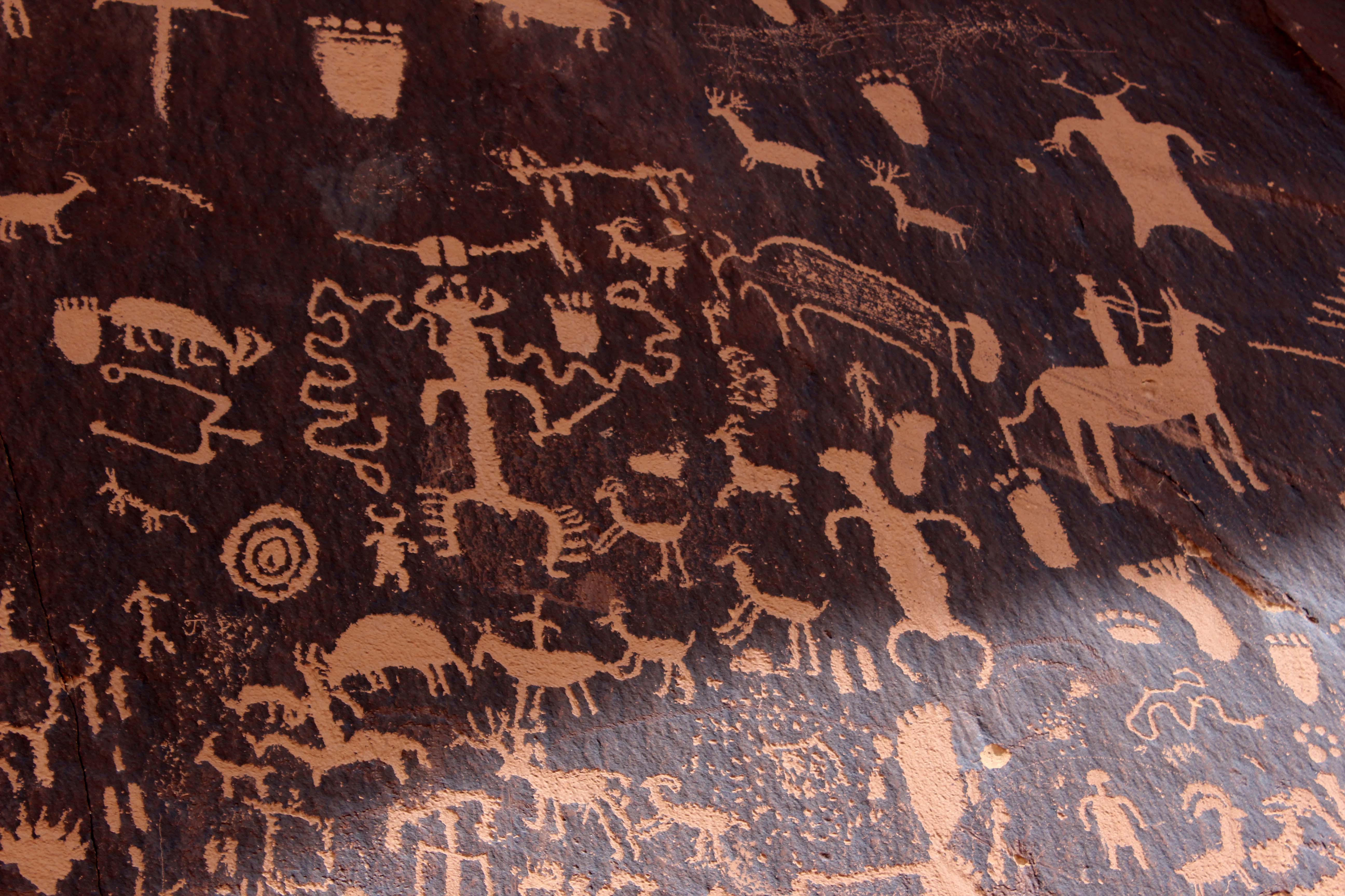


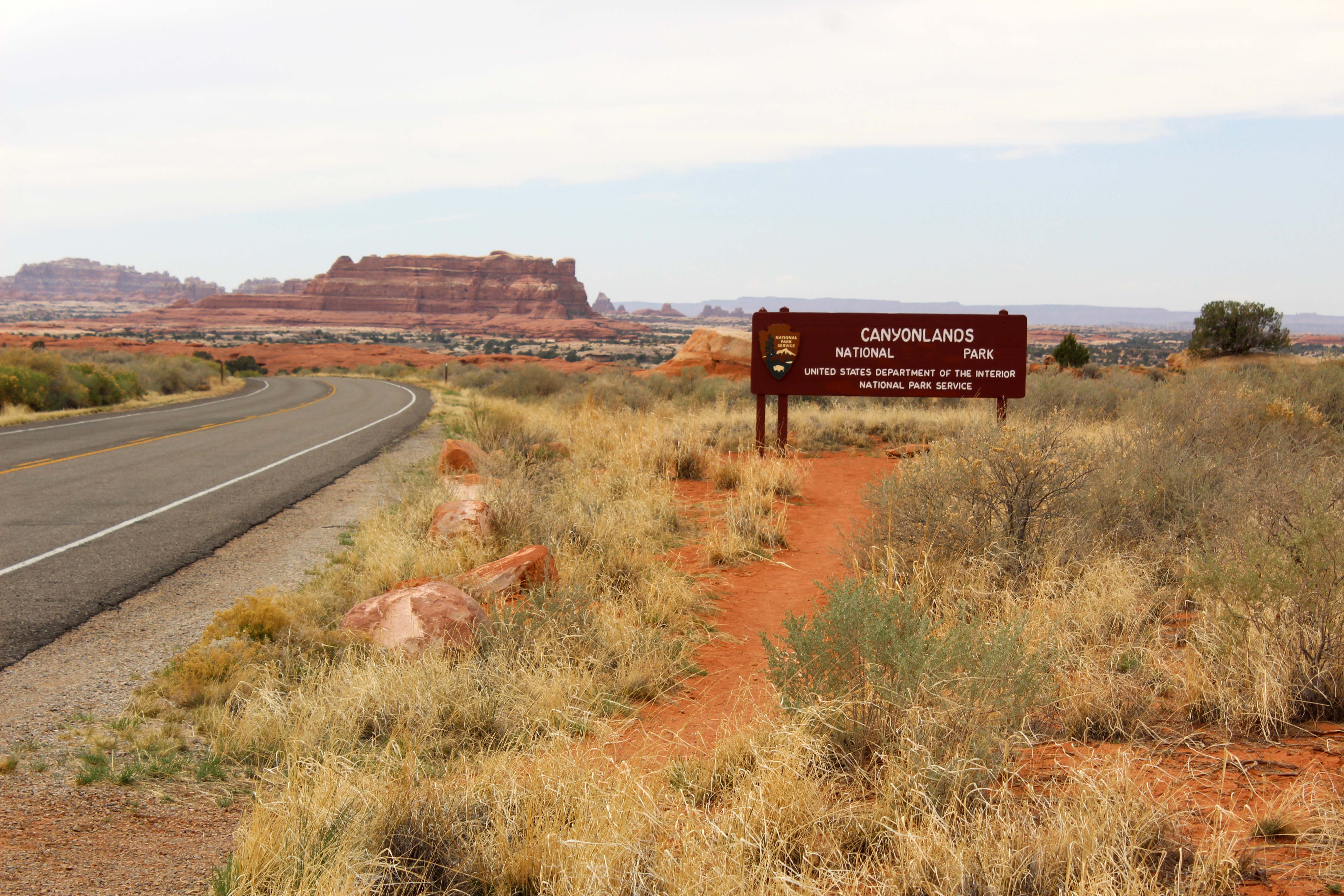
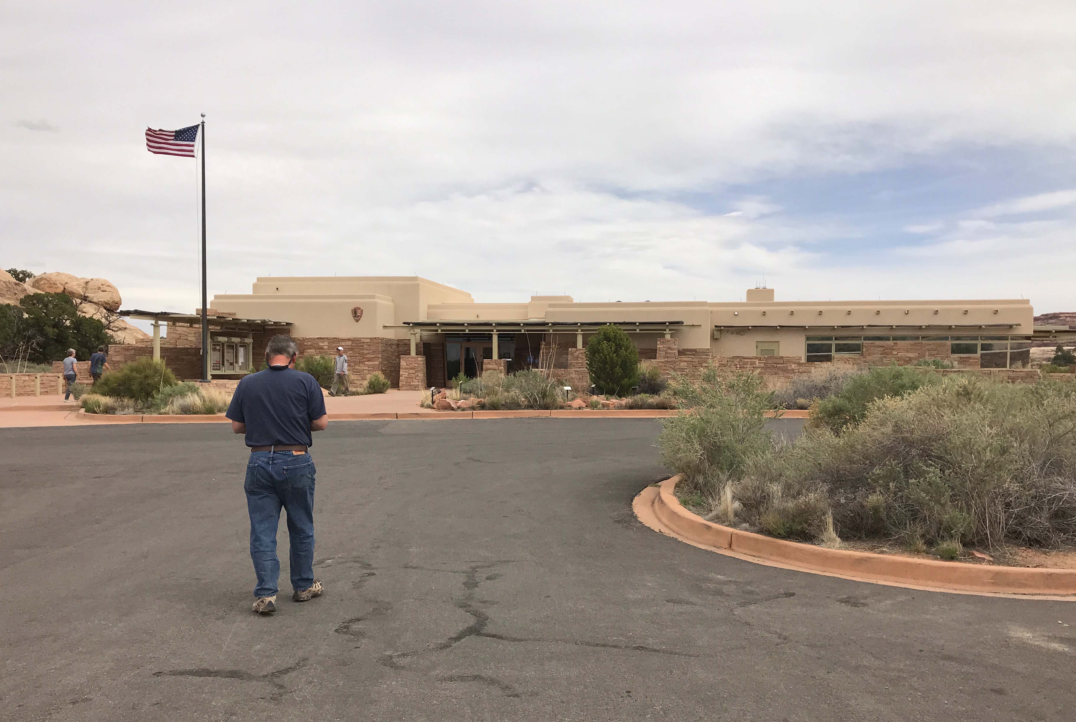

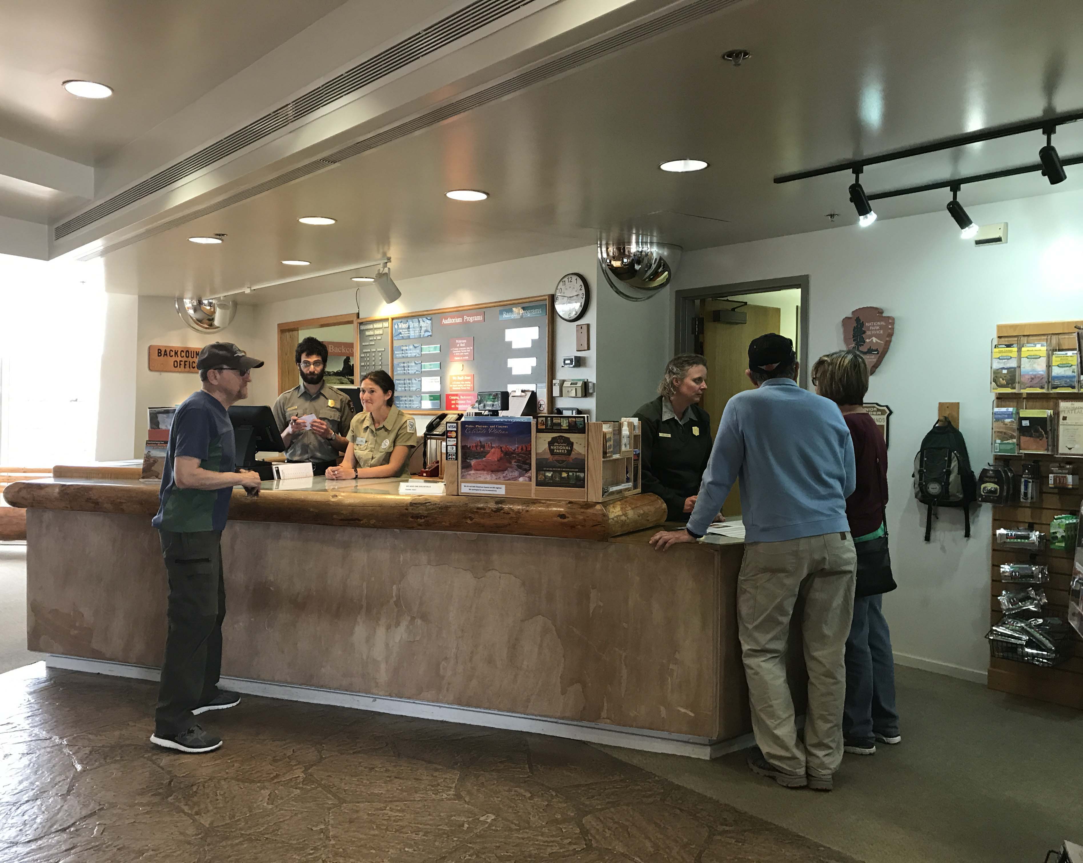
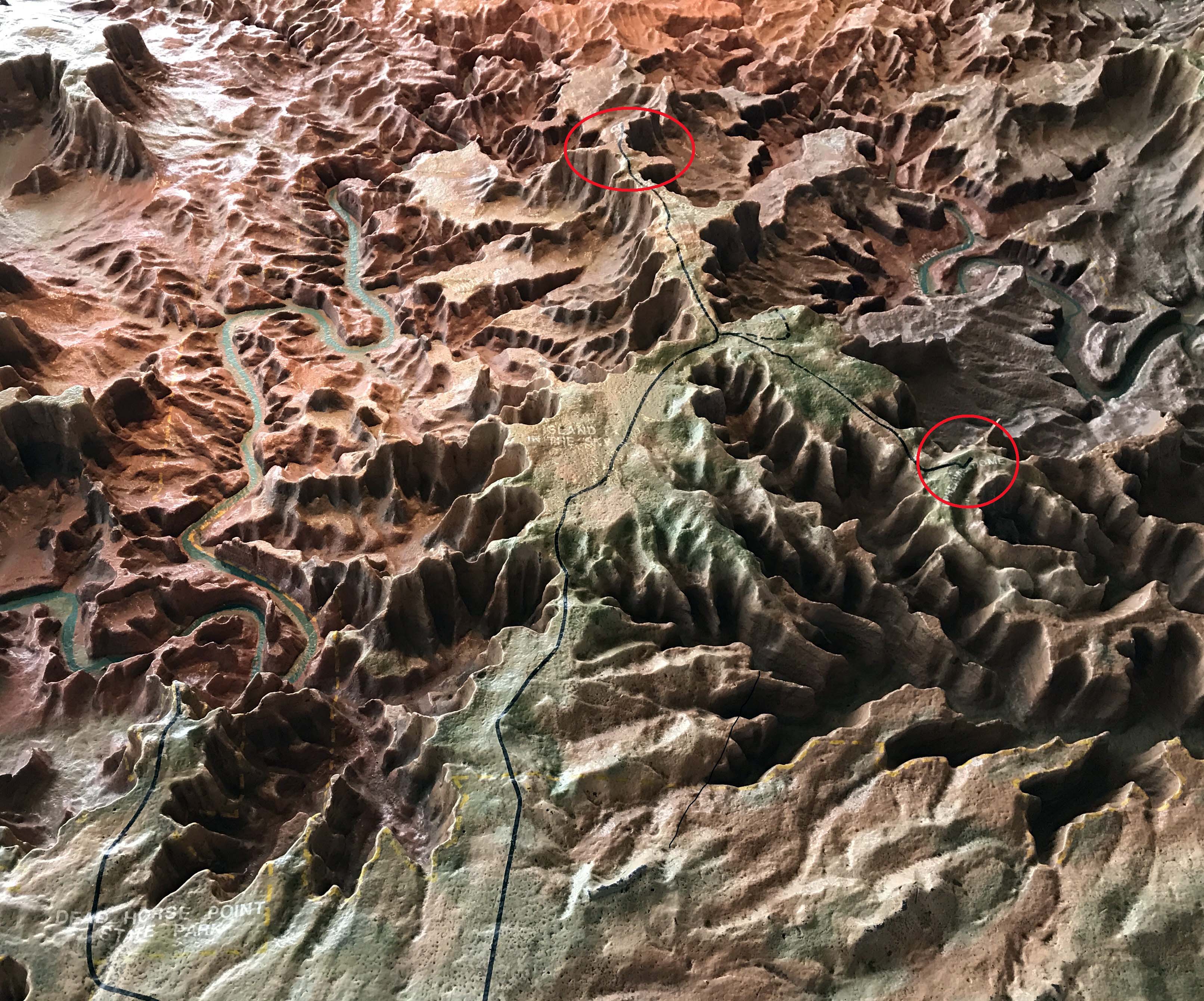
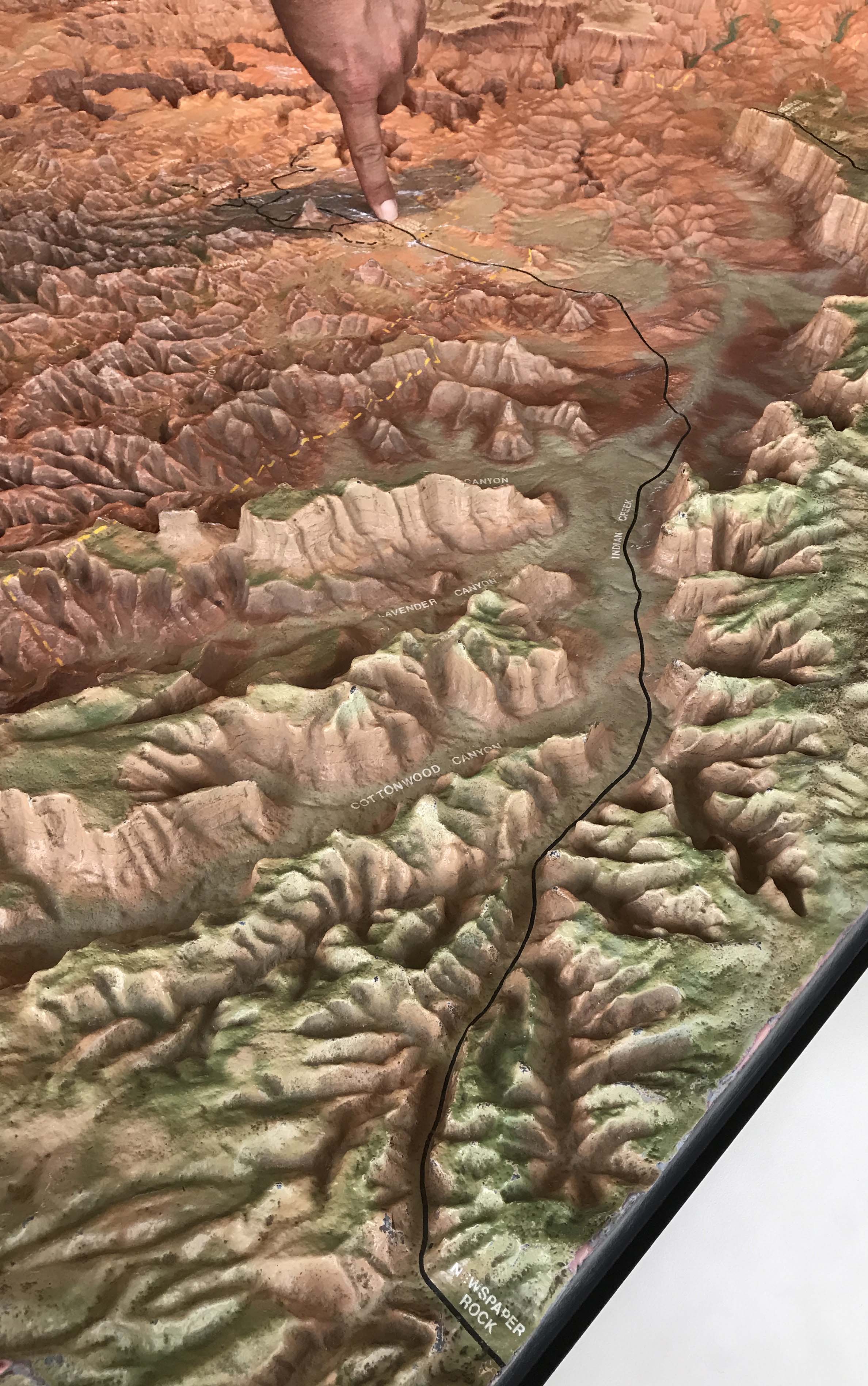


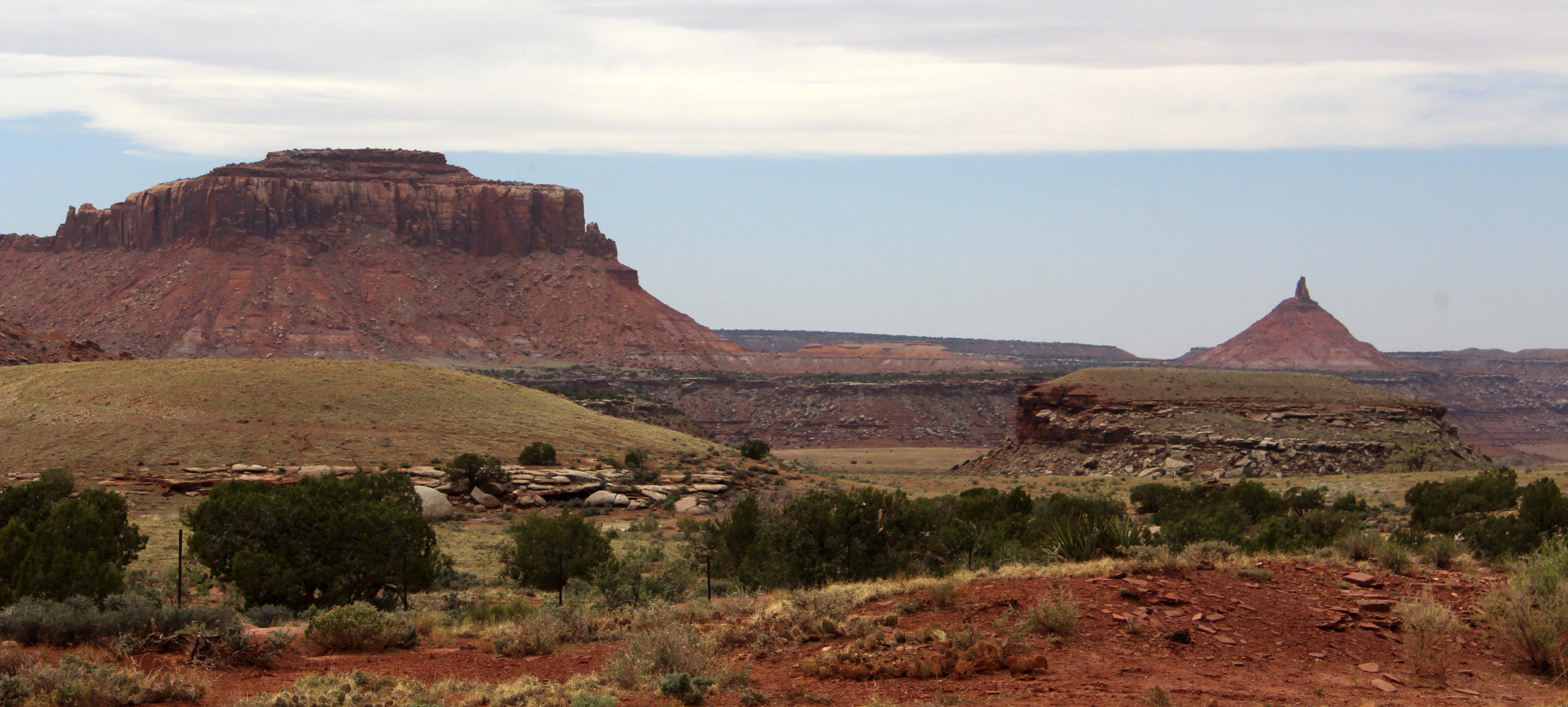
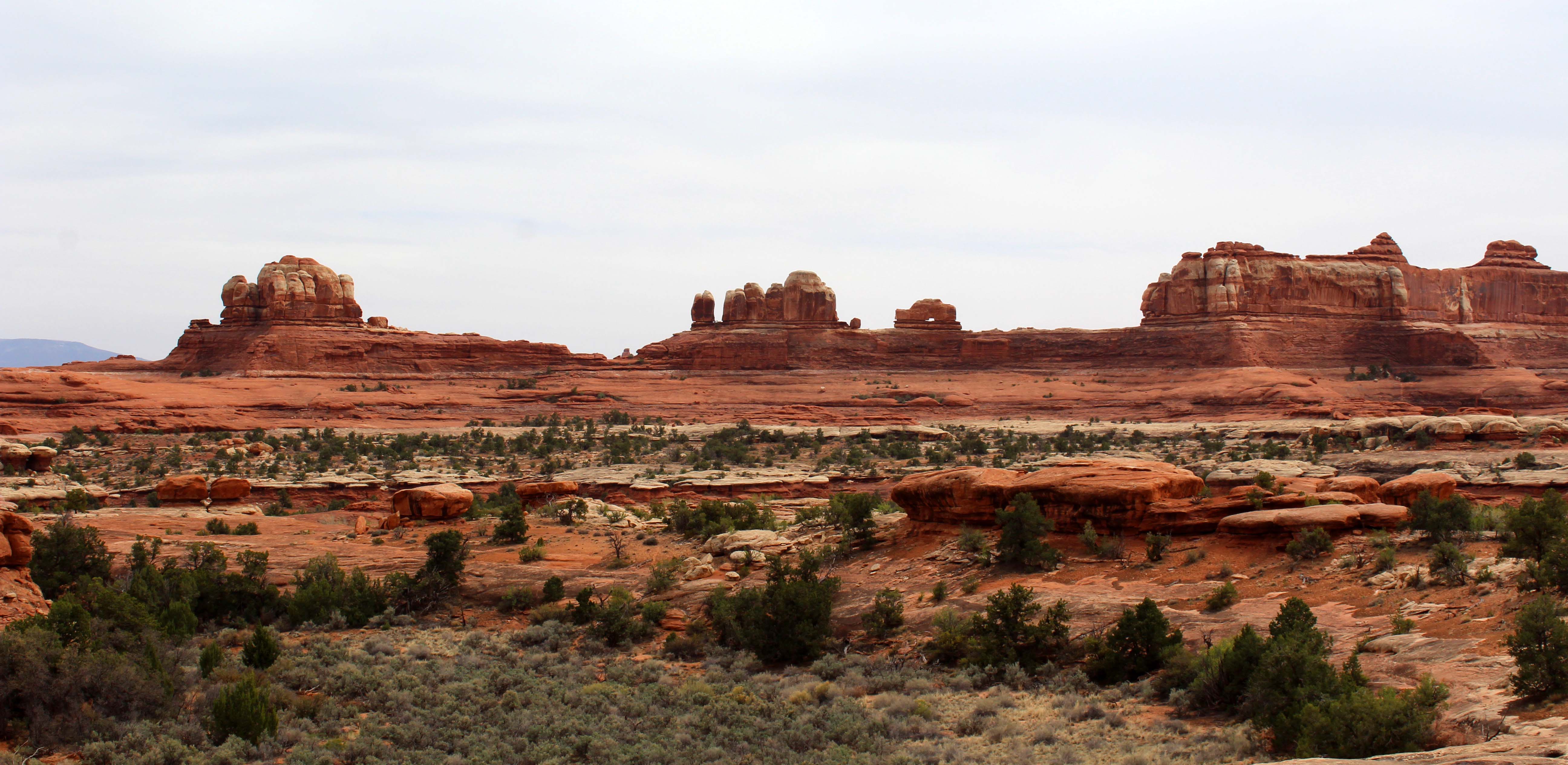


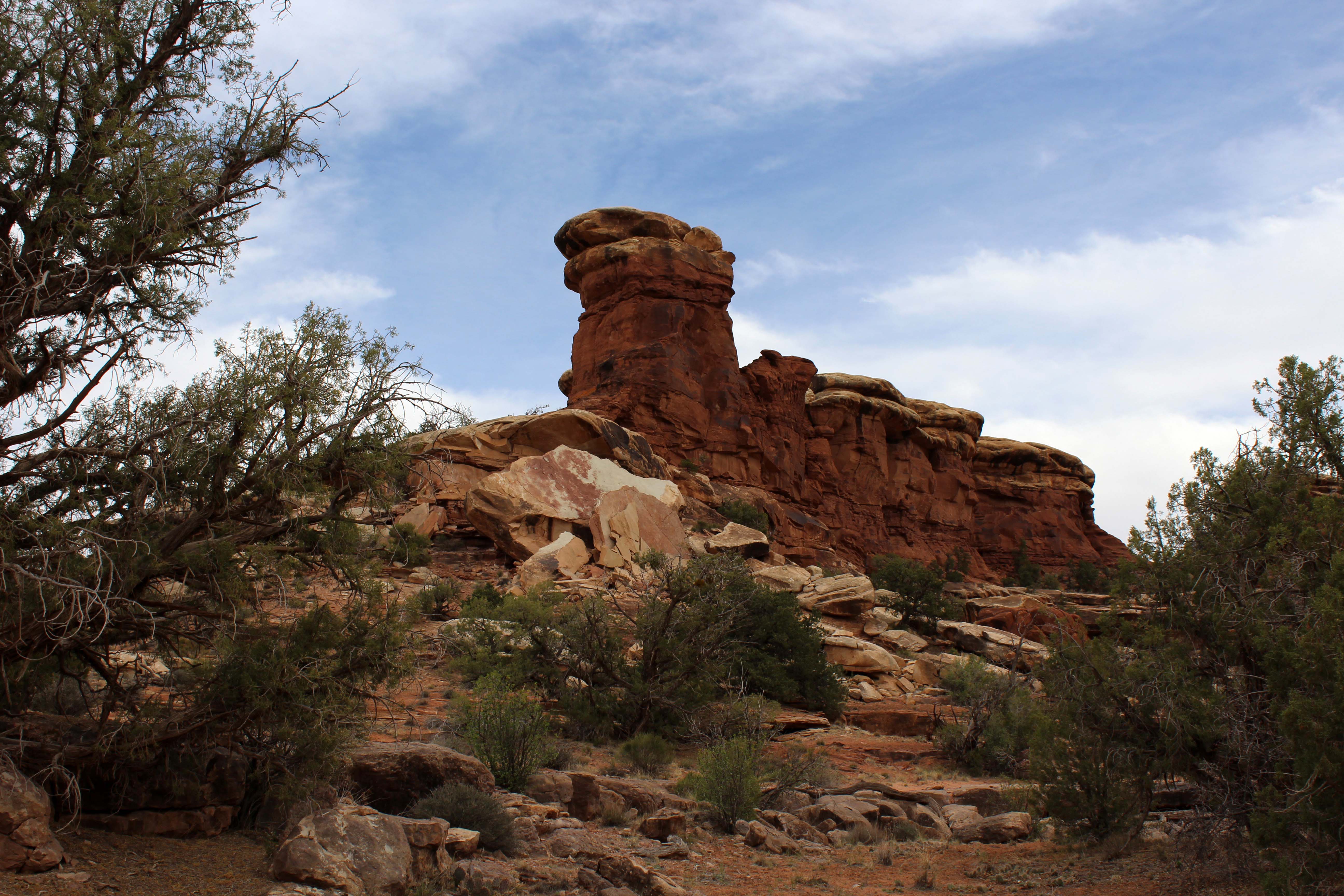
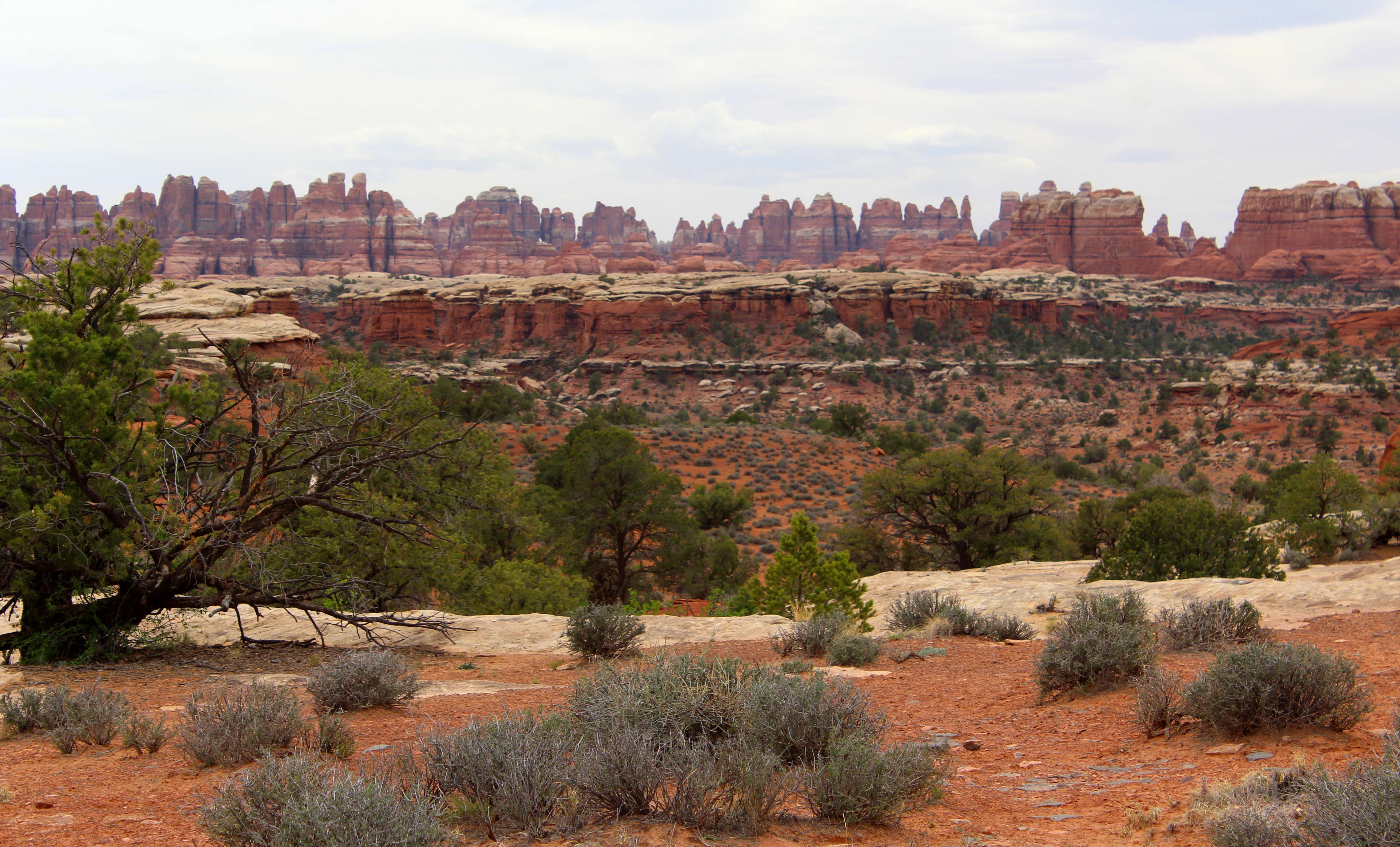
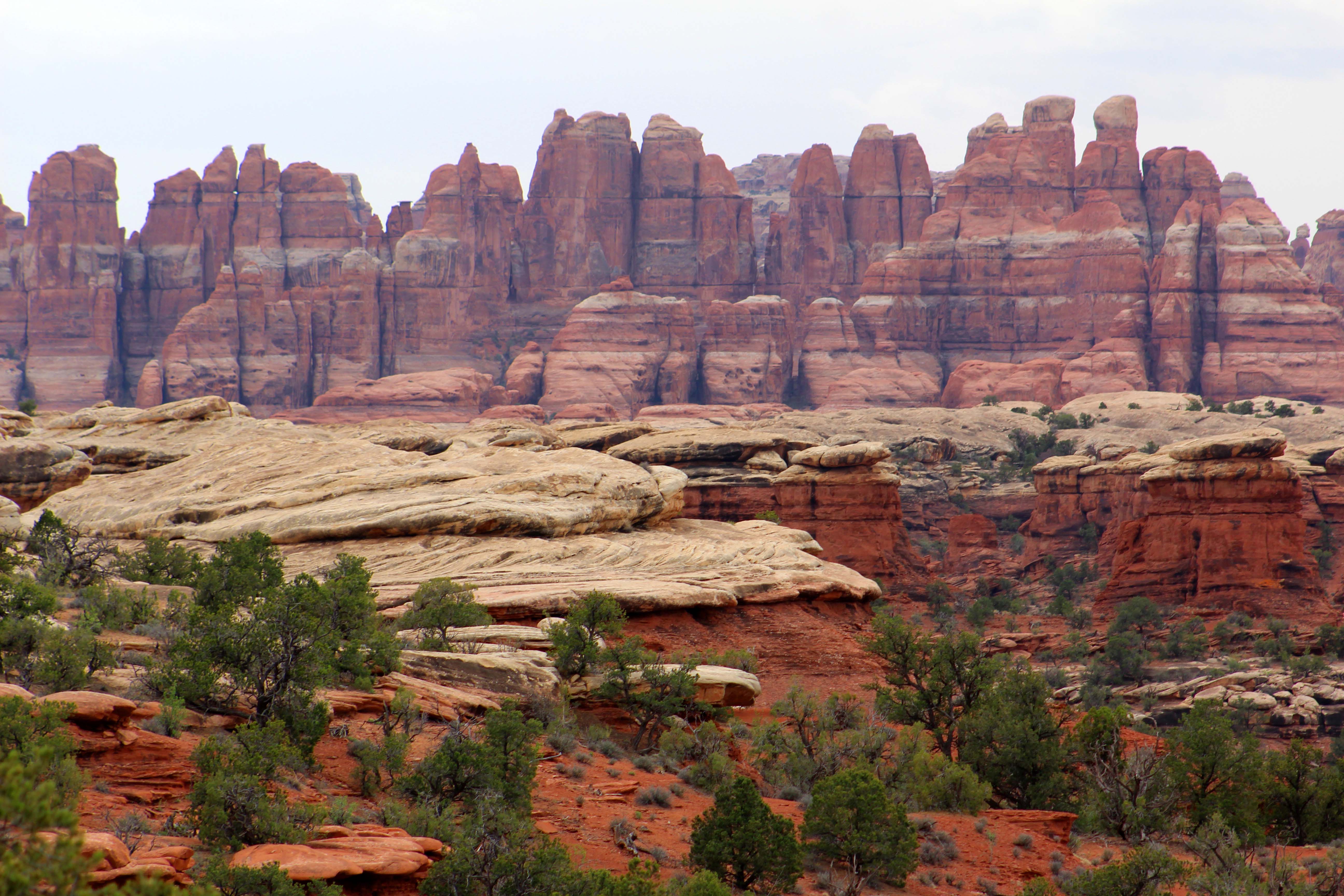

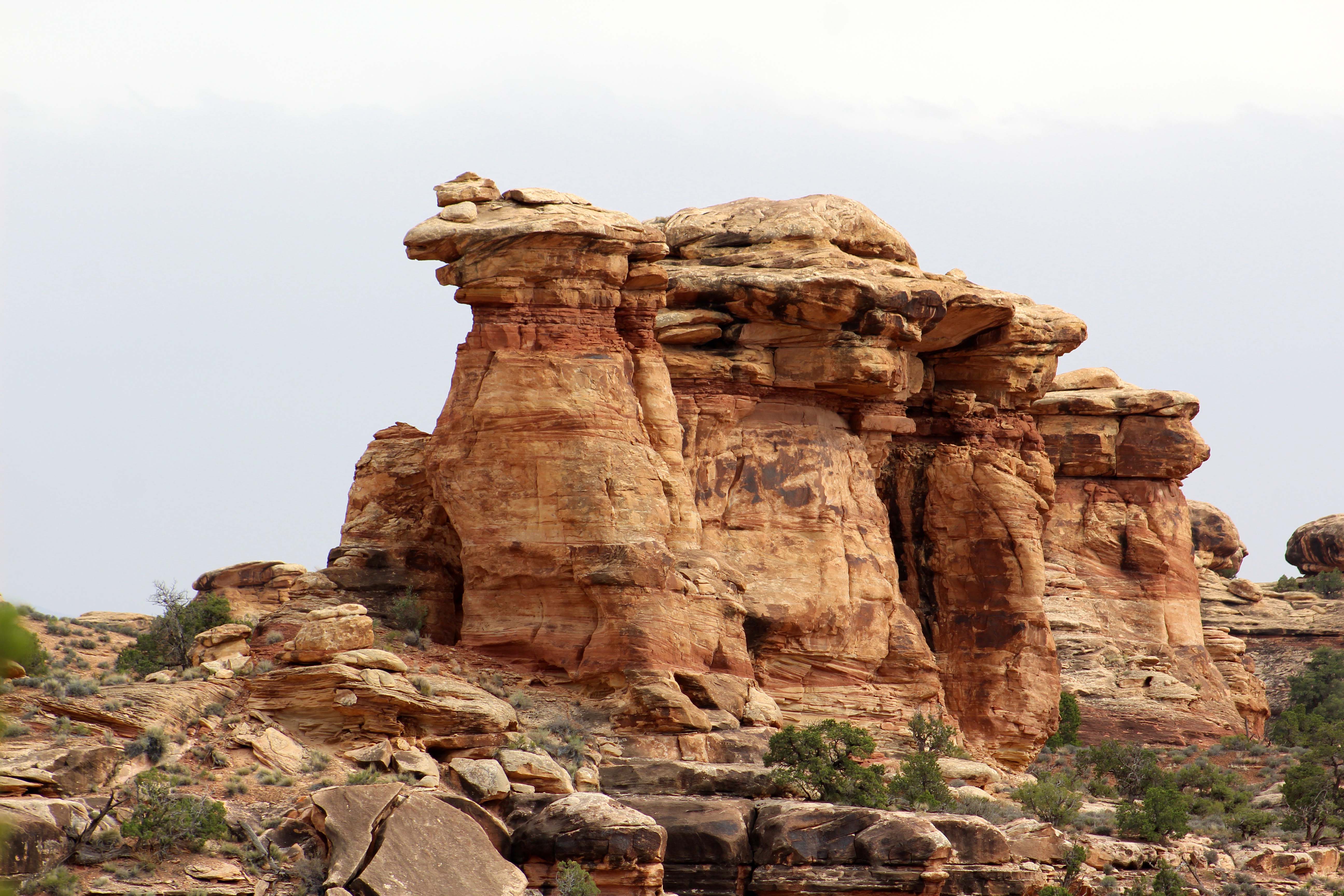


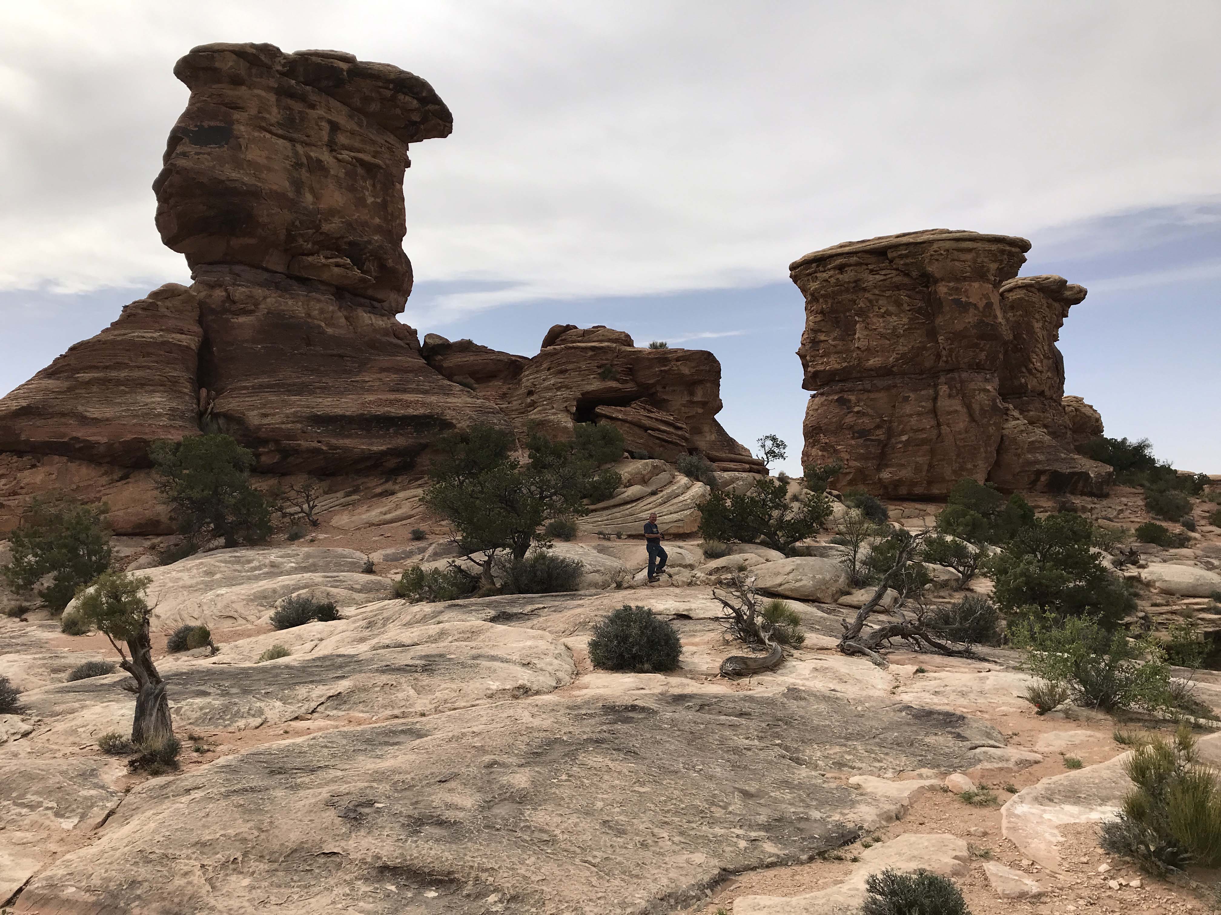
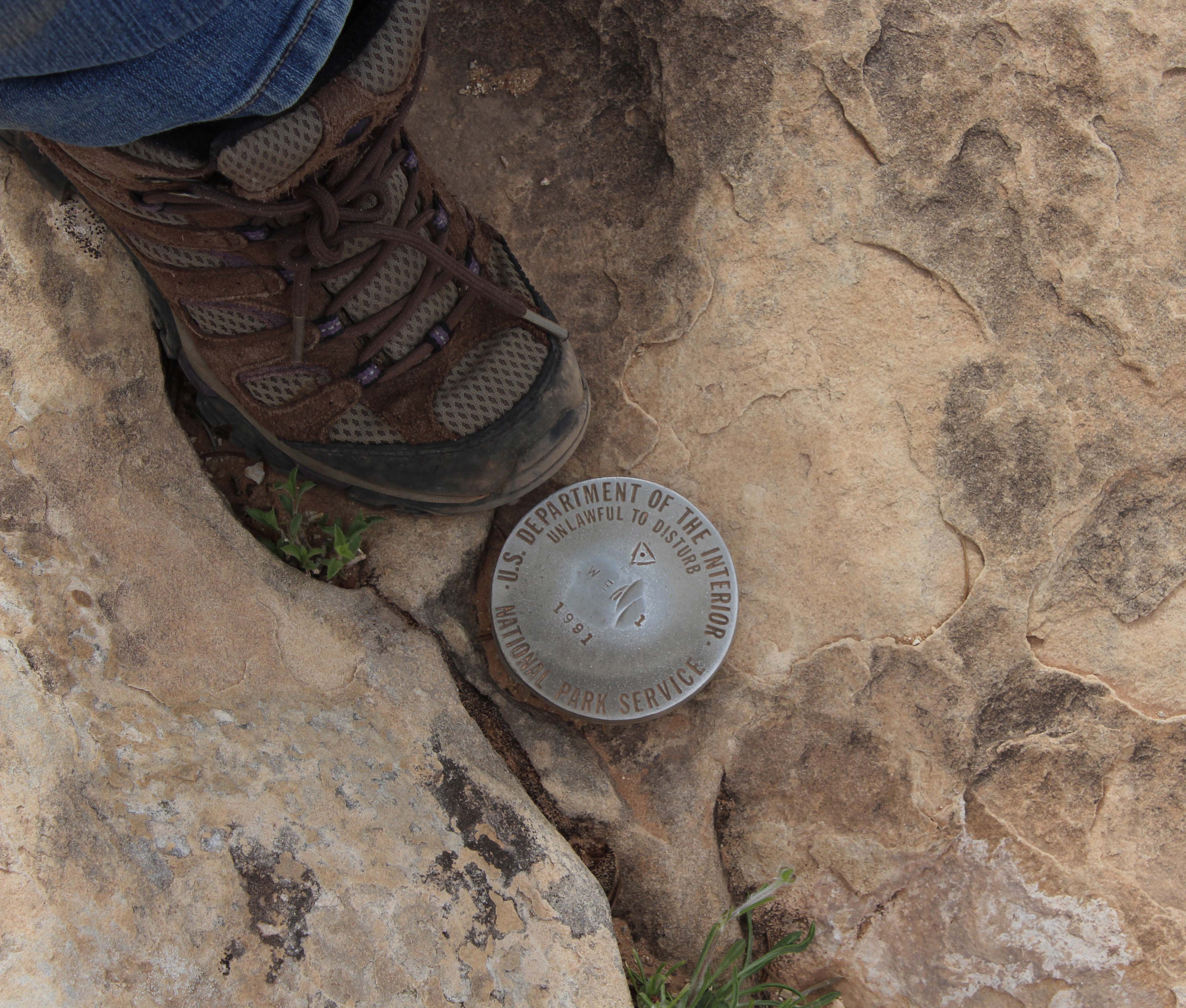
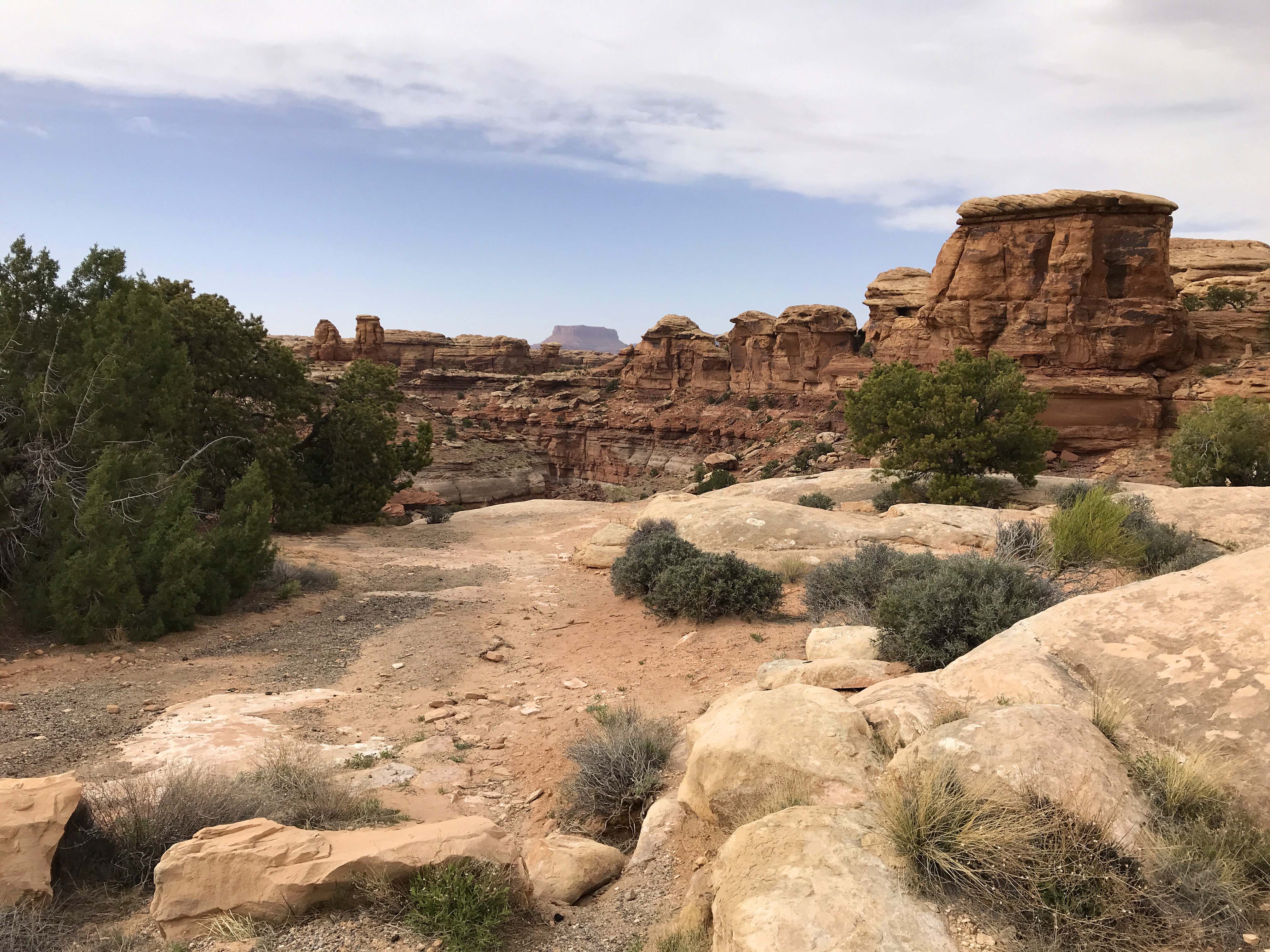

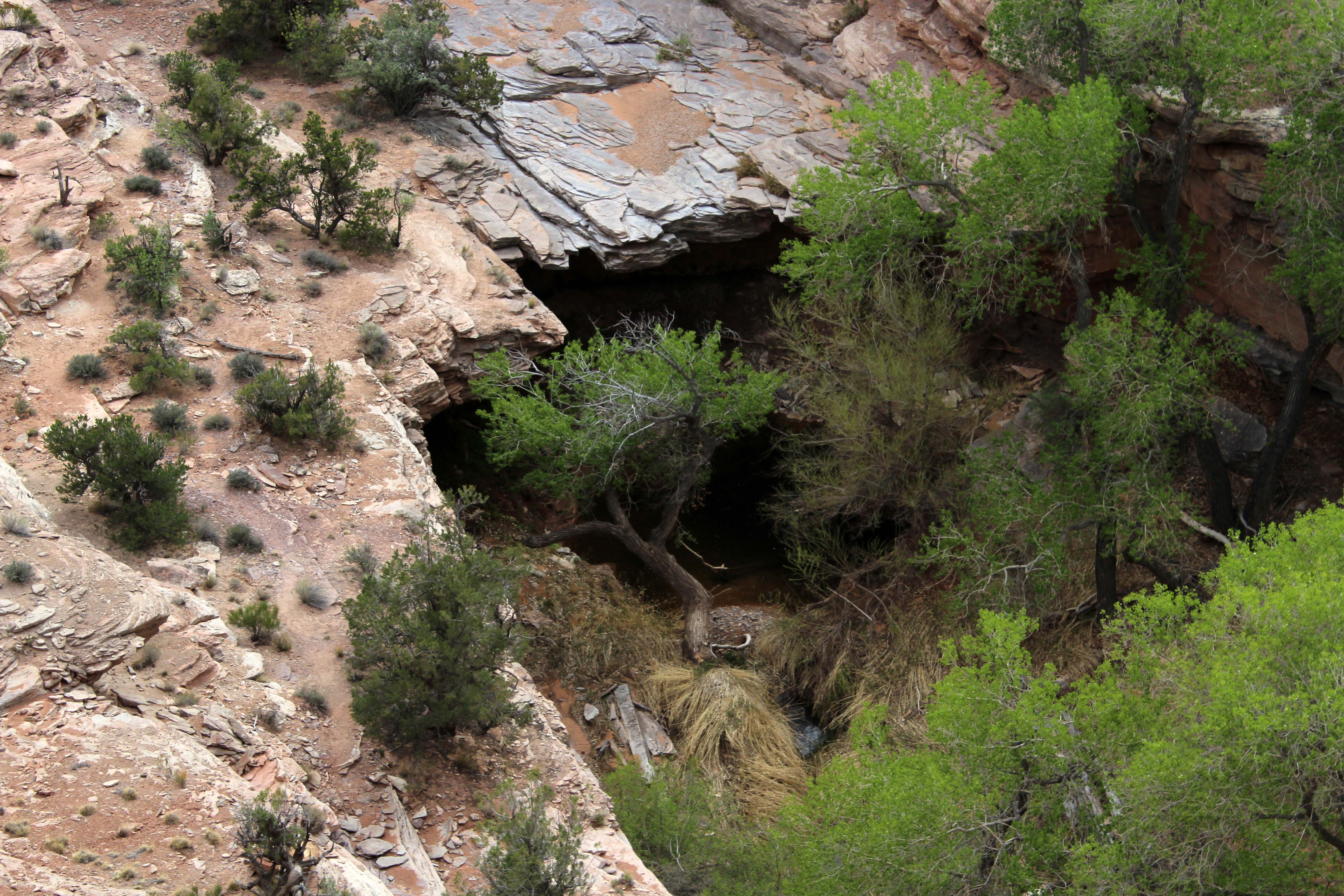


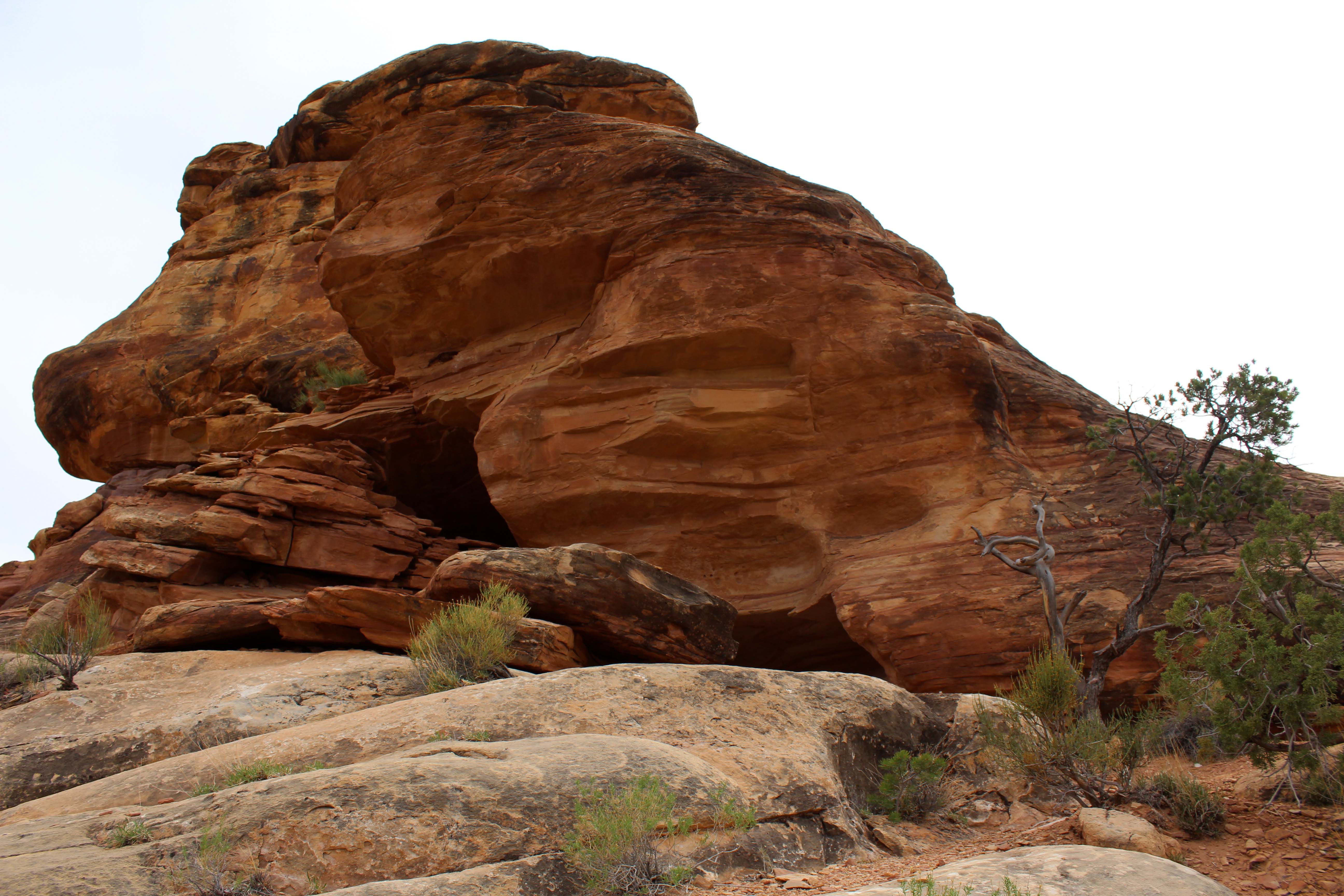
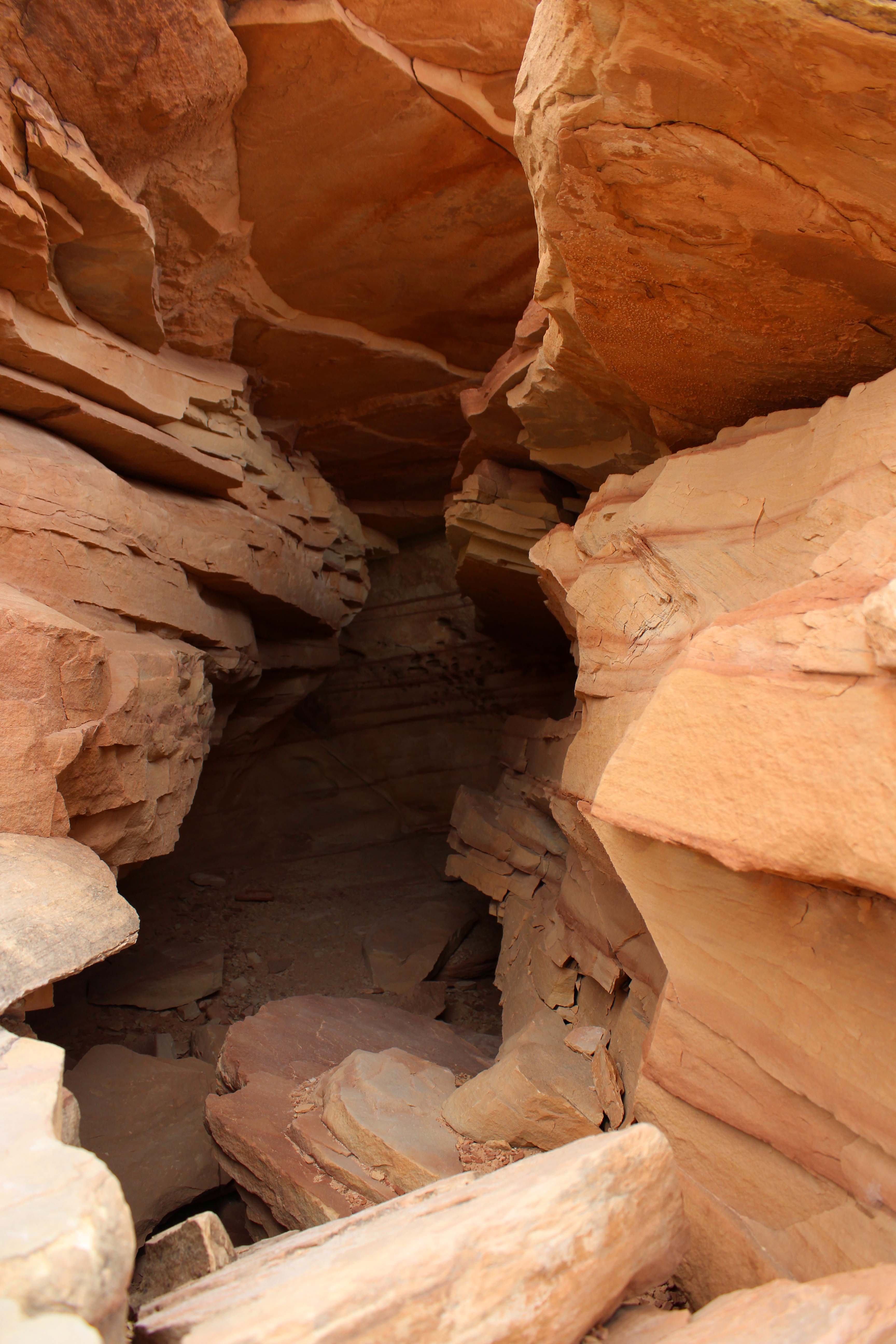

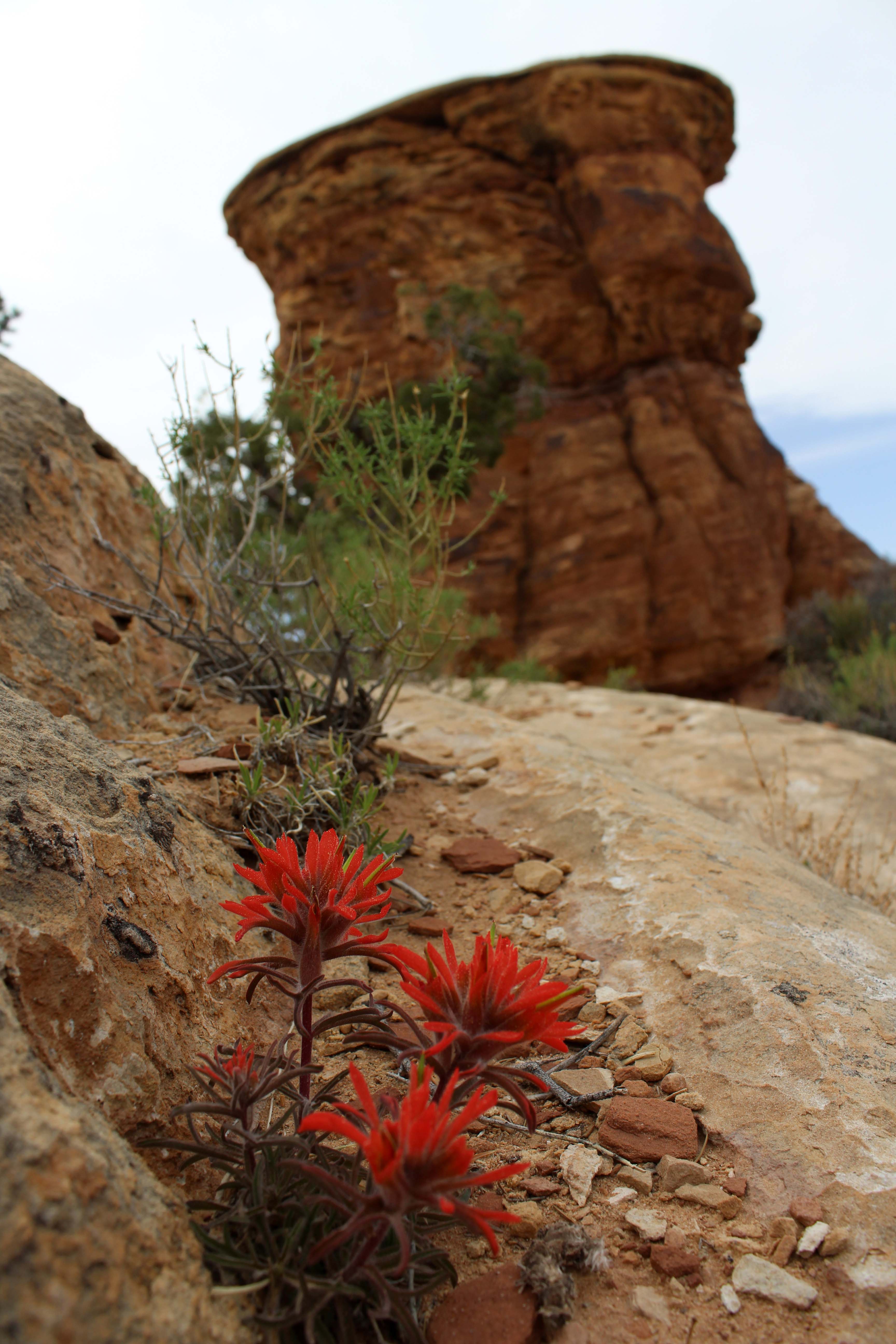

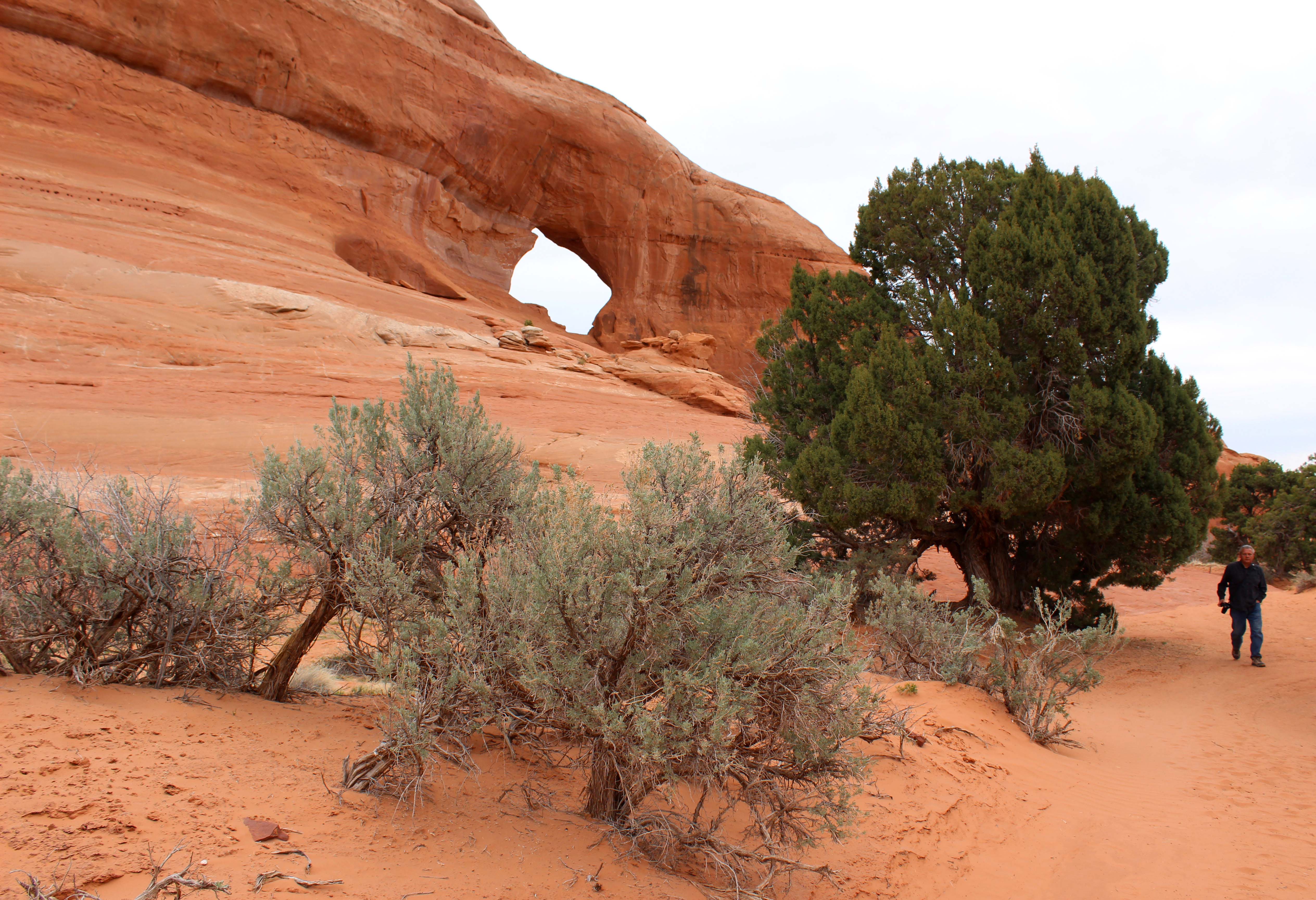
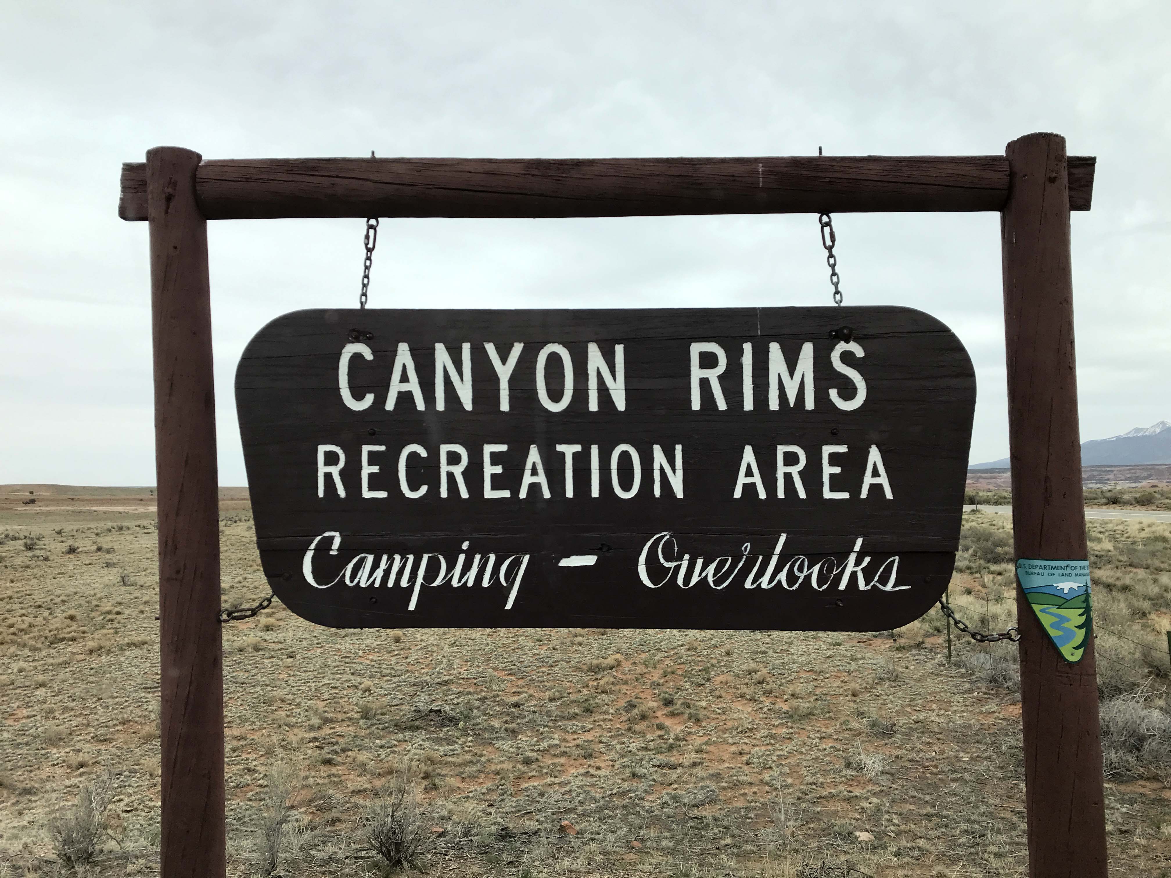
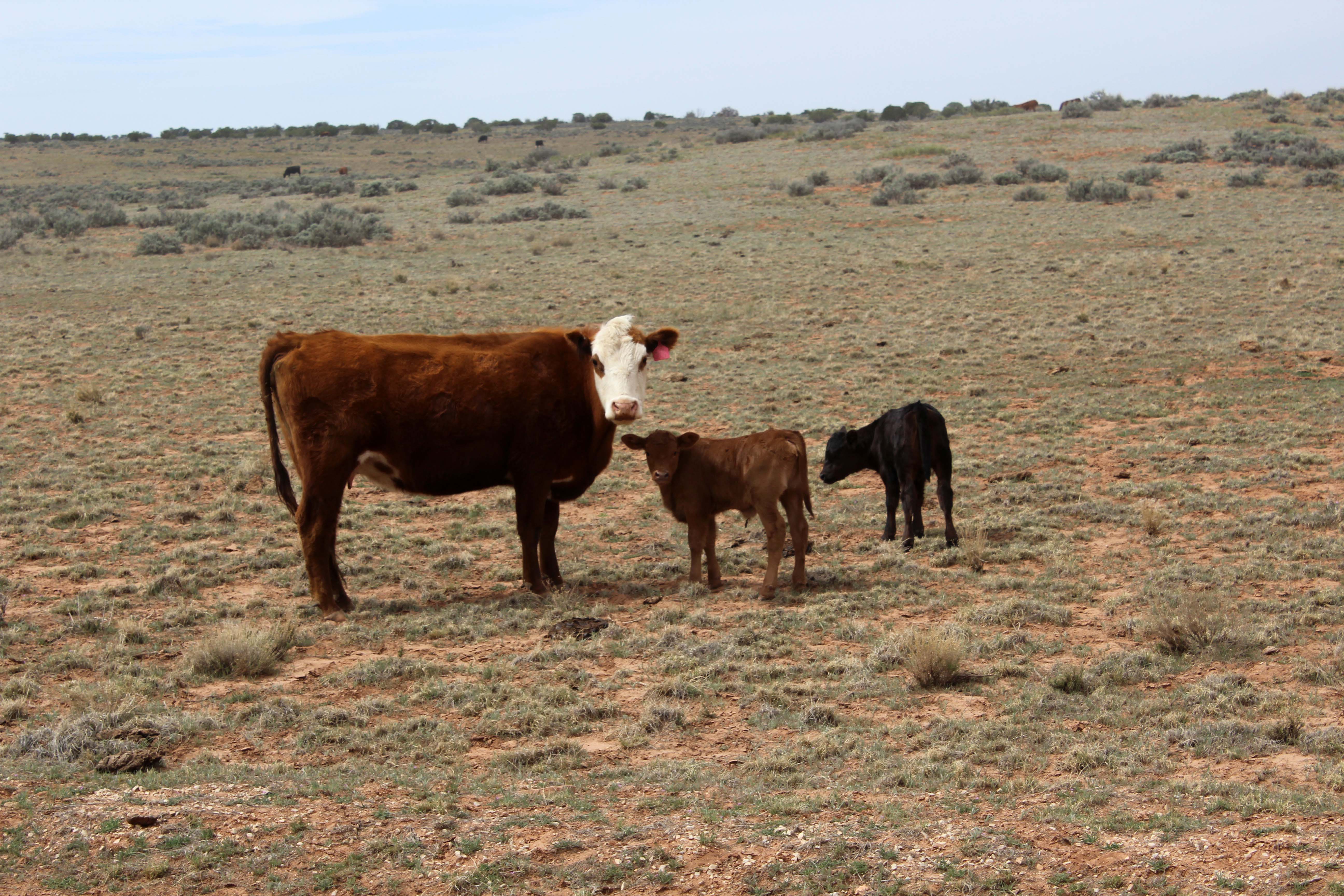
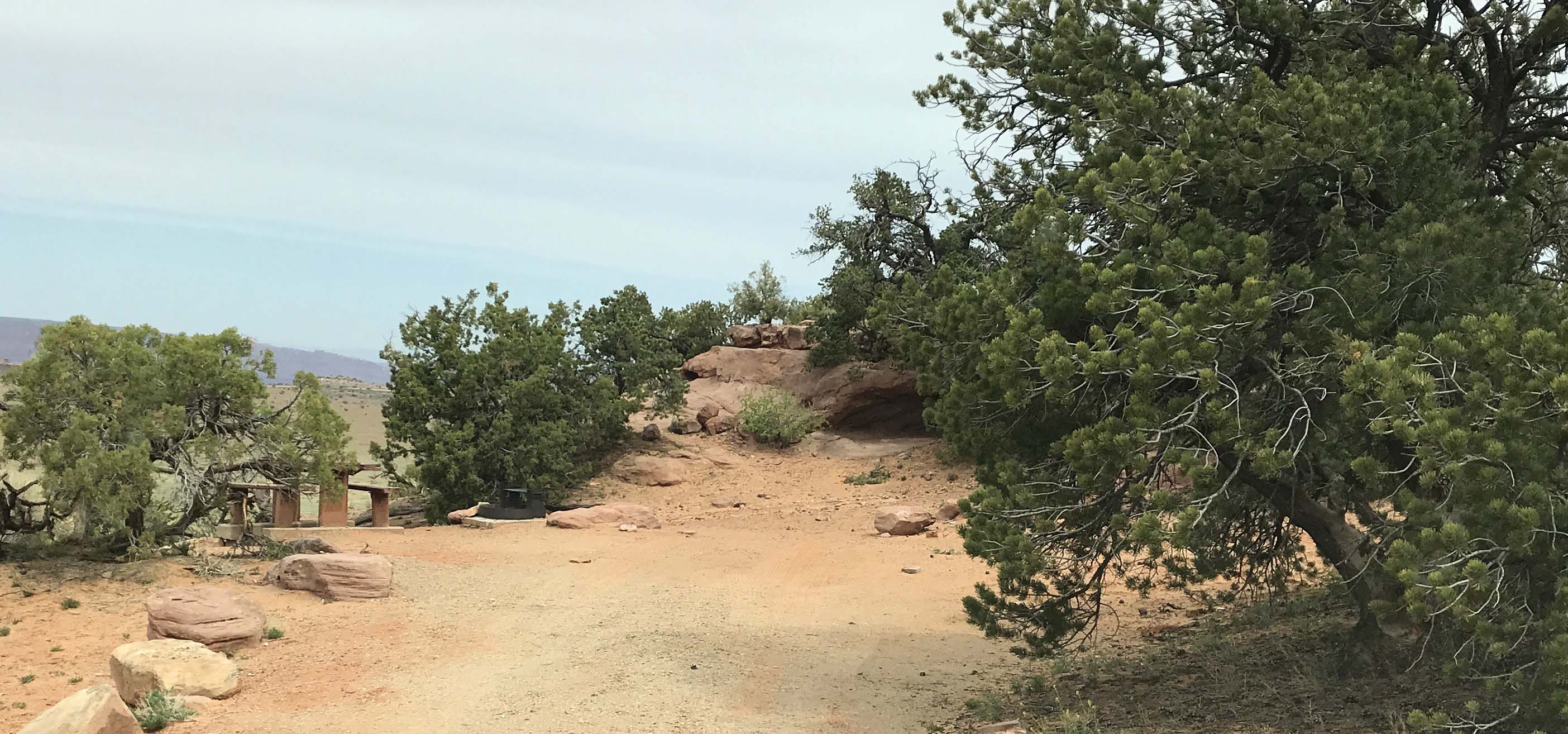
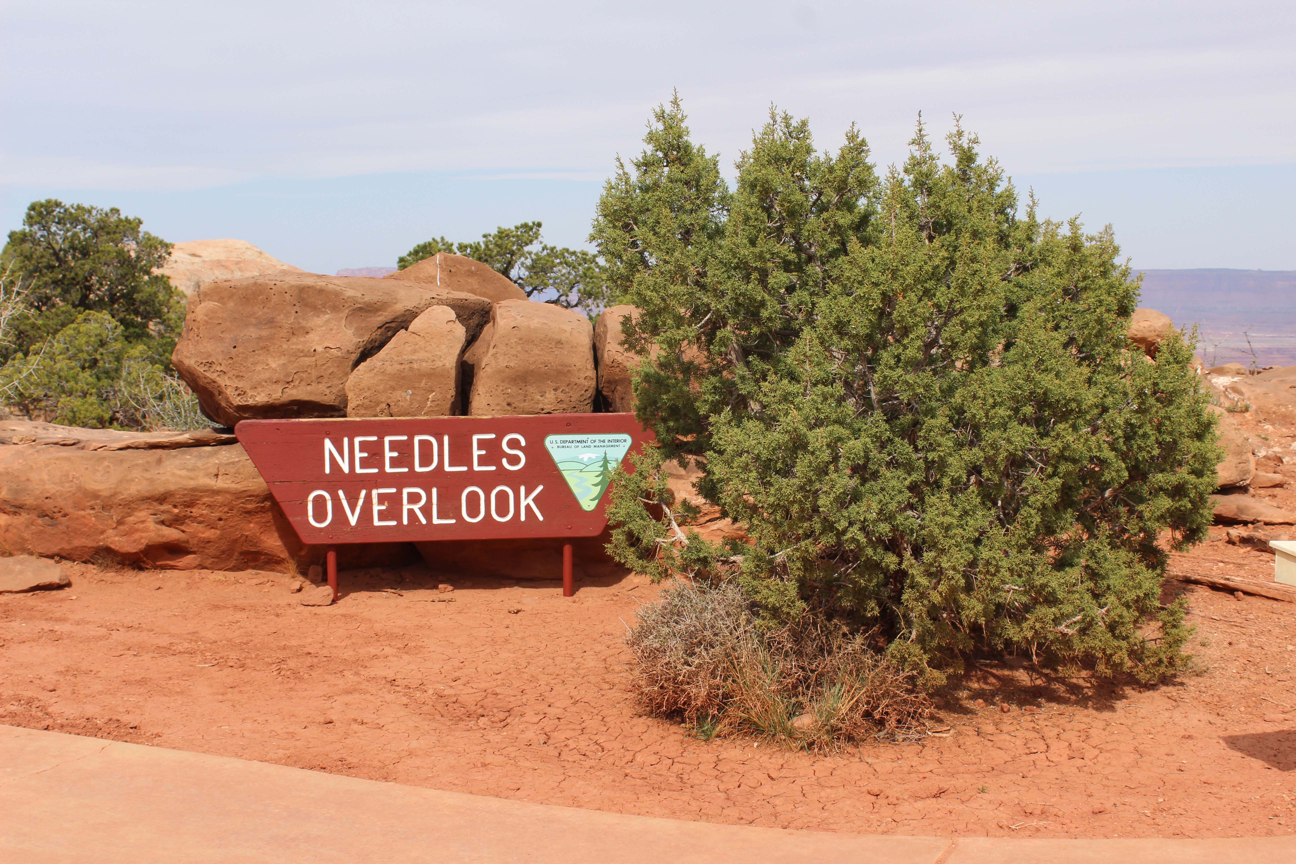

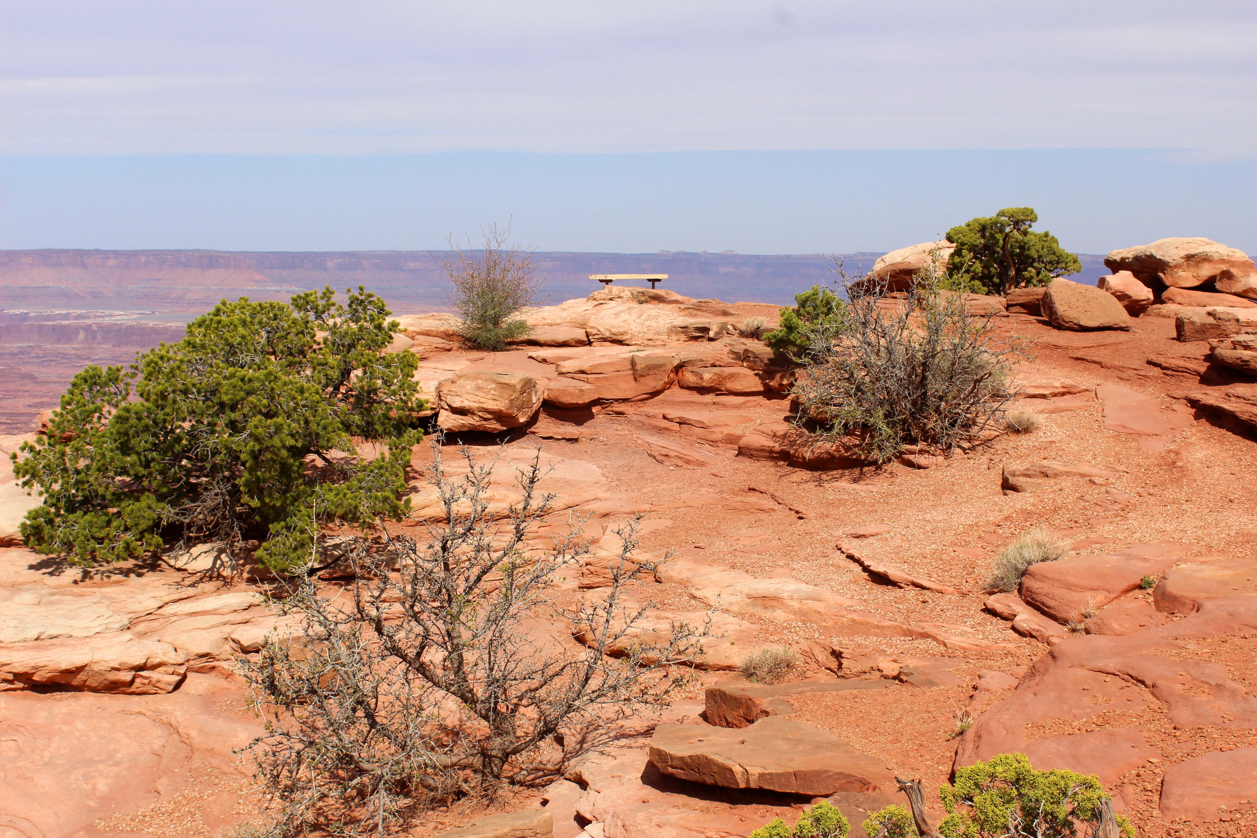
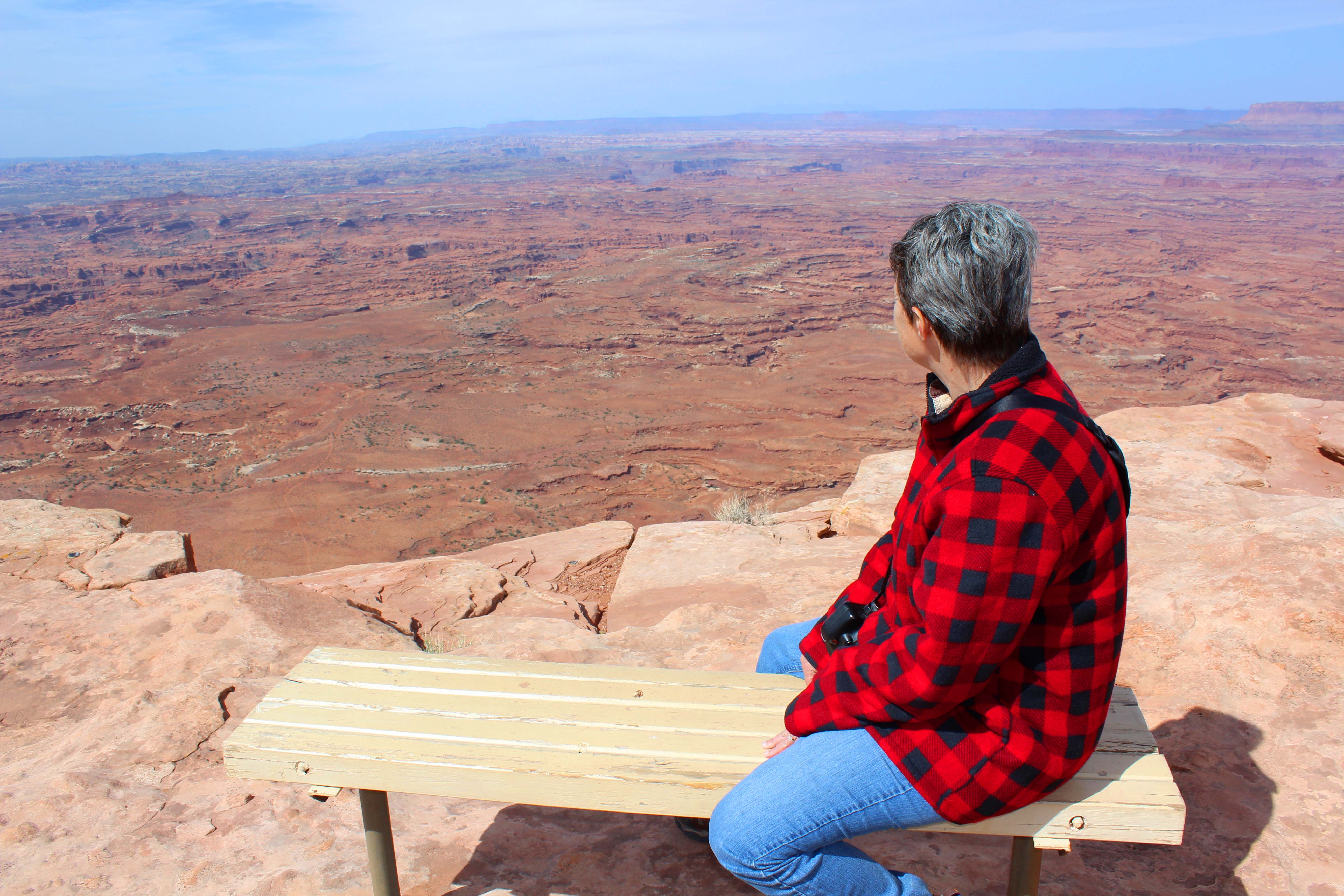
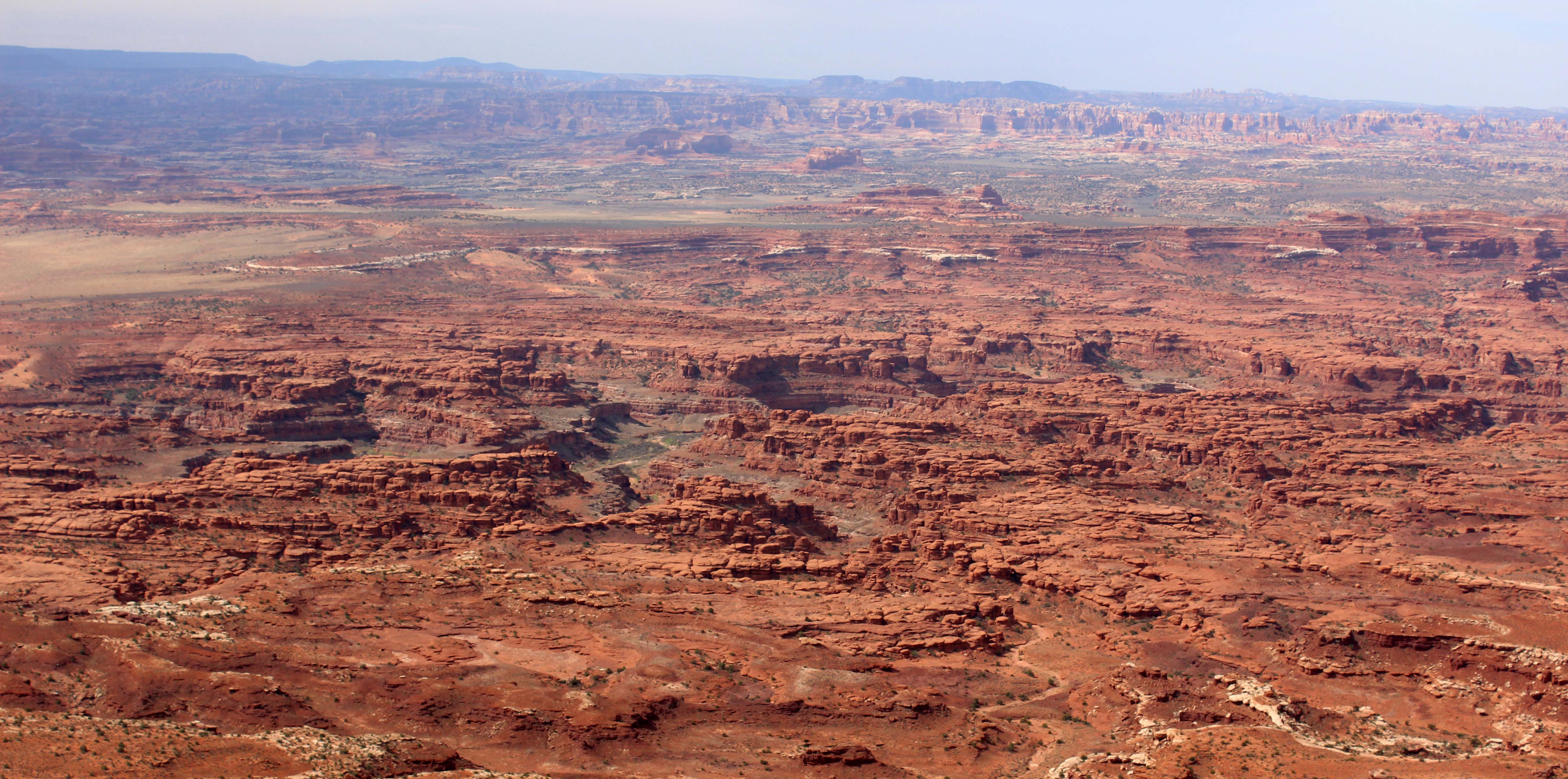
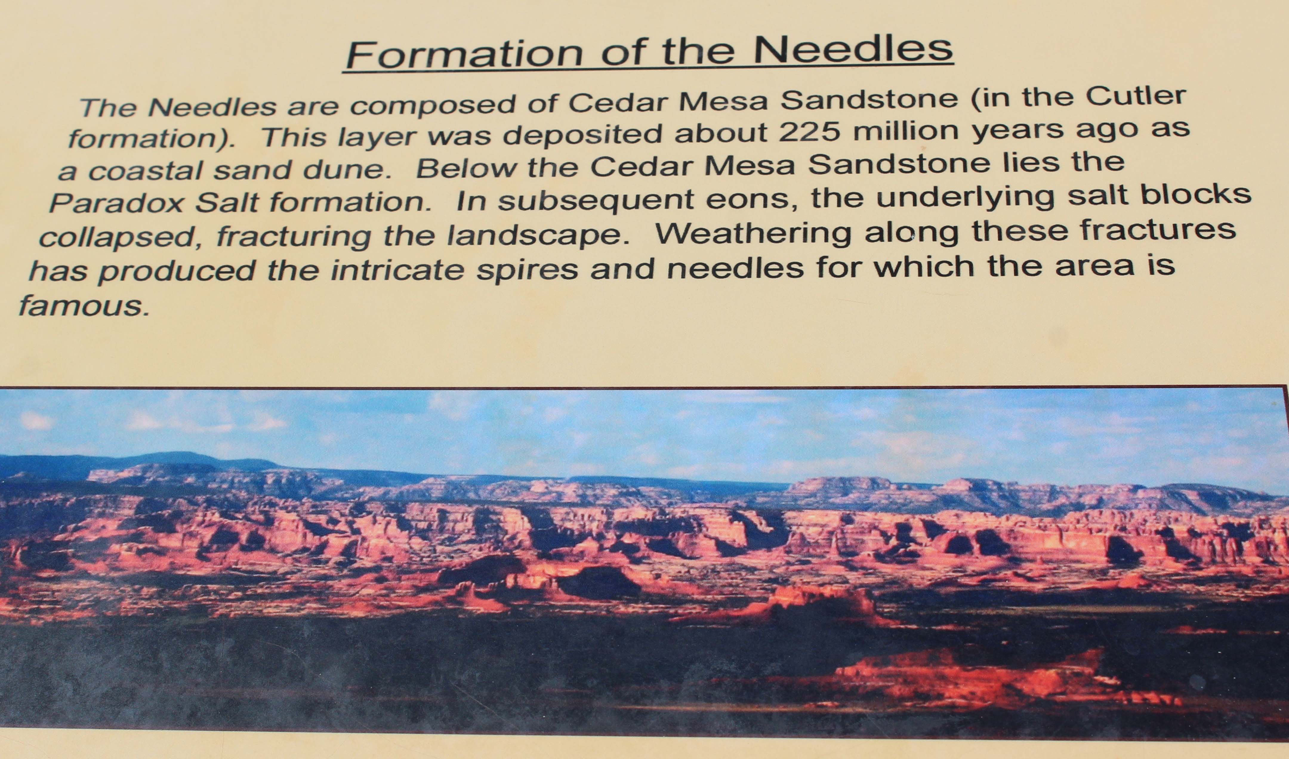

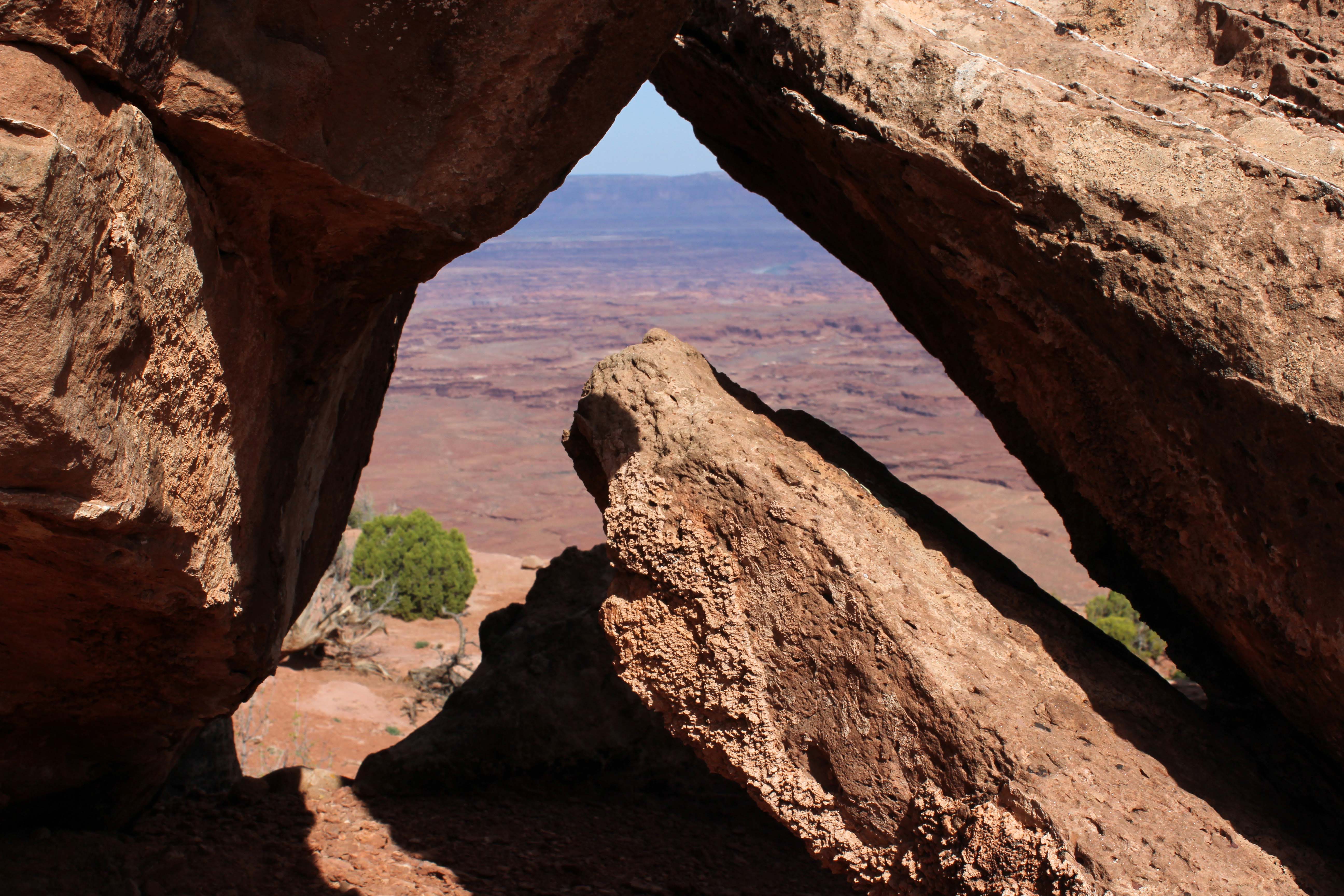
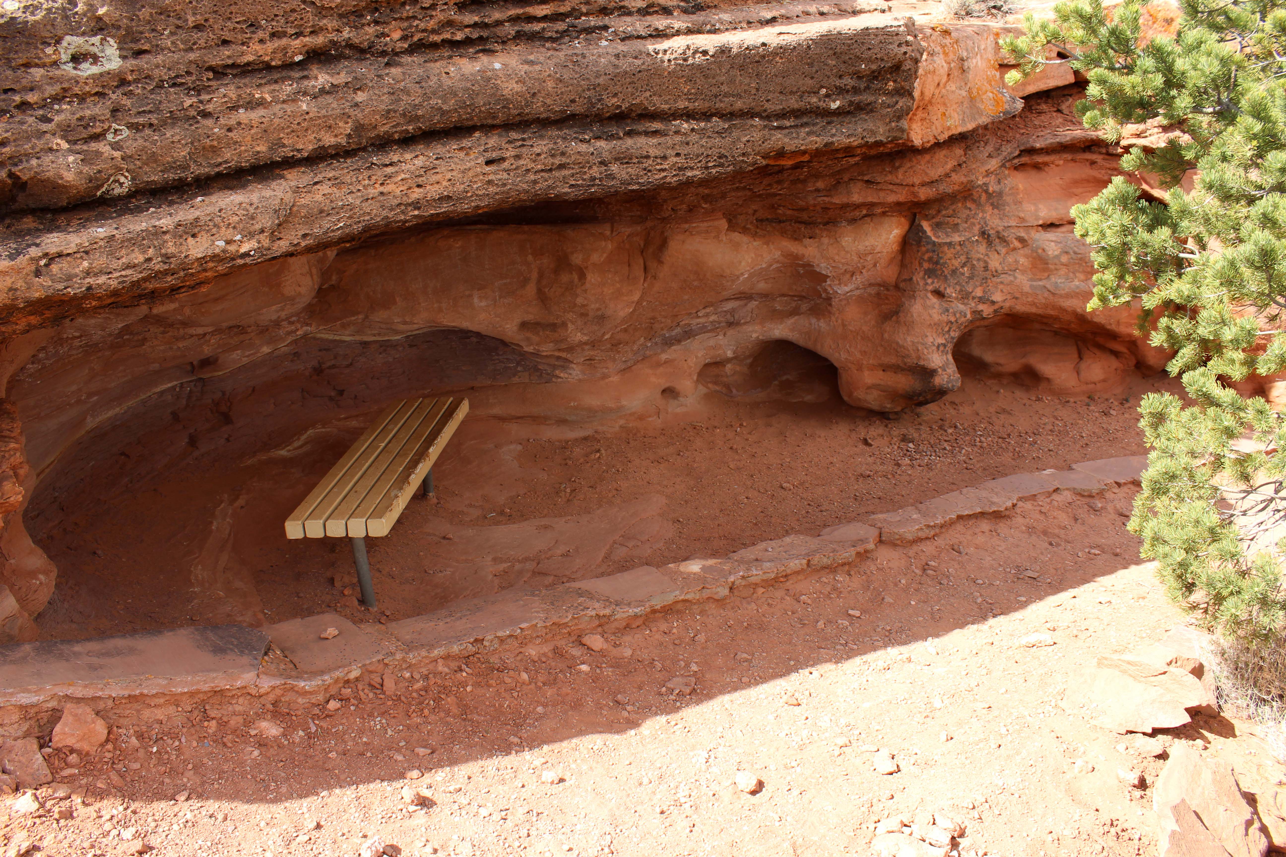
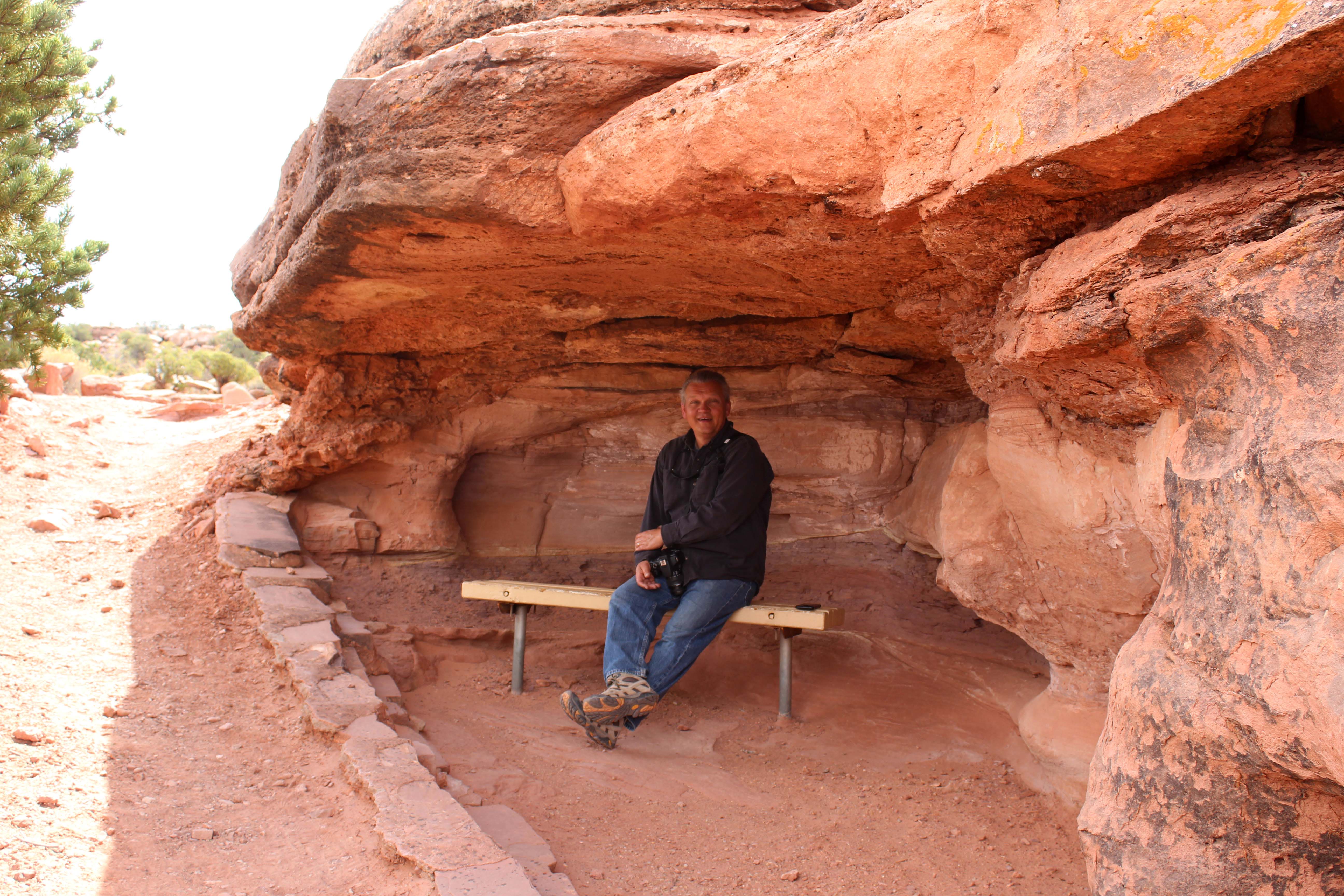

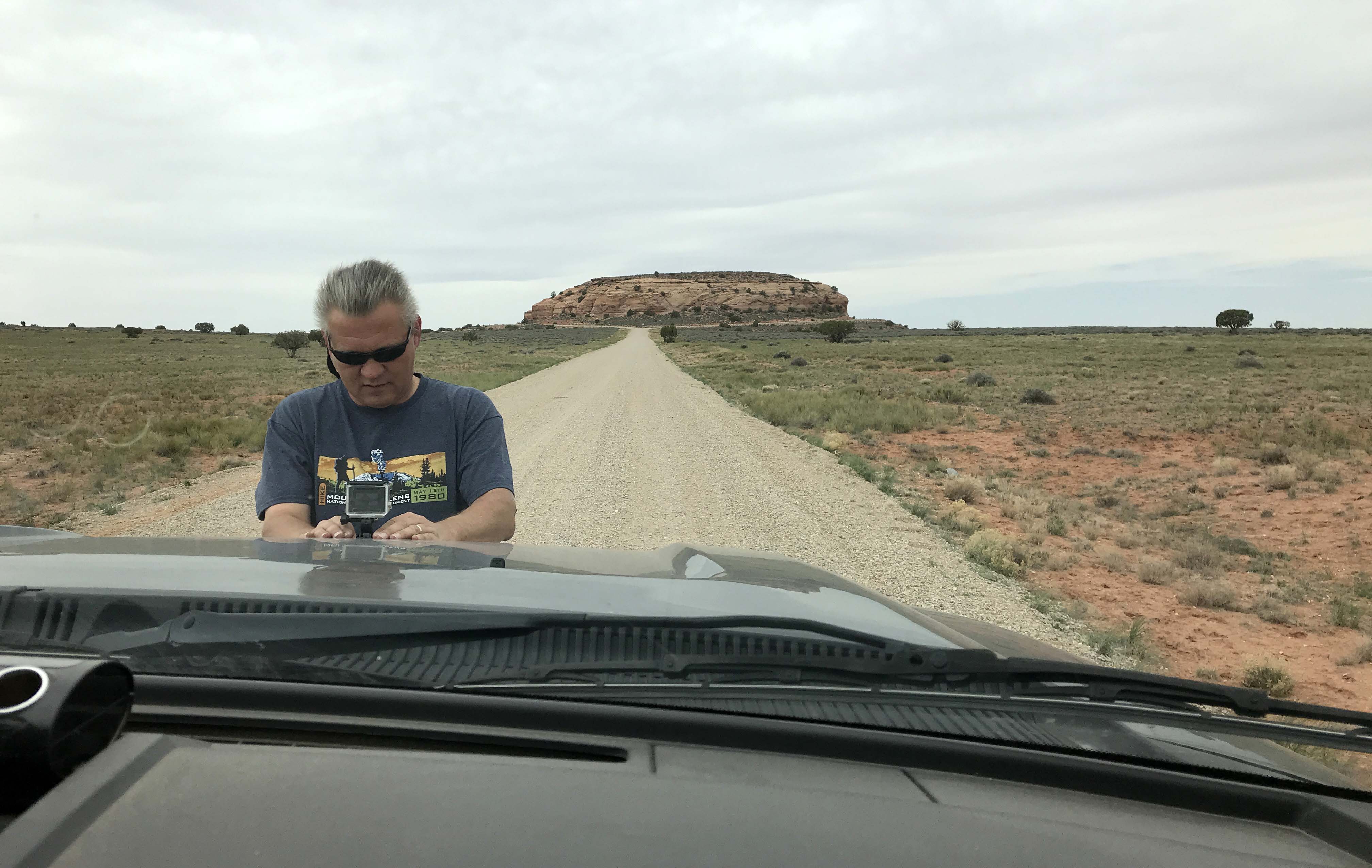

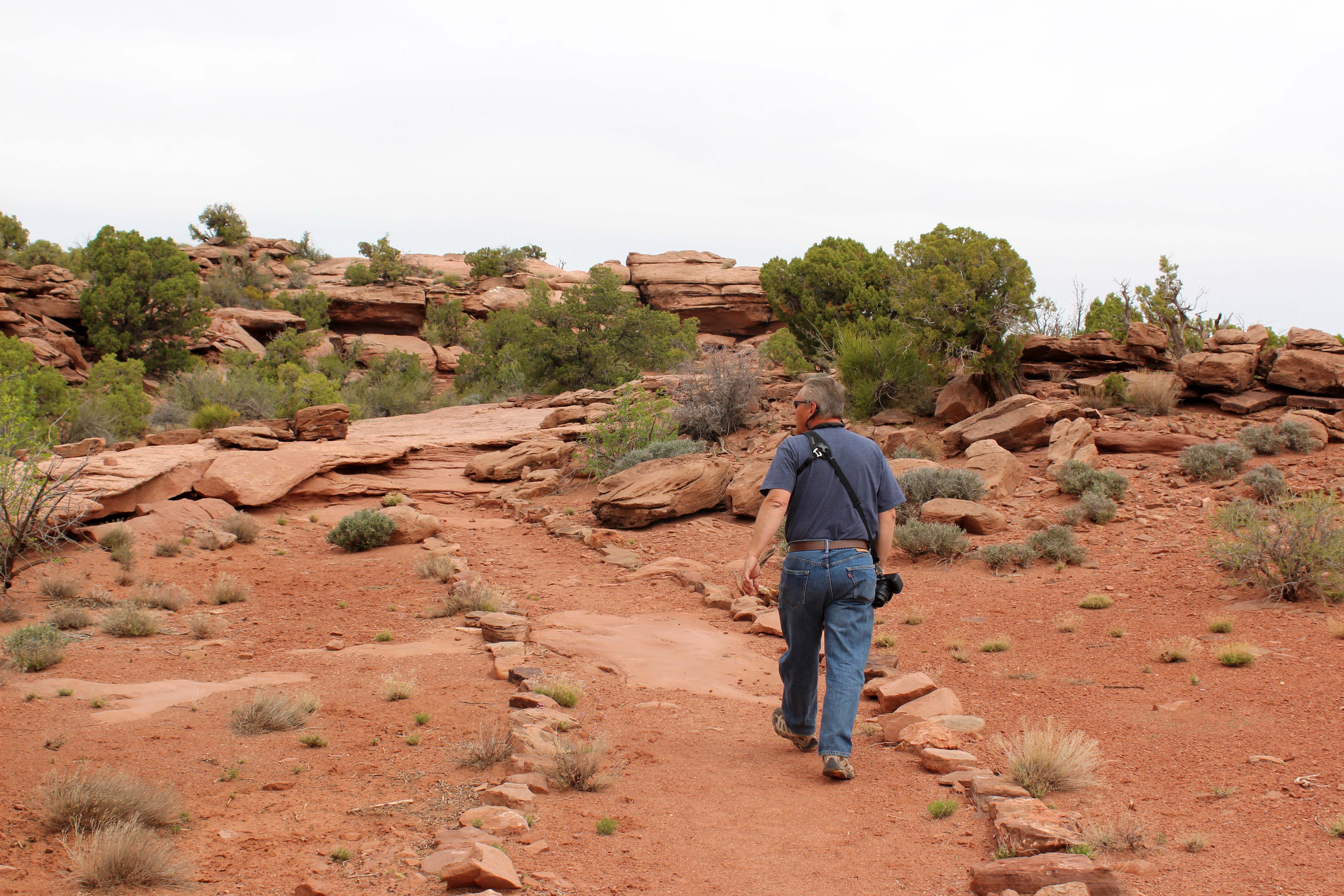
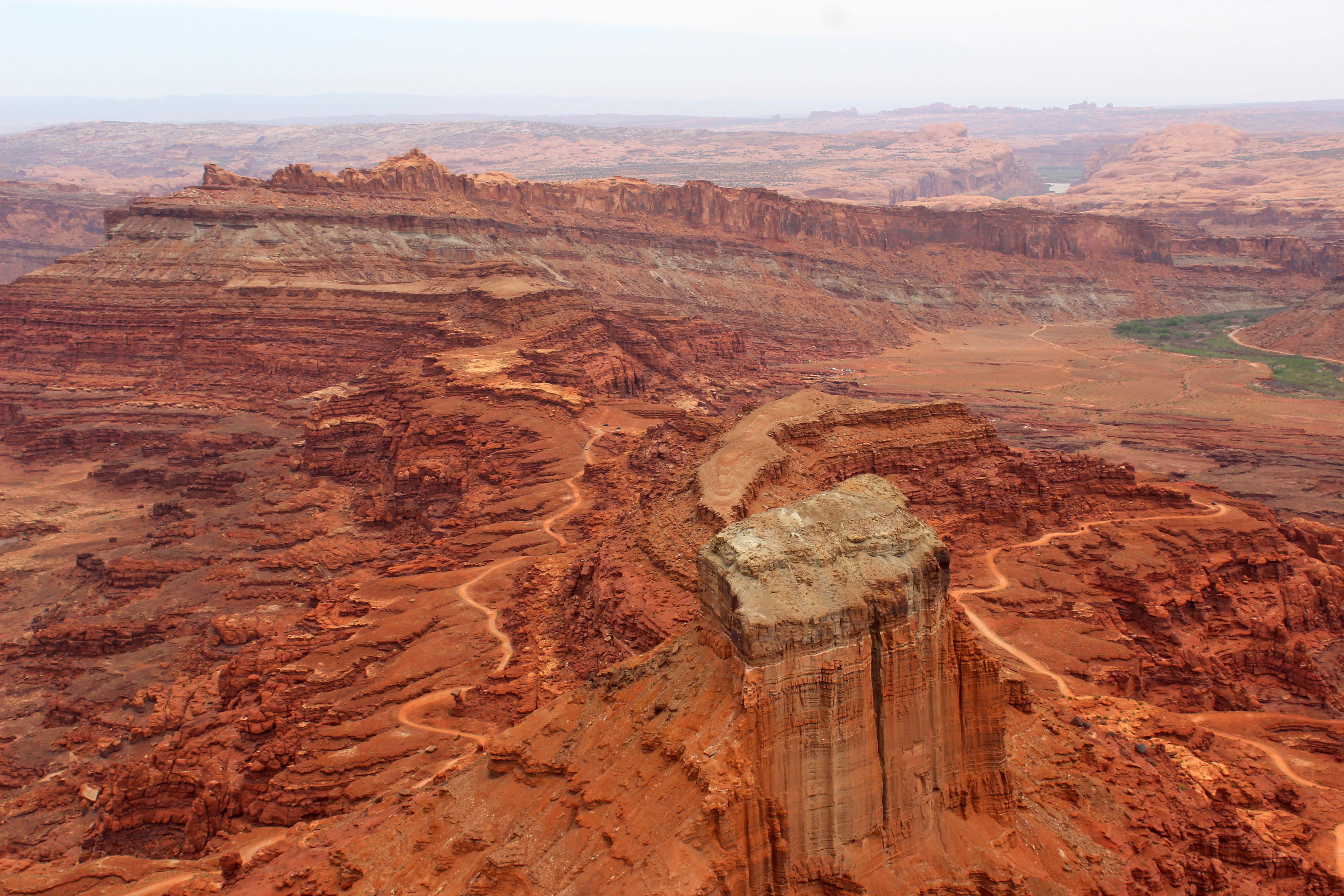

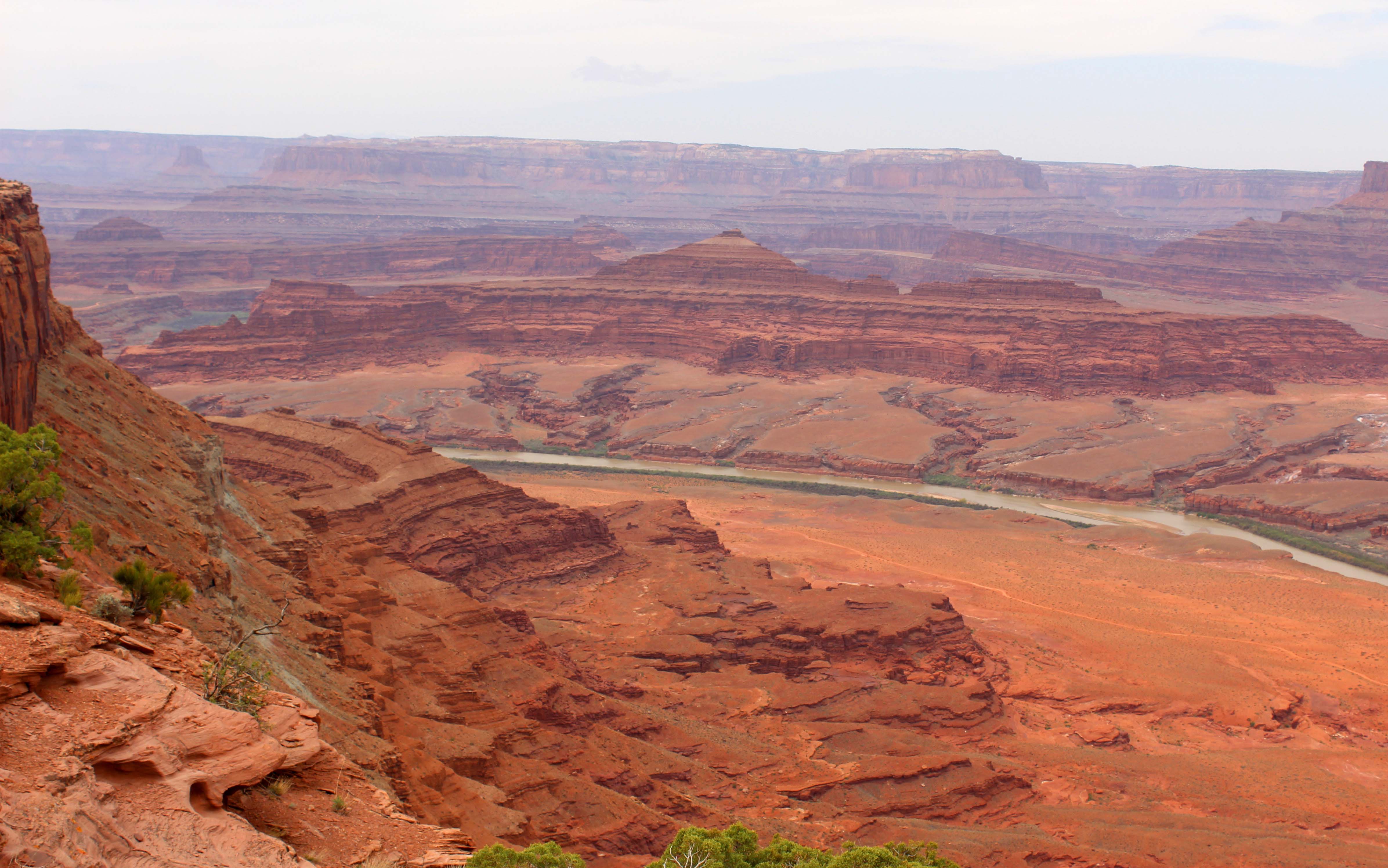
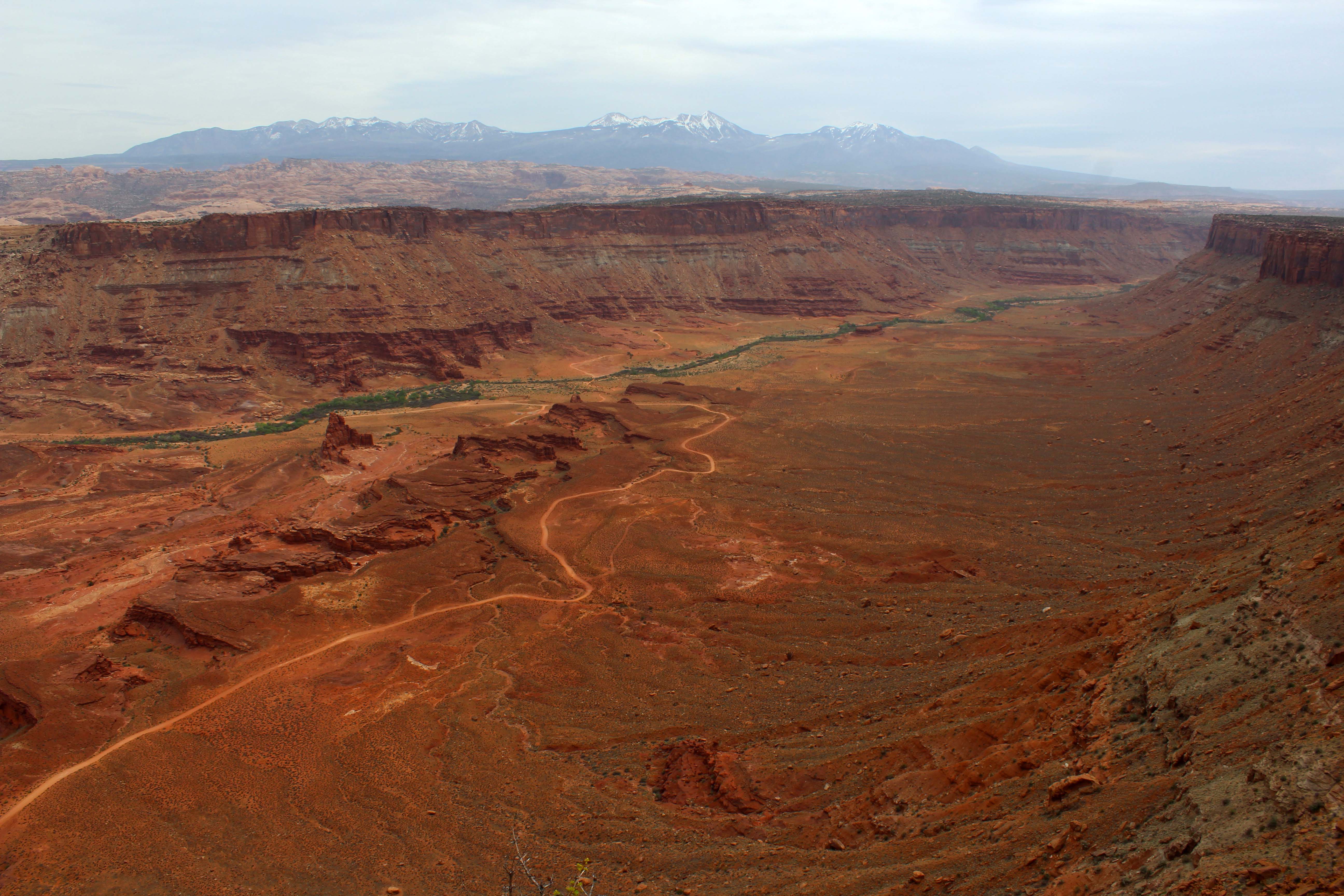
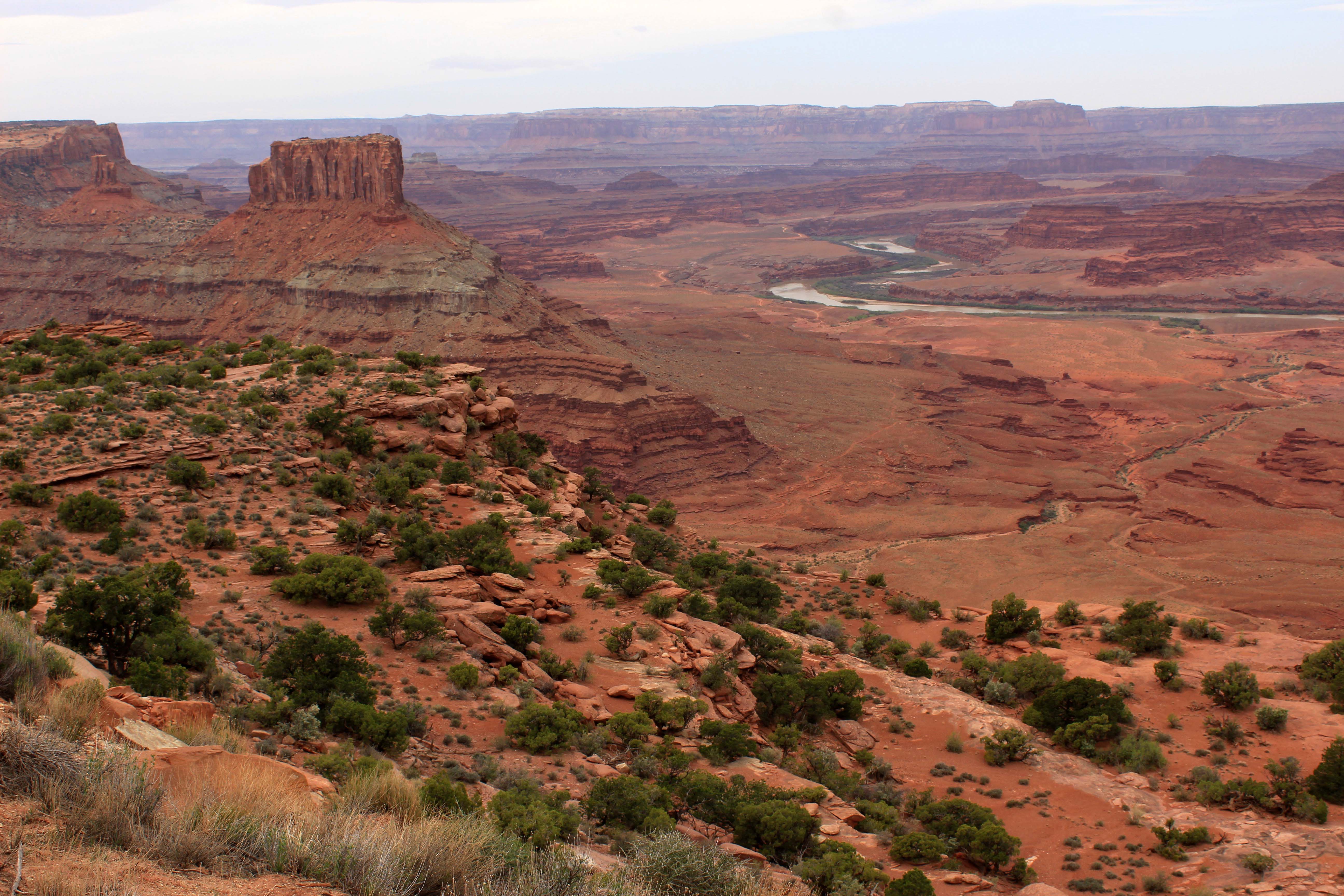
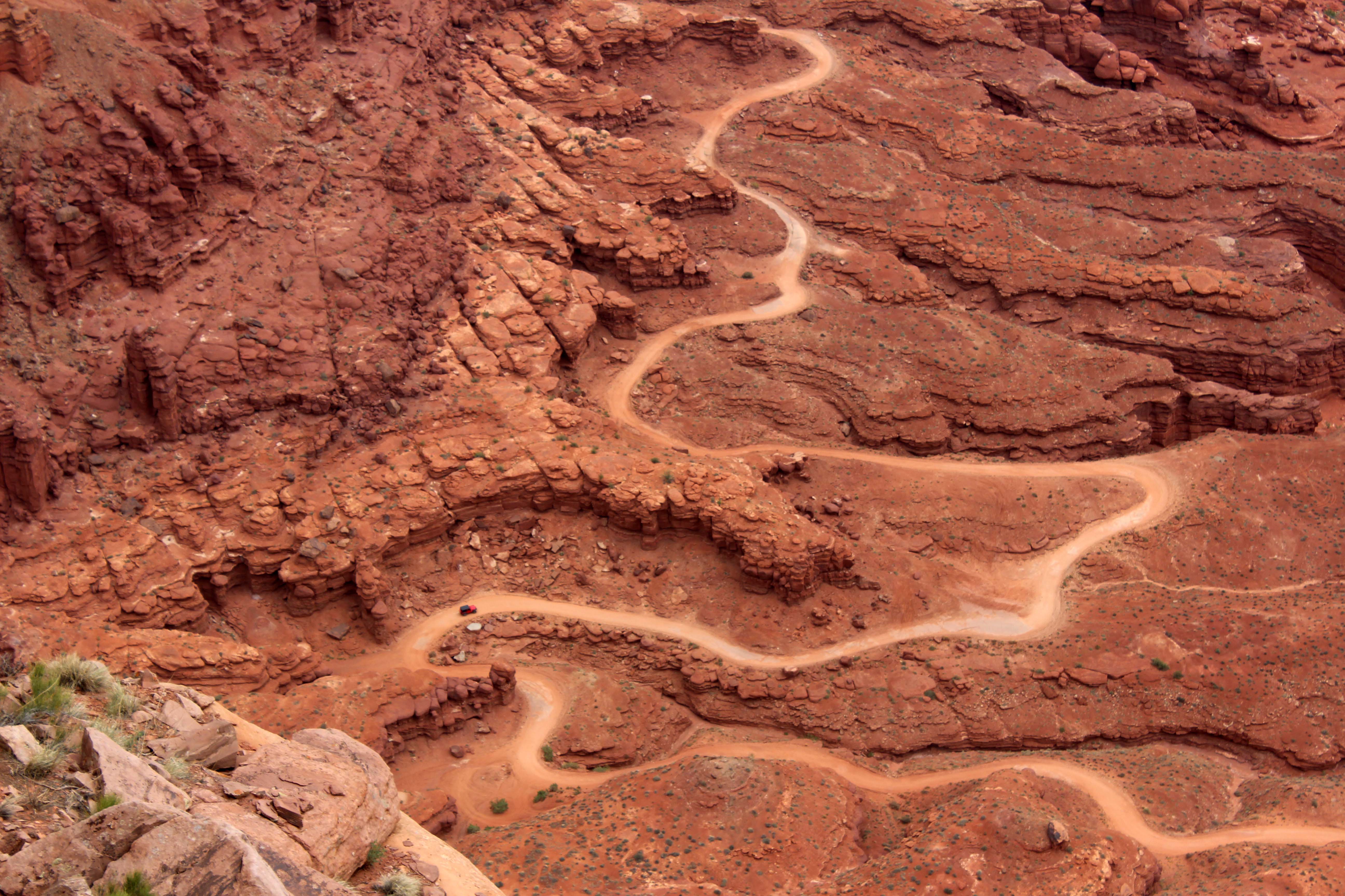

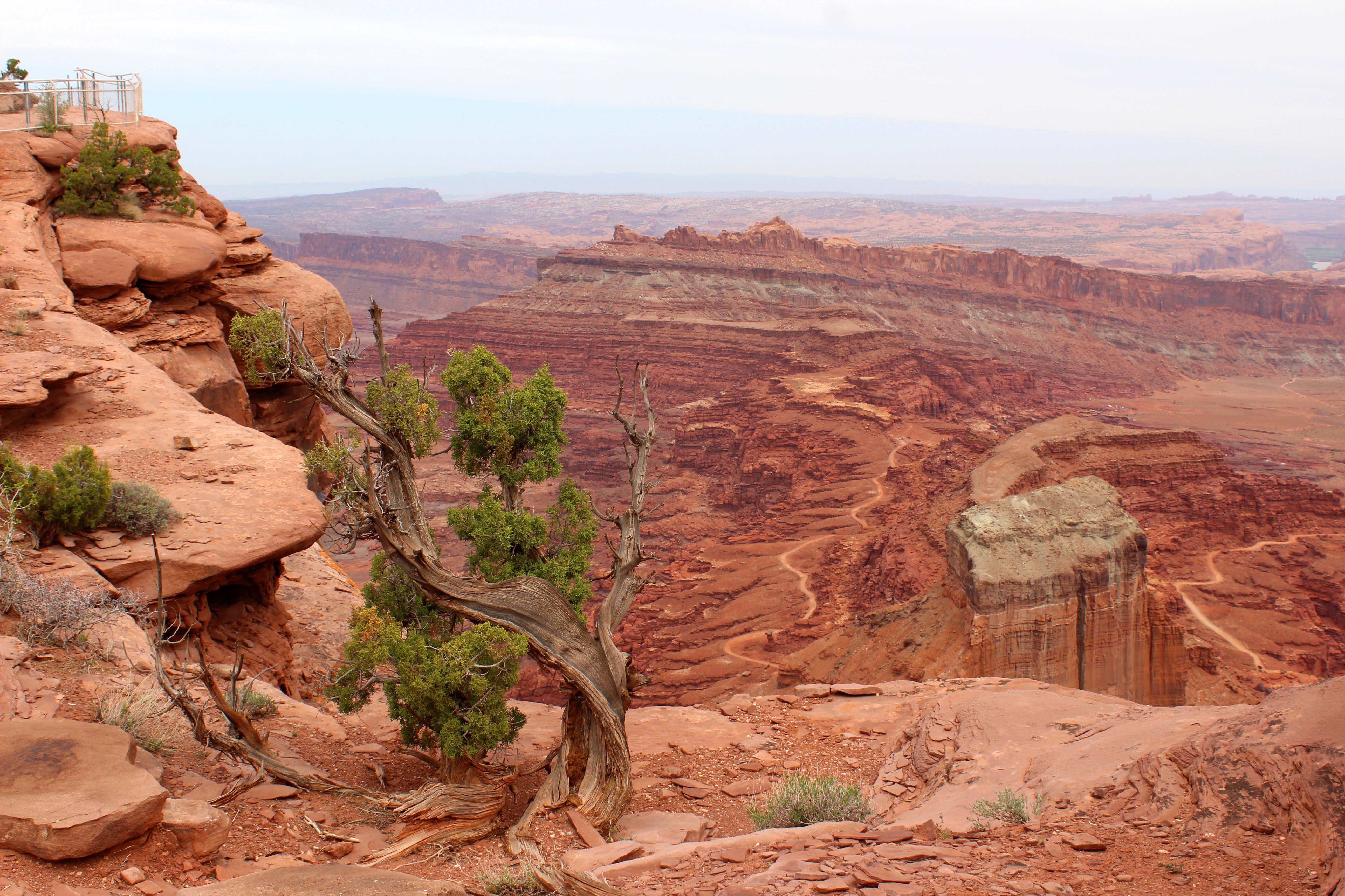
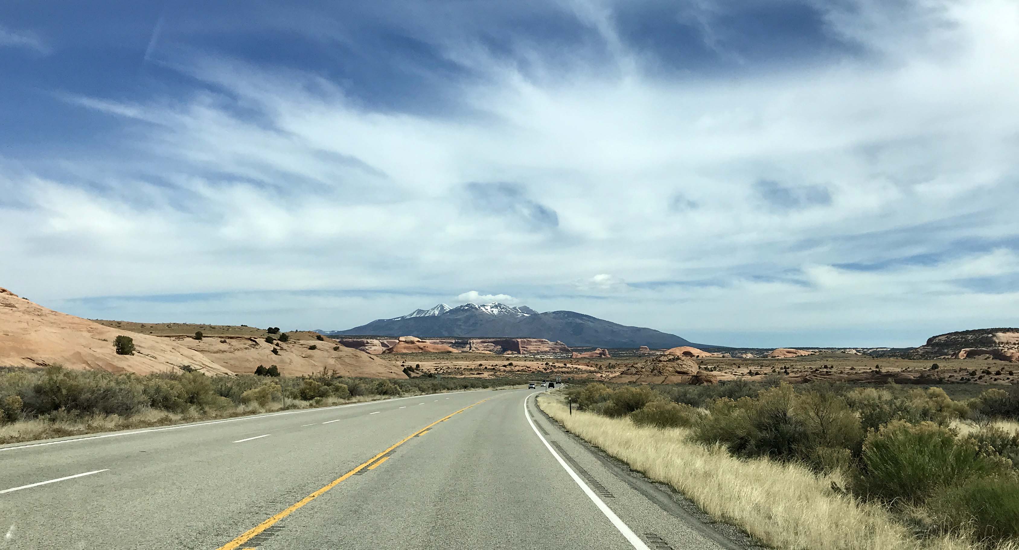
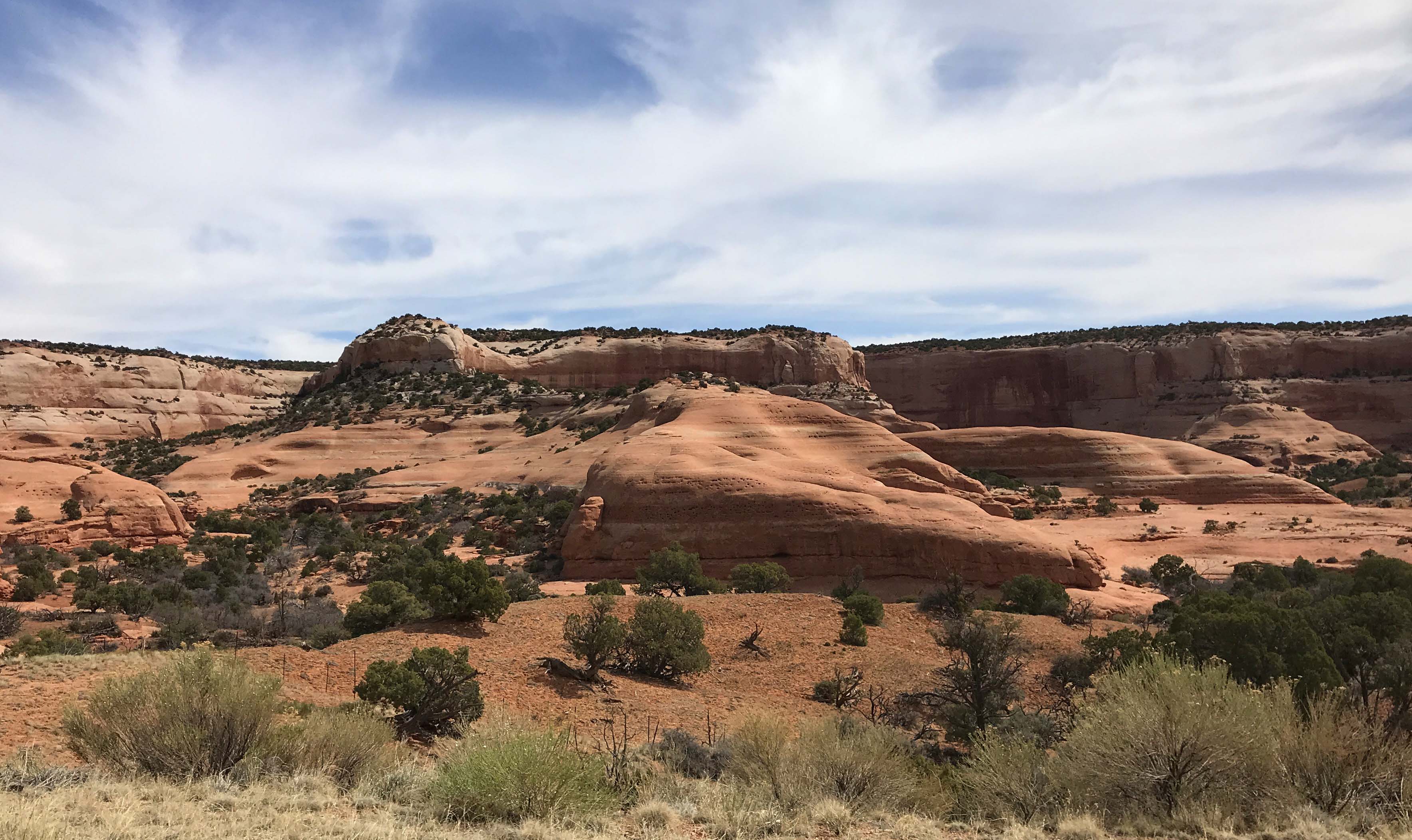
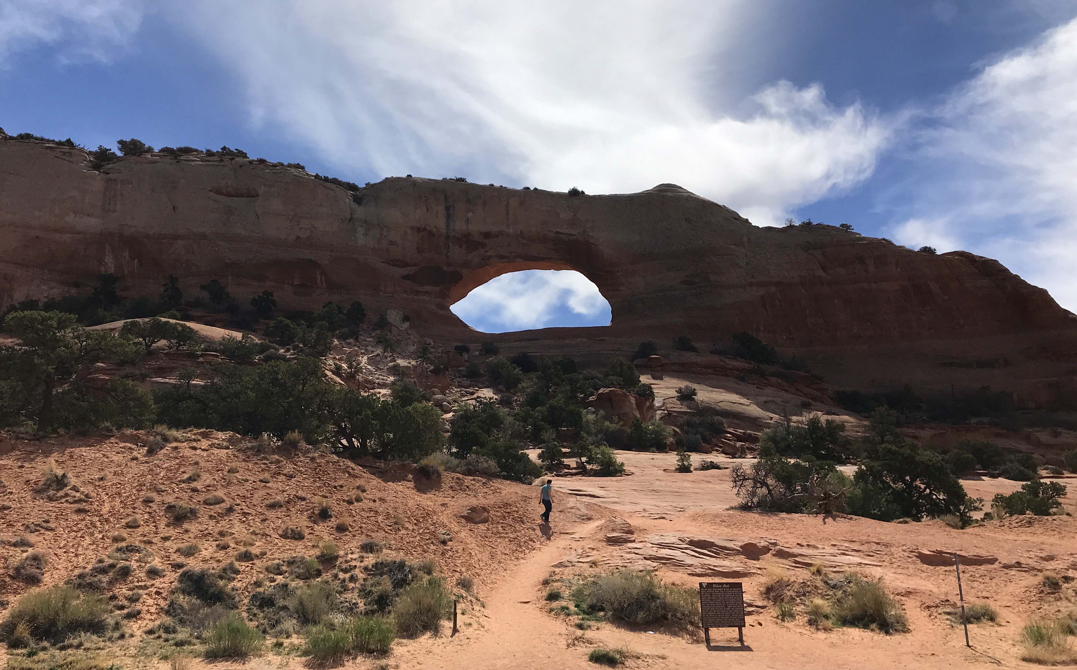
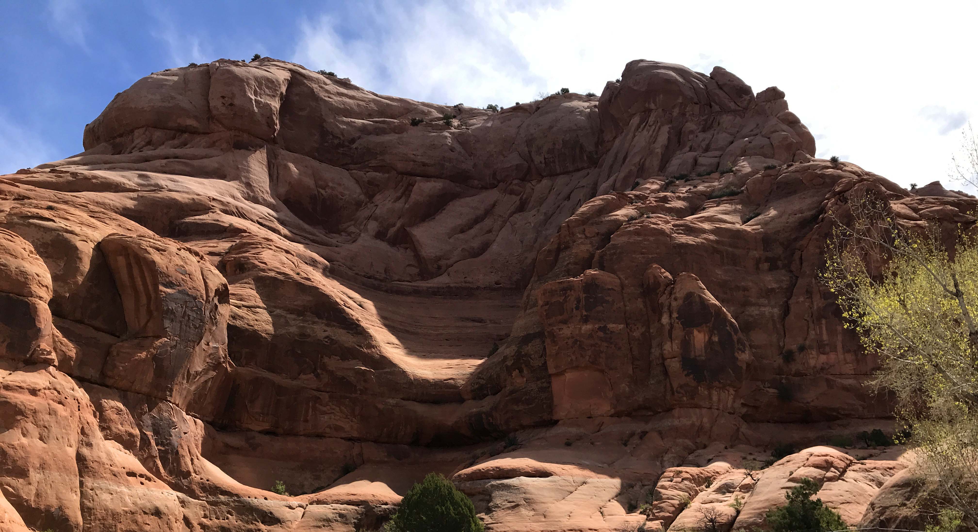
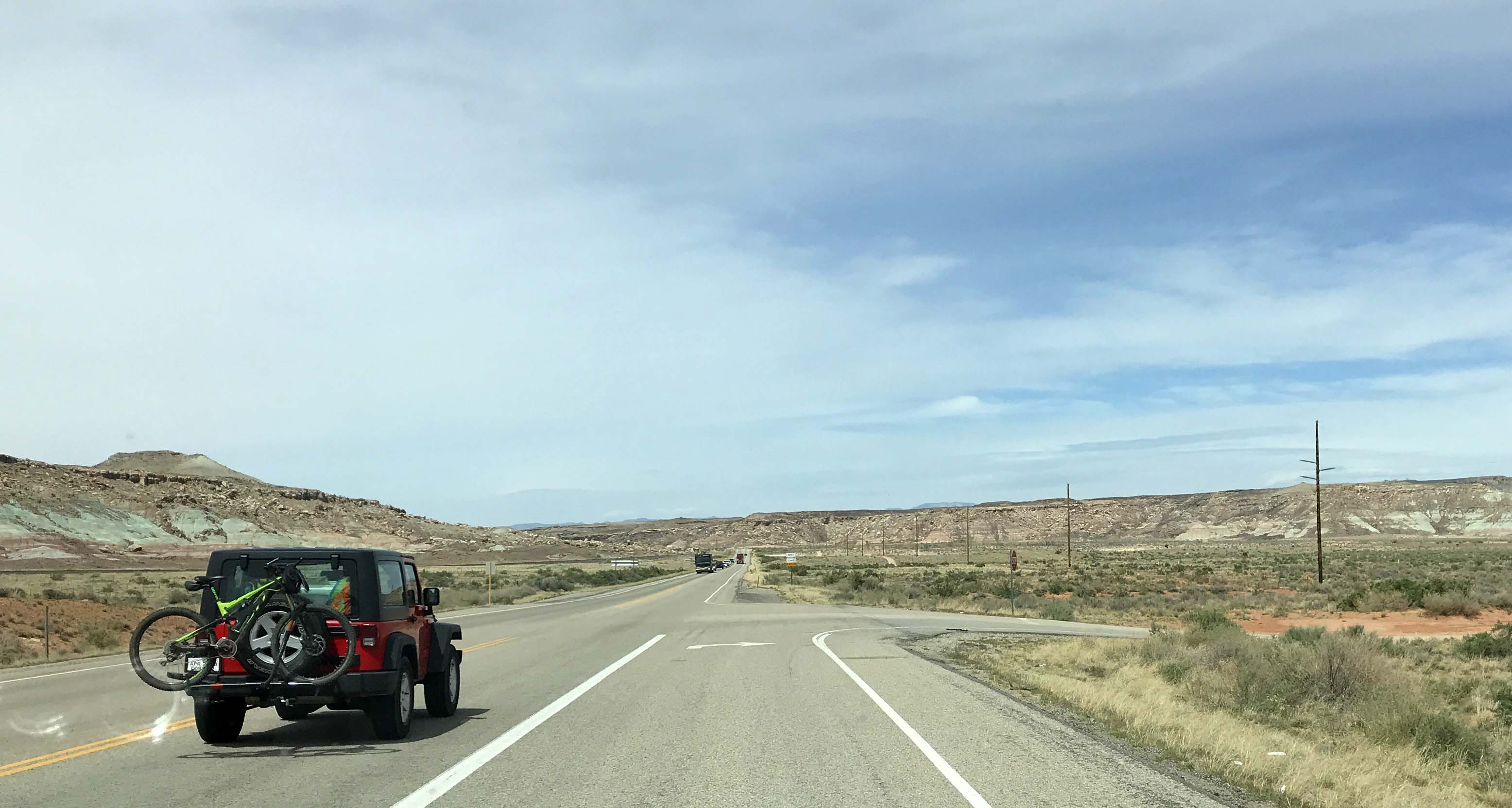
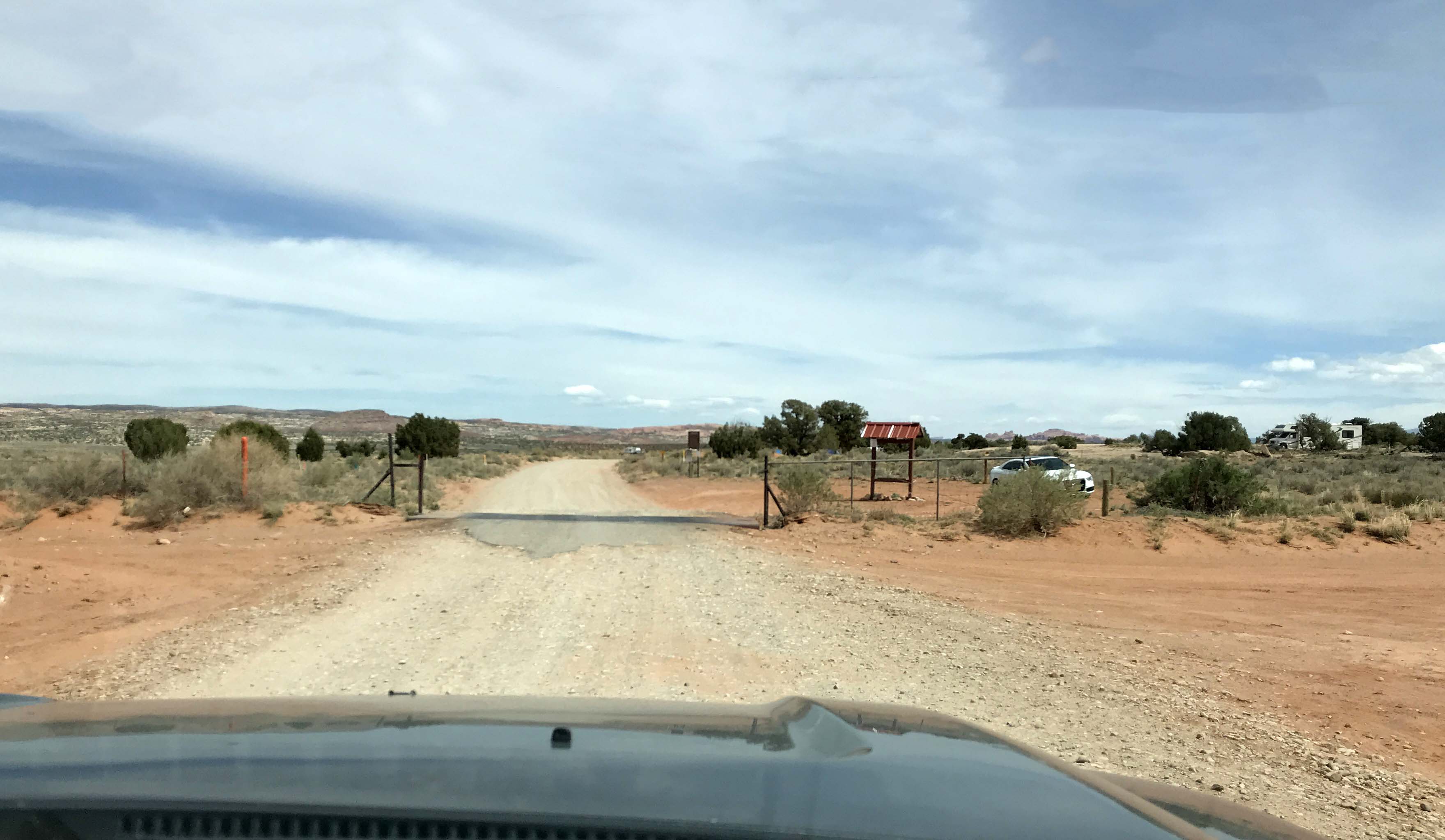
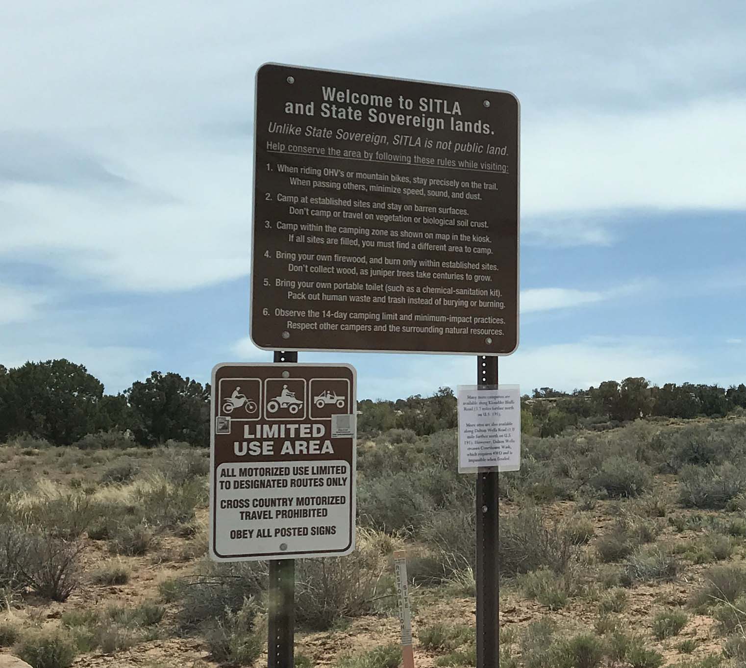
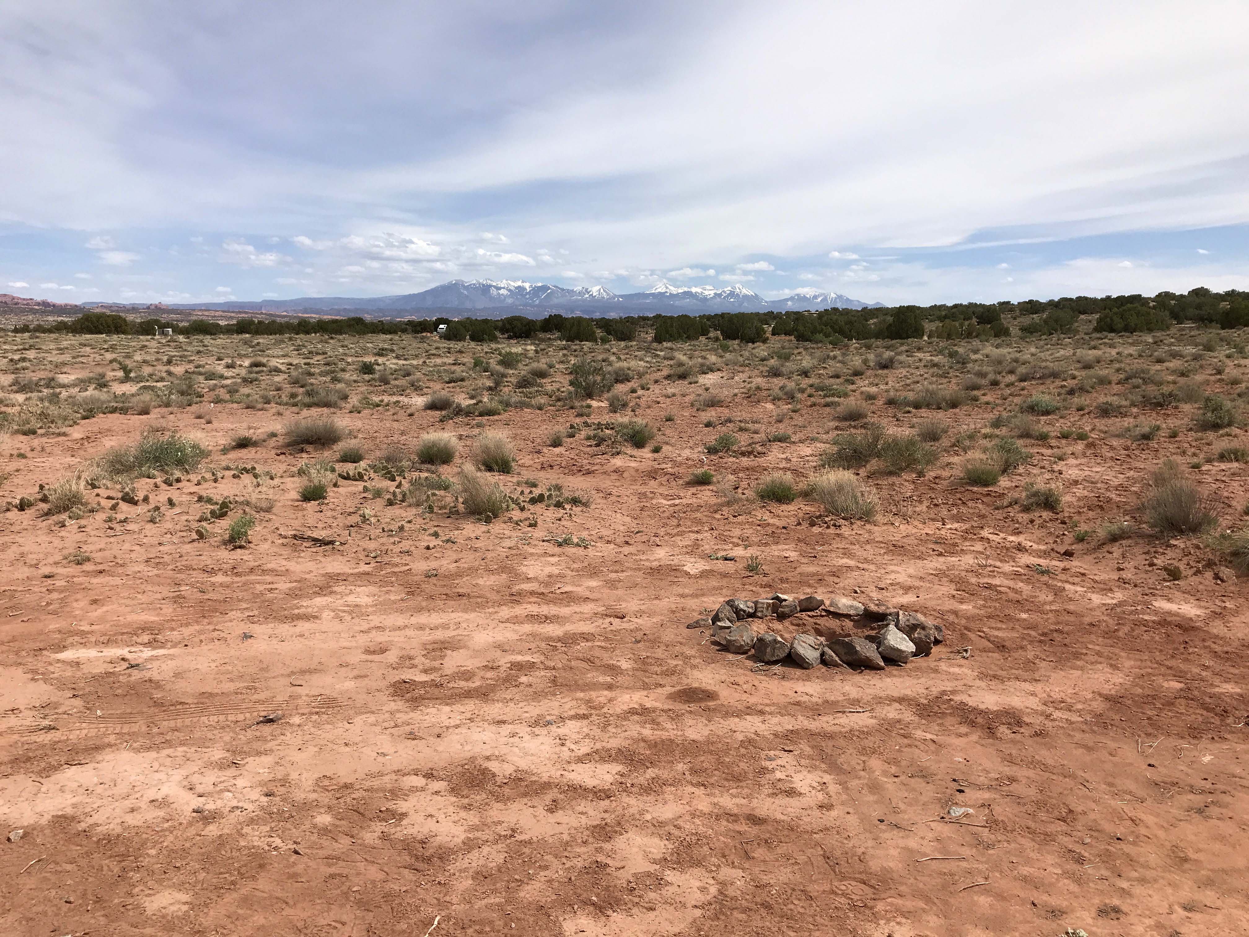
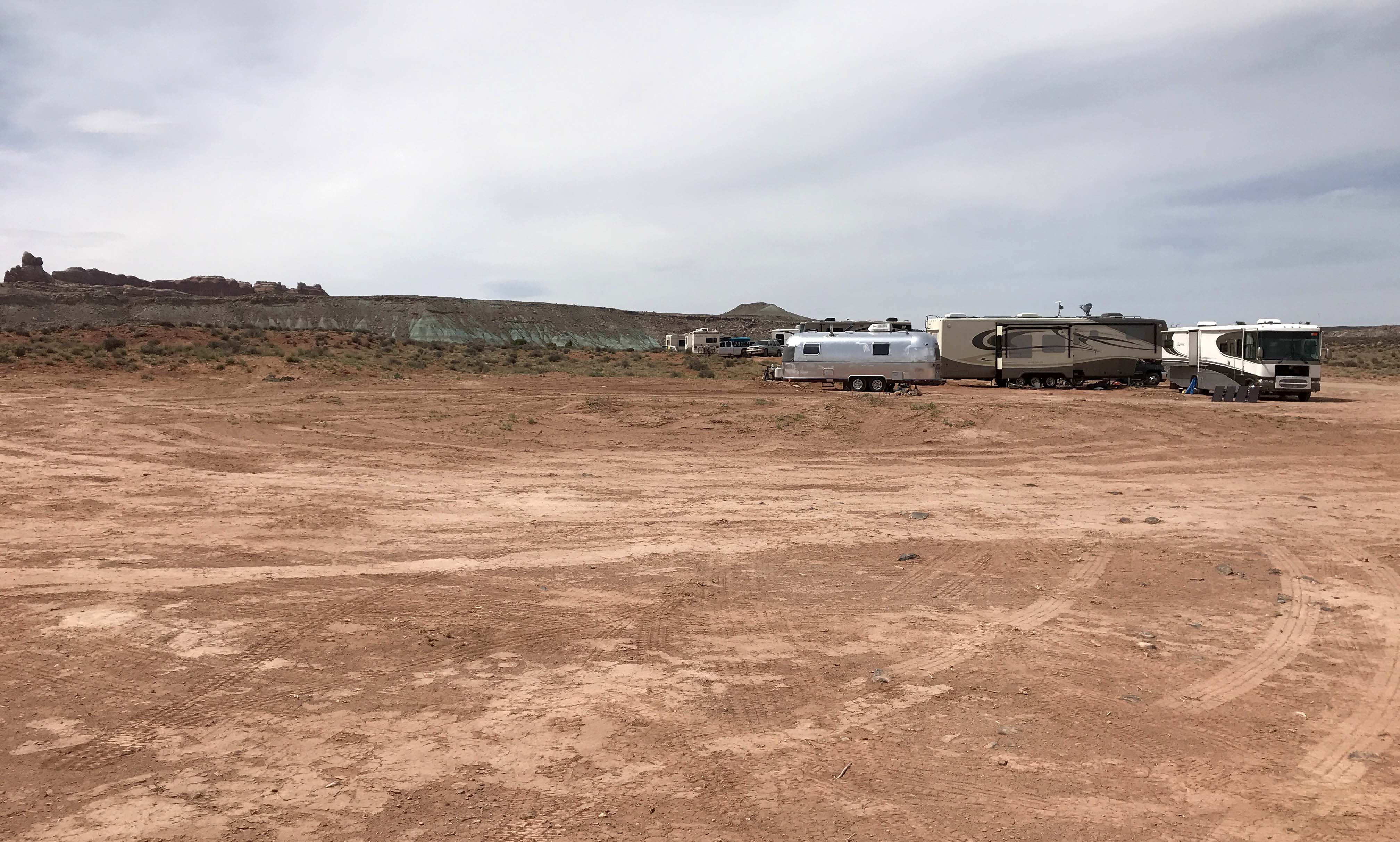
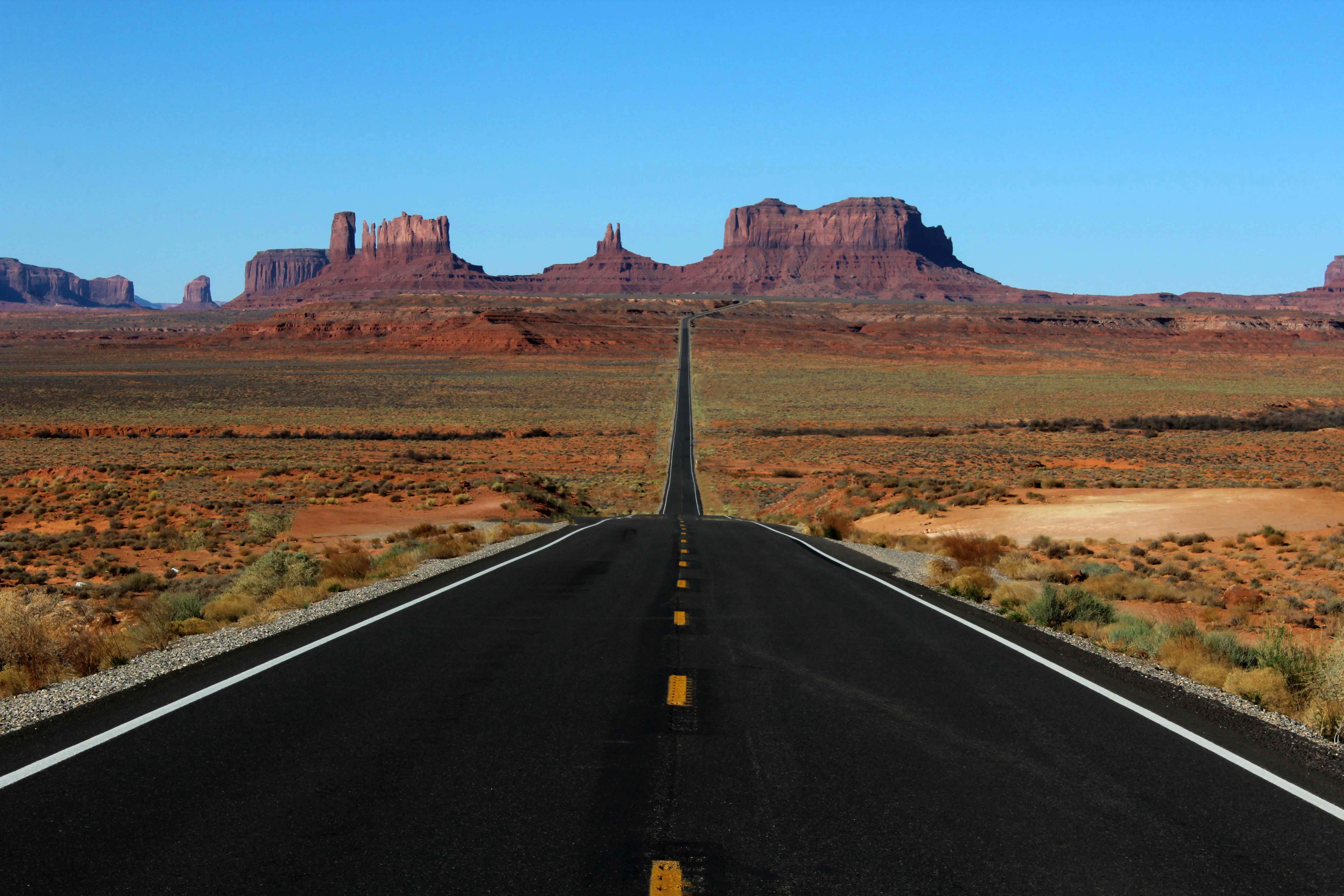
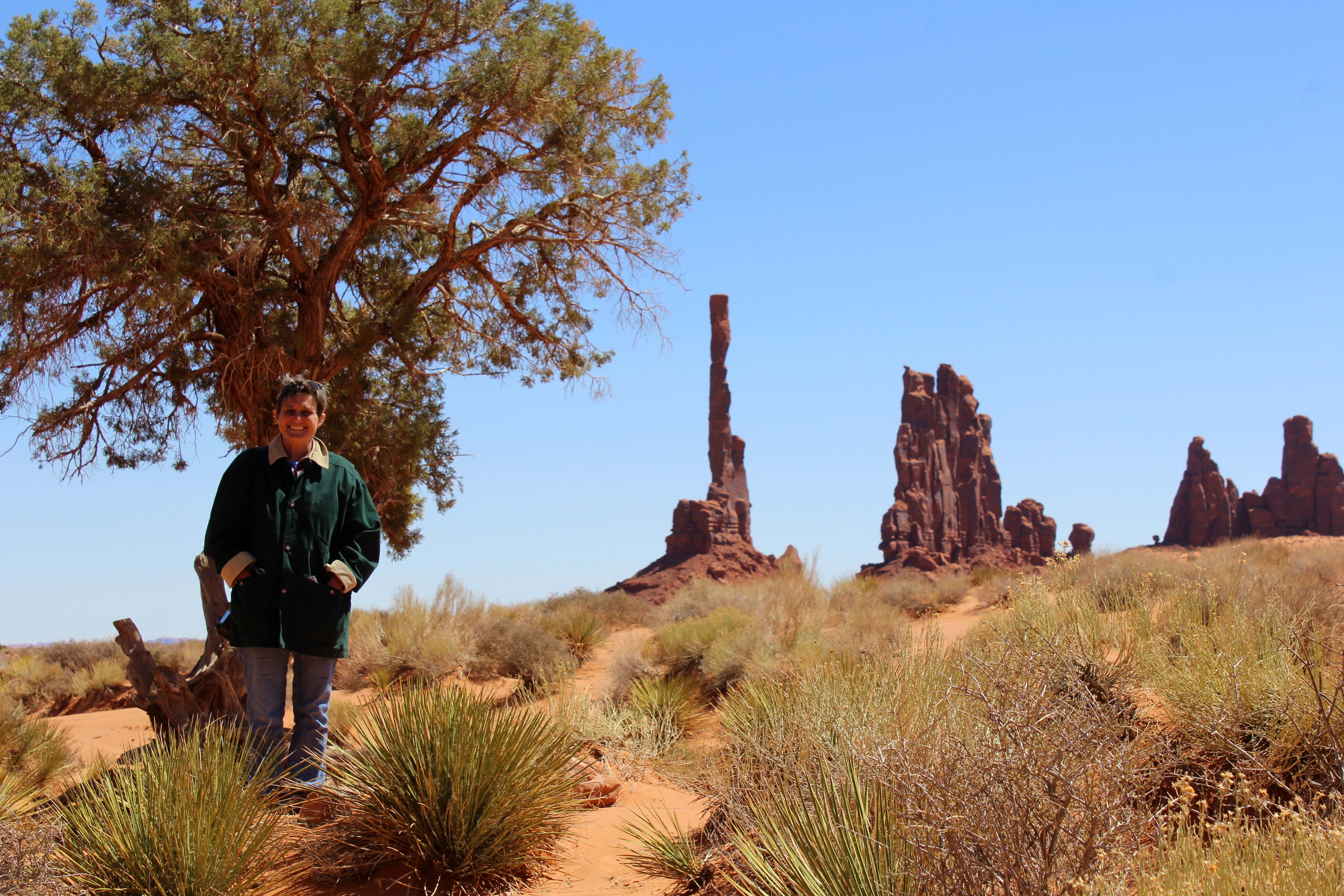
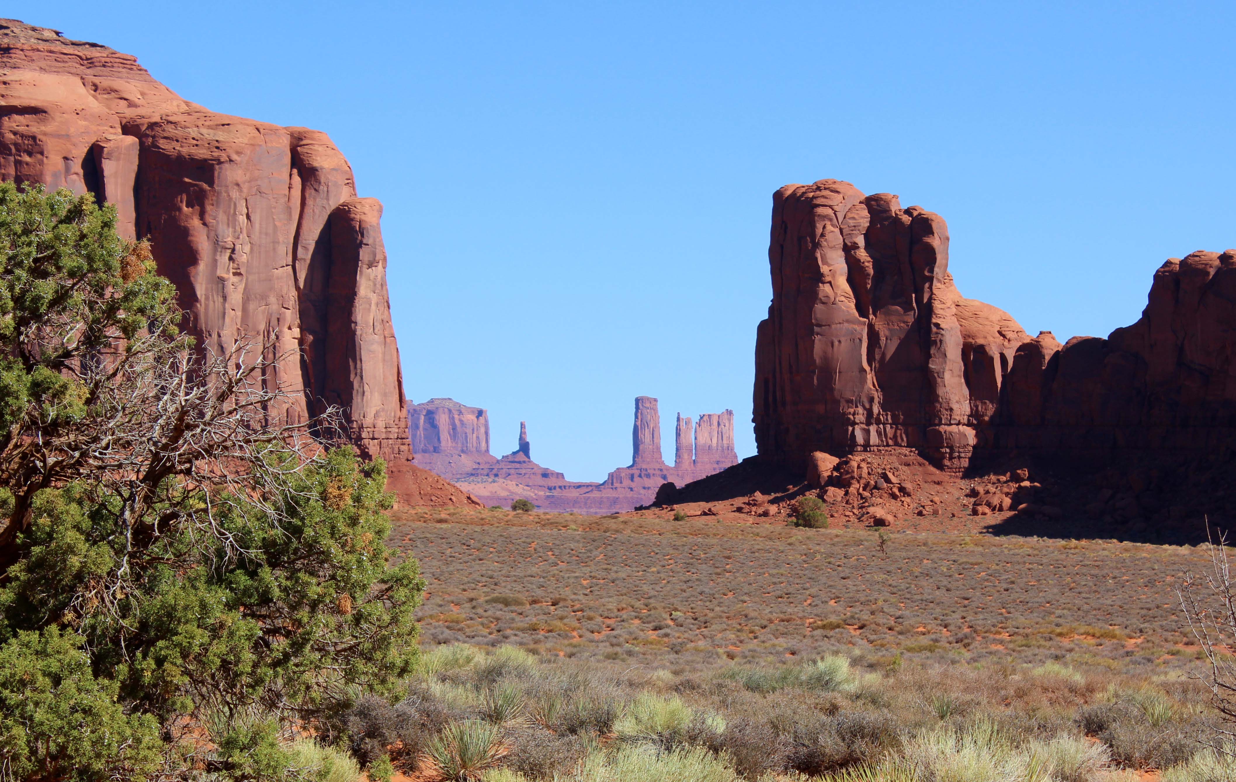
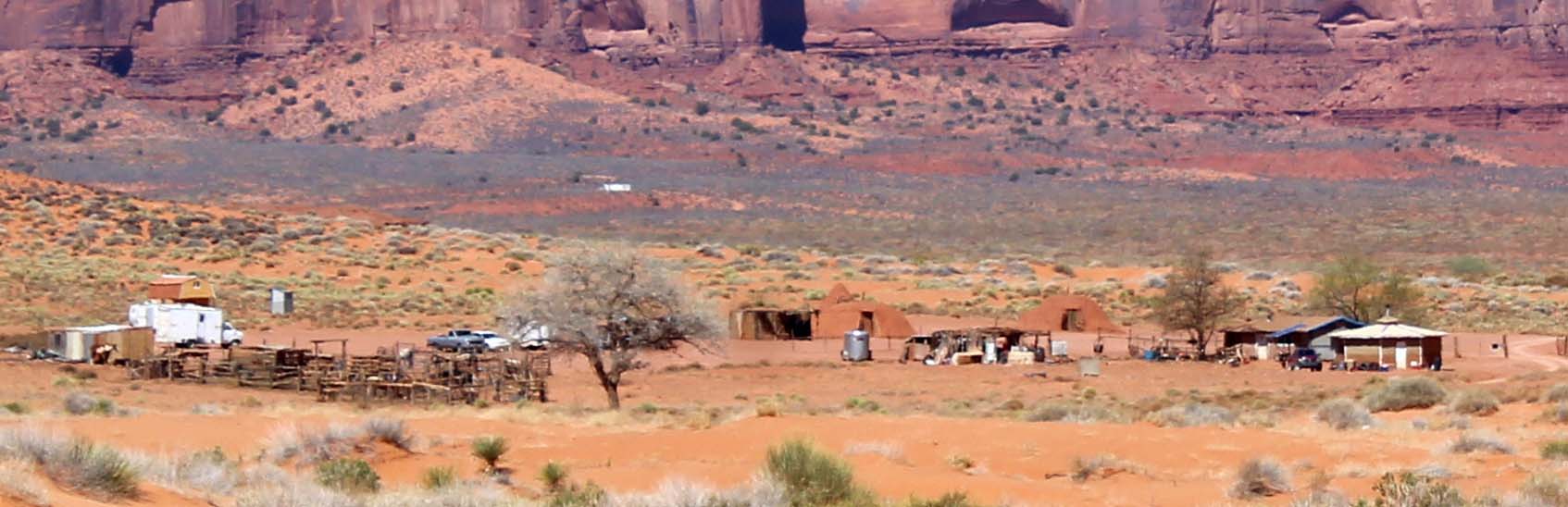
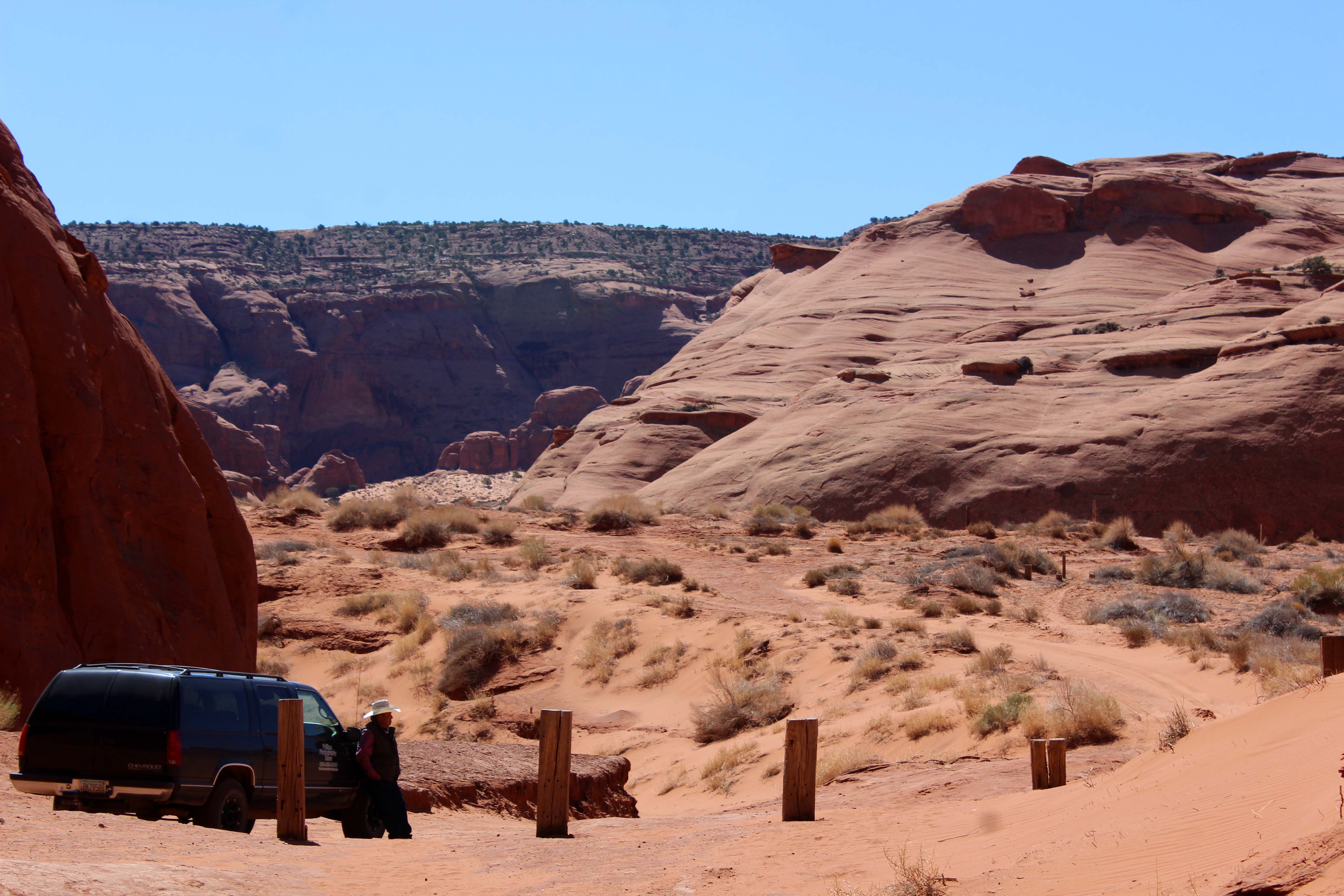
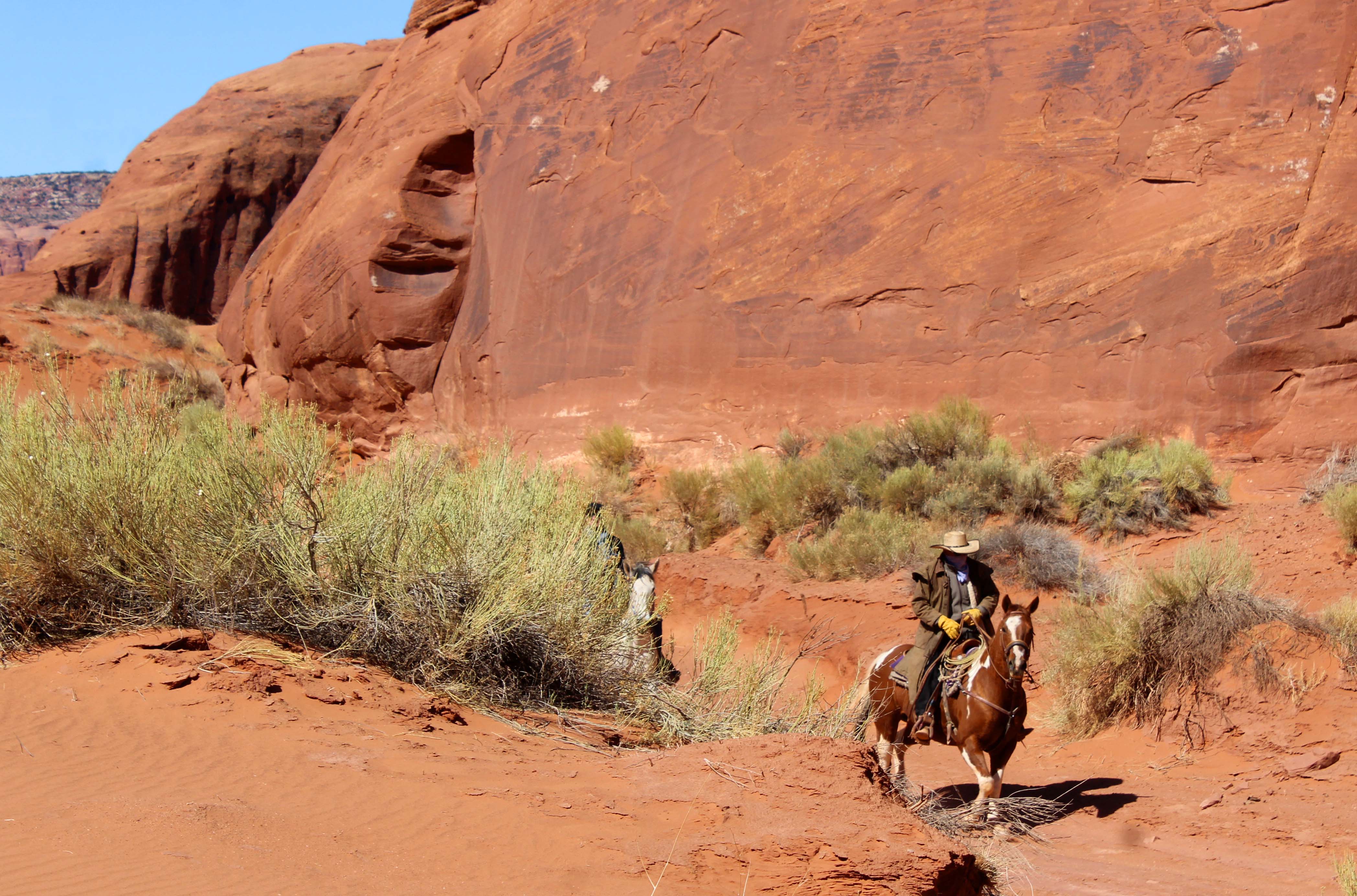
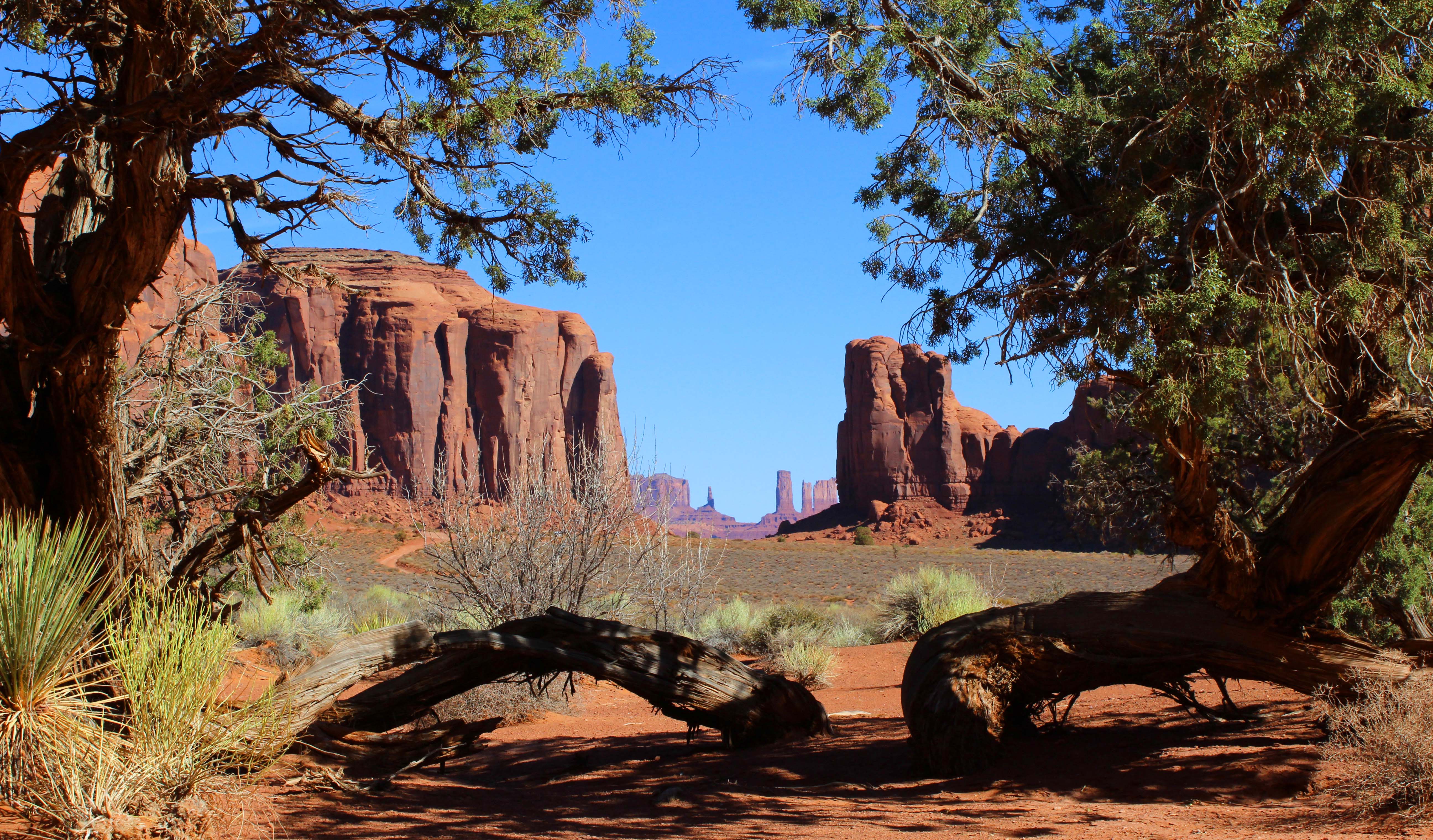
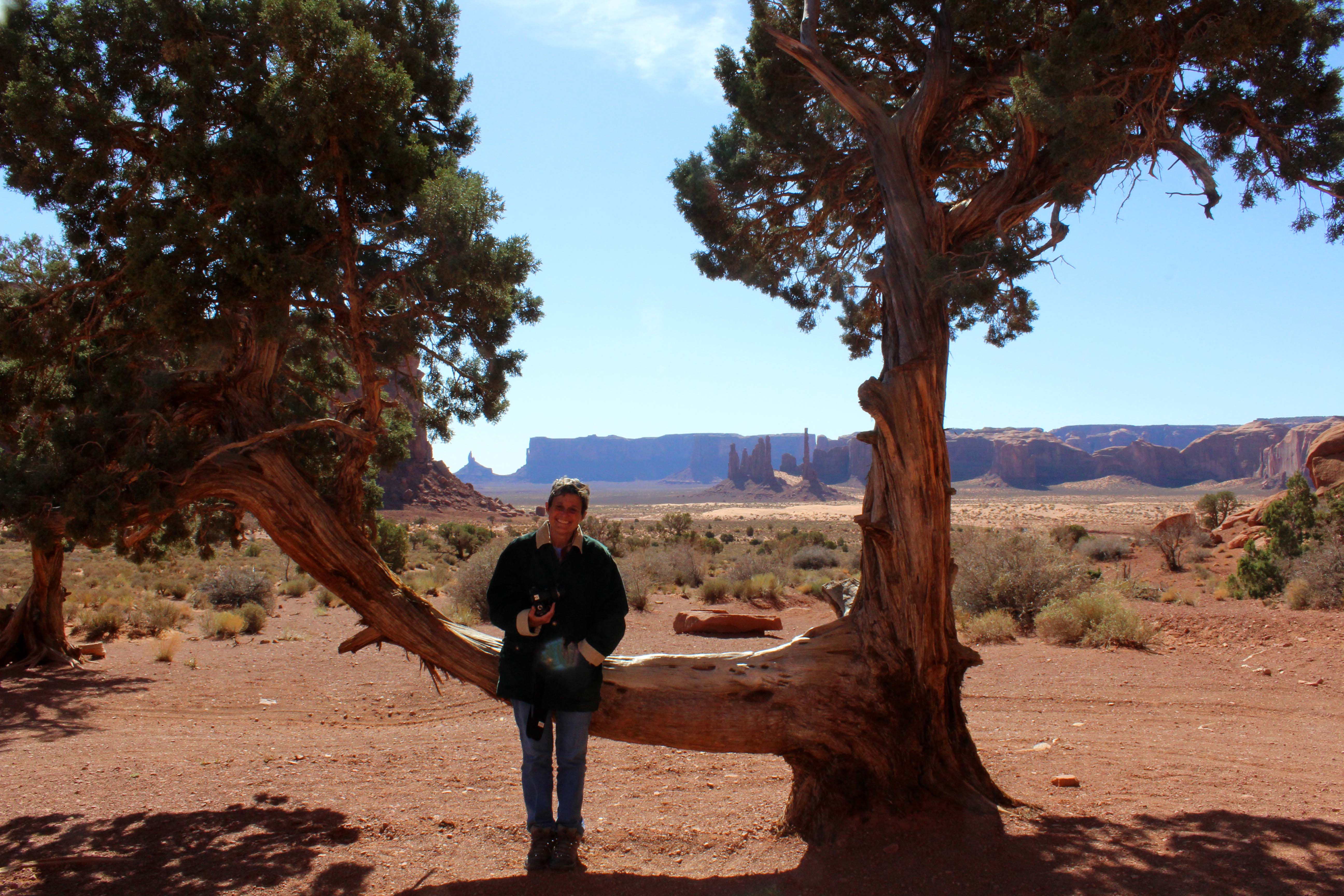
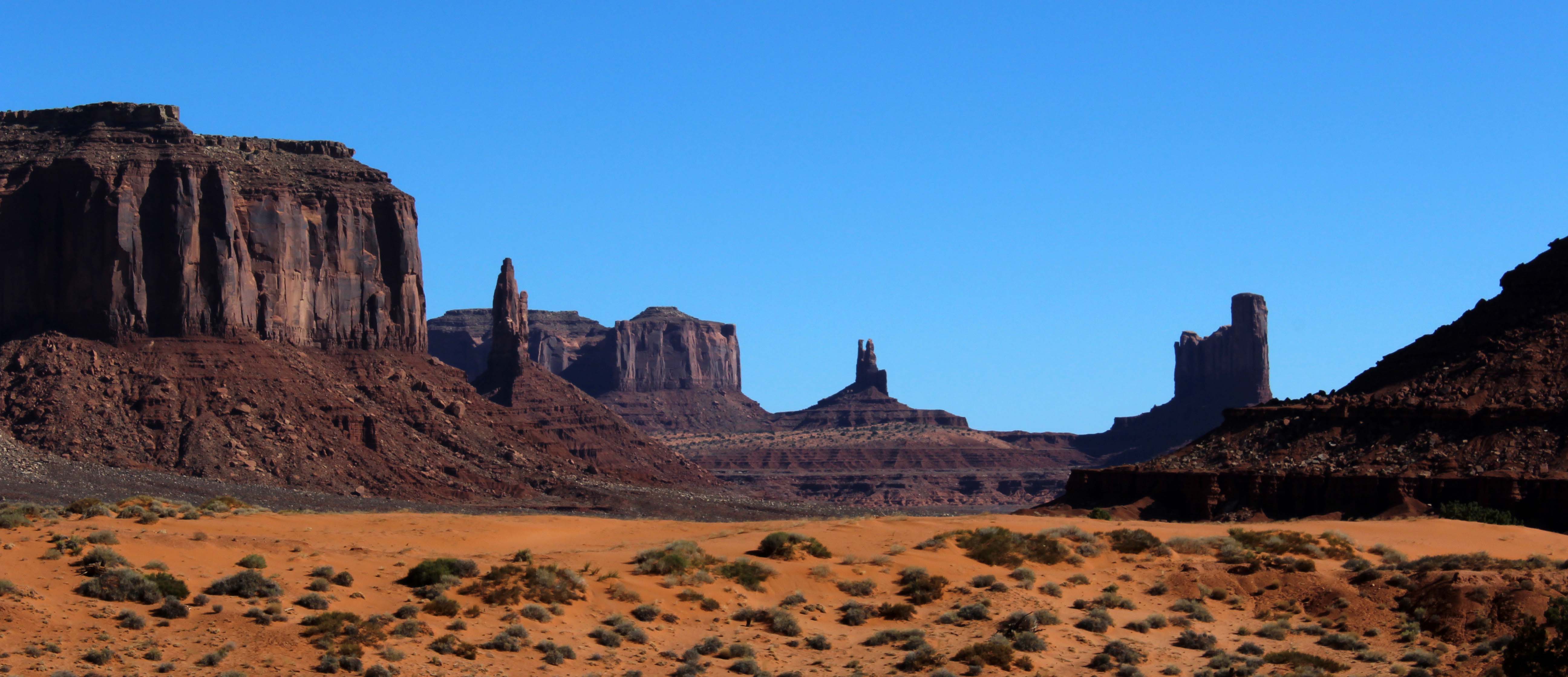
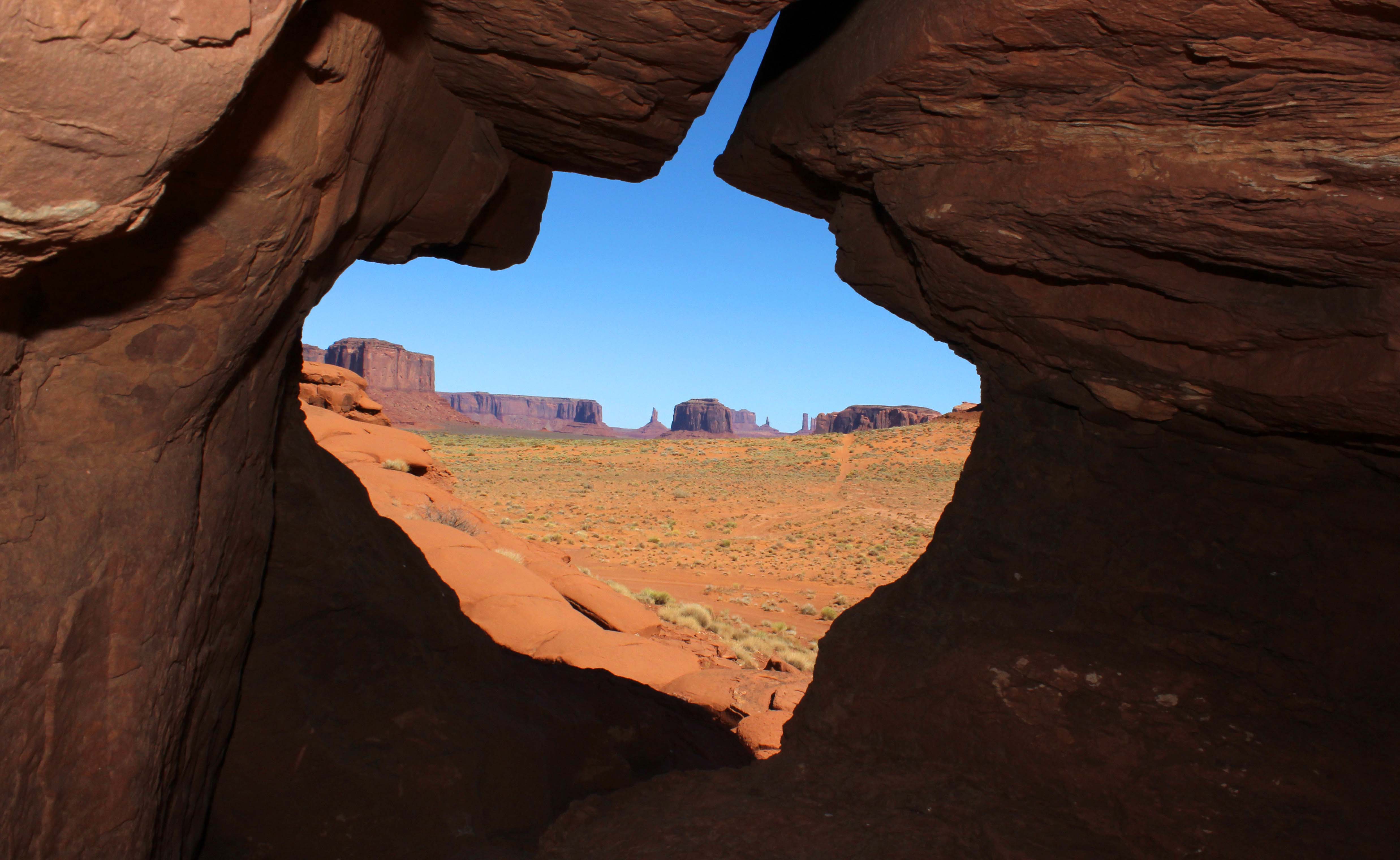


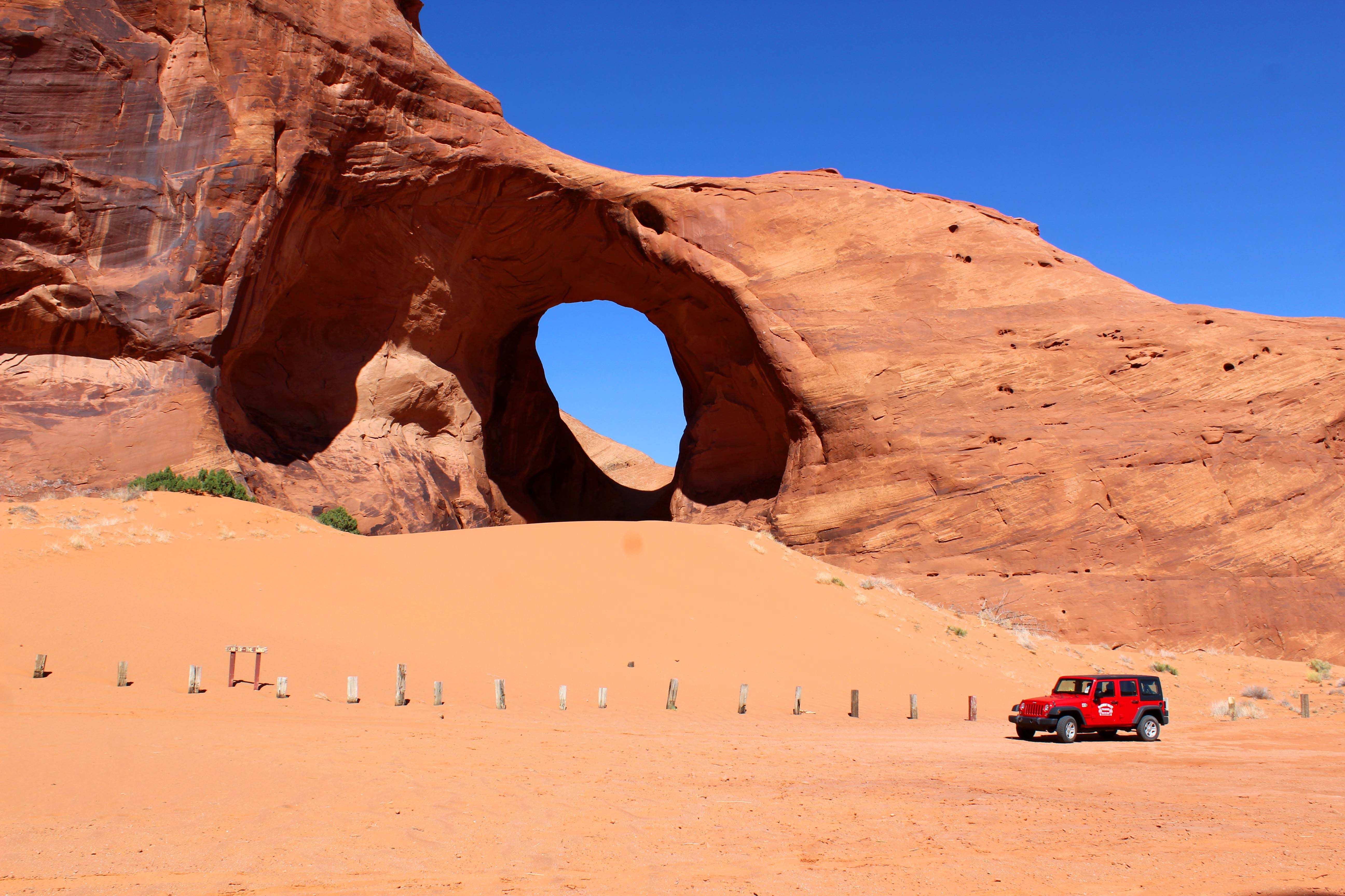
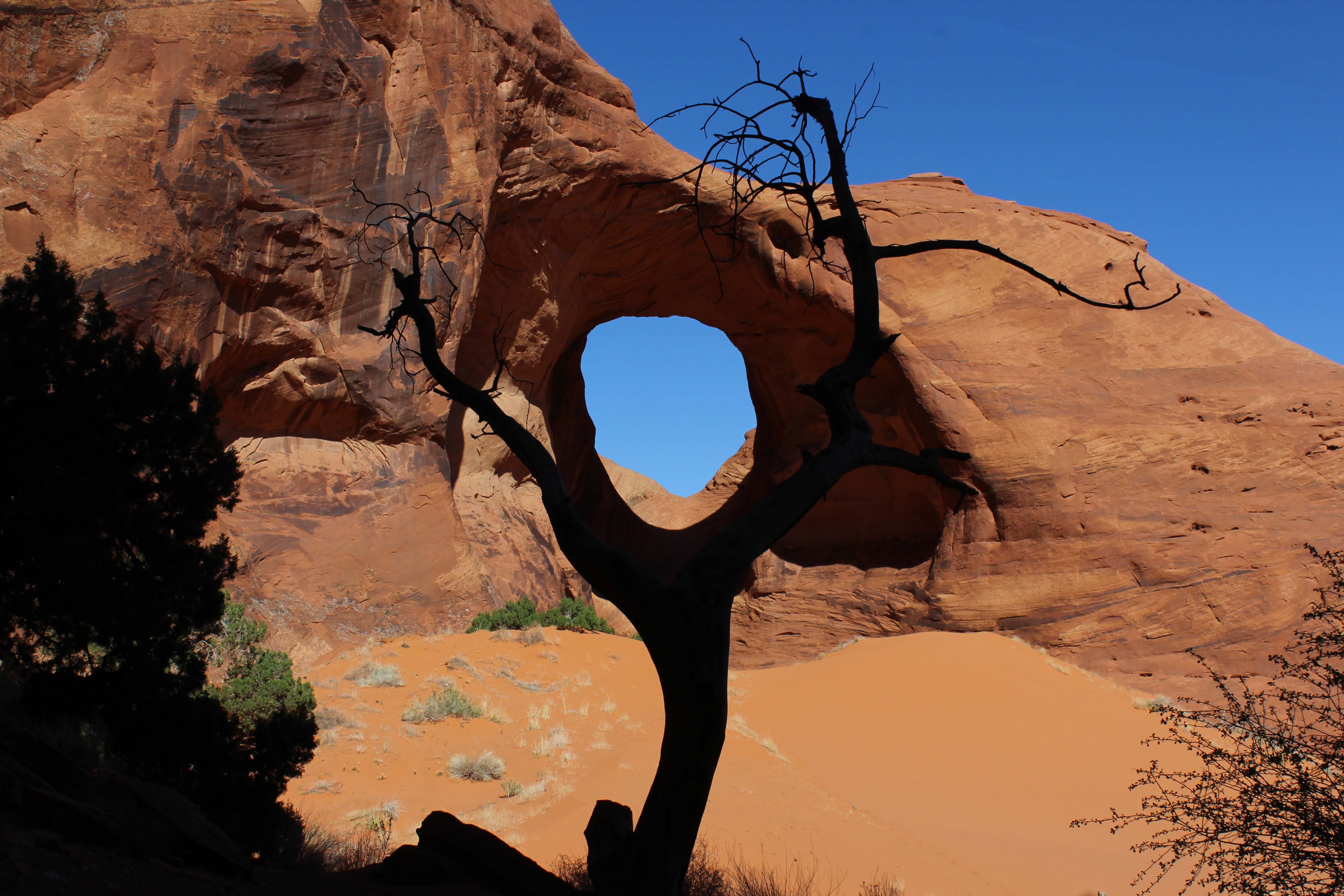

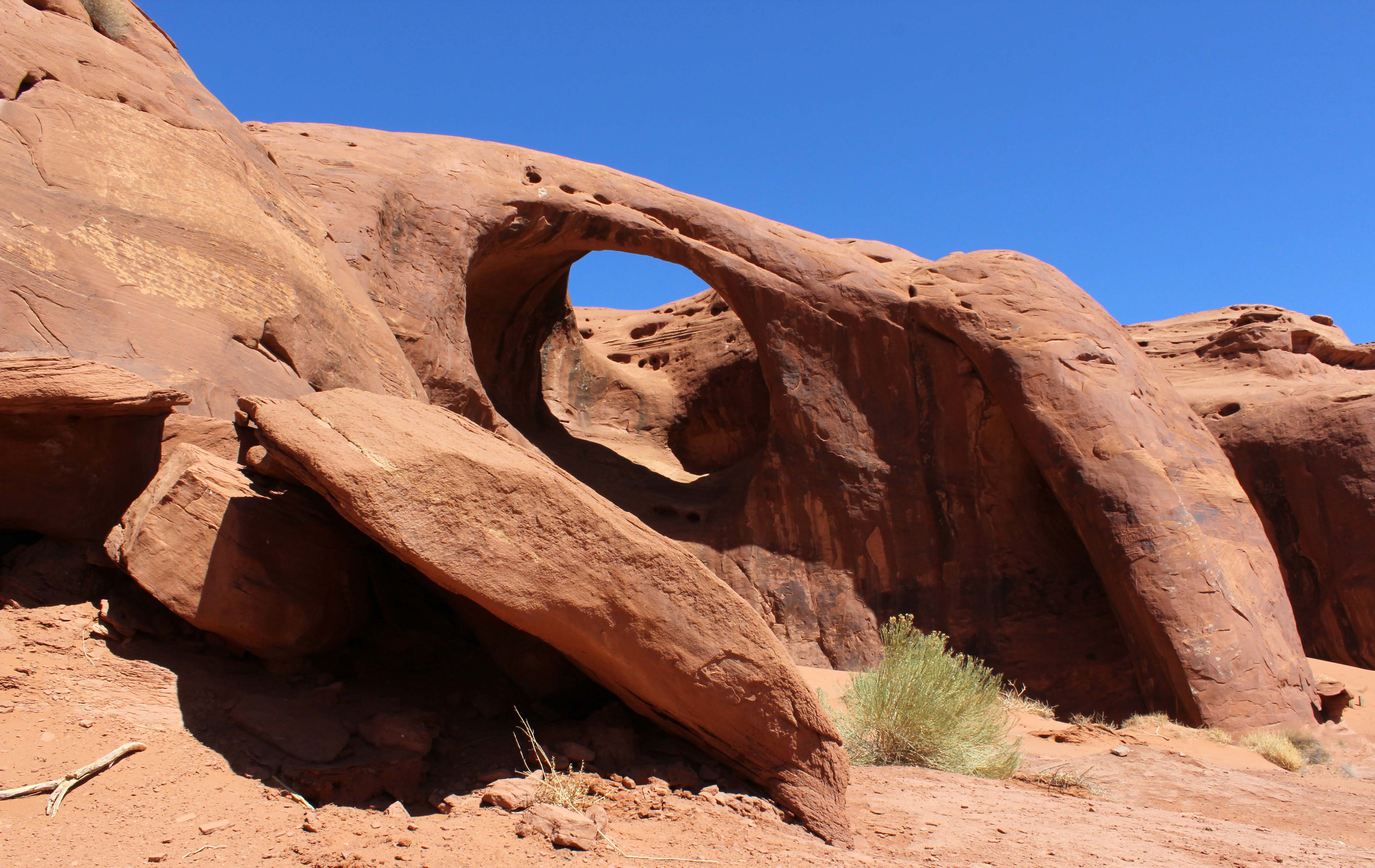
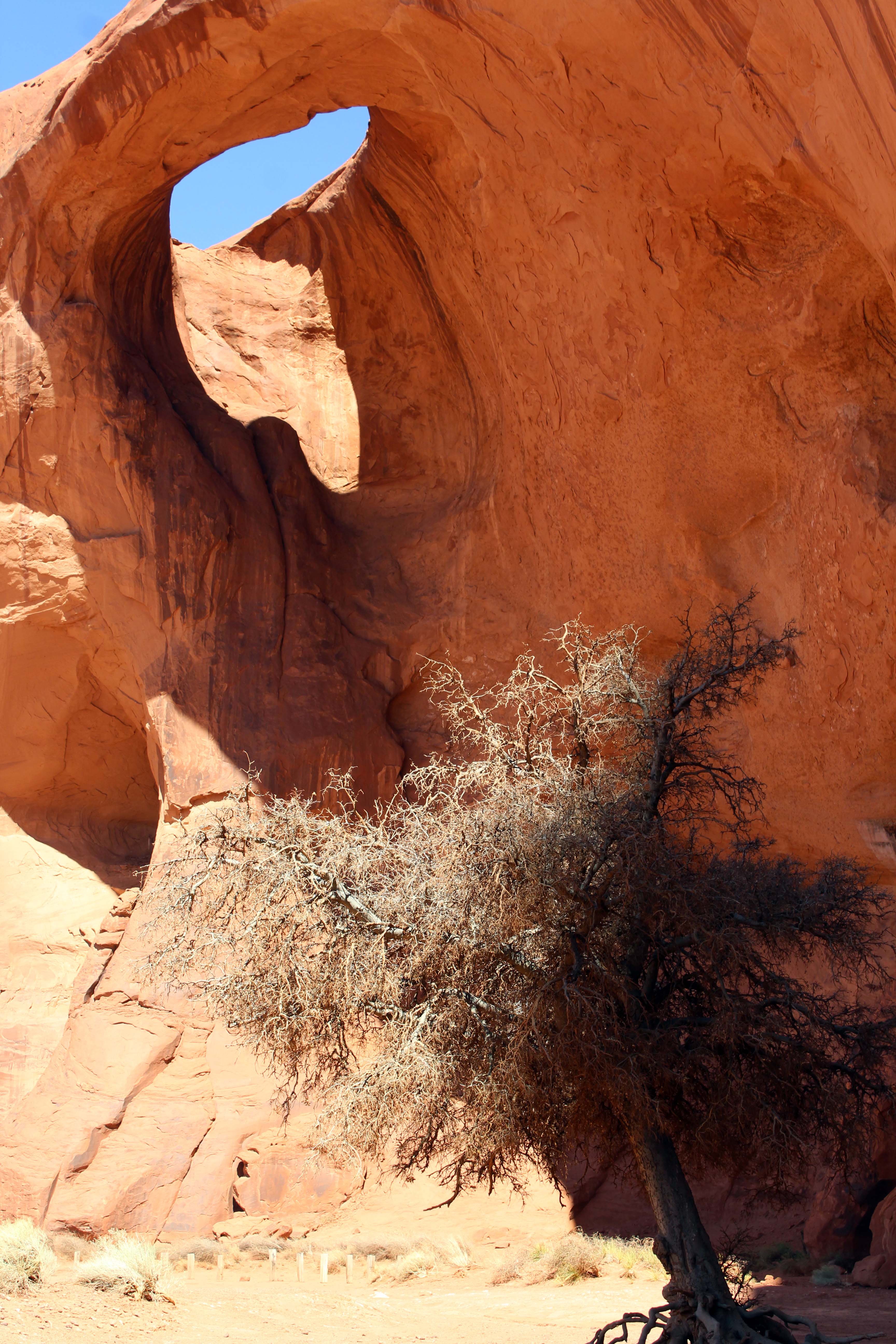
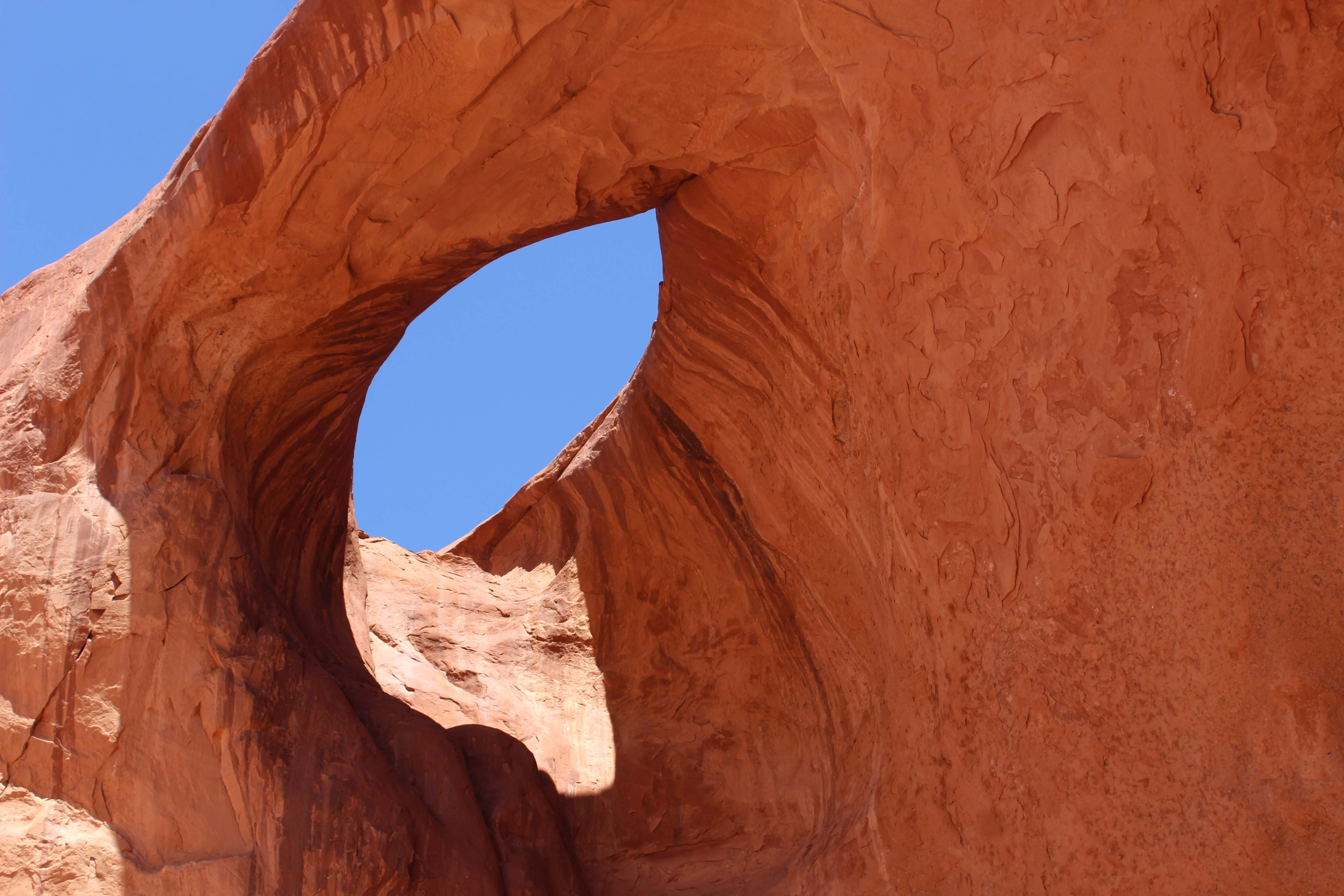
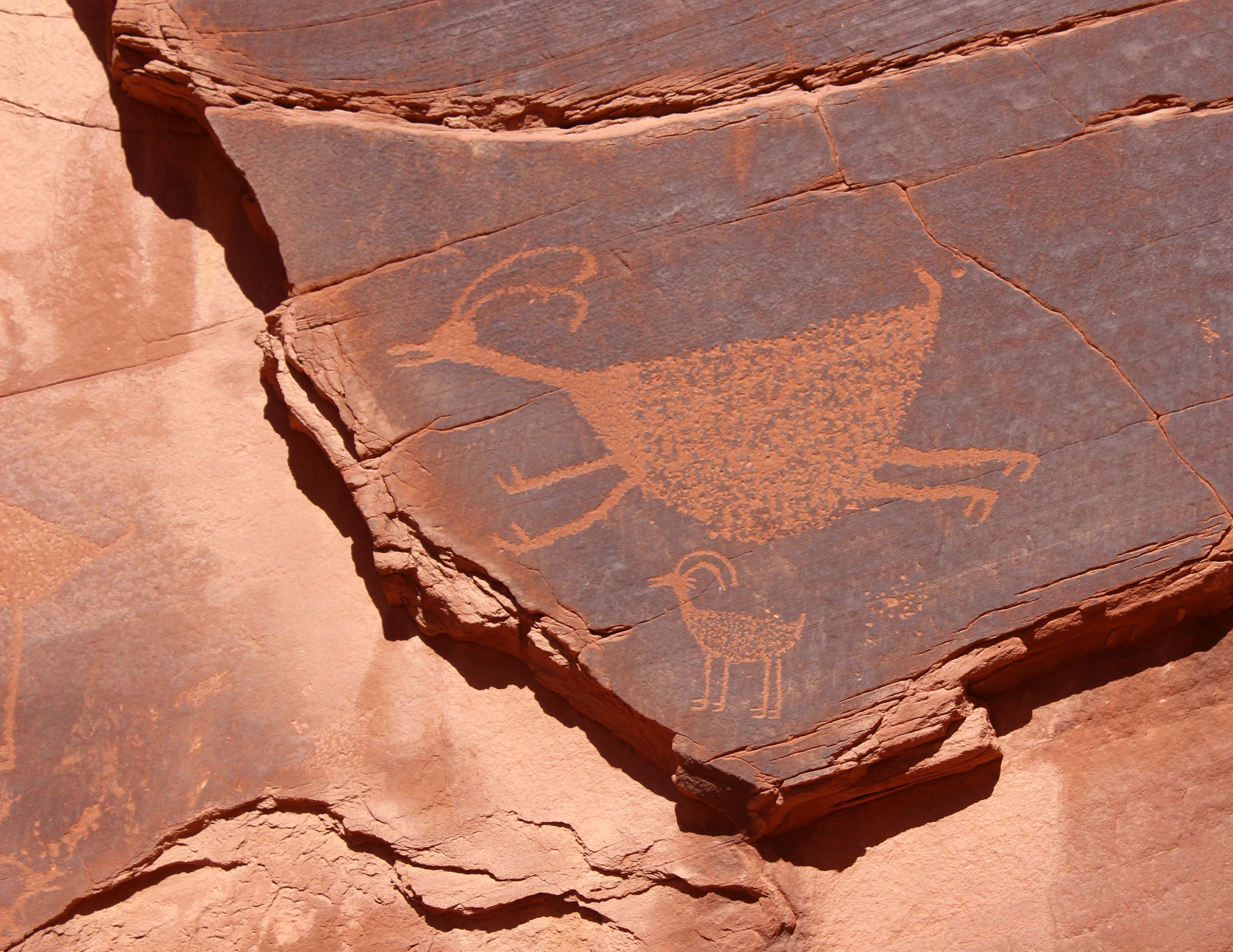
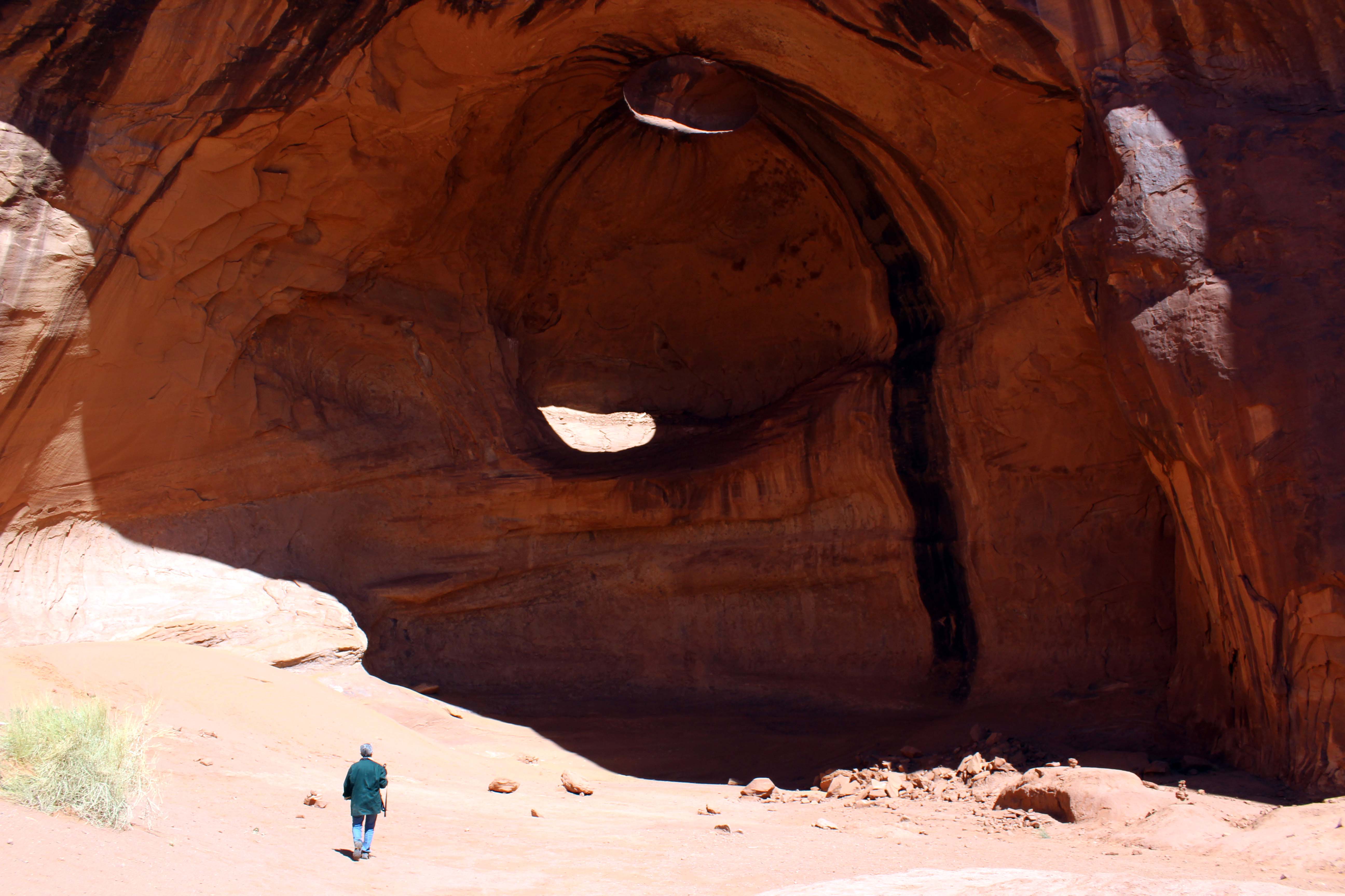

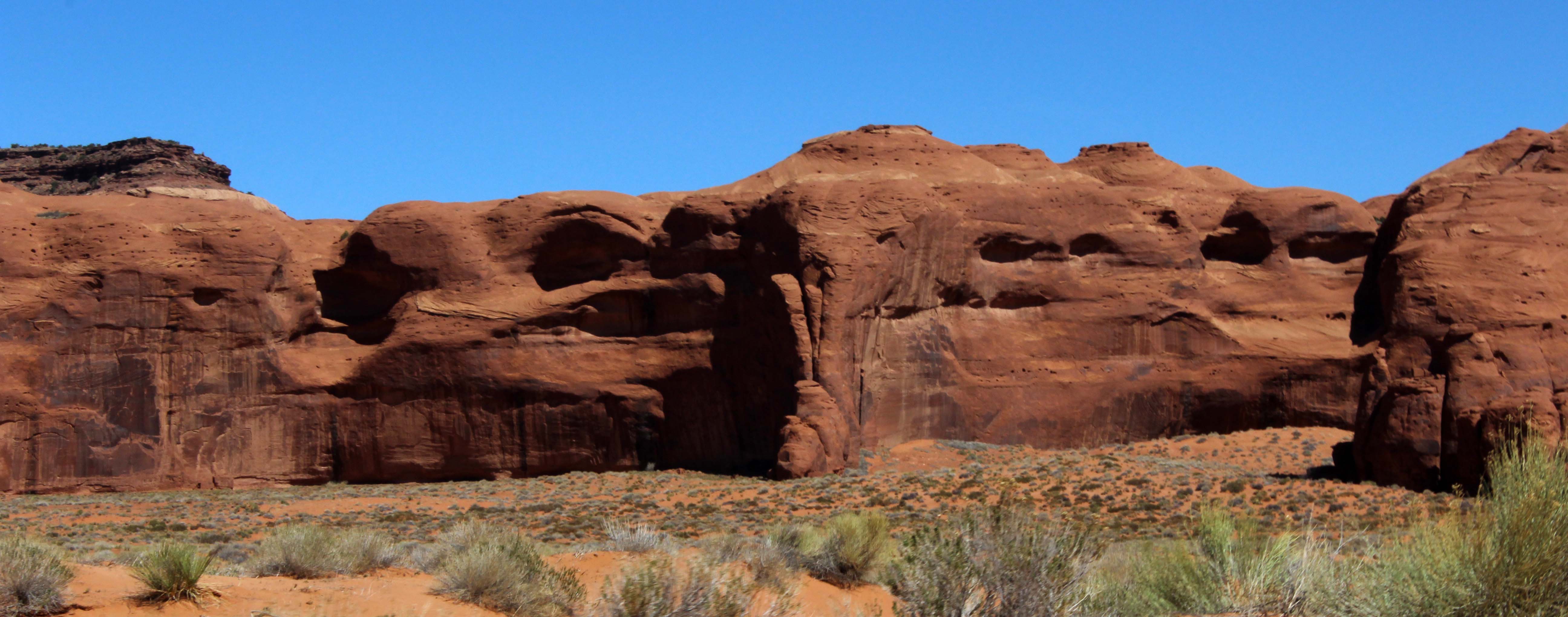
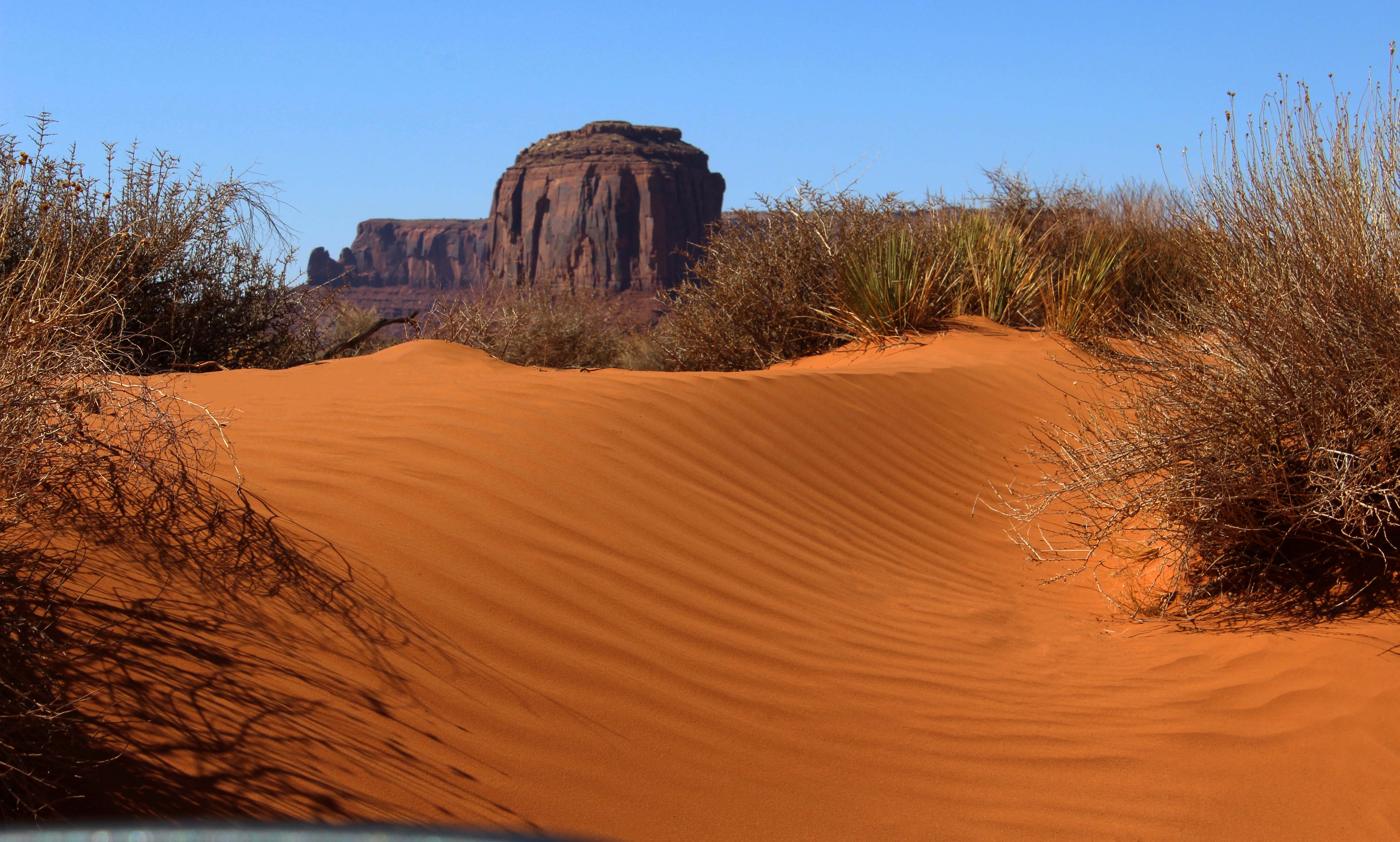

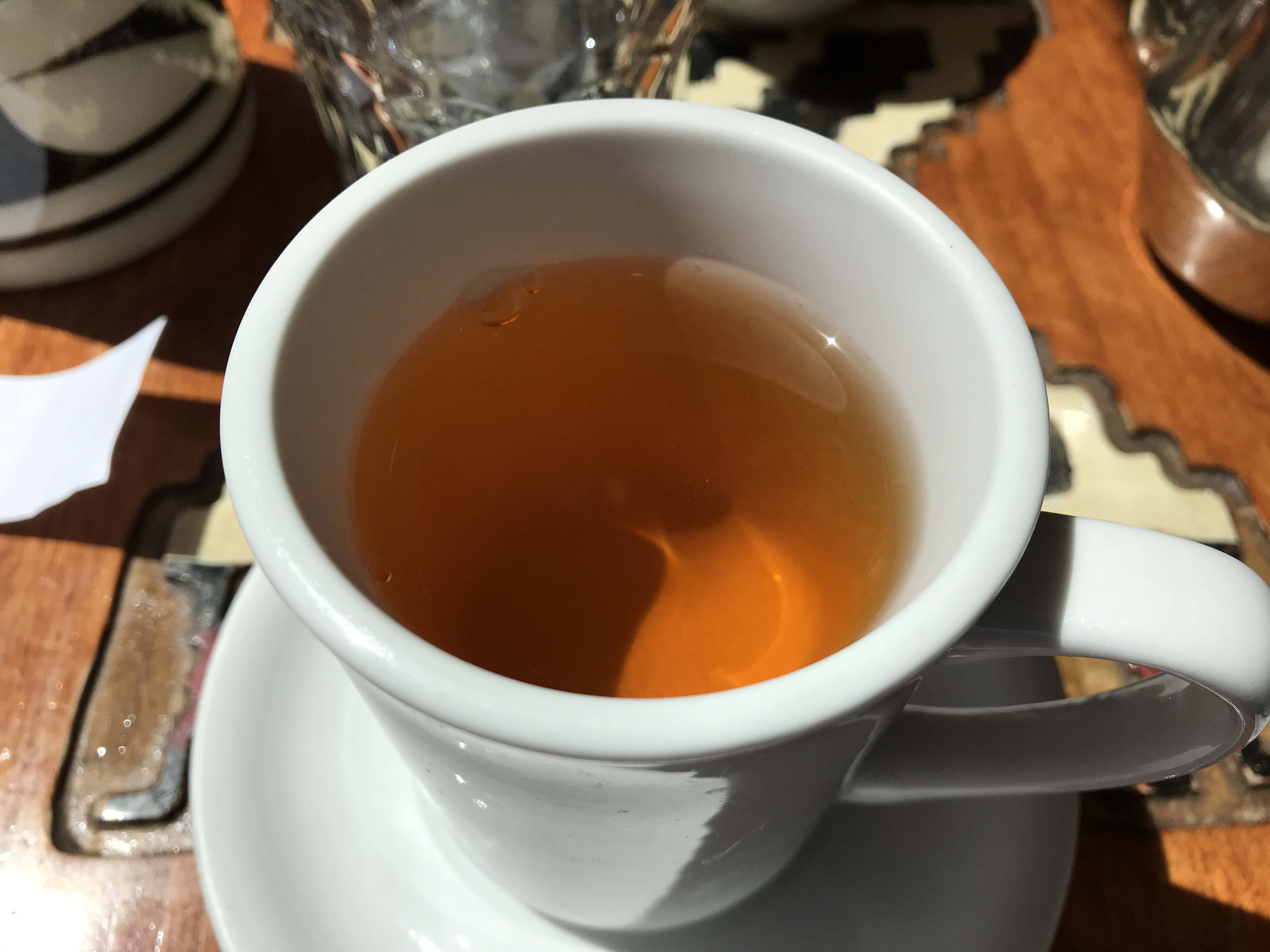

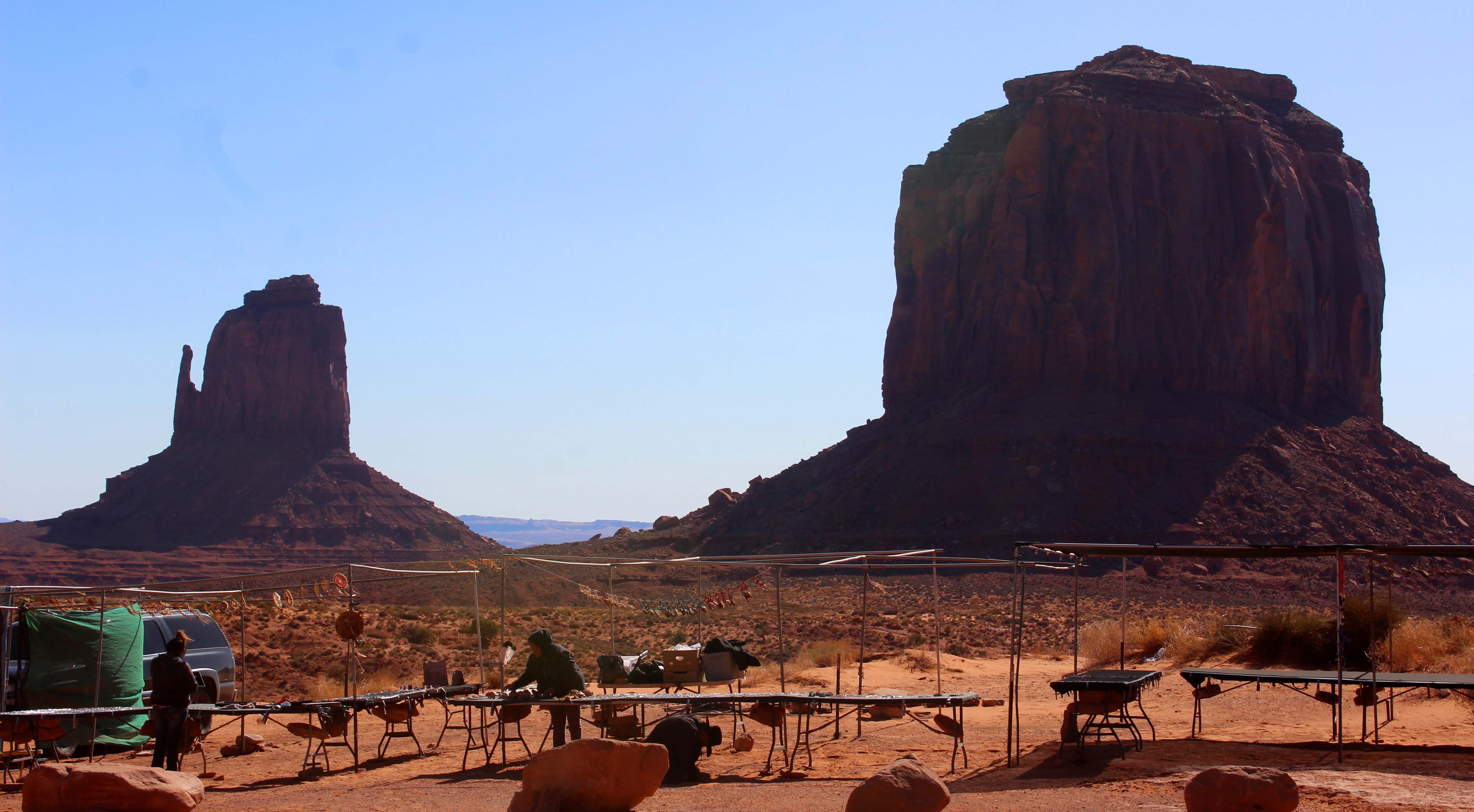
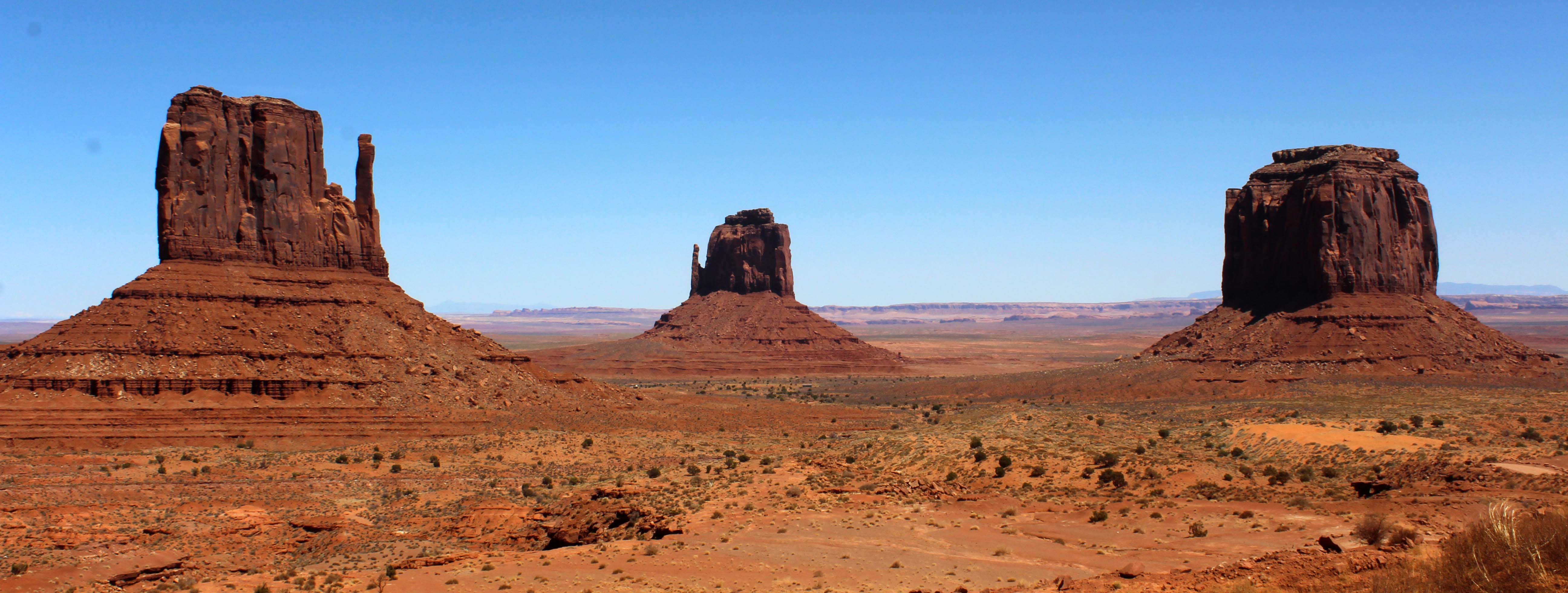


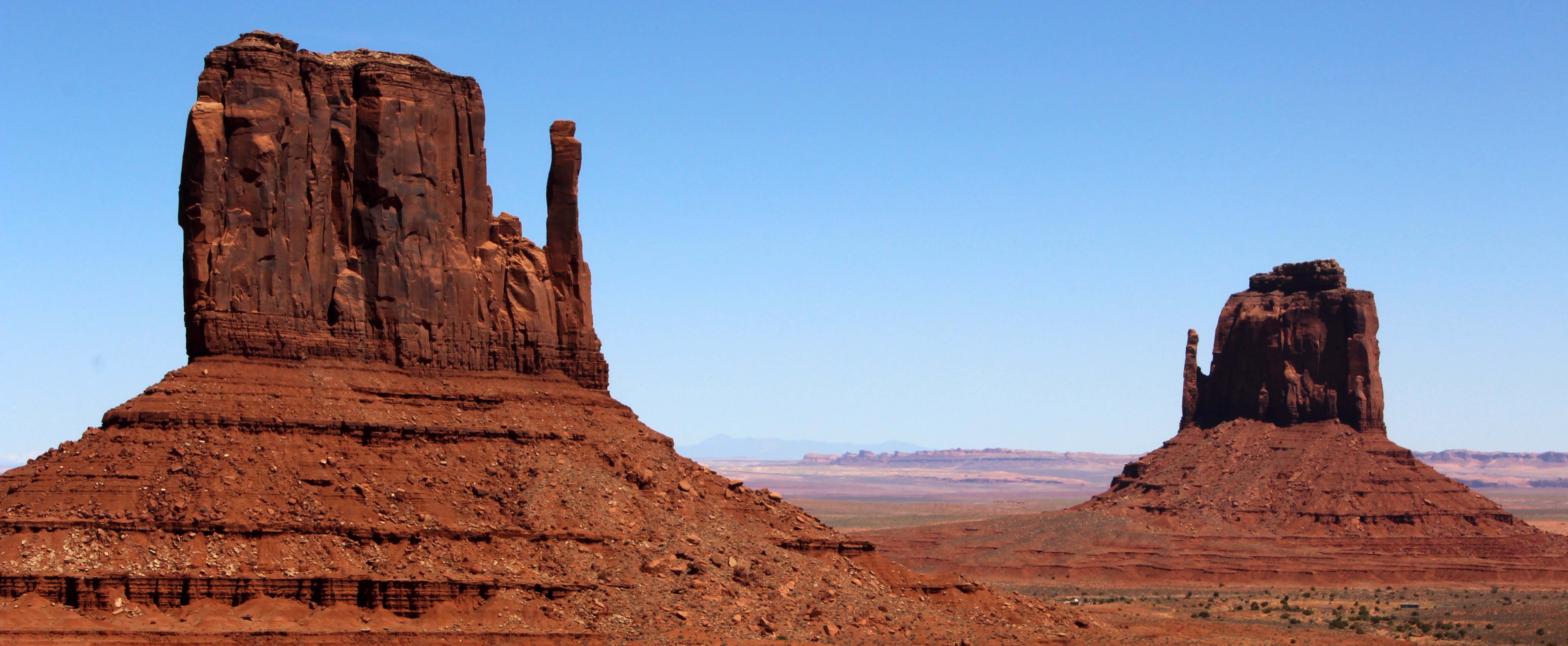


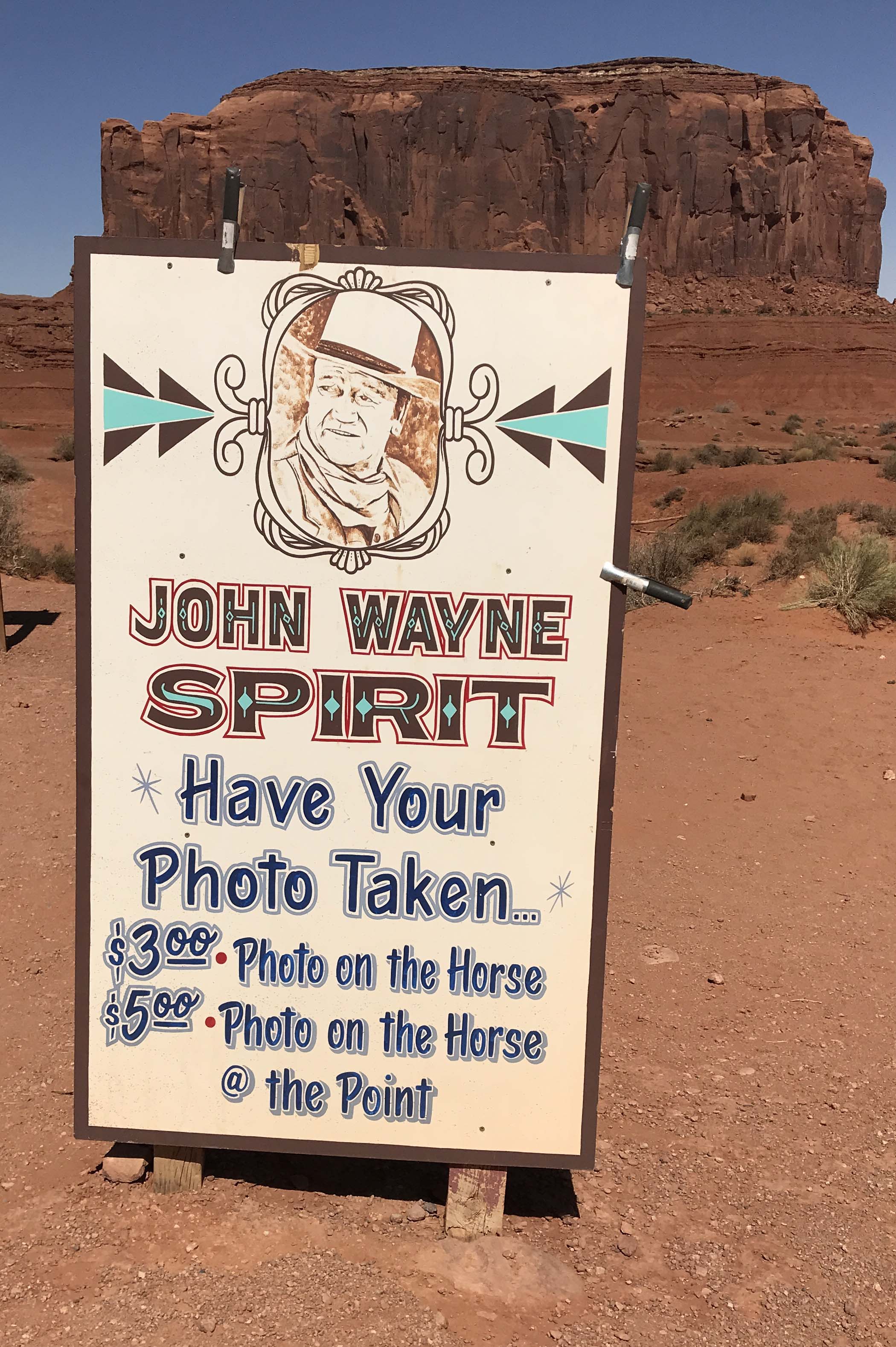
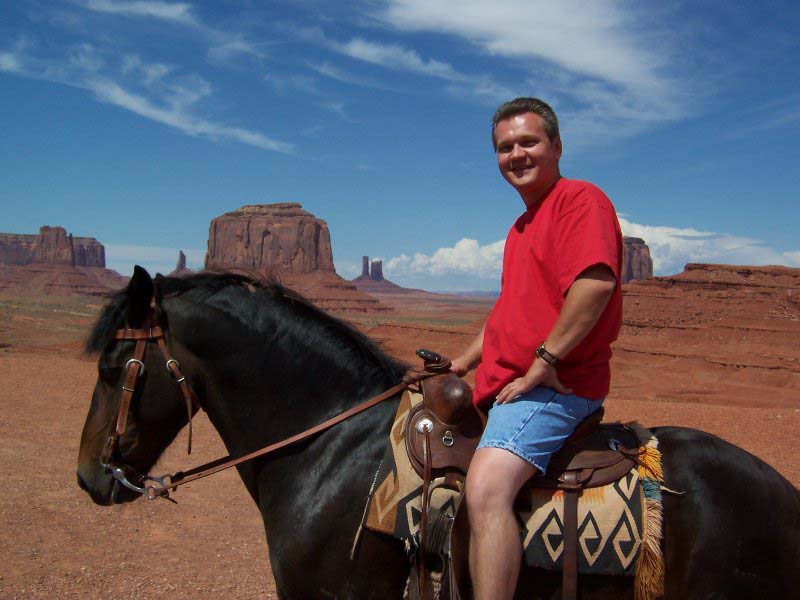
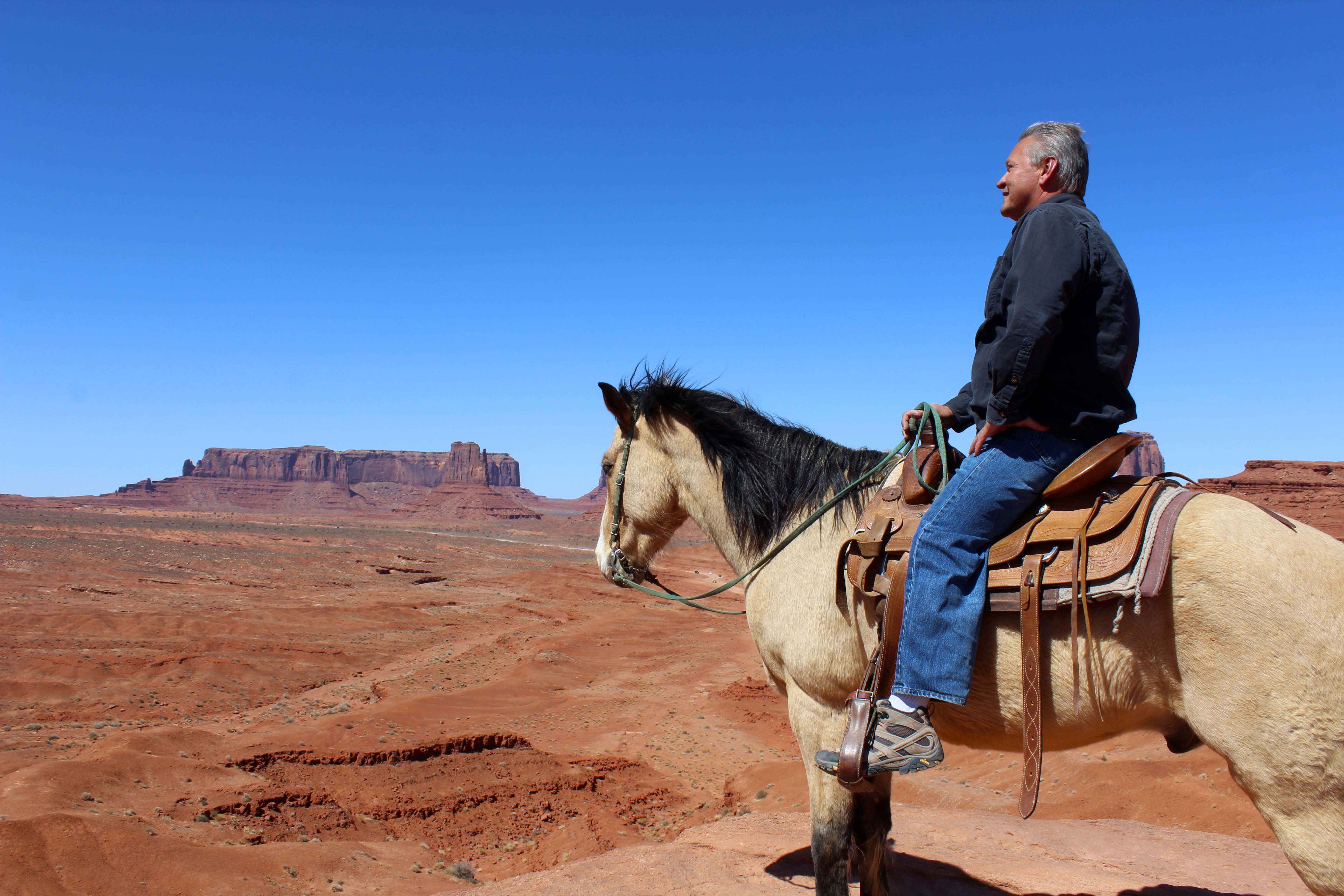
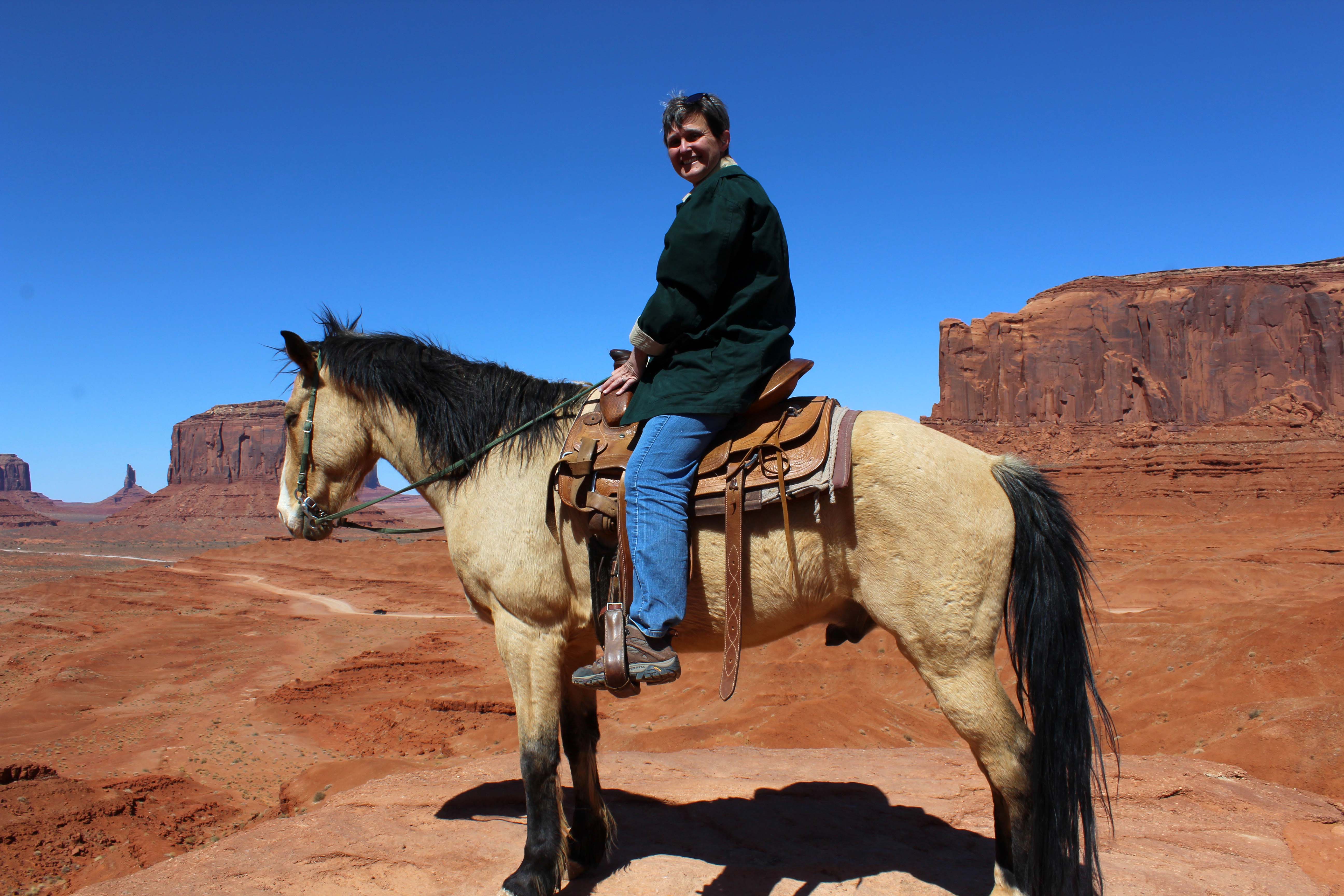

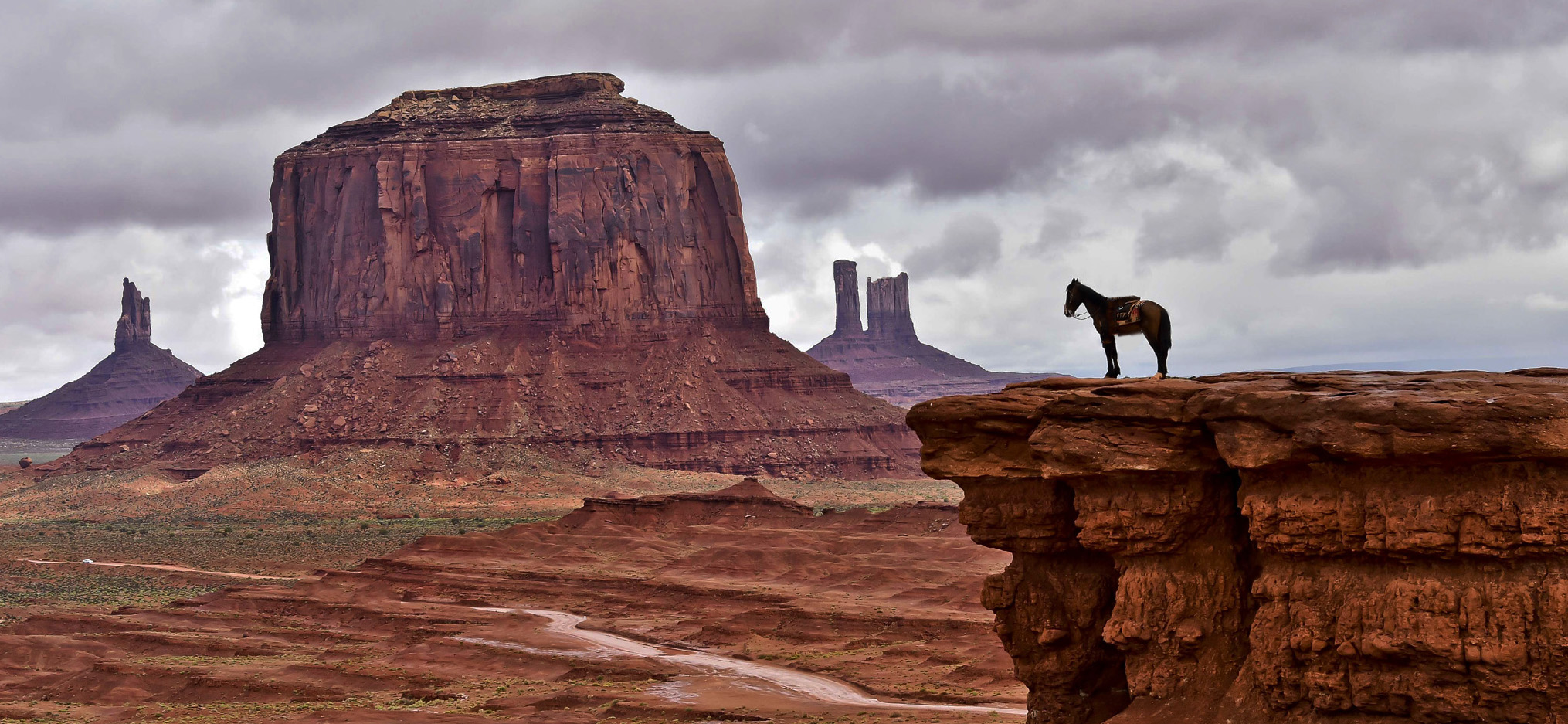


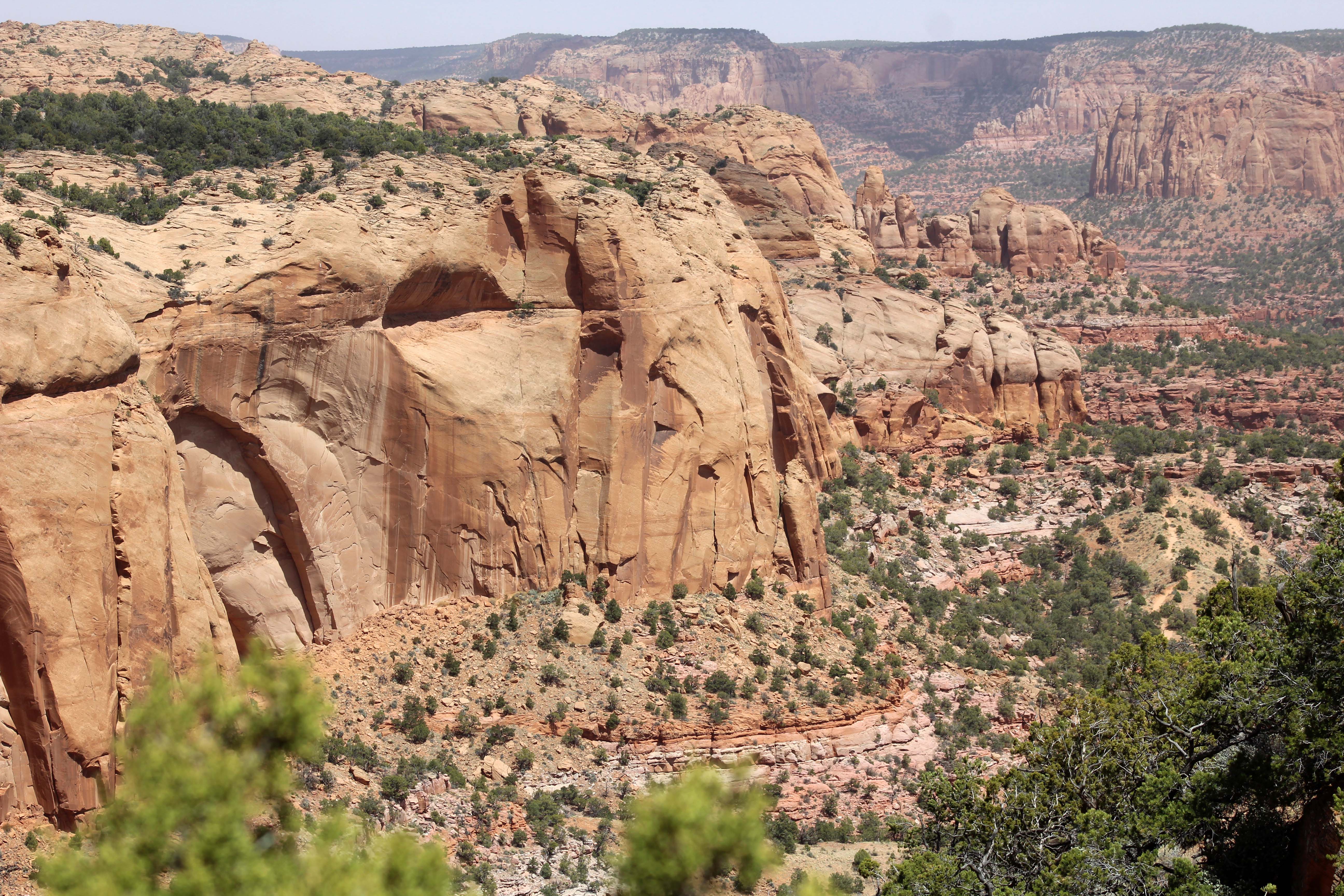


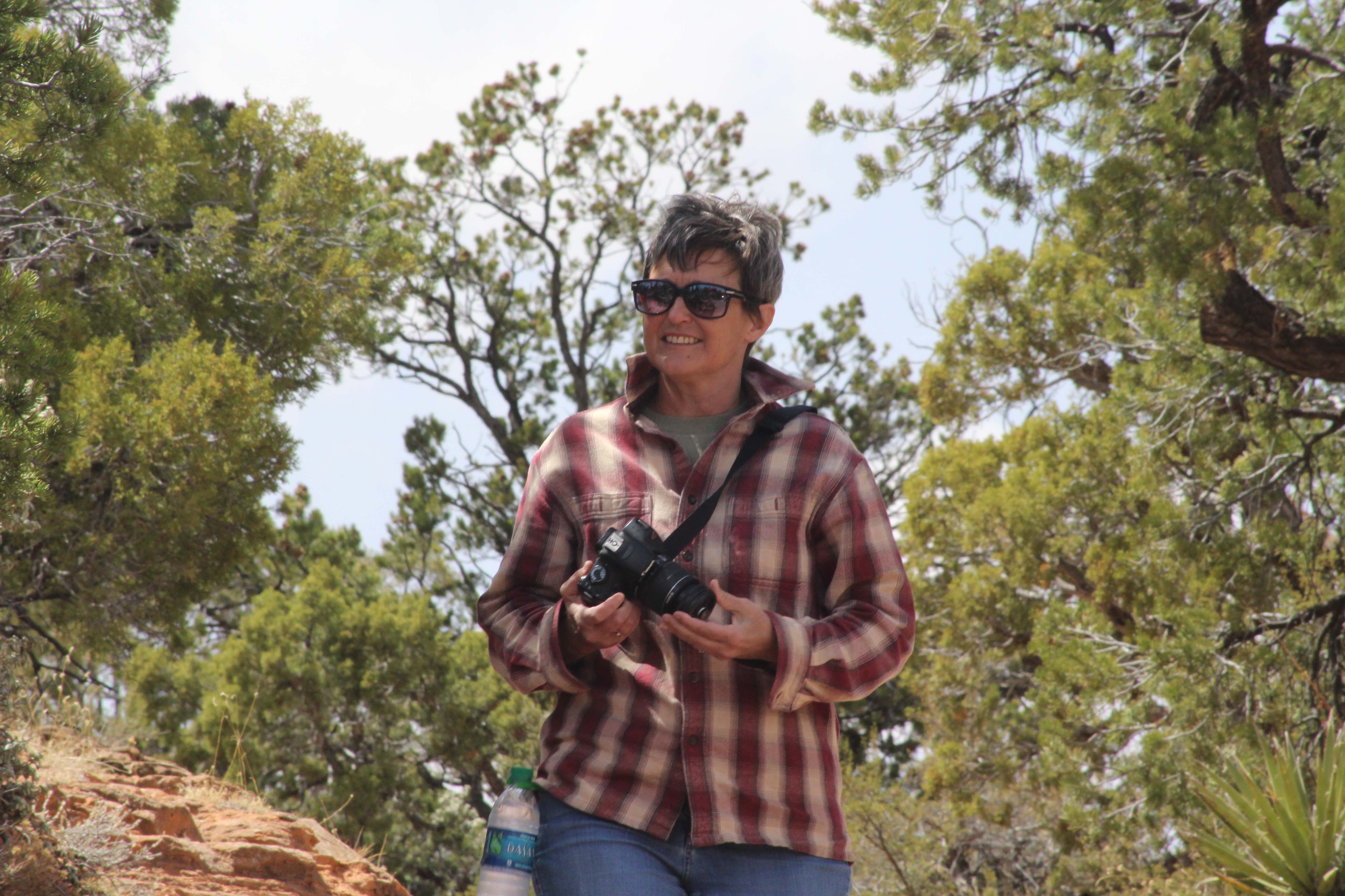
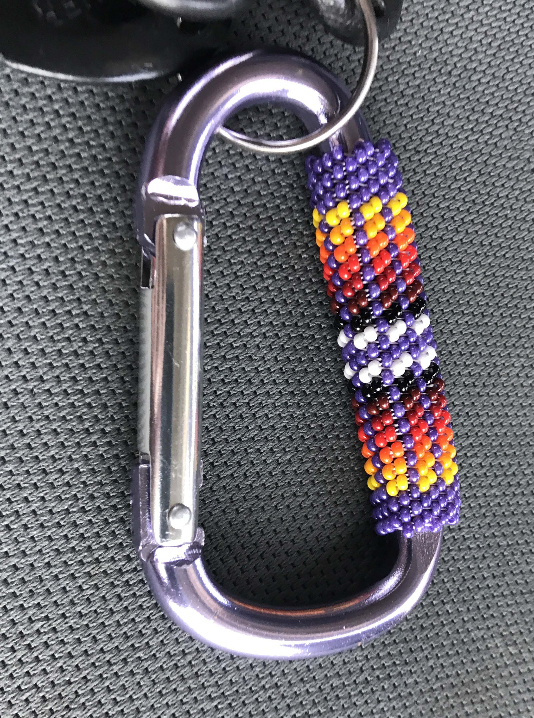


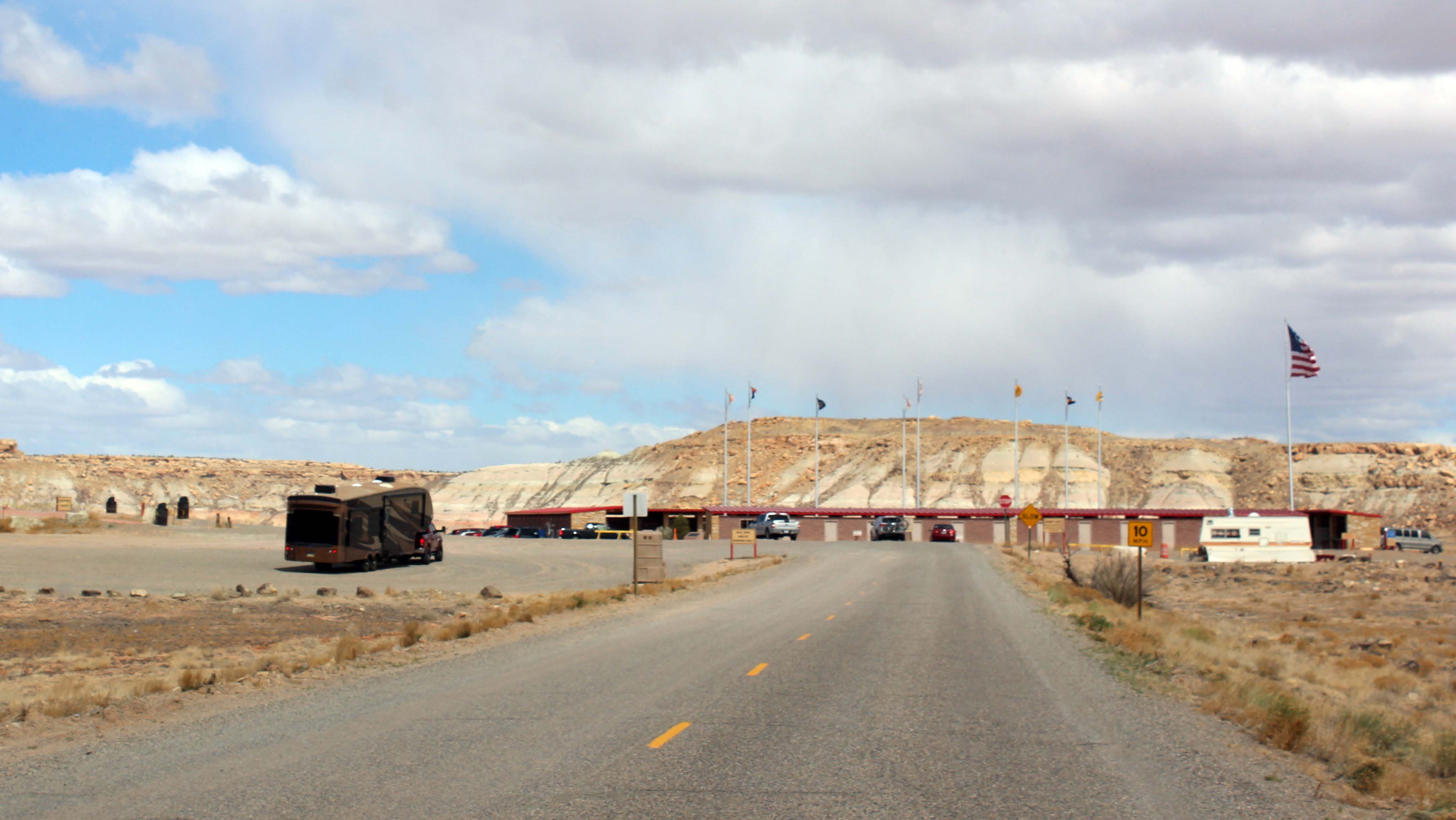

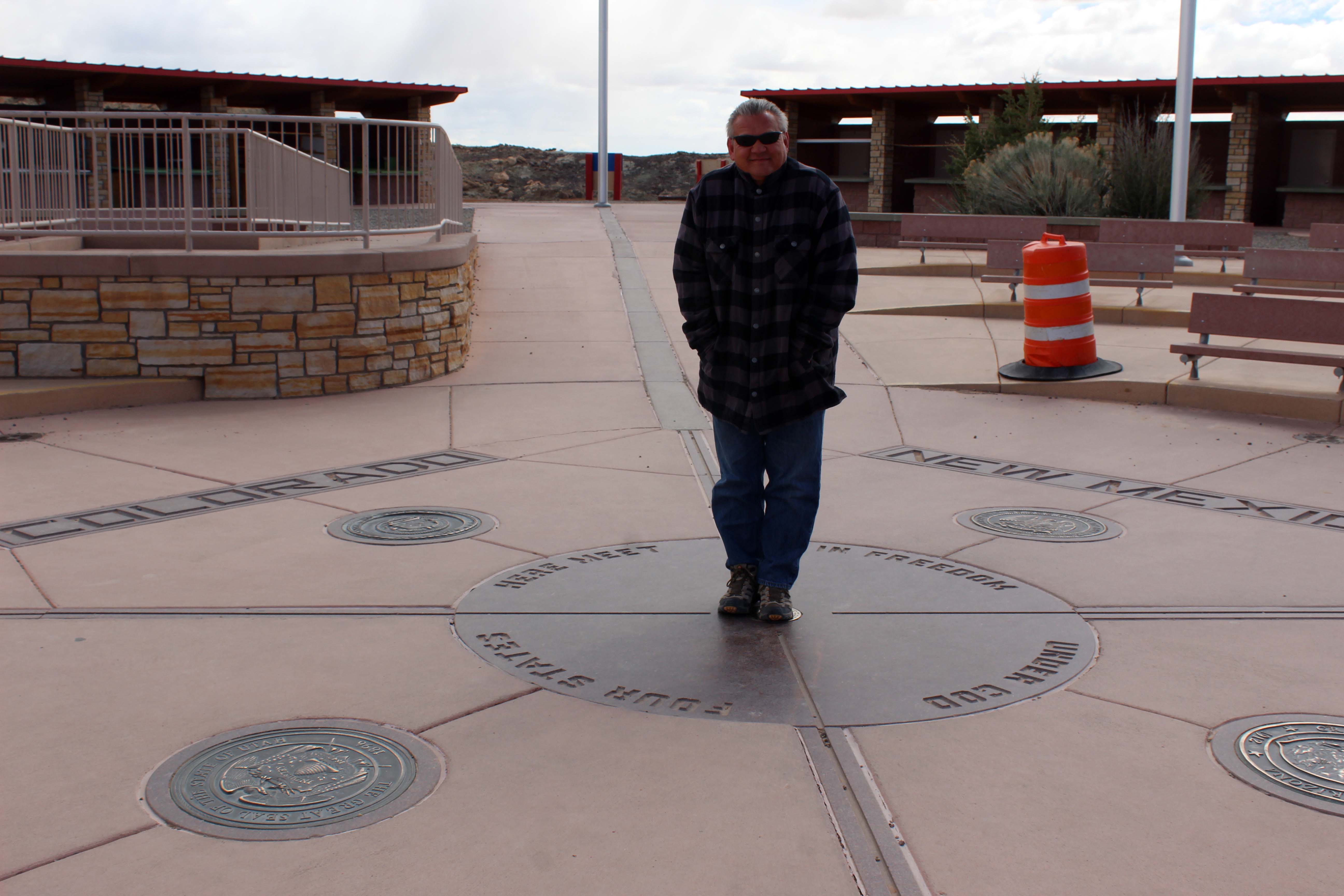
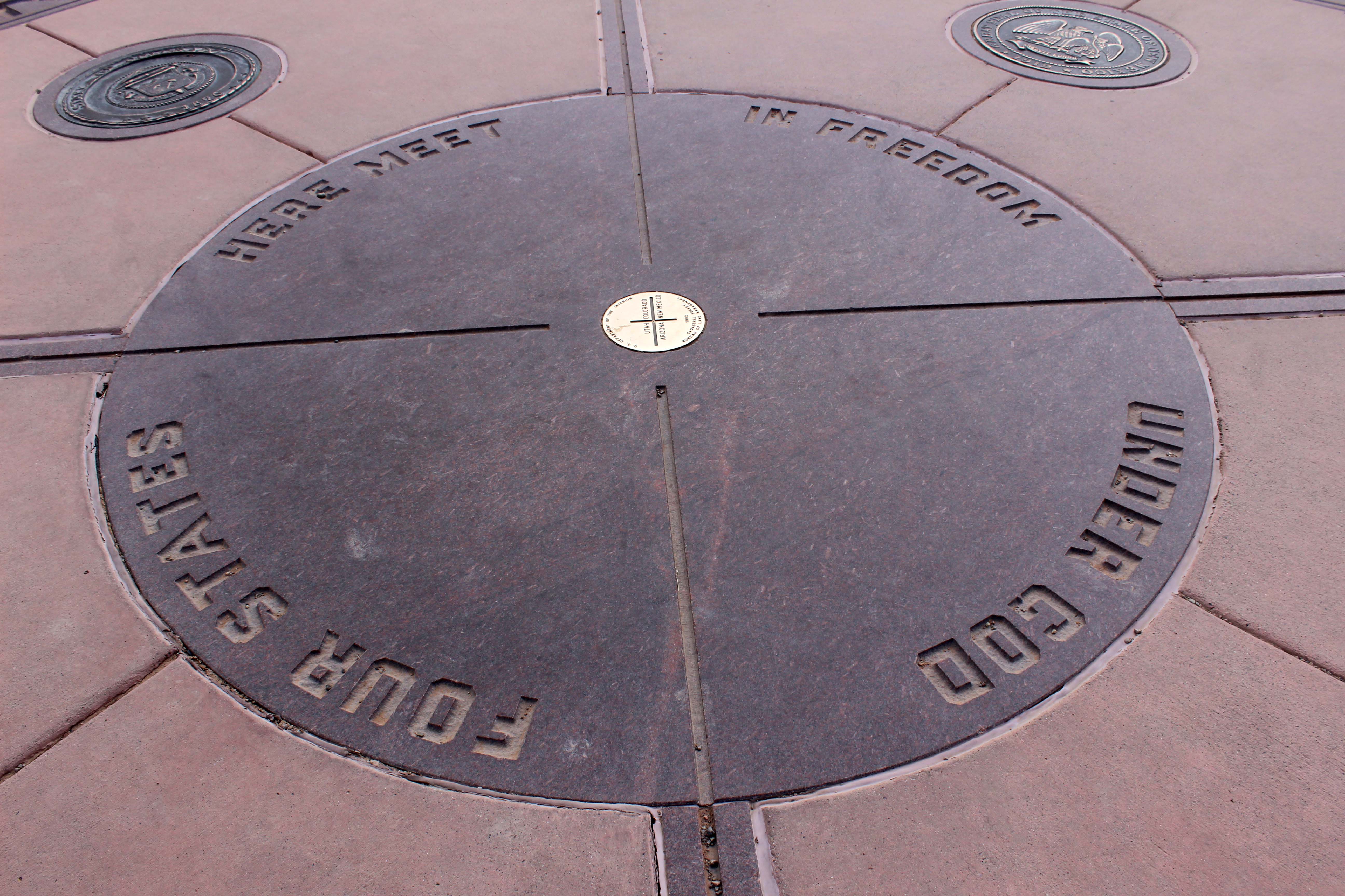


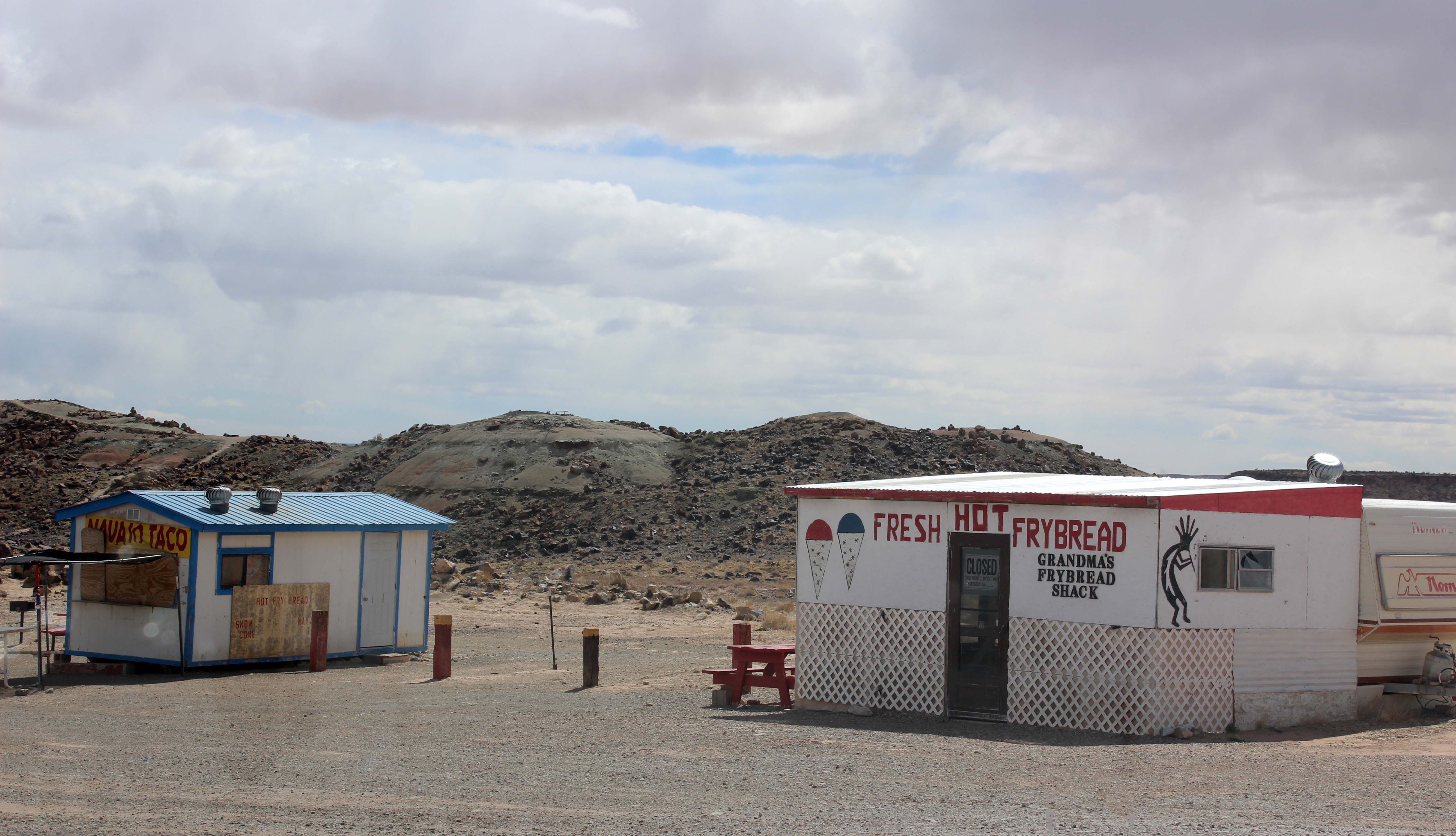


 (only $6.41 on Amazon) and because they are universal he was more than happy to give it to Harry. I have included the link above, and seriously, do yourself a favor and buy one of these. I think we have proven that you are bound to be in an inconvenient place when one fails!