
Today was about doing something fun. I don’t have an update on the truck (our adjuster has been out of town all week, so hopefully we will get an answer on Monday) and after an emotional last week at my job (which I am not ready to talk about yet) we decided to ride the Bizz Johnson Trail. (Well, the best part of it, anyway. – Lee) This past Saturday was the annual Fall Foliage ride and Lee volunteered to ride sweep. (The sweep rider is the person who brings up the back of the pack, and makes sure that if anyone has any mechanical trouble, or gets hurt, that they aren’t left to die all alone on the side of the trail. Since I have no bike fixing abilities, or medical training, I was really only able to guarantee that they wouldn’t die alone. – Lee) 16 people had signed up for the ride. Lee used a BLM truck and horse trailer to take all the bikes up to the far end of the trail, in a little town called Westwood, and the riders took a shuttle bus along with Stan, the BLM recreation director for this area. The Bizz Johnson trail is basically Stan’s life work, and he loves to ride the bus and give people a 30 minute talk on the history of the trail, and things to look for. Once the riders were all suited up and ready to go, they took off from Westwood for a quick three mile ride to Mason Station, the trailhead where the Bizz leaves the road. Stan followed along in the truck and trailer to check in with Lee at various checkpoints along the trail where BLM and Forest Service roads cross the trail. Below is a map of the trail.


The ride from Westwood to Hobo Camp (where we are work kamping) took most of the day, since he was going as slow as the slowest riders, but he came home raving about how much I would love it. Since we have been talking about going, and reconnecting with nature is a great way to shake off other things that are going on in your life, I was in. Lee did say that he wanted to start at the 18 mile mark, Westwood Junction, which I was happy to hear. Apparently the first 8 miles has a 3% upgrade and Lee said it wasn’t hard so much as “relentless”. The downhill section starts at Westwood Junction and knowing his audience Lee thought that would be more my speed. (The whole concept of “rails to trails” fascinates me. Back home in Keene, NH, there was a great rails to trails trail, and I just love the idea of abandoned railroads being re-purposed for something else, instead of just sitting there being of no use to anyone. The best part is, for those of us who are old (Tracy) and out of shape (Tracy, and to a lesser degree, me) and smokers (Tracy got me started smoking, I used to be a good kid, but she ruined me) railroad grades are never steep. The maximum for 19th century and early 20th century was 3%, which is in the neighborhood of only 150 feet of elevation change per mile. That’s a pretty easy grade, even for old out of shape smokers like Tracy. The downside to that is, when they have to make a lot of elevation, it can be a very, very, very long climb. So, it’s not hard, but it’s relentless. As you can see in the elevation profile below, it starts at about 5100 feet (the starting elevation is not accurate, Westwood is at 5100 feet) and over the course of 8 miles, it climbs to about 5600 feet. That’s not a lot of climb, but it’s steady. Basically, there’s no point in that first 8 miles that you can coast. Ever. It’s constant pedaling against gravity. Also, the first 4 miles is along the side of a county road, not a lot of room for bikes. And then once you get from Westwood to Mason Station, you’re on the trail, but it’s another 4 miles of 3% grade, and as if that wasn’t bad enough, it’s boring. So, I decided to start from Westwood Junction, one of the handful of places where a Forest Service road crosses the trail. From there, it’s about a mile of level ground, then it’s all downhill from there. – Lee)

Let me say here that this was hands down the best bike ride I have ever been on in my life. There were whole long sections you can coast down if you want to, the trail is in very good condition, and I was thrilled by all of the different landscapes we saw in that 18 mile ride. It was so good I am not going to spend a ton of time talking about it though. Just let the pictures speak for themselves.

Where we started. (Stan was generous enough to let us use his BLM pickup to drive the bikes up to Westwood Junction, so we parked there and then headed out. Technically, as BLM camp hosts, we’re supposed to check the trails, so this was a legitimate official use of the vehicle. – Lee)

Dry creek beds, they have water in the spring. (The Susan River goes along the trail, and the trail crosses it many times, on beautiful old railroad bridges. Unfortunately, this time of year, and with it being as dry as it is, there’s no water in the river until the last 8 miles or so of the trail. – Lee)

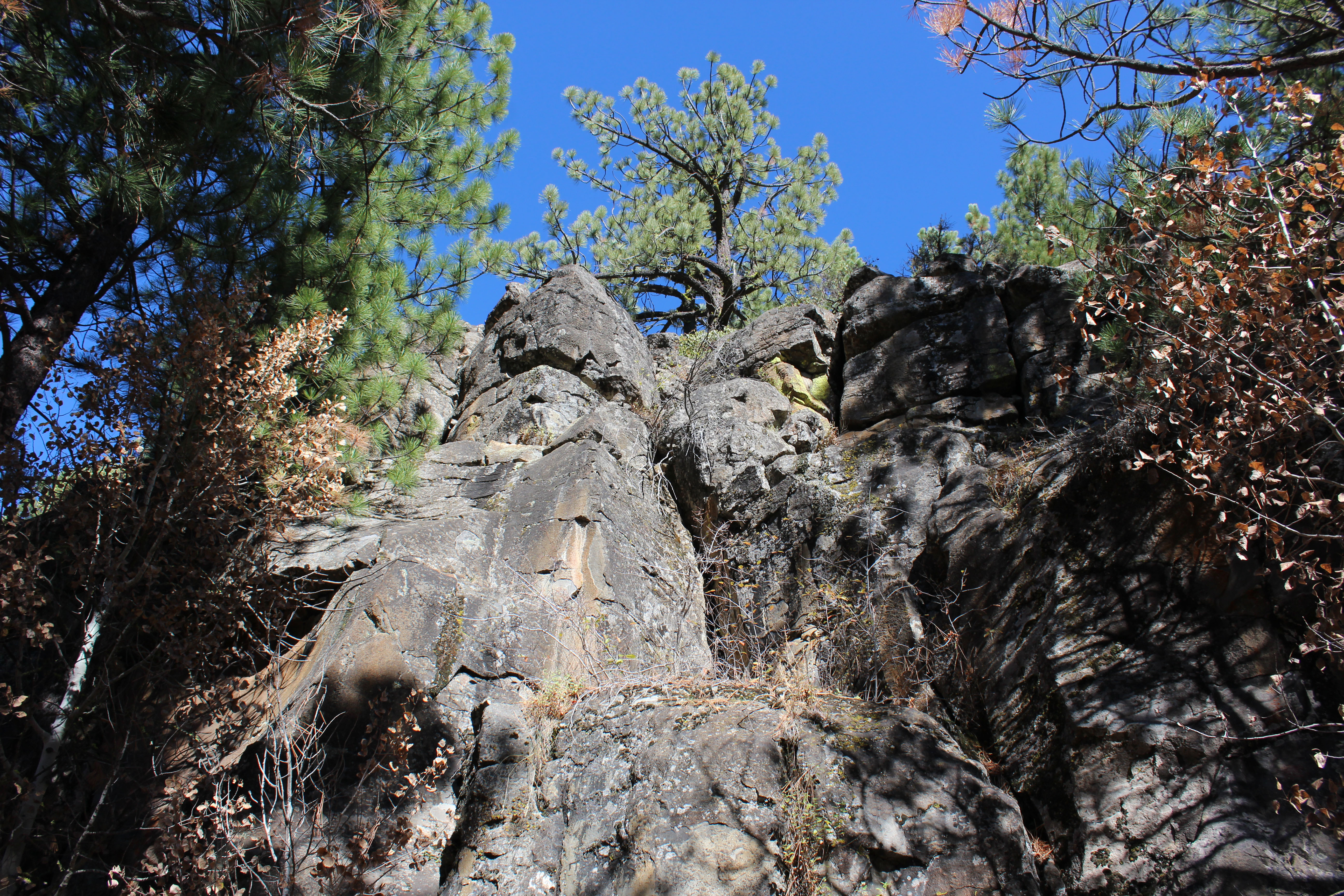
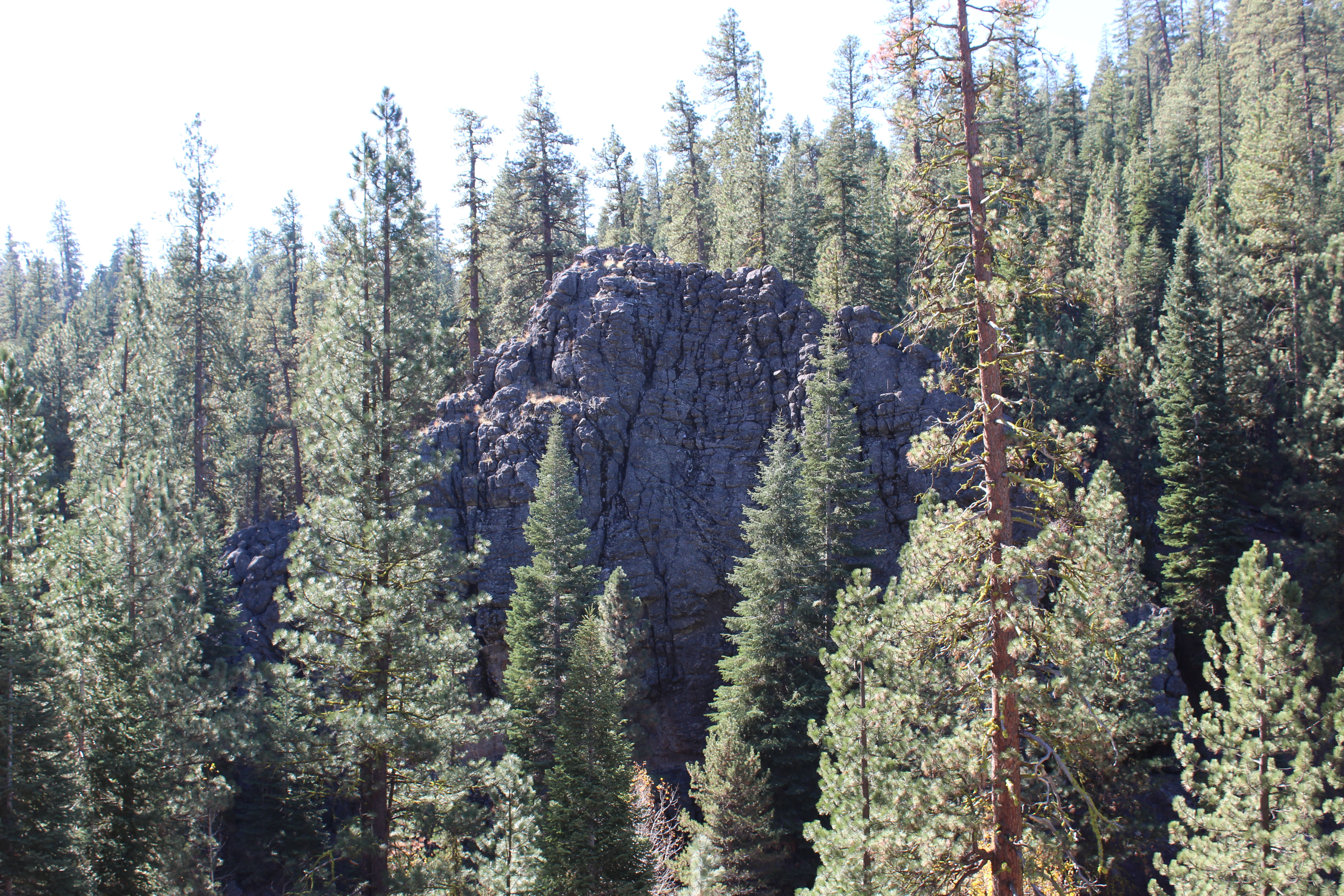
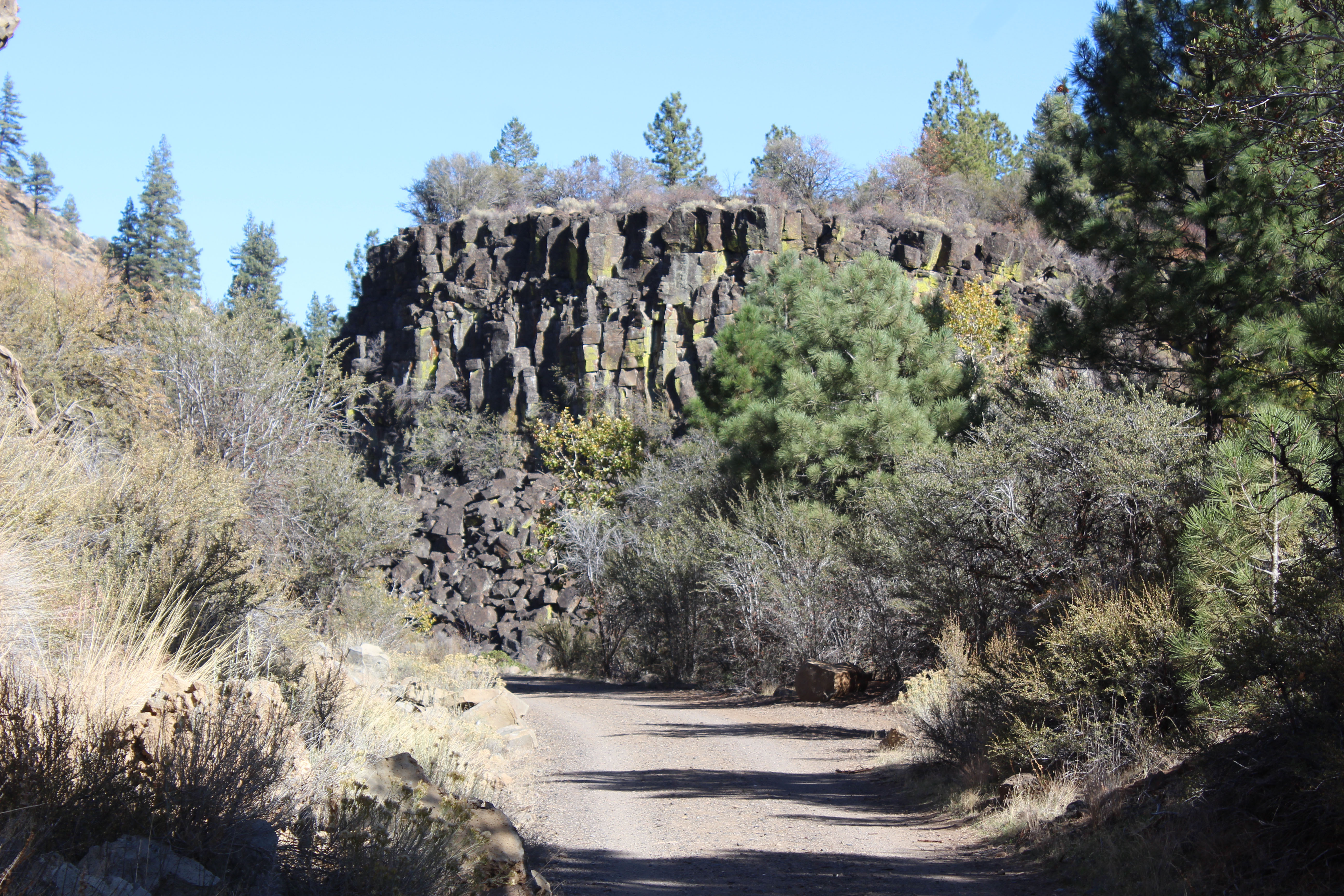
Beautiful rock outcroppings all along the trail

One of my favorite spot was a dry creek bed that according to Stan is raging white water in the spring.

The rocks were huge and even I with my love of rocks wouldn’t walk out very far.

Lee stood out a bit to give it some persepctive
Right next to the trail and so neat to look straight up

An old powder shed build by the railroad out of railroad ties. Imagine that this little shed was once full of explosives!
One of my favorite views


(The section in the pictures above is the first “drop” in elevation. You not only don’t have to pedal once you get about a mile from Westwood Junction, you actually need to use your brakes. 3% isn’t much when you’re going up, but coming down gravity will grab ya! About 5 miles from Westwood Junction you come to Goumaz, which is a National Forest Service campground. It’s very small, with only 5 unimproved campsites, along the river. There’s a pit toilet, and a water spigot, and that’s it. Access to it is via a gravel road, and the sites are big enough for travel trailers, and at least one would easily hold our 40′ fifth wheel. No traffic noise, no air traffic, very quiet and peaceful, and best of all, totally free. – Lee)

There was a pit toilet available for use near Goumaz campground we passed through
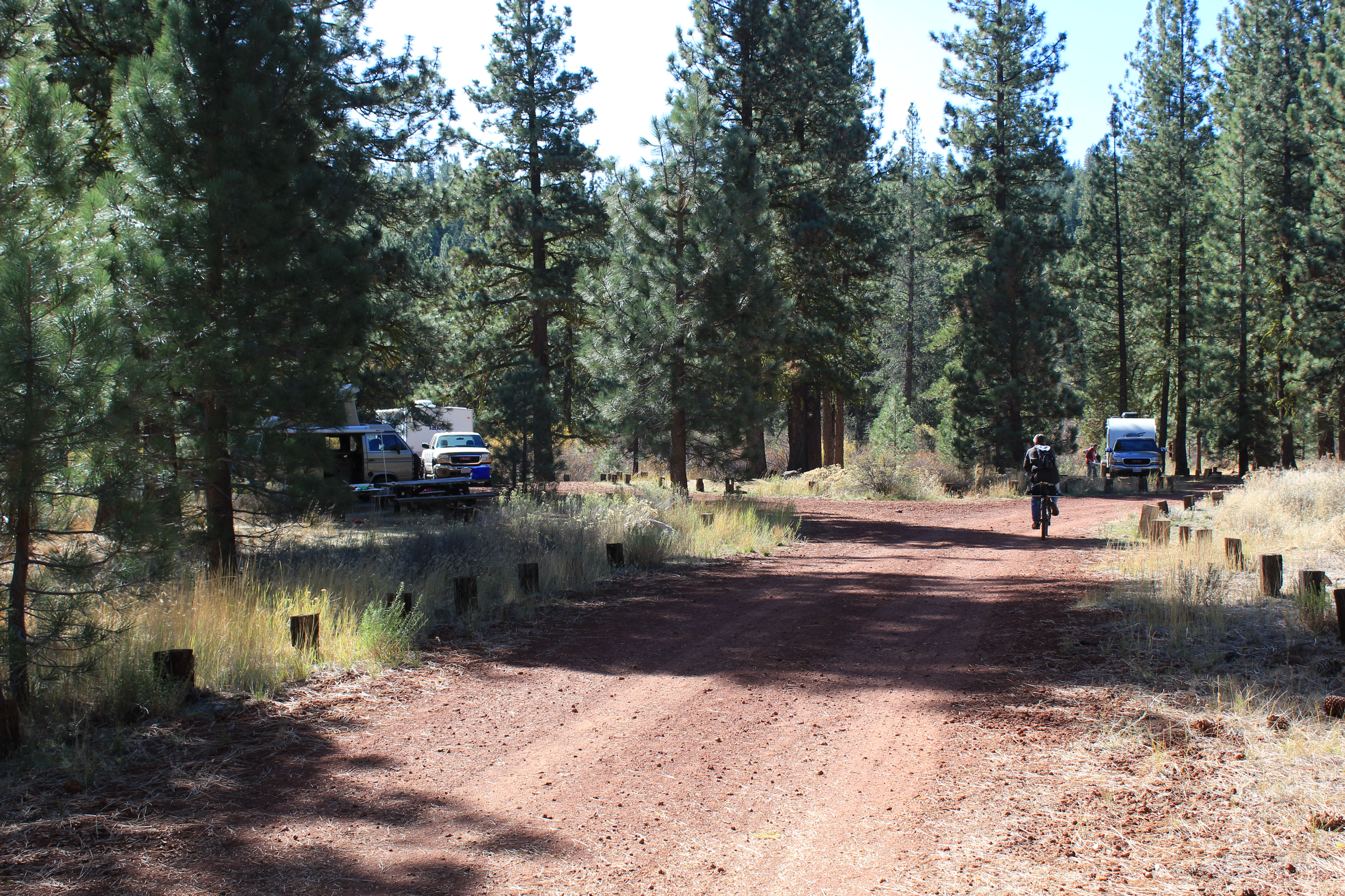
Dry camping, but free and we could have fit in a couple of these spots

At a certain point there was water in the river and we got to bicycle by it as we went

Do you see the face in the rock? Looks like a donkey to me

These trees were amazing hanging onto this hillside

It was sandy in some places and rocky in others
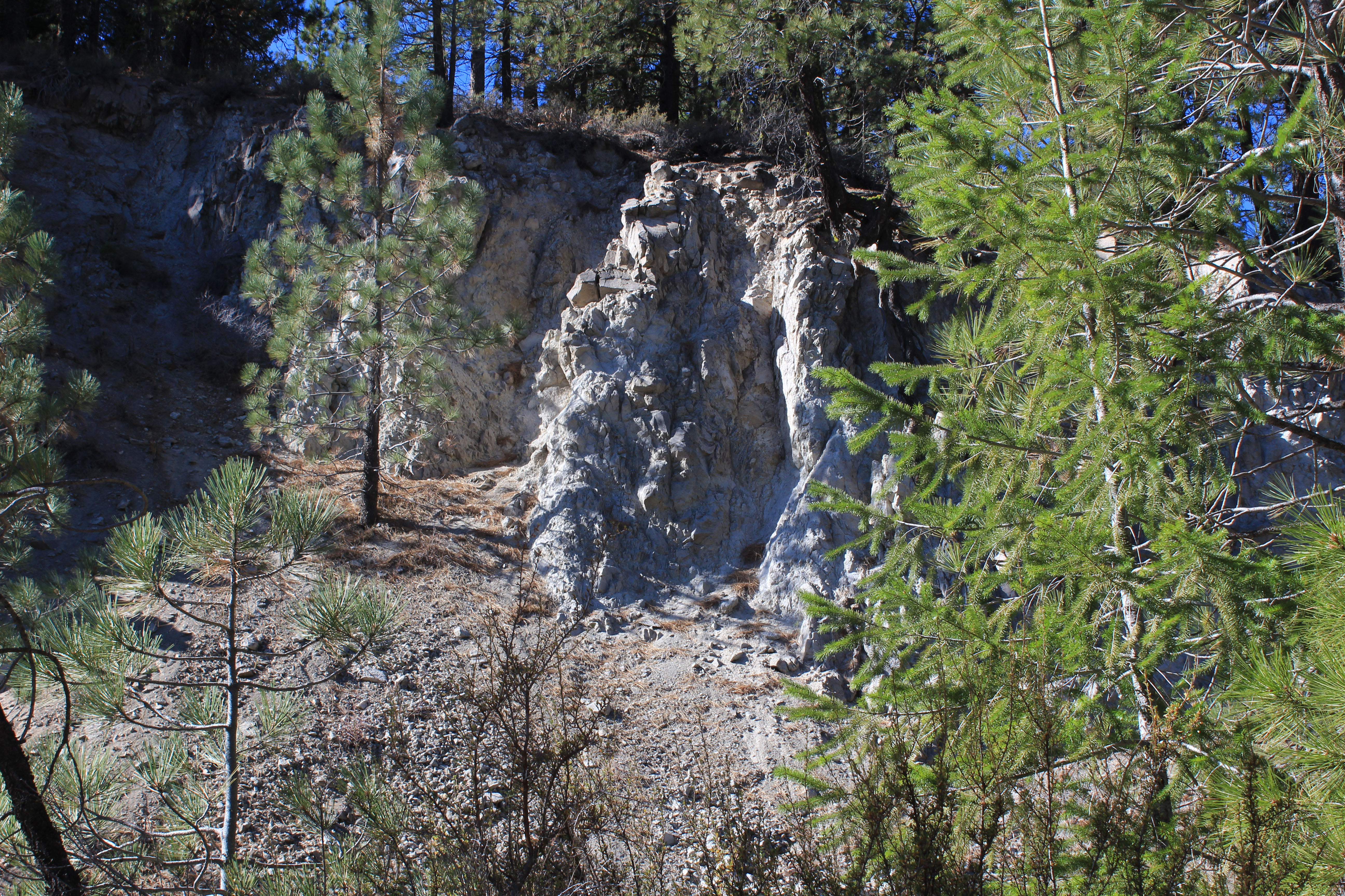
Beautiful white rocks in one section
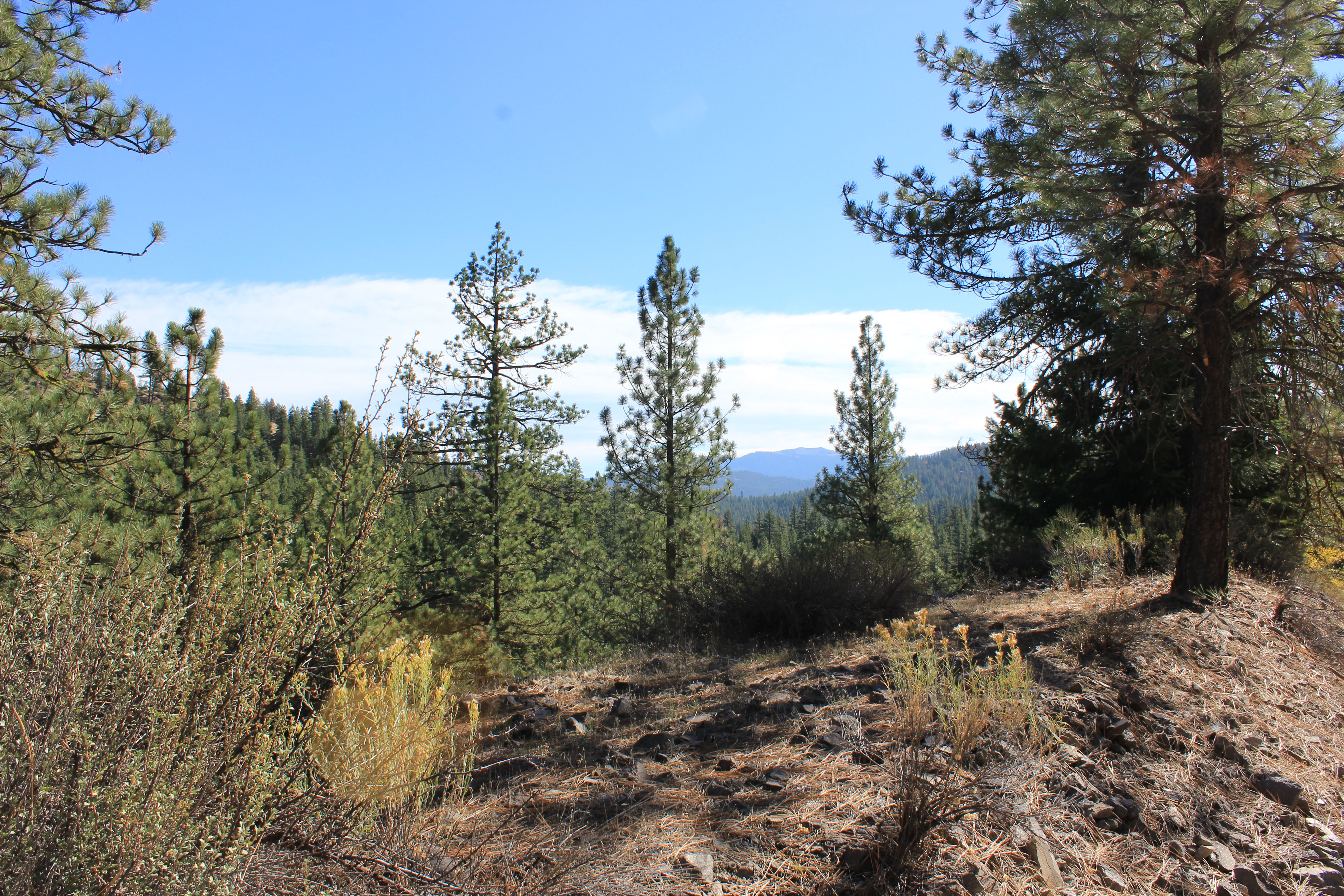
View of the mountain
Lee had a beautiful place picked out for our lunch, but after two hours of riding and only seeing 4 other people, there were people at the spot. He was pretty bummed but we kept on going and I thought we found a really nice place close by. (After Goumaz, there’s another nice long smooth drop, through totally different rock and vegetation, so you really get to see four distinct environments on the ride. It’s very interesting. Here and there along the trail, Boy Scout groups have cleared out a little area along the trail and built really nice benches. I had picked out a great spot near the bottom of the second drop section, where the trees were gone, and there is this huge flat valley floor with a massive ranch and the ranch house in the distance. It was a perfect spot for lunch, and we arrived there at just the right time, but there were people there. I should have made a reservation. – Lee)

The bench we ate on

Our lunch view
(After the second drop, the trail crosses a great trestle bridge, and then goes under the road. If you look at the elevation profile, it shows this in detail. It’s a very steep and very fast 100′ drop, under the road, and then on the other side you have to push your bike up, it’s way too steep and the gravel is too loose and deep to ride up. Instead, we rode down the older part of the trail, which is “closed” and just crossed the road. Way faster and no elevation change.I did the ride and push yesterday, and had no desire to do it again. If you’re following along on the map, this is the beginning of the final drop, at Devil’s Corral. This is another trail head, with parking and a pit toilet, and this is where the canyon part of the trail starts. This is by far the best part of the ride. – Lee)

There are lots of these railroad bridges, but this was the longest, and definitely the highest.

Underneath is a second stone bridge that’s no longer in use, from where the road used to cross the river. Now it’s just part of the trail.


One of the coolest things were the two railroad tunnels built in 1913 that you got to ride through

These redwood support beams are the original and in fantastic condition
(The two tunnels are a lot of fun. The second one, as you head downhill, is much longer than the first, and the temperature inside is at least 20 degrees cooler than the outside. Plus, when you leave the tunnels, about 50 feet in front of them you get hit by a blast of that cold air because as it comes out, the wind coming over the top of the mountain pushes it away from the entrance. So as soon as you exit the tunnel, you feel the normal outside temperature, then you ride through this brief section of air that’s as cold as the tunnel. Very neat. The Boy Scouts put a bench at that spot for that reason. It’s outside air conditioning! – Lee)


Loved these rocks along the trail

Beautiful outcroppings
One of my favorite pictures
(This last section of the trail continues to wind through the canyon, along the river, crossing it at six different bridges, and the water is a nice wide shallow clear river. It’s really beautiful and peaceful. It’s a very gentle down slope. There are lots of long gentle curves, with the river on one side, and steep canyon walls beyond the river, and 100′ steep rock canyon walls on the other side. After about 4 miles you reach the short connector trail that takes you into the Hobo Camp day use area, where we are living. The trail continues for another mile to the historic Susanville Depot and museum. We didn’t go all the way to the end, of course. We had driven our rental car down from the camper to the day use parking area, so we wouldn’t have to walk our bikes up the steep drive from the day use area to our camper. We locked the bikes in the bathroom storage room, drove the rental car back up to Westwood Junction to get the truck, and then drove the truck back to get the bikes. Wouldn’t you know it, Stan was walking the trail with his dog Sandy to get pictures of the fall colors in the late afternoon light. We had a nice chat with him and he gave us high fives for riding the trail. Stan really, really loves his job, and the Bizz Johnson trail. – Lee)
As you can see Lee is very passionate about the trail and I was totally serious when I said it was the best bike ride of my life. That being said, my tush is a little sore and I am on the tired side, so I asked Lee to jump in and help make this post not totally suck. I can see he took my request seriously 🙂 It really is a great ride and well worth a detour to try it. I hope you get to ride it some day.
(We’re going to watch some TV now, and then I might massage her tush. Cuz, you know, it’s sore. – Lee)
————————————————————————————————————————————-
Camper Chronicles is a participant in the Amazon Services LLC Associates Program, an affiliate advertising program designed to provide a means for sites to earn advertising fees by advertising and linking to amazon.com. Search Amazon.com here


Wow! What a terrifc experience for you both. In spite of the drought conditions at least you’re able to get out a do really fun stuff.
At first the drought conditions bothered me, but there is still life here. It’s interesting how plants and animals find a way to thrive under any conditions.
LOVE Rails to Trails and that sure was a beauty!!!
Love it, Tracy! I noticed that some spots look like two track. Do you see recumbent trikes using the trail? The crushed stone is fine, but the grass in the middle may slow us down. We’d love to try it out someday!
There were only a few spots where there was grass in the middle of the trail and I think you would easily crush it down. That being said never rode a trike so couldn’t say for sure. Definitely it would be fine Devils corral down as that is more heavily used
Hello again!
Re-reading this post as we leave in a couple days for our last camper trip. We’ll be doing Lassen/Susanville/Prosser Lake and back to Placerville. We finally have a chance to ride the Bizz Jo Trail on our bikes. Nice to read this post again and looking forward to it!
Thats wonderful love that trail!!
LOVE seeing Stan interjecting! We’ve missed him! 🙂
What a fantastic trail! I’ve long heard about it but never ridden it. Definitely something I’ve got to do. I love those rail trails. There are some in Placerville where we lived and it goes over a very high trestle over the river. I agree with you, I’m all for making them walking/riding trails. Thanks for the great post!
Just added the trail to our list of possible stops. Took a look at the bikes in one of your photos. I’m still trying to decide how aggressive a tire tread I want on ours. Road for the police department as a bike cop for 6 years. Our tires were too aggressive for the road but came in handy while off-road. Might seem like a strange question, but did you guys do any research on the type of tires before you bought, and if so what tire did you go with? I’d definitely get a tire with a liner inside to help with punctures. I’ve never been a huge supporter of patching tires that will generally leak air again. So I carried a couple of plastic tools to change out a tire tube and made sure to have a couple of extra tubes with me.
Wonderful photos and would have loved to be along with you all for the ride.
We actually borrowed some mountain bikes but I think our regular bikes could have handled it just fine. We bought the middle tread on our personal bikes…not mountain bike but also not street only. Honestly we are not the best people to ask since we ride rarely.